Download presentation
Presentation is loading. Please wait.

1
DEPARTMENT OF PRIMARY INDUSTRIES Demonstrating delivery of Geological Data using Web Feature and Web Mapping Services based on international standards Bruce Simons & Alistair Ritchie GeoScience Victoria, Minerals & Petroleum

2
GeoScience Markup Language (GeoSciML) Design Task Group: GeoSciML is a Geography Markup Language (GML) schema for sharing geological information Testbed Task Group: Demonstrate GeoSciML using Web Feature and Web Mapping Services Also Service Architecture, Use-cases & Requirements, Technical Assistance, and Content Task Groups IUGS Commission for the Management and Application of Geoscience Information (CGI)
 Design Task Group: GeoSciML is a Geography Markup Language (GML) schema for sharing geological information Testbed Task Group: Demonstrate GeoSciML using Web Feature and Web Mapping Services Also Service Architecture, Use-cases & Requirements, Technical Assistance, and Content Task Groups IUGS Commission for the Management and Application of Geoscience Information (CGI)")
3
GML Client Testbed 2 Data Sources WMS WFS WMS WFS WMS WFS WMS WFS WMS WFS WMS WFS USGS schema BRGM schema GSC schema BGS schema SGU schema GA schema GeoSciML Australia Sweden UK France USA Canada

4
Remember: Service not designed to work with any specific software package (eg ESRI) Uses open community defined standards (ISO, OpenGIS) Uses a rich scientific data model (eg GeoDATA.Vic) Complex Feature GML 3.1 Not “traditional” flat GIS data structures About exchange of data (not use of data)
 Uses open community defined standards (ISO, OpenGIS) Uses a rich scientific data model (eg GeoDATA.Vic) Complex Feature GML 3.1 Not traditional flat GIS data structures About exchange of data (not use of data)")
5
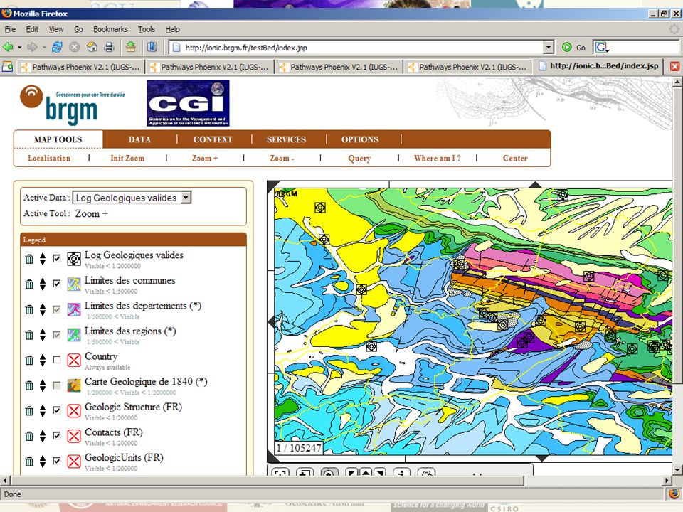
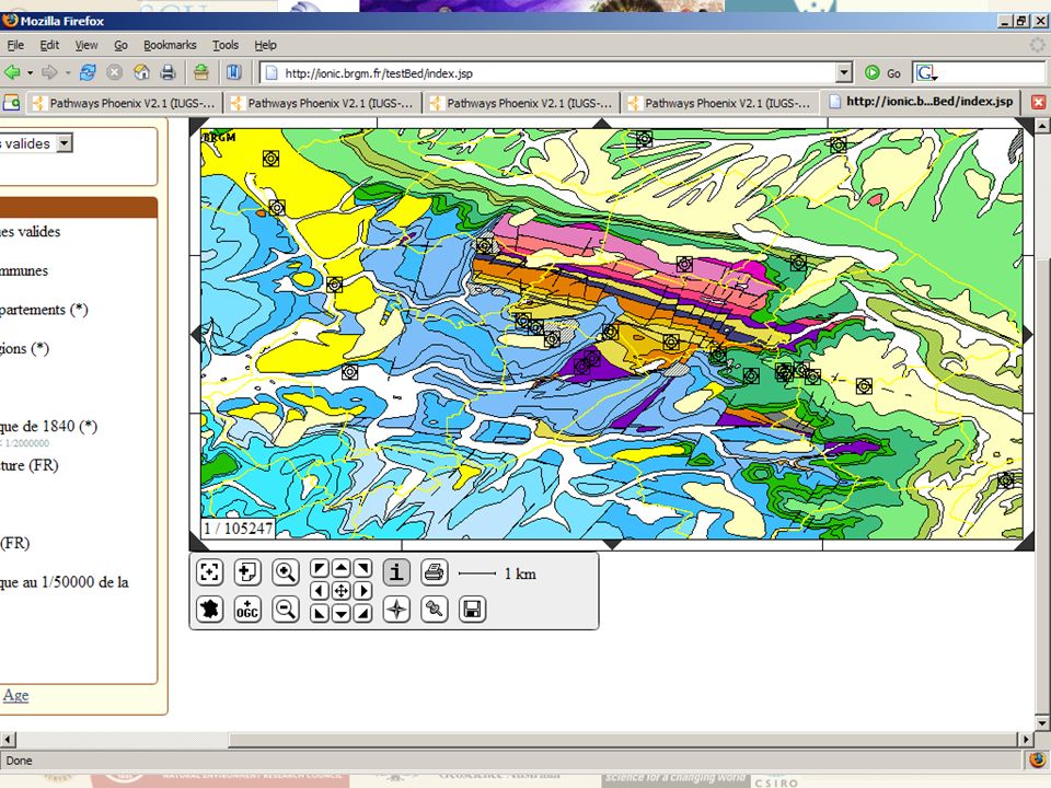
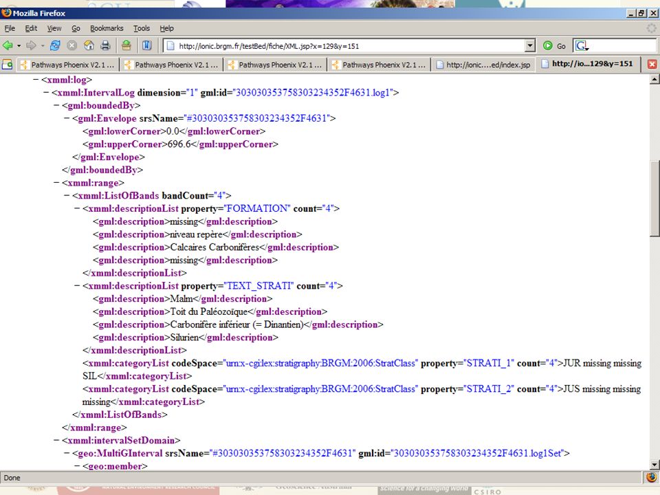
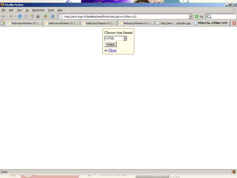
USE CASE ONE Get Feature Information Display map Query one feature (a geometry) Return attributes in GeoSciML format Bonus - Return attributes as “pretty” HTML formatted GeoSciML
 Return attributes in GeoSciML format Bonus - Return attributes as pretty HTML formatted GeoSciML")
6
DEPARTMENT OF PRIMARY INDUSTRIES

7
DEPARTMENT OF PRIMARY INDUSTRIES

8
DEPARTMENT OF PRIMARY INDUSTRIES

9
DEPARTMENT OF PRIMARY INDUSTRIES

10
DEPARTMENT OF PRIMARY INDUSTRIES

11
DEPARTMENT OF PRIMARY INDUSTRIES

12
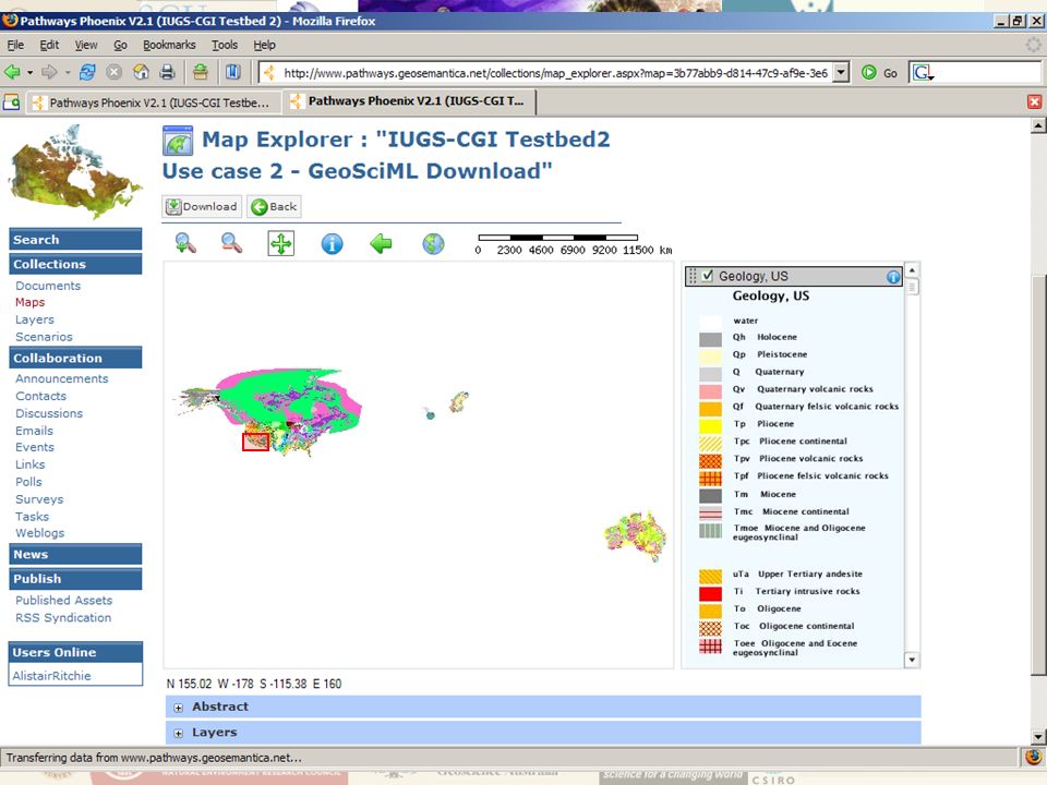
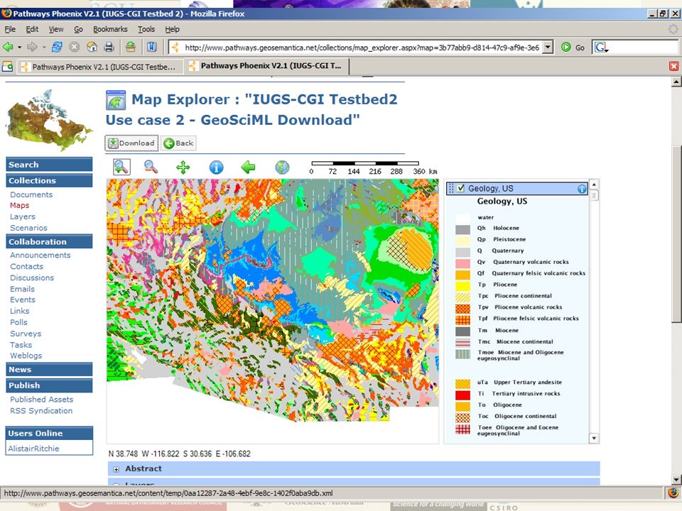
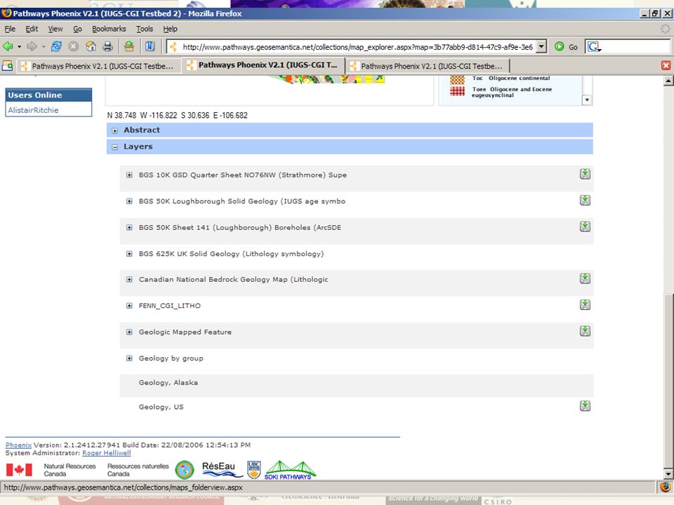
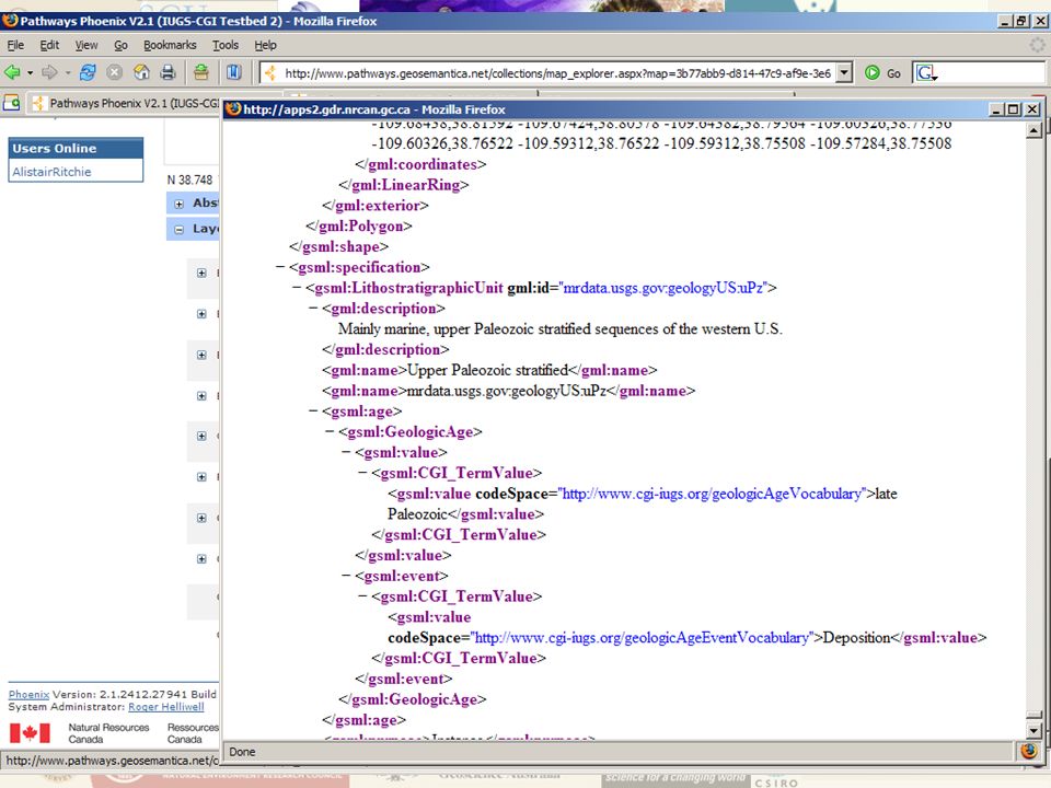
USE CASE TWO GeoSciML Data Download Display map Select several features Return attributes of the selected features as GeoSciML file for download

18
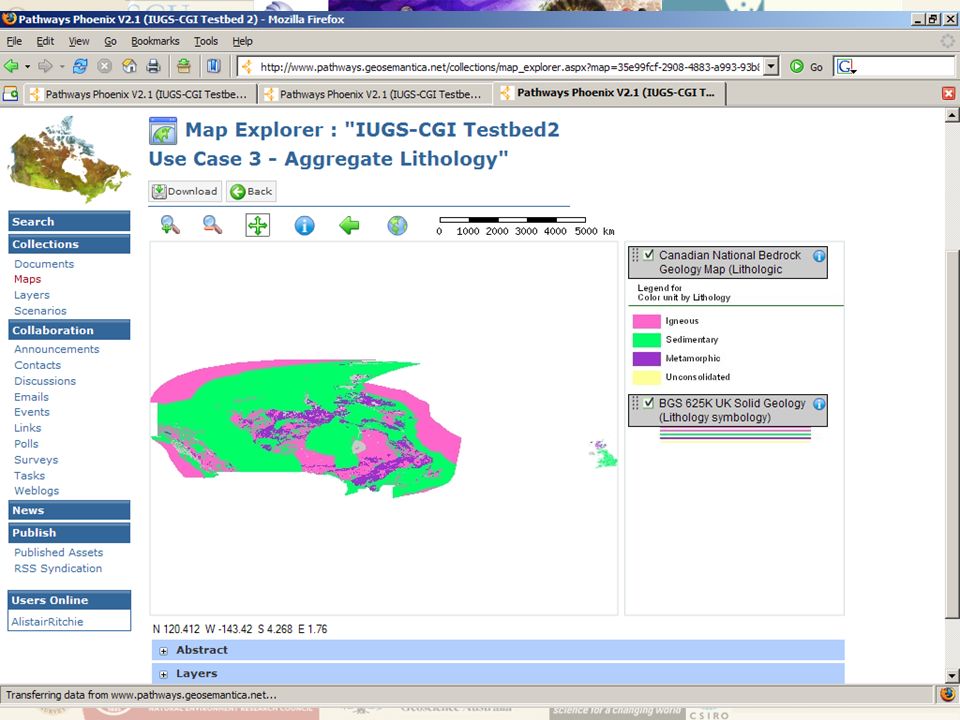
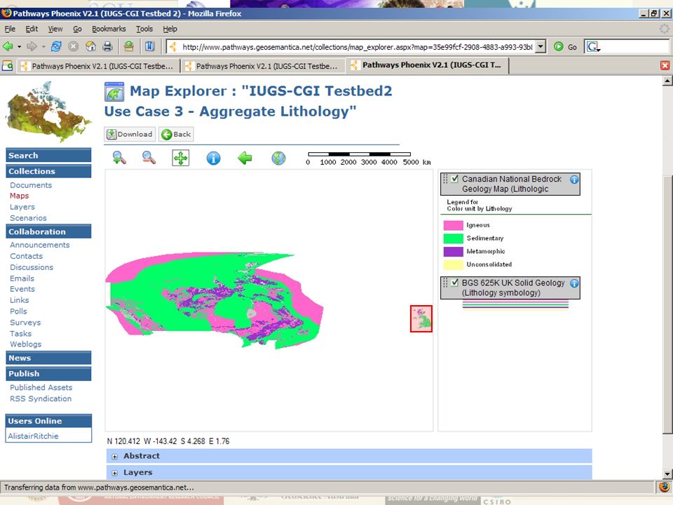
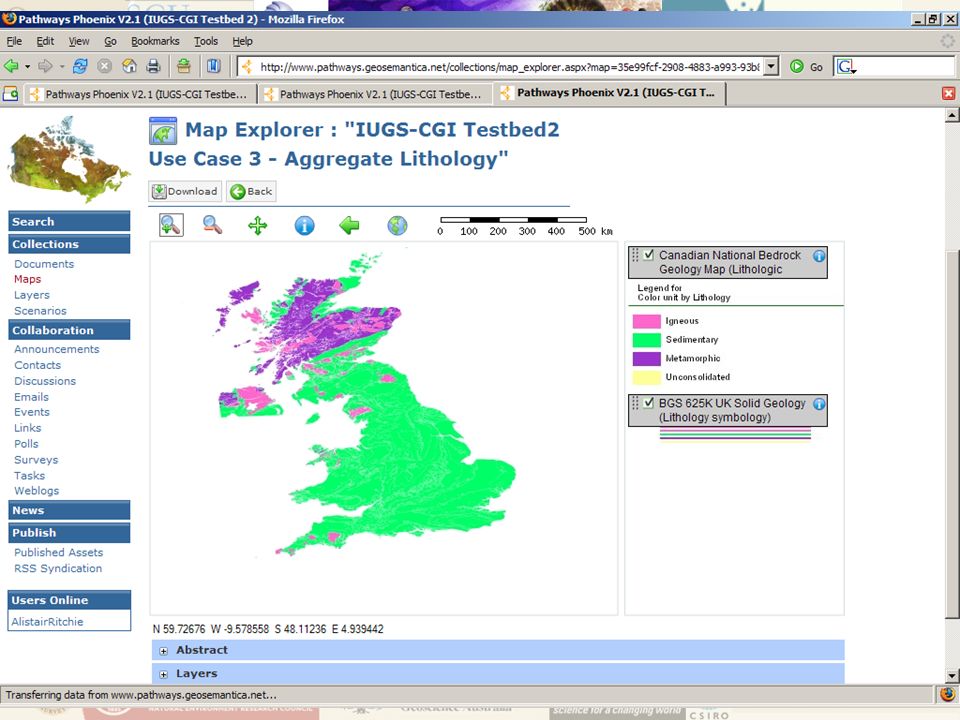
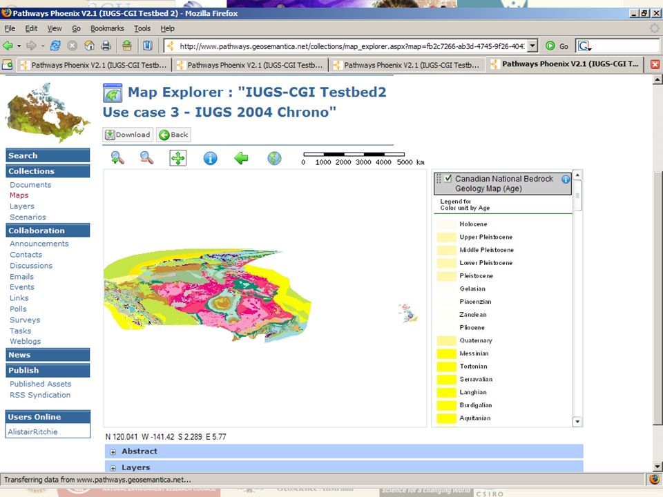
USE CASE THREE Thematic Mapping Reclassify map features based on Lithology Geological Age Essentially produce two thematic maps

23
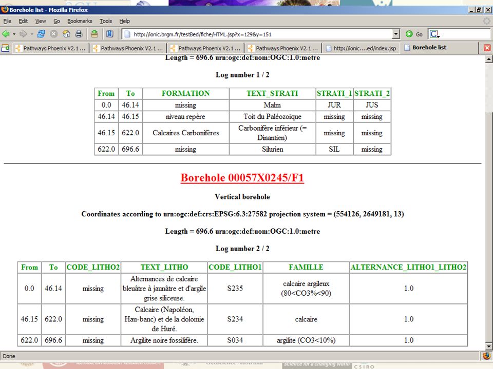
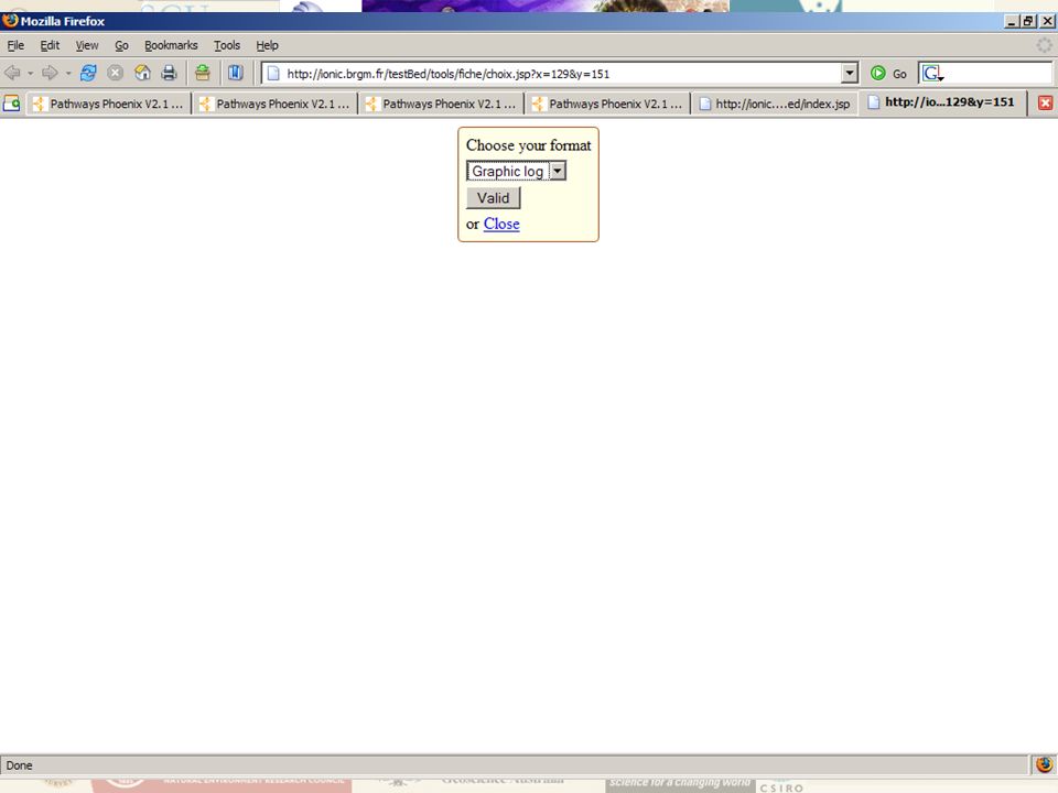
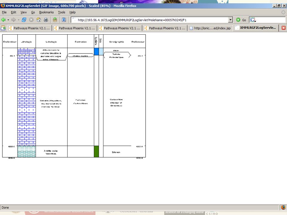
OTHER WORK Boreholes (from Testbed 1) Developed by UK (BGS) and France (BRGM) Delivery of Boreholes data
 Developed by UK (BGS) and France (BRGM) Delivery of Boreholes data")
24
OTHER WORK Boreholes – BRGM Client Display Boreholes points from WFS Select Borehole Display borehole attributes as: GeoSciML/XMML “Pretty” HTML based on GeoSciML Graphic Log based on GeoSciML

33
One service – many uses GML-based data can be …. Rendered into a queryable map … … formatted into a report or …. … read and used by any WFS/GML enabled application Condition: community-standard data model/encoding

34
DPI Involvement GeoSciML Task Groups: Design (Bruce Simons – Chair) Testing (Alistair Ritchie) Content (Linda Bibby) GeoDATA.Vic: Developing a rich geological information system Gold Undercover Initiative Infrastructure Web Service tools
 Testing (Alistair Ritchie) Content (Linda Bibby) GeoDATA.Vic: Developing a rich geological information system Gold Undercover Initiative Infrastructure Web Service tools")
35
Minerals Exploration Action Agenda Pre-competitive Geoscience Strategy “Governments in consultation with industry, to develop and implement nation-wide protocols, standards and systems that provide internet-based access to, and effective storage and archiving of geoscience datasets and industry- generated exploration data” Why?

36
systems syntax schematic semantic GeoSciML Ontology Geoscience Community Geography Markup Language Web Feature Services, Web Mapping Services OpenGIS Community What? Responsible Community Interoperability (data systems) (data language) (data structure) (data content)
 (data language) (data structure) (data content).")
37
Next GeoSciML 2 Design Task Group: March 2007, Tucson – initial design work September 2007, Melbourne – finalise design July 2008, Uppsala – finalise documentation August 2008, Oslo – GeoSciML 2 release Testbed 3 Task Group: September 2007, Melbourne – finalise design July 2008, Uppsala – establish Testbed3 August 2008, Oslo – demonstrate Testbed3 Service Architecture Task Group: September 2007, Melbourne – establish services July 2008, Uppsala – establish services August 2008, Oslo – demonstrate services

Similar presentations


>")


, John Laxton (BGS)>")

How will 1G integrate with topographic data? 2)Centralized, distributed, or.>")


 ICC Conference Santiago, Chile 15-21.>")


: Use of GIS for making statistics.>")


