Download presentation
Presentation is loading. Please wait.

1
Introduction to Satellite Aerosol Products
Week – 3 – April 02, 2014 Introduction to Satellite Aerosol Products Pawan Gupta Introduction to Remote Sensing for Air Quality Applications for the Indian Sub-Continent and Surrounding Regions Summer 2013 ARSET - AQ Applied Remote Sensing Education and Training – Air Quality A project of NASA Applied Sciences

2
Aerosol Optical Depth AOD - Aerosol Optical Depth
AOT - Aerosol Optical Thickness These optical measurements of light extinction are used to represent aerosol amount in the entire column of the atmosphere. More about aerosol optical depth ---

3
Moderate AOD ~0.40 Near Mt. Abu, India Photo courtesy of Brent Holben
This picture gives an visual sense of 0.4 AOD Photo courtesy of Brent Holben

4
Visibility and PM2.5 Aerosol optical depth is related to PM2.5 – both terms can be represent the presence of aerosols and its impact on visibility or haziness of the atmosphere. Therefore satellite derived AOD can be used as surrogate to represents particulate mass at the surface.

5
Optical Depth Sun The optical depth expresses the quantity of light removed from a beam by scattering or absorption during its path through a medium. optical depth τ as Atmosphere I0 Here I0 is the intensity of radiation at the source and I is the observed intensity after a given path I Surface

6
AERONET Aerosol Robotic Network http://aeronet.gsfc.nas.gov
Global aeronet network – more than 200 stations in operation Aerosol Robotic Network AERONET serve as validation tool for satellite aerosol product

7
Ground based AOD network (AERONET) in the region
 in the region")
8
Aerosols from Satellite

9
Aerosol Retrieval Algorithm
Radiance -to- Aerosol Products High This slide shows that Satellites does not measure directly aerosol properties but it measure top of the atmosphere radiance in different spectral and angular bins – which later inverted into aerosol or particulate matter properties. Low No Retrievals Aerosol Retrieval Algorithm

10
Data Product Hierarchy
Level 1 Products - Raw data with and without applied calibration. – NO AEROSOL DATA Level 2 Products - Geophysical Products - AEROSOL DATA Level 3 Products - Globally gridded geophysical products

11
Satellites for air quality data
MODIS (Terra and Aqua) AOD: columnar aerosol loading – can be used to get particulate matter mass concentration MISR (Terra) Columnar aerosol loading in different particle size bins in some cases aerosol heights OMI (Aura) Absorbing aerosols Trace gases VIIRS (NPP) Aerosol Optical Depth, Aerosol Type
 AOD: columnar aerosol loading – can be used to get particulate matter mass concentration. MISR (Terra) Columnar aerosol loading in different particle size bins. in some cases aerosol heights. OMI (Aura) Absorbing aerosols. Trace gases. VIIRS (NPP) Aerosol Optical Depth, Aerosol Type.")
12
Instrument Capabilities for Air Quality
Sensor Measurement Resolution MODIS – m-1 KM Resolution MISR m- 1.1 KM Resolution OMI – x 24 KM Resolution VIIRS – m There are many ways of grouping remote sensing satellites: Orbit, sensor type, sensor function etc.

13
Satellite Aerosol Products
InInI MODIS MISR OMI VIIRS Strengths Coverage Resolution Calibration Accuracy Particle shape Aerosol height for thick layer or plume Indication of absorbing or scattering particles Smaller bow-tie effect Weaknesses Bright Surfaces* Ocean glint Non-spherical particles Cloud contamination Main Products AOD Ocean – 5 wavelengths Land – 3 wavelengths Fine Fraction* *Ocean only 4 wavelengths Spherical/ Non-spherical ratio Particle Size (3 Bins) AAOD Aerosol Index Aerosol Type Product Resolution (level 2 and at Nadir) 10 Km 3 Km 17.6 Km 13 X 24 Km 0.75 km 6 km Product Levels 2 Global Level 3 Aggregates Daily 8 Day 30 Day Monthly 3 Month Annual This comparison chart is mainly for level 2 products – Most of the level 3 products are in much coarser resolution – like 0.25, 0.5, or 1 deg
 AAOD. Aerosol Index. Aerosol Type. Product Resolution (level 2 and at Nadir) 10 Km. 3 Km Km. 13 X 24 Km km. 6 km. Product Levels. 2. Global Level 3 Aggregates. Daily. 8 Day. 30 Day. Monthly. 3 Month. Annual. This comparison chart is mainly for level 2 products – Most of the level 3 products are in much coarser resolution – like 0.25, 0.5, or 1 deg.")
14
MODIS

15
Understanding a MODIS File Name
Terra - MOD04 Aqua - MYD04 Time Collection MOD04_L2.A hdf File processing information Product Name Date - year, Julian day HDFLook, Panoply, IDL, Python, Fortran, Mat Lab can be used to read the data

16
MODIS Aerosol Parameters (SDS)
Optical_Depth_Land_And_Ocean (with recommended quality flags over land and ocean) Dark_Target_Deep_Blue_Optical_Depth_550_Combined (Deep Blue & Dark Target Algorithm merged product) Dark_Target_Deep_Blue_Optical_Depth_550_Combined_QA (Quality Flag associated with DD product) Reference:
 Dark_Target_Deep_Blue_Optical_Depth_550_Combined. (Deep Blue & Dark Target Algorithm merged product) Dark_Target_Deep_Blue_Optical_Depth_550_Combined_QA. (Quality Flag associated with DD product) Reference:")
17
Access to MODIS Aerosol Products
NASA LAADSWEB. Searchable data base, FTP access MODIS-Atmos Site: Complete RGB archive and Level 3 product imagery. Giovanni – web tool for imagery visualization and analysis

18
OMI

19
Instrument Characteristics
Ozone Monitoring Instrument (OMI) One of four sensors on the EOS-Aura platform (OMI, MLS, TES, HIRDLS) An international project: Holland, USA, Finland Launched on Instrument Characteristics -Nadir solar backscatter spectrometer -Spectral range nm (resolution~1nm ) Spatial resolution: 13X24 km footprint Swath width: 2600 km (global daily coverage) Retrieval Products Column Amounts -Ozone (O3) -Nitrogen Dioxide (NO2) -Sulfur Dioxide: (SO2) -Others Aerosols
 One of four sensors on the EOS-Aura platform (OMI, MLS, TES, HIRDLS) An international project: Holland, USA, Finland. Launched on Instrument Characteristics. -Nadir solar backscatter spectrometer. -Spectral range nm (resolution~1nm ) Spatial resolution: 13X24 km footprint. Swath width: 2600 km (global daily coverage) Retrieval Products. Column Amounts. -Ozone (O3) -Nitrogen Dioxide (NO2) -Sulfur Dioxide: (SO2) -Others. Aerosols.")
20
Applications of the Aerosol Index
Validation tool for transport models Separation of carbonaceous from sulfate aerosols Identification of aerosols above PBL (i.e., PBL aerosols are not detectable by AI) Tracking of aerosol plumes above clouds and over ice/snow Aerosol s over clouds: April 14, 2006 Transport around the globe of a high altitude smoke layer generated by the Australian fires in December Numbers indicate the day of the month.
 Tracking of aerosol plumes above clouds and over ice/snow. Aerosol s over clouds: April 14, Transport around the globe of a high altitude smoke layer generated by the. Australian fires in December Numbers indicate the day of the month.")
21
OMI-Aura_L2-OMAERUV_2011m1024t0521-o38692_v003-2011m1024t115317.he5
OMI data site OMI-Aura_L2-OMAERUV_2011m1024t0521-o38692_v m1024t he5 Product name YYYYmMMDDtHHMM

22
MISR

23
How the angular information is related to size and shape of particles
Angular observations (which are not available in MODIS) makes MISR capable of providing additional information on particle size, shape and aerosol height under specific cases
 makes MISR capable of providing additional information on particle size, shape and aerosol height under specific cases.")
24
Aerosol Heights from MISR
Smoke Signals from the Alaska and Yukon Fires - July 2004

25
MISR Level 3 Tool

26
Data access and handling tutorial
Level 2 & 3 aerosol 1 file = one orbit - about 98 min Data 17.6x17.6 km2 , 0.5x0.5, and 1x1deg, daily, monthly, seasonal MISR_AM1_AS_AEROSOL_P028_O002510_F12_0022.hdf RegBestEstimateSpectralOptDepth (AOD – 4 wavelengths) RegBestEstimateSpectralOptDepthFraction (AOD fraction for small, medium, large, spherical, and non-spherical particles) Data access and handling tutorial
 RegBestEstimateSpectralOptDepthFraction (AOD fraction for small, medium, large, spherical, and non-spherical particles) Data access and handling tutorial.")
27
VIIRS

28
VIIRS is a multiwavelength imager, like MODIS
with similar wavelength bands in the aerosol range MODIS VIIRS Orbit altitude 690 km 824 km Equator crossing time 13:30 LT Granule size 5 minutes 86 seconds swath 2330 km 3000 km Pixel nadir 0.5 km 0.75 km Pixel edge 2 km 1.5 km

29
VIIRS MODIS 0.67 – 0.55 – 0.49 µm 0.66 – 0.55 – 0.47 µm 2 Sep 2012
VIIRS granule NASA MODIS Atmospheres SSEC PEATE VIIRS 0.67 – 0.55 – 0.49 µm 2 Sep 2012 20:24:27.8 UTC MODIS 0.66 – 0.55 – 0.47 µm 2 Sep 2012 21:40 UTC

30
VIIRS Nov 24, 2011 MODIS - AQUA Nov 24, 2011

31
VIIRS Level 2 & 3 Aerosol Data
Level 2, VIIRS Data Level 3, Quarter Degree Gridded VIIRS Data

32
For Today’s Material click here
References & links . ARSET-AQ webpage . MODIS ATMOS . MISR DATA . OMI DATA . IDEA . SMOG BLOG For Today’s Material click here

33
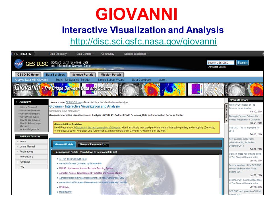
GIOVANNI Interactive Visualization and Analysis
34
GIOVANNI Atmospheric Portal Aerosols Express (powered by Giovanni-4)
A-Train along CloudSat Track Aerosols Express (powered by Giovanni-4) MAPSS: Multi-sensor Aerosol Products Sampling System AeroStat: Aerosol data measured by satellites and Aeronet stations Aerosol Optical Thickness Measurement and Model Comparison: Daily Aerosol Optical Thickness Measurement and Model Comparison: Monthly MISR Daily MISR Monthly Aqua/AIRS Global: Daily Aqua/AIRS Global: Monthly Terra and Aqua MODIS: Daily Terra and Aqua MODIS: Monthly Aura OMI Level 3 Aura OMI Level 2G Aura Microwave Limb Sounder (MLS) Aura High Resolution Dynamics Limb Sounder (HIRDLS) Aura Tropospheric Emission Spectrometer (TES) Earth Probe and Nimbus-7 TOMS Upper Atmosphere Research Satellite (UARS) Halogen Occultation Experiment (HALOE) SeaWiFS Deep Blue Level 3 Long-Term Aerosol Data: Daily SeaWiFS Deep Blue Level 3 Long-Term Aerosol Data: Monthly
 MAPSS: Multi-sensor Aerosol Products Sampling System. AeroStat: Aerosol data measured by satellites and Aeronet stations. Aerosol Optical Thickness Measurement and Model Comparison: Daily. Aerosol Optical Thickness Measurement and Model Comparison: Monthly. MISR Daily. MISR Monthly. Aqua/AIRS Global: Daily. Aqua/AIRS Global: Monthly. Terra and Aqua MODIS: Daily. Terra and Aqua MODIS: Monthly. Aura OMI Level 3. Aura OMI Level 2G. Aura Microwave Limb Sounder (MLS) Aura High Resolution Dynamics Limb Sounder (HIRDLS) Aura Tropospheric Emission Spectrometer (TES) Earth Probe and Nimbus-7 TOMS. Upper Atmosphere Research Satellite (UARS) Halogen Occultation Experiment (HALOE) SeaWiFS Deep Blue Level 3 Long-Term Aerosol Data: Daily. SeaWiFS Deep Blue Level 3 Long-Term Aerosol Data: Monthly.")
35
Assignment – Week 3 Due on April 8, 2014

Similar presentations


