Download presentation
Presentation is loading. Please wait.

1
Early Detection & Monitoring North America Drought from Space
Felix Kogan National Oceanic & Atmospheric Administration National Environmental Satellite Data & Information Services Mexico 2006

2
Topics Background AVHRR Data Theory Method Product Application
Validation New, 4 km 26-year data set

3
Drought as Natural Disaster
Drought (D) is a part of earth’s climate D. occurs every year D. does not recognize borders, political & economic differences D. affects the largest number of people D. unique features Start unnoticeably Build-up slowly Develop cumulatively Impact cumulative & not immediately observable When damage is evident it’s too late to mitigate the consequences
 is a part of earth’s climate. D. occurs every year. D. does not recognize borders, political & economic differences. D. affects the largest number of people. D. unique features. Start unnoticeably. Build-up slowly. Develop cumulatively. Impact cumulative & not immediately observable. When damage is evident it’s too late to mitigate the consequences.")
4
NOAA Operational Environmental Satellites

5
DATA from NOAA operational polar orbiting satellites
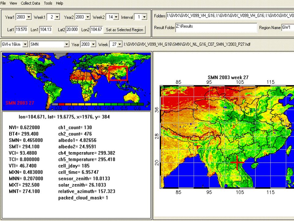
Sensor: Advanced Very High Resolution Radiometer (AVHRR) Satellites: NOAA-7, 9, 11, 14, 16, 18 (afternoon.), 17 Data Resolution: Spatial km GAC, sampled to 16 km; Temporal - 7-day composit Period: Coverage: World (75 N to 55 S) Channels: VIS (ch1), NIR (ch2), Thermal (ch4, ch5)
 Satellites: NOAA-7, 9, 11, 14, 16, 18 (afternoon.), 17. Data Resolution: Spatial - 4 km GAC, sampled to 16 km; Temporal - 7-day composit. Period: Coverage: World (75 N to 55 S) Channels: VIS (ch1), NIR (ch2), Thermal (ch4, ch5)")
6
AVHRR observations

7
Typical Vegetation Reflectance
NIR reflectance depends on WATER CONTENT CELL STRUCTURE VIS reflectance depends on CHLOROPHYLL CAROTENOID

8
Reflectance & chlorophyll

9
AVHRR Reflectance

10
NDVI & Smoothed NDVI Eliminate high frequency noise
Emphasize seasonal cycle Separate medium & low frequency variations

11
NDVI & Rainfall (% mean), SUDAN
115% 73% 95% 51%

12
NDVI annual time series, Illinois, USA

13
Weather & Ecosystem Components in NDVI & BT, Central USA

14
PRODUCTS 0 – indicates extreme stress
Vegetation condition index (VCI), values VCI=(NDVI-NDVImin)/(NDVImax-NDVImin) NDVImax, and NDVImin – climatology ( maximum and minimum NDVI for a pixel; Temperature condition index (TCI), values TCI=(BTmax-BTmin)/(BTmax-BTmin) NDVImax, and NDVImin – climatology ( maximum and minimum NDVI for a pixel Vegetation Health Index (VHI), values 0 – 100 VHI=a*VCI+(1-a)*TCI 0 – indicates extreme stress 100 – indicates favorable conditions Our newer products use more sophisticated climatology along with NDVI values and Brightness Temperatures to determine vegetation characteristics. The first experimental product is the Vegetation Condition Index based on the NDVI, the NDVI climatology and the most recent values of the NDVI. Lower values of this index indicate an unfavorable vegetation condition due to less moisture.
, values VCI=(NDVI-NDVImin)/(NDVImax-NDVImin) NDVImax, and NDVImin – climatology ( maximum and minimum NDVI for a pixel; Temperature condition index (TCI), values TCI=(BTmax-BTmin)/(BTmax-BTmin) NDVImax, and NDVImin – climatology ( maximum and minimum NDVI for a pixel. Vegetation Health Index (VHI), values 0 – 100. VHI=a*VCI+(1-a)*TCI. 0 – indicates extreme stress. 100 – indicates favorable conditions. Our newer products use more sophisticated climatology along with NDVI values and Brightness Temperatures to determine vegetation characteristics. The first experimental product is the Vegetation Condition Index based on the NDVI, the NDVI climatology and the most recent values of the NDVI. Lower values of this index indicate an unfavorable vegetation condition due to less moisture.")
15
Vegetation Health Indices Algorithm
Ch1&Ch2 Ch4 NDVI Brightness Temp. Climatology VCI TCI Vegetation Condition Index Temperature Condition Index VHI Vegetation Health Index

16
What Vegetation Health Indices Assess?
Moisture Condition (VCI) Thermal Condition (TCI) Vegetation Health (VHI) Fire Risk (FRI) Drought Start (DS) Drought Area (DA) Drought Dynamics (DD)
 Thermal Condition (TCI) Vegetation Health (VHI) Fire Risk (FRI) Drought Start (DS) Drought Area (DA) Drought Dynamics (DD)")
17
Vegetation Products ECOSYSTEMS (distribution & change)
WEATHER (droughts) FORESTRY (fire risk) NWS MODELS (vegetation fraction) AGRICULTURE (production) CLIMATE (ENSO) HUMAN HEALTH (epidemics) WATER (irrigation)
 FORESTRY (fire risk) NWS MODELS (vegetation fraction) AGRICULTURE (production) CLIMATE (ENSO) HUMAN HEALTH (epidemics) WATER (irrigation)")
18
Drought 1988 Severe Moisture and Thermal Vegetation Stress

19
Percent of USA with rainfall < 50% and VCI < 10

20
Drought 1988, Satellite & In Situ Data

21
Major US Droughts 1985-2000 Early season
Late season drought Late season drought Early season Drought, Winter Wheat affected Early season droughts in winter wheat is effected Mid-season drought, corn affected

22
Major US Droughts,

23
Vegetation Health Indices 2006 North America

24
Fire Risk Western USA Index is based on: DROUGHT INTENSITY (VHI<30)
and DURATION (1-5 weeks) Fire Fire Fire Danger is estimated from VHI based on intensity and duration of vegetation stress
 Fire. Fire. Fire Danger is estimated from VHI based on intensity and duration of vegetation stress.")
25
Vegetation Health Index 2000-2001

26
Percent of a state with extreme & exceptional drought

27
Precipitation and VHI, Chicago 2005-2006

28
Precipitation & VHI, Tucson, AZ, 2000-2006

29
VHI vs Drought Monitor

30
Greenness (USGS) vs VHI (NESDIS) vs DM
 vs VHI (NESDIS) vs DM")
31
CRD Winter Wheat Production, Kansas

32
Winter Wheat Yield, Kansas, 1981-2003

33
Correlation Dynamics: WW dY vs VHI’s, KANSAS

34
Correlation of dY vs VCI, Winter Wheat KANSAS CRD

35
Model Verification, Kasas, Winter Wheat

36
CRD CORN Production, Kansas

37
DYNAMICS of dY vs VCI & TCI, Kansas, CORN, 1985-2006

38
Corn Yield, Haskell Co, Kansas

39
Correlation Corn dY vs VHIs Haskell Co, Kansas

40
Independent model verification, Kansas, CORN, 1985-2005

41
Correlation of dY vs VCI, Kasas

42
GVI-x: New 26-year, 4-km, 7-day Composit AVHRR Data Set for Land Cover & Climate Study

43
Conditions Data set must be: - Longest - Highest resolution: * spatial
* temporal - Contain maximum original parameters - Contain products - Compatible with geography - Validated against in situ data - High accuracy - Easy understandable nomenclature

44
Normalized Difference Vegetation Index (NDVI)
")
45
Vegetation Health Index USA, 1988, week27 GVI-x vs GVI2

46
Global Long-Term Land Data Sets

47
1988 US Drought Satellite and Ground Data

49
Global Area NDVI NOAA-17 vs NOAA-16

50
Web http://www.orbit.nesdis.noaa.gov/smcd/emb/vci
Every Monday new information on Vegetation Conditions & Health is posted

51
VIIRS vs AVHRR AVHRR VIS NIR

52
AVHRR vs MODIS

53
Thank You

54
Spectral Response Function & Vegetation Reflectance

55
SST anomaly & Vegetation Health El Nino & La Nina December

56
Vegetation Health, Mid-July 2006
Vegetation Health, Surface Conditions Vegetation Health, surface condition

57
Publications

58
Processing Pre-Launch Calibration VIS, NIR
Post-Launch Calibration VIS, NIR Correct response function difference VIS, NIR Calculate NDVI and BT (from IR4) Apply non-linear correction to BT Remove high frequency noise NDVI and BT Derive NDVI & BT climatology Calculate Vegetation health indices (VHIs)
 Apply non-linear correction to BT. Remove high frequency noise NDVI and BT. Derive NDVI & BT climatology. Calculate Vegetation health indices (VHIs)")
Similar presentations
 and F. Rembold (JRC) One of the main water sources.>")


 Dr. Xuefeng Cui (BNU) Impact of agricultural.>")


. Why TRMM? n Tropical Rainfall Measuring Mission (TRMM) is a joint US-Japan study initiated in 1997 to study.>")

 derived from the Visible Infrared Imaging Radiometer Suite (VIIRS) sensor onboard the SNPP satellite Zhangyan Jiang 1,2,>")


-Polar Orbiting Environmental Satellite (POES) Orbital characteristics.>")

 Review 09 – 11 March 2010 Correction of Vegetation Time Series for Long Term Monitoring Marco Vargas¹.>")

