Download presentation
Presentation is loading. Please wait.

1
Zusmanis and Willers 2002

2
Custom Application Extension for Imagine® for Precision Agriculture Management of Cotton J. L. Willers Mississippi State, Ms Andy Zusmanis, Integrated Solutions Group Leica Geosystems, LLC, Atlanta, Ga Scott Samson Extension GIS, Mississippi State, MS Patrick English MAFES, Stoneville, MS C. G. O’Hara, GeoResources Institute Mississippi State University

3
Project Partnerships (1997-2004): Leica Geo-systems, Atlanta, GA ITD Spectral Visions, Stennis Space Center, MS NASA Commercial Remote Sensing Project GPS, Inc., Inverness, MS InTime, Inc., Cleveland, MS K. Hood, Producer Perthshire Farms, Gunnison, MS Paul Good, Producer, Good Longview Farms, Macon, MS Advanced Spatial Technologies In Agriculture Project, GeoResources Institute, Mississippi State, MS USDA Area-Wide Management of the Tarnished Plant Bug Project

4
Definition of Precision Agriculture The Right Amount… At the Right Place… At the Right Time!!!

5
Small Plot Problems in Commercial Fields Difficult for farm operators to impose treatments General failure to incorporate spatial characteristics of harvest sub-samples within and among small plots Difficult to define representative units of replication and their size Plots of same size and shape do NOT work

6
Small Plot Problems in Commercial Fields (Continued) Uncontrollable variability due to weather, soil type, and topography interactions Difficult to remove effects of past management practices (soil leveling, fertility, etc.) Spatial applications of different inputs are often NOT coincident in time and space Difficulty in defining the inferential space to other fields or farms Traditional practice of randomization does NOT solve these problems
 Uncontrollable variability due to weather, soil type, and topography interactions Difficult to remove effects of past management practices (soil leveling, fertility, etc.) Spatial applications of different inputs are often NOT coincident in time and space Difficulty in defining the inferential space to other fields or farms Traditional practice of randomization does NOT solve these problems")
10
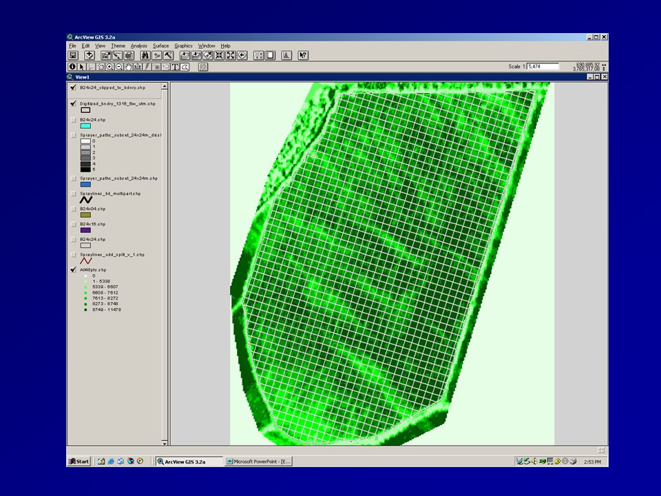
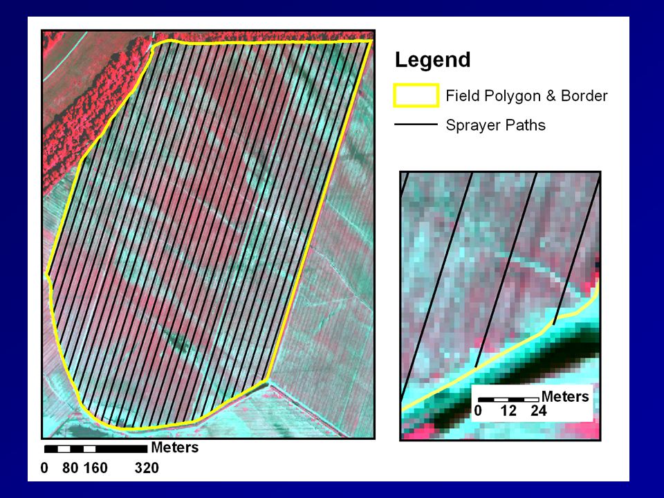
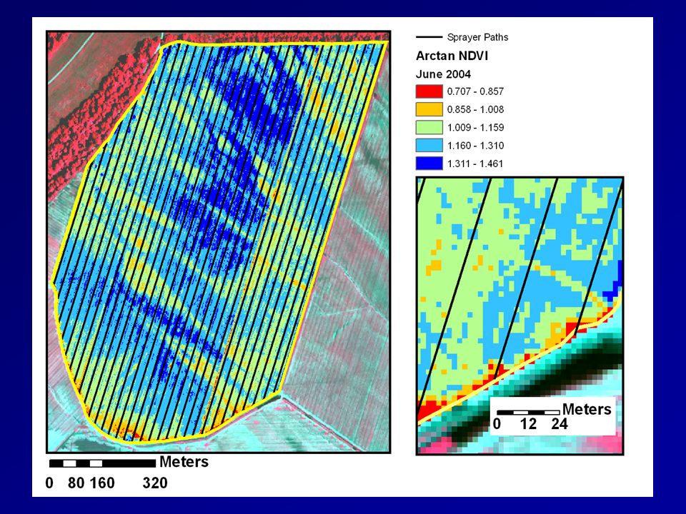
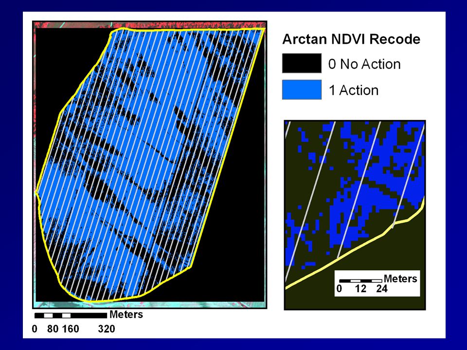
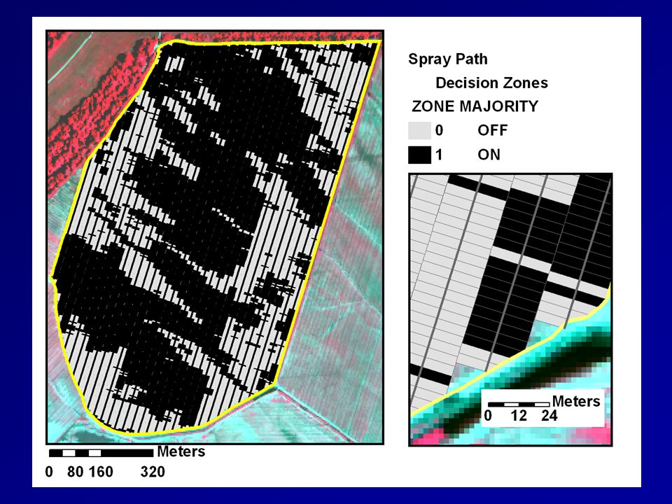
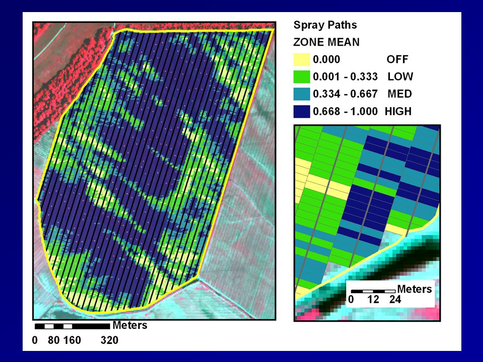
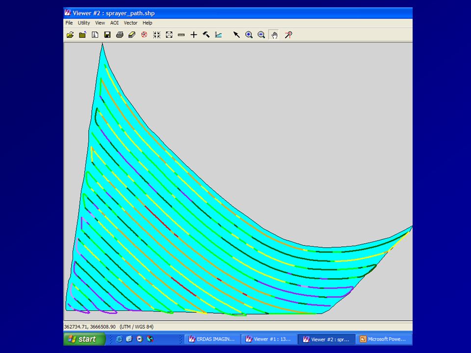
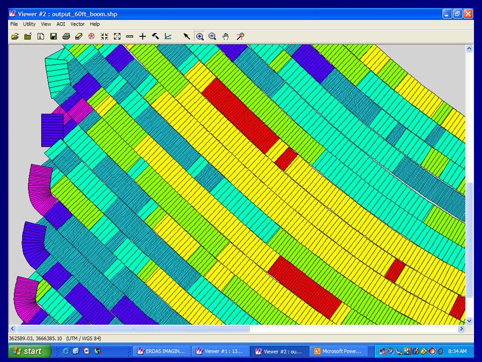
USDA/ERDAS Imagine Custom Sprayer Path Application Joint effort between USDA ARS, MSU and Leica Geosystems Integrated Solutions Group Requires polyline of sprayer path Polyline can be divided by LIDs Application responsive to geometry of sprayer boom Companion Spatial Modeler model completes zonal function(s) of underlying raster layer to build final prescription
 of underlying raster layer to build final prescription")
17
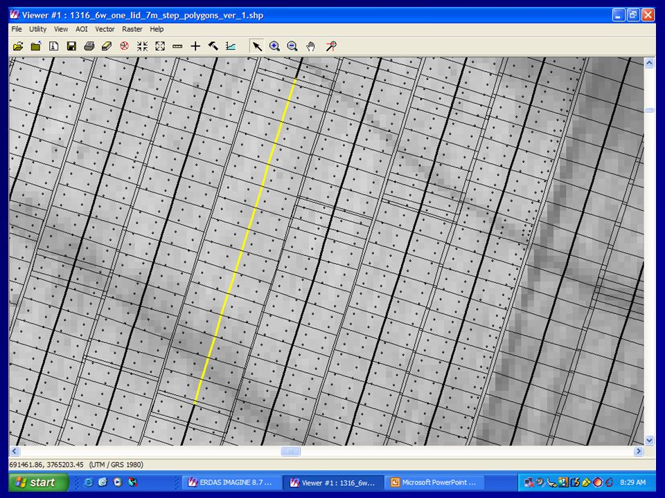
Curved Rows and Different Step Sizes of Spray Cells

20
Application Relates to Topological Experimental Designs Exploit spatial/geometric resolution of remote sensing (near and far systems) Exploit topological information provided by remote sensor systems Exploit topology information provided by VR Controllers and Yield Monitors Exploit Producer/Researcher judgement and experience Exploit spatially variable and different sized experimental units Exploit capability of General Linear Mixed Models
 Exploit topological information provided by remote sensor systems Exploit topology information provided by VR Controllers and Yield Monitors Exploit Producer/Researcher judgement and experience Exploit spatially variable and different sized experimental units Exploit capability of General Linear Mixed Models")
21
THE END [Job 12: 7 – 10] (English and Harris) (USDA ARS)
![THE END [Job 12: 7 – 10] (English and Harris) (USDA ARS)](http://images.slideplayer.com/27/9006043/slides/slide_21.jpg "THE END [Job 12: 7 – 10] (English and Harris) (USDA ARS)")
Similar presentations