Download presentation
Presentation is loading. Please wait.

1
What’s the Reference?

2
Applying the Technique: 6 Steps 1. Identify the Evaluation Area 2. Obtain or develop Reference Worksheet 3. Obtain or develop Evaluation Matrix 4. Complete characterization worksheets 5. Rate 17 indicators 6. Rate the 3 Rangeland Health Attributes

3
What’s the Reference? An Ecological Reference Worksheet is developed for each ecological site using soil surveys, ecological site descriptions, reference areas, research and expert knowledge. Indicators. For each indicator, describe the potential for the site. Where possible, (1) use numbers, (2) include expected range of values for above- and below-average years, when appropriate & (3) cite data. Continue descriptions on separate sheet. 1. Number and extent of rills: 2. Presence of water flow patterns: 3. Number and height of erosional pedestals or terracettes: Etc... for indicators 4-17
 use numbers, (2) include expected range of values for above- and below-average years, when appropriate & (3) cite data. Continue descriptions on separate sheet. 1. Number and extent of rills: 2. Presence of water flow patterns: 3. Number and height of erosional pedestals or terracettes: Etc... for indicators")
4
A unique reference is needed for each Ecological Site u An ecological site is a kind of land with specific physical characteristics (soil, topography, climate) which differs from other kinds of land in its ability to produce distinctive kinds and amounts of vegetation in its’ response to management. u In other words, a kind of land with similar potential. u Other stratification systems can also be used at a broader scale.

5
Where does the information come from?

7
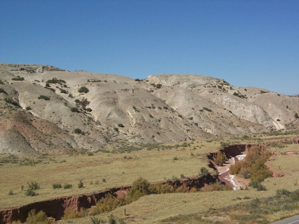
Evaluation Area

8
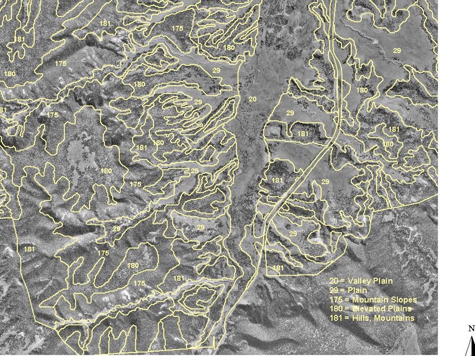
Using soils to identify ecological sites An ecological site can include more than one soil series, provided that the soils are similar A soil map unit can include more than one ecological site. Soil map units often include many different soils, with different potentials to support plant communities Even a soil series can include more than one ecological site. Soil surface texture often varies within a soil series. Soil surface texture is very important in distinguishing ecological sites.

9
Map Units u Soils are grouped into soil mapping units because we often cannot map soils at the scale at which they vary u Same for ecological sites: in order to map ecological sites, they often must be combined into ecological site mapping units, just as soils are combined into soil mapping

11
A soil map unit (what’s on the map) can be: u An ASSOCIATION of two or more soil soils* that occur in a fairly repetitive and predictable pattern (e.g. low ridges & swales) u A COMPLEX of two or more soils* that usually do not occur in a predictable pattern (e.g. coarse and fine soils in a river floodplain) u A single soil series (but even these map units usually have “inclusions” too small to be mapped). Sometimes call a CONSOCIATION
 u A COMPLEX of two or more soils* that usually do not occur in a predictable pattern (e.g. coarse and fine soils in a river floodplain) u A single soil series (but even these map units usually have inclusions too small to be mapped). Sometimes call a CONSOCIATION.")
12
VEGETATION RANGE SUCCESSION MODEL Excellent Condition Climax Poor Condition Early successional Condition scale (adapted from Westoby, Walker, Noy-Meir 1989) 0255075100 Range Condition What’s the Reference?
 Range Condition What’s the Reference")
13
State and Transition Model Potential Natural Community

14
Reference State… The state where the functional capabilities represented by soil and site stability, hydrologic function, and biotic integrity are performing at a near-optimum level under the natural disturbance regime.

15
Reference State Community A Community B Community C

16
Generating the reference worksheet u What do you need to define potential for an ecological site?

17
Generating the reference worksheet u What do you need to define potential for an ecological site? –Ecological Site Descriptions Ecological Site Description http://plants.usda.gov/esis

18
Generating the reference worksheet u What do you need to define potential for an ecological site? –Ecological Site Descriptions –Soil survey information

19
STATSGO Soil Mapping Available at 1:250,000 scale (http://soils.usda.gov) SSURGO Soil Mapping Available at 1:24,000 scale (http://soils.usda.gov)

20
Generating the reference worksheet u What do you need to define potential for an ecological site? –Ecological Site Descriptions –Soil survey information –Ecological Reference Areas

21
Ecological Reference Area(s) “A landscape unit in which ecological processes are functioning within a normal range of variability and the plant community has adequate resistance to and resiliency from most disturbances” Special Management Areas Well-managed rangeland Exclosures
 A landscape unit in which ecological processes are functioning within a normal range of variability and the plant community has adequate resistance to and resiliency from most disturbances Special Management Areas Well-managed rangeland Exclosures")
22
Ecological Reference Area(s) Verify soils Establish baseline studies Communication area
 Verify soils Establish baseline studies Communication area")
23
Generating the reference worksheet u What do you need to define potential for an ecological site? –Ecological Site Descriptions –Soil survey information –Reference sites –Expert knowledge (old timers and brilliant ecologists)
.")
24
Generating the reference worksheet u What do you need to define potential for an ecological site? –Ecological Site Descriptions –Soil survey information –Ecological Reference Area(s) –Expert knowledge (old timers and brilliant ecologists) –Other data (e.g. from LTER and other long- term studies)
 –Expert knowledge (old timers and brilliant ecologists) –Other data (e.g. from LTER and other long- term studies).")
25
Generating the ecological reference worksheet Capture temporal and disturbance variability!

26
Generating the ecological reference worksheet Reference Worksheet defines the “None to Slight” Category in the Evaluation Worksheet

27
No Reference Worksheet--- don’t bother going to the field!

28
Current EFR Handbook Guidance

29
What’s the Reference?

Similar presentations


 Natural Potential Large Variation Between Years Climax.>")

 for a particular.>")


