Download presentation
Presentation is loading. Please wait.

1
Creating Digital Elevation Models

2
What is a DEM? Raster files with specific elevation values at specific grid point locations

3
Create a DEM from contours data Spatial Analyst Tools Interpolation Topo to Raster All input data stored in same coordinate system and with the same z-units –z-units = elevation units: meters, feet, etc.

4
Input feature needs z data –Nivel = level in Español

5
Type of input PointElevation—A point feature class representing surface elevations. The Field stores the elevations of the points http://resources.arcgis.com/en/help/main/1 0.1/index.html#//009z0000007m000000

6
Type of input Contour—A line feature class that represents elevation contours. The Field stores the elevations of the contour lines

7
Type of input Boundary—A feature class containing a single polygon that represents the outer boundary of the output raster. Cells in the output raster outside this boundary will be NoData. This option can be used for clipping out water areas along coastlines before making the final output raster. There is no Field option for Boundary.

8
Stream—A line feature class of stream locations. All arcs must be oriented to point downstream. The feature class should only contain single arc streams. There is no Field option for Stream. Sink—A point feature class that represents known topographic depressions. Topo to Raster will not attempt to remove from the analysis any points explicitly identified as sinks. The Field used should be one that stores the elevation of the legitimate sink. If NONE is selected, only the location of the sink is used. Lake—A polygon feature class that specifies the location of lakes. All output raster cells within a lake will be assigned to the minimum elevation value of all cells along the shoreline. There is no Field option for Lake. Cliff—A line feature class of the cliffs. The cliff line features must be oriented so that the left-hand side of the line is on the low side of the cliff and the right-hand side is the high side of the cliff. There is no Field option for Cliff. Exclusion—A polygon feature class of the areas in which the input data should be ignored. These polygons permit removal of elevation data from the interpolation process. This is typically used to remove elevation data associated with dam walls and bridges. This enables interpolation of the underlying valley with connected drainage structure. There is no Field option for Exclusion. Coast—A polygon feature class containing the outline of a coastal area. Cells in the final output raster that lie outside these polygons are set to a value that is less than the user-specified minimum height limit. There is no Field option for Coast.

9
Output cell size –Size of each individual pixel in raster –Smaller cell sizes are more accurate –units of the input raster 10 m resolution pixel resolution of 10 m vertical accuracy of 20 m

10
Five counties, Indiana, 1:200,000 scale. https://www.igic.org/news/index.php?itemid=500

11
Surface Analyses

12
What to do with a DEM? Visualization pixel resolution of 10 m vertical accuracy of 20 m

13
Surface Analysis Slope Viewshed Aspect Hillshade Contouring

14
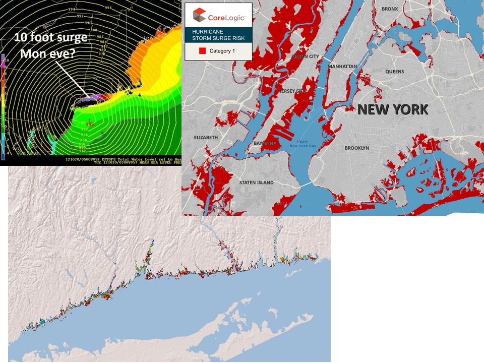
Elevation analyses –Sea level rise

15
Elevation analyses –Sea level rise on habitats

17
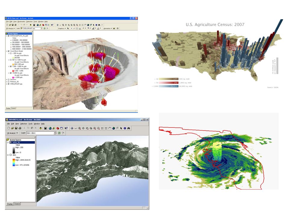
Creating 3-D Scenes

18
ArcScene 3D visualization Vertical exaggeration = 5

20
http://www.youtube.com/watch?v=Nun95_cQzBg

21
Questions? ? ?

22
Helpful site: –http://www.gsd.harvard.edu/gis/manual/dem/http://www.gsd.harvard.edu/gis/manual/dem/

Similar presentations


>")


