Download presentation
Presentation is loading. Please wait.

1
Geographic data

2
Types of Geographic data Surveys Photographs Sketches Numerical data (eg counting the number of a particular item in an area) Brochures, tourism leaflets etc
 Brochures, tourism leaflets etc")
3
Surveys Ask members of the public some questions Have to be prepared with questions beforehand Ask the same questions of each person you survey Be polite, explain who you are and what you are working on Only ask 2-3 quick questions: people are busy and you shouldn’t take up too much of their time.

4
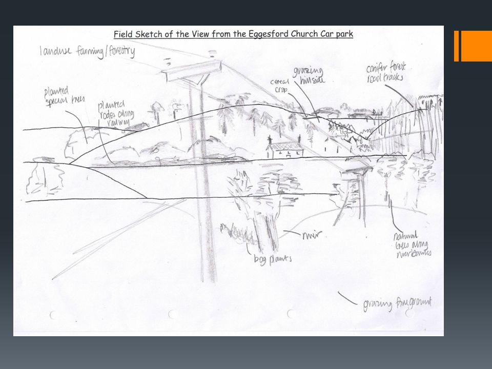
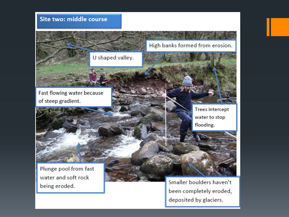
Photographs & Sketches Field sketching and field photography are fundamental parts of any field work investigation. Benefits of sketches: You can annotate your sketch: add notes, create a legend, label items you want to draw attention to. Benefits of photographs: Before and after shots could be taken to show differences before and after an event, for example a rain storm Taking photographs of the same place at different times of the day can show changes, eg the change in traffic flow at a particular junction, the pedestrian flow across an intersection. Can also add digital annotations afterwards, but would have to record these on paper during the fieldwork trip as well

7
Numerical data Counting the number of a particular item in an area For example: How many bins are located along Swanston Street: between Flinders & Collins; Collins & Bourke; How many different types of facilities are located within some of Melbourne’s parks, gardens & reserves (eg playgrounds, public toilets) How many drain pipes feed into the Yarra River between Princes Bridge (St Kilda Road) and Queensbridge St (bridge just before Casino); and Queensbridge St and Kings Way bridge
 How many drain pipes feed into the Yarra River between Princes Bridge (St Kilda Road) and Queensbridge St (bridge just before Casino); and Queensbridge St and Kings Way bridge")
8
Numerical data Can present in graph format afterwards to make comparisons (see example below) Can also mark items on a map on the day of the fieldwork excursion Have printed maps with you on the day to add annotations and rough sketches too
 Can also mark items on a map on the day of the fieldwork excursion Have printed maps with you on the day to add annotations and rough sketches too")
9
Brochures, tourism leaflets etc Useful for seeing maps and locations of things, eg: parks; various items along water ways; public transport, cycle and walking routes. Go to the Visitor’s Centre at Federation Square to collect these items

Similar presentations