Download presentation
Presentation is loading. Please wait.

1
1 GIS Activities of the State Emergency Response Team Richard Butgereit GIS Administrator 850-413-9907 richard.butgereit@em.myflorida.com

2
2 Some activities to cover… 1.US National Grid 2.Virtual USA 3.Geospatial Assessment Tool for Operations and Response – GATOR 4.KML for Google Earth 5.E-Plan 6.Incident Mapper

3
3 United States National Grid Lessons learned have taught us that standardized grids are needed for positional reporting. As far back as Hurricane Andrew, problems were recognized for emergency managers...

4
4 Florida Adopts the USNG USNG was adopted by the FFCA FDEM to adopt the USNG in the States CEMP Florida Fire College, Florida Fire Chiefs Association, FL National Guard to develop curriculum and instructor manuals Modules incorporated into Firefighter II curriculum

5
5 FEMA Adopts the USNG Near term priority approved by Administrator Fugate Establish a standard for FEMA operational maps using the National Grid

6
6 What’s wrong with current systems? We already have… – Latitude/Longitude – Township/Range/Section – Street Address and Zip – “Bingo” Grids

7
7 Latitude/Longitude Multiple formats are confusing DD -85.990151, 30.272240 DM -85 59.409089, 30.16.334386 DMS 85 59’24.545”W, 30 16’20.063”N All the same location!!!

8
8 How far is a second anyway? What is the distance from…. 85 59’24.545”W, 30 16’20.063”N To here…. 85 59’26.292”W, 30 16’14.546”N

9
9 Township/Range/Section Township/Range/Section grid from the Public Lands Survey System is an important and good system… – basis of land ownership records – been in use for over 180 years

10
10 Township/Range/Section But a perfect section really doesn’t exist irregular in coastal areas too large to meet needs of ground crews

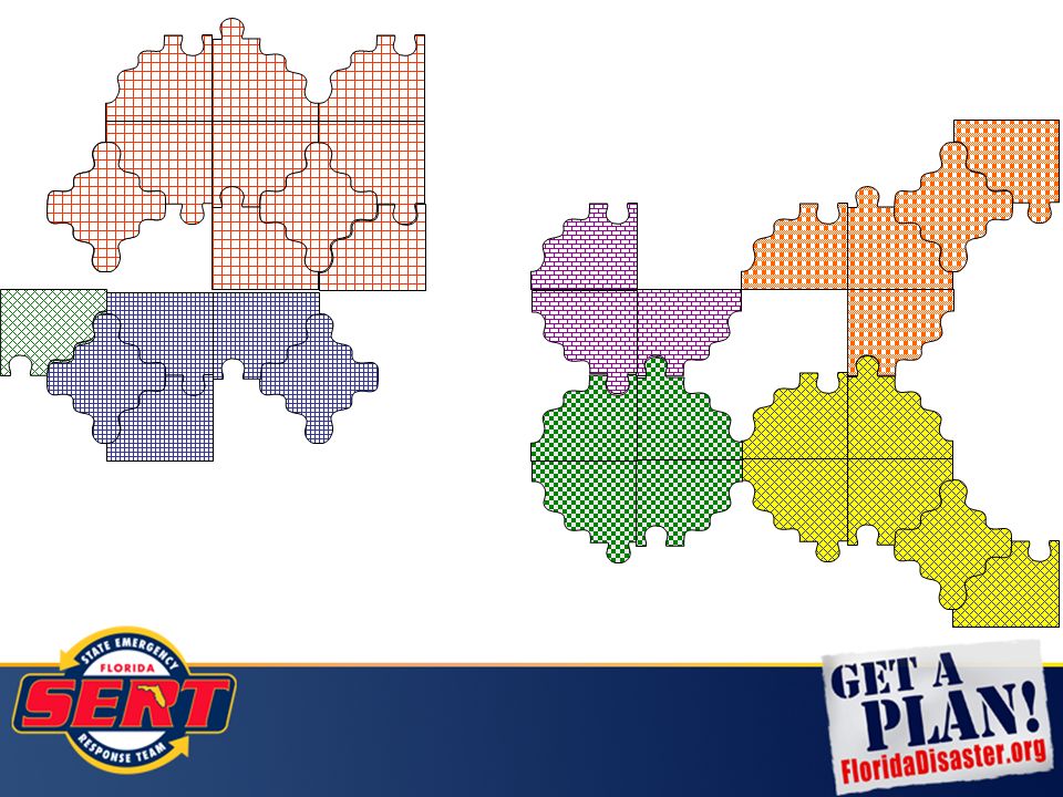
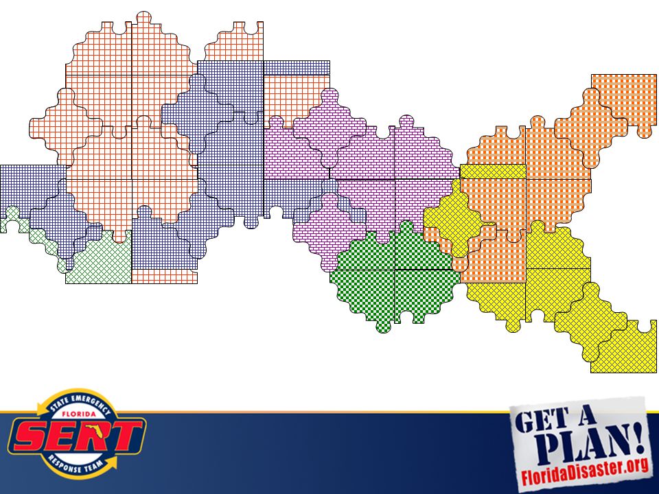
11
11 Street Address and Zip Problematic due to… – rural routes – post office boxes – House numbers missing or obscured

12
12 What do you do when the SIGNS are gone?

13
13 What do you do when the ROADS are gone?

17
17 Developed by the United States Army Corps of Engineers in the 1940s A position on the Earth is referenced in the UTM system by the UTM zone, and the easting and northing coordinate pair. Abbreviated as “UTM” 16R 766000 3364820 Universal Transverse Mercator

18
18 is the geocoordinate standard used by North Atlantic Treaty Organization (NATO) for locating points on the earth. is derived from the UTM grid system, but uses a different labeling convention. Abbreviated as “MGRS” 16R GU 66000 64820 Military Grid Reference System

19
19 Practically identical to MGRS. Difference is the datum – MGRS uses WGS84, which USNG uses NAD 83 Coordinates reported identical. Abbreviated as “USNG” 16R GU 66000 64820 United States National Grid

20
20 USNG it has the advantage of being easily plotted on USGS topographic maps by using a simple "right and then up" method instead of having to plot from right to left when using latitude and longitude in the Western Hemisphere. The coordinates are also easily translated to distance since they are in meters. Thus the distance between two coordinates can quickly be determined in the field.

21
21

22
22 16R GU 66000 64820 How to read USNG 100,000 Meter Grid – identification for regional areas Grid Coordinates – Easting and Northing position Grid Zone Designation – for a world-wide unique address, identifies the longitude zone number and the latitude band letter

23
23 16R GU 66000 64820 16R17R Truncate for locality just like you don’t have to dial an area code to make a local call… all Florida locations will be 16R or 17R

24
24 16R GU 66000 64820 16R17R Truncate for locality 100,000 meter zone designation may be dropped when working locally

25
25 Truncate for less precision… Locates within 1000 meters66 64 6600 6482 Locates within 10 meters 660 648 Locates within 100 meters 66000 64820 Locates within 1 meter 16R GU 66000 64820

26
26 USNG Easily scaleable Pin-point and cell based locational reporting “Grid within a Grid”

27
27 Global Positioning Systems I have GPS……..why do I need to care about any of this? – USNG can be used with GPS – GPS supplements USNG – USNG will work when your GPS won’t

28
28 USNG and GPS Most GPS units explicitly support USNG as an option for units If you choose USNG, you must also choose NAD 83 as your datum (or technically, you haven’t chosen USNG) You may also choose MGRS with NAD 83 to be the functional equivalent of USNG
 You may also choose MGRS with NAD 83 to be the functional equivalent of USNG")
29
29 Support for USNG http://www.floridadisaster.org/gis/usng –tools and instructions for GIS staff FDEM’s GATOR –new mapping website with USNG tools FDEP’s Incident Mapper –simple Google Maps mashup with USNG tools GeoPDF’s –new PDF formats have GIS capabilities, including USNG support

30
30 USNG in ArcGIS 9.1 USNG National Grid Tools Repackaging of… –Military Analyst –Product line tool set (PLTS) USNG Locational Toolbar Available from ArcScripts –Less complicated, easier to use
 USNG Locational Toolbar Available from ArcScripts –Less complicated, easier to use")
31
31 USNG in ArcGIS 9.2/9.3 Integrated… – Go to X,Y Tool – Identify –Graticules

32
32 Military Analyst in ArcGIS 9.2/9.3 USNG coordinates may easily be added to a feature class. NAR-C is proper NAD 83 choice - “North American Reference CONUS”

33
33 Military Analyst in ArcGIS 9.2/9.3 USNG coordinates added to a feature class.

34
34 Map Book Templates DS Map Book (free extension to ArcMap Produce 4,000 m x 5,000 8.5” x 11” 1:24,000 scale maps Style guide, templates and video from Delta State University linked from http://www.floridadisaster.org/gis/USNG/in dex.htm#mapbooks http://www.floridadisaster.org/gis/USNG/in dex.htm#mapbooks

35
35 Map Book Templates

36
36 Map Books If you have a county wide map book (with USNG or not), please let us know for inclusion on our website
, please let us know for inclusion on our website")
37
37

38
38 An information sharing initiative (not an application, nor a website) Regional Operational Pilot Platform between southeastern states from Feb – Nov 2009 Florida State Emergency Response Team participates, creates new mapping website, KML network links, and GeoRSS feeds Virtual USA
 Regional Operational Pilot Platform between southeastern states from Feb – Nov 2009 Florida State Emergency Response Team participates, creates new mapping website, KML network links, and GeoRSS feeds Virtual USA")
39
39 EMForum.org- http://www.emforum.org/vforum/091118.htm http://www.emforum.org/vforum/091118.htm DHS Secretary Napolitano Unveils Virtual USA http://www.dhs.gov/ynews/releases/pr_1260375414161.shtm Virtual USA

40
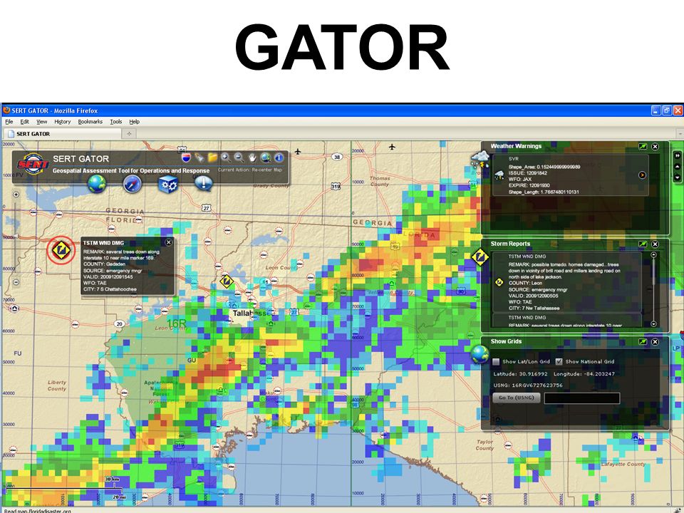
40 http://map.floridadisaster.org/GATOR Geospatial Assessment Tool for Operations and Response web mapping application real-time data like weather radar, watches, storm reports base map and post-event data GATOR

43
43 GATOR

44
44 FDEM Incident Recorder – show hazardous material and waste water spills Your data – Virginia DEM’s VIPER displays 911 calls and includes links to audio recordings –Map services or GeoRSS feeds used to display your incidents, operations, and response Incorporate social media Where can we go?

45
45 KML for Google Earth http://map.floridadisaster.org/ArcGIS/KML Critical Facilities “Excepted Facilities” Missions from EM Constellation USNG layers Primary Indicators of Response

46
46 KML for Google Earth

47
47 http://www.floridadisaster.org/gis/kml

48
48 Hazardous Material Facilities For first responders User names/password provided through Local Emergency Planning Committee https://erplan.net E-Plan

49
49

50
50

51
51

52
52 http://www.floridadisaster.org/gis/kml/viewer.htm simple Google Maps mashup with USNG tools real-time data like weather radar, watches, storm reports will be transitioning to GATOR Incident Mapper

53
53

54
54

55
55

56
56 Bonus Round… 1.FDOT Unified Basemap Repository 2.HAZUS Data Web Portal & Risk Assessments 3.State Regional Evacuation Studies (Coastal LiDAR/SLOSH Project) 4.Mapping for Blackberry
 4.Mapping for Blackberry")
57
57 https://www3.dot.state.fl.us/unifiedbasemaprepository FDOT has funded a statewide, enterprise license for government agencies NAVTEQ roads now available for all levels of Florida government FDOT Unified Basemap

58
58 Regional Evacuation Studies Study and Update Regional Hurricane Evacuation in light of new legislation (HB 1359 – SB 7121) Utilize New LIDAR data combined with updated SLOSH modeling Utilize Consistent methodology and format to ensure complete transparency and visibility Expected completion in 2010
 Utilize New LIDAR data combined with updated SLOSH modeling Utilize Consistent methodology and format to ensure complete transparency and visibility Expected completion in 2010")
59
59 Call Disposition# of calls Complete 18,800 Schedule Callback 4,201 Refused 46,753 Terminated Early 1,998 Government/Business 2,608 Answering Machine 138,319 Language barrier 2,077 Over Quota 225 Non-working/disconn 21,054 Busy 19,103 No Answer 90,070 Wrong number 286 Fax machine/modem 3,430 Out of town 260 Call back later 23,234 Non-qualified respondent 1,959 Already completed 427 Left message 22 Duplicate Number 134 Push to Night 5,958 Total Calls 380,918 Response rate = 27.8%

60
60 Percent Complete Evacuation Analyses Storm Surge Analysis ** ** Requires updated Storm Surge Zones **

61
61 Transporation Model

62
62

63
63

64
64 LiDAR Projects

65
65 26 - Accepted 12 - Under Review Status of Deliverables FDEM Coastal LiDAR

66
66 11 RPCs 12 SLOSH Basins

67
67 SLOSH Data Development

68
68 BasinLiDAR & DEMBasin Data SLOSH MOM Tampa Bay Panama City Pensacola Apalachicola Cape Canaveral Fort Myers Cedar Key Biscayne Bay Palm Beach Florida Bay Okeechobee Jacksonville Status 12/09

69
69 What is HAZUS-MH? Tool that can identify hazard related risks, calculate potential losses to life and property, and help define effective ways to reduce losses Available from FEMA free of charge http://www.fema.gov/plan/prevent/hazus http://www.fema.gov/plan/prevent/hazus

70
70 What is CDMS? CDMS is a tool developed by FEMA to support integration of locally developed inventory data into the HAZUS-MH loss estimation process. Primary functions –Support transfer of data into and out of the major master statewide databases –Provide validation of new data into the system

71
71

72
72

73
73 Statewide Analyses Hurricane Winds Coastal Floods

74
74 Debris in Tons

75
75 Loss Ratio

76
76 Florida HAZUS User Group flhug.hazus.orgflhug.hazus.org www.usehazus.com/flhugwww.usehazus.com/flhug floridadisaster.org/gisfloridadisaster.org/gis flhazusdata.comflhazusdata.com

77
77 Maps for Blackberry light-weight web mapping application real-time data like weather radar, watches, storm reports more to come…

78
78 Questions? FloridaDisaster.org/gis

Similar presentations