Download presentation
Presentation is loading. Please wait.

1
GIS Resources For Emergency Management Randy Knippel Dakota County

3
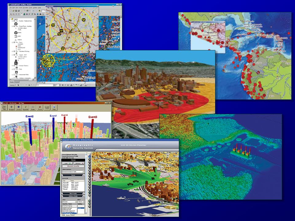
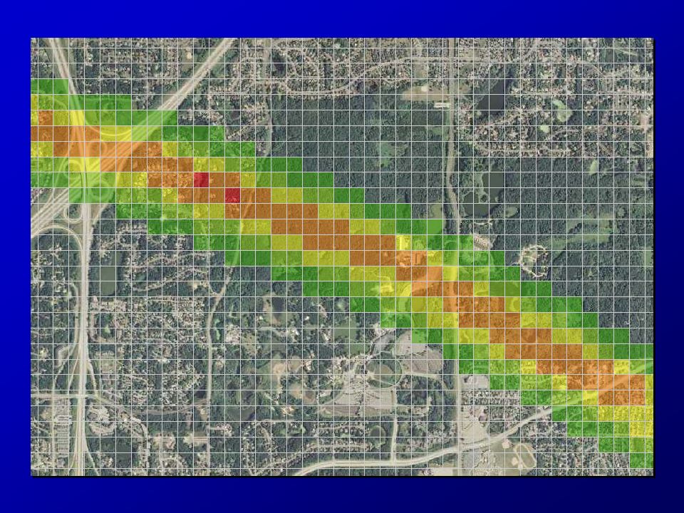
GIS For Emergency Management Damage assessmentDamage assessment StatusStatus Resource deploymentResource deployment AnalysisAnalysis PlanningPlanning

4
Maps!

5
Agenda Emergency Response MapsEmergency Response Maps The U.S. National GridThe U.S. National Grid ExercisesExercises

6
Emergency Response Maps

7
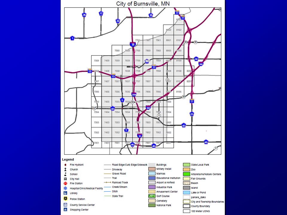
Map Book

8
Map Legend

9
Map Index

10
Map Pages

11
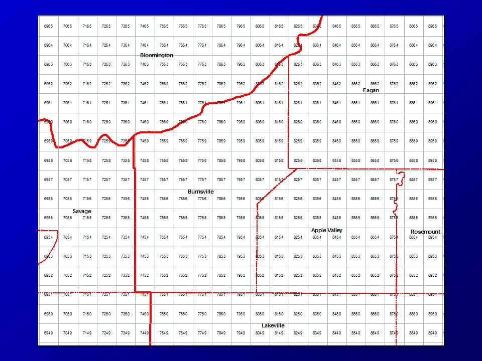
Map 7456

12
Street Index

13
Dana Dr.

18
United States National Grid (USNG) National standard since 2001National standard since 2001 Adopted by federal agenciesAdopted by federal agencies –FEMA, DHS, NGA, USGS Adopted by several statesAdopted by several states –Florida, Missouri, North Carolina, others –Minnesota (March 25, 2009) Military Grid Referencing SystemMilitary Grid Referencing System –Metric system
 National standard since 2001National standard since 2001 Adopted by federal agenciesAdopted by federal agencies –FEMA, DHS, NGA, USGS Adopted by several statesAdopted by several states –Florida, Missouri, North Carolina, others –Minnesota (March 25, 2009) Military Grid Referencing SystemMilitary Grid Referencing System –Metric system")
19
Why? Multiple gridsMultiple grids –Needed one for everyone Need efficient location referencingNeed efficient location referencing Need interoperabilityNeed interoperability –Across jurisdictions –Local, state, federal, military

20
What about Lat / Long? Not intuitiveNot intuitive –Degrees, minutes, seconds Several formatsSeveral formats –DMS, DMS.sss, DM.mmm, D.ddd –Longitude + / - + / - West / eastWest / east Increases right to leftIncreases right to left

21
What about Lat / Long? How big is a degree?How big is a degree? –It varies 69 miles at the equator69 miles at the equator Longitude gets smaller toward polesLongitude gets smaller toward poles 50 miles in Dakota County50 miles in Dakota County Distance calculations are difficultDistance calculations are difficult

22
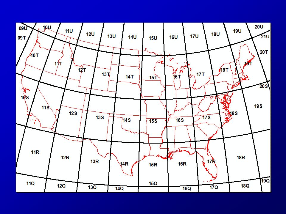
Grid Zone Designation (GZD) 6 x 8 Degrees
 6 x 8 Degrees")
23
100 Km Squares

24
10 Km Squares USNG:15T VK 75

25
1 Km Squares

27
Map 7456 (15T VK 74 56)
")
28
Map VK75 7456

29
USNG Components 15TVK738915116215TVK7389151162 GZD 100K XXXXX YYYYYGZD 100K XXXXX YYYYY

30
741565 (15T VK 741 565) Map 7456 (15T VK 74 56)
 Map 7456 (15T VK 74 56)")
31
Scalable National Regional Local

32
Precision and Truncation 18SUJ233710651918SUJ2337106519 –18S UJ 23371 06519 1 meter precision, full USNG designation1 meter precision, full USNG designation –UJ2306 Assume GZD (18S)Assume GZD (18S) UJ – 100,000 m precision (100 km square)UJ – 100,000 m precision (100 km square) 23 06 – 1000 m precision (1 km square)23 06 – 1000 m precision (1 km square) –2337 0651 10 m precision10 m precision Assume GZD and 100 km squareAssume GZD and 100 km square
Assume GZD (18S) UJ – 100,000 m precision (100 km square)UJ – 100,000 m precision (100 km square) – 1000 m precision (1 km square)23 06 – 1000 m precision (1 km square) – m precision10 m precision Assume GZD and 100 km squareAssume GZD and 100 km square")
33
Truncating GZD USNG:15T VK (100Km square) VK is unique for 800 miles in any direction USNG:15T VK (100Km square) VK is unique for 800 miles in any direction
 VK is unique for 800 miles in any direction USNG:15T VK (100Km square) VK is unique for 800 miles in any direction")
37
Critical Infrastructure Key Resources Vulnerable Population

38
Deployment Standard map productsStandard map products –Seamless across jurisdictions Common Operating PictureCommon Operating Picture –Critical infrastructure –Key Resources –Vulnerable population TrainingTraining Use the USNGUse the USNG

39
Read right, then up!

40
The Romer Scale

41
Read right, then up!

42
Examples – VK86 VK86 What is at 15T VK 869 628?What is at 15T VK 869 628? –Eagan City Hall

43
Examples What is at 15T VK 8360 6361?What is at 15T VK 8360 6361? – tank

44
Examples What is at 15T VK 8259 6084?What is at 15T VK 8259 6084? –Church

45
Examples Describe 15T VK 8417 6473?Describe 15T VK 8417 6473? –Railroad track

46
Examples What map book page covers the 35E & 494 interchange?What map book page covers the 35E & 494 interchange? –8867

47
Examples - Mapbook Mapbook Find 1449 Loan Oak Ln. at 863 662Find 1449 Loan Oak Ln. at 863 662 Find it on VK86Find it on VK86

48
Examples What is at 15T VK 887 664?What is at 15T VK 887 664? –Lexington Park

49
Examples What is at 15T VK 864 659?What is at 15T VK 864 659? –Pilot Knob Elementary

50
Examples What is at 15T VK 8740 6575?What is at 15T VK 8740 6575? –Trail intersection

51
Examples What is the address at 15T VK 8718 6534What is the address at 15T VK 8718 6534 –1321 Jurdy Rd.

Similar presentations


 Randy Knippel – Dakota County GCGI Emergency Preparedness Committee.>")


 – An OverviewU.S. National Grid (USNG) – An Overview Steve Swazee SharedGeo IowaGIC Conference April 8, 2015.>")


