Download presentation
Presentation is loading. Please wait.

1
Agronomy Training November 9, 2005 @WSU Ryan Maiden, Ag Tech Rep

2
Today’s Schedule

3
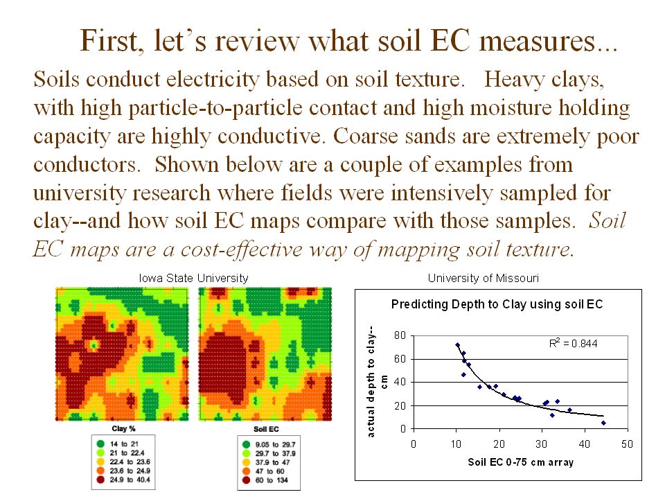
Soil EC Maps Electrical Conductivity Maps

4
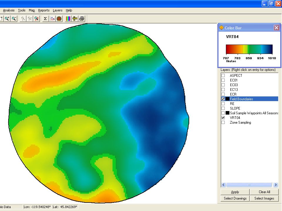
EC Maps, what are they? A Map of Your Soil!

5
EC Maps, what do they mean?

6
Veris Direct Soil Contact

9
The amount of clay in the soil plays a huge role in water and nutrient holding capacity. The cation-exchange capacity (CEC) of the soil is based largely on the clay content. If you can map this accurately, you have a good start on defining the differences in productive potential in the field. Why is soil texture important?
 of the soil is based largely on the clay content. If you can map this accurately, you have a good start on defining the differences in productive potential in the field. Why is soil texture important .")
10
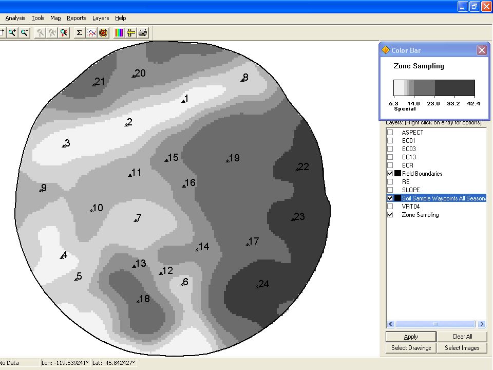
Improved soil sampling: “Directed grids” x x x x xx xx x x x x x x x x Conventional grids Directed grid sampling Brian E.

11
Improved soil sampling: “Management Zones” Sampling density and lab analysis costs can be reduced by dividing a field into management zones, based on soil EC and soil texture variability. In this example of zones, the number of samples was reduced by 50% versus 2.5 acre grids. Zone 1 Zone 2 Zone 3 Zone 4

12
What about changes over time? Won’t soil moisture affect soil EC? Yes, soil moisture and soil temperature do affect the readings. But the relative values remain consistent. In other words, the soil patterns that show up on an EC map are very repeatable. The conductivity numbers will change--but not the zones.

13
Collected Comments about EC Gaining Confidence Internet search>12,000 articles

14
Czech University of Ag Prague, Czech Republic “Those who want to start up with precision management should know well the land that they take care of.” “Currently, yield maps are the most widespread tool.”

15
“Yield maps say nothing about soil properties such as soil type, clay content, organic matter, water holding capacity/drainage, nutrient provision, topsoil depth and surface profile, which all influence yield.” cont.

16
EC maps : NRCS soil surveys SS’s laid over EC map correlate nicely Order 2 SS’s allow 2.5 ac inclusions Transitions, soils don’t change on a line No GPS available during SS’s

17
2005 EC Activity Veris Acres mapped between LCB and UCB this fall - 3100 acres @ $9.00 w/o soil analysis - Billing code to be used is 90007

18
2005 PA Projections Yield Maps –Double 2004 acres Veris in Willamette Valley – 1000 acres Veris in Umatilla/UCB – 750-1000 acres GPS Boundaries and Grid Sampling –10,000 acres

19
Start!

24
Finish!

25
Questions ?

Similar presentations


 Nielsen Professor of Agronomy Purdue University West Lafayette, IN 47907-1150 Web:>")


