Download presentation
Presentation is loading. Please wait.

1
Chapter 6 Photogrammetry

2
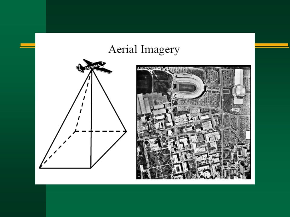
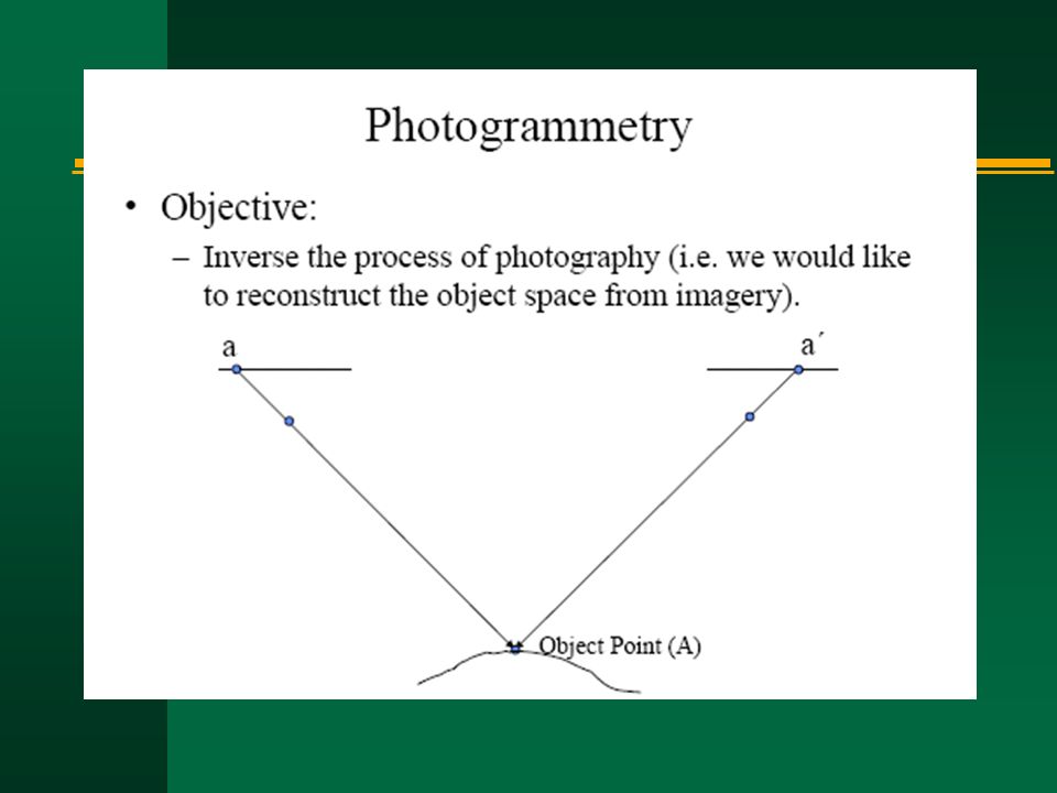
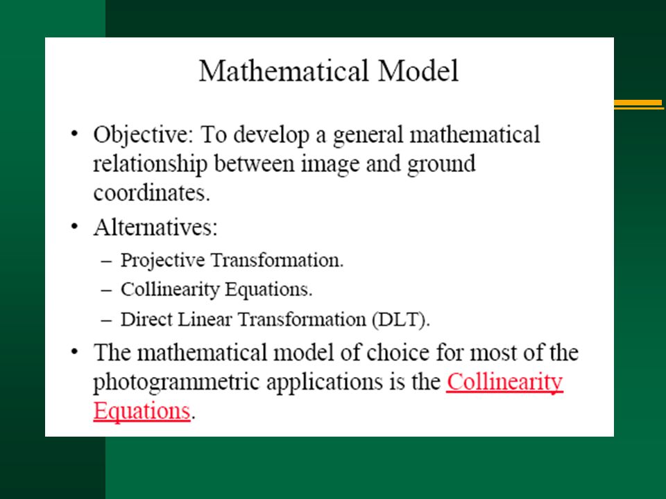
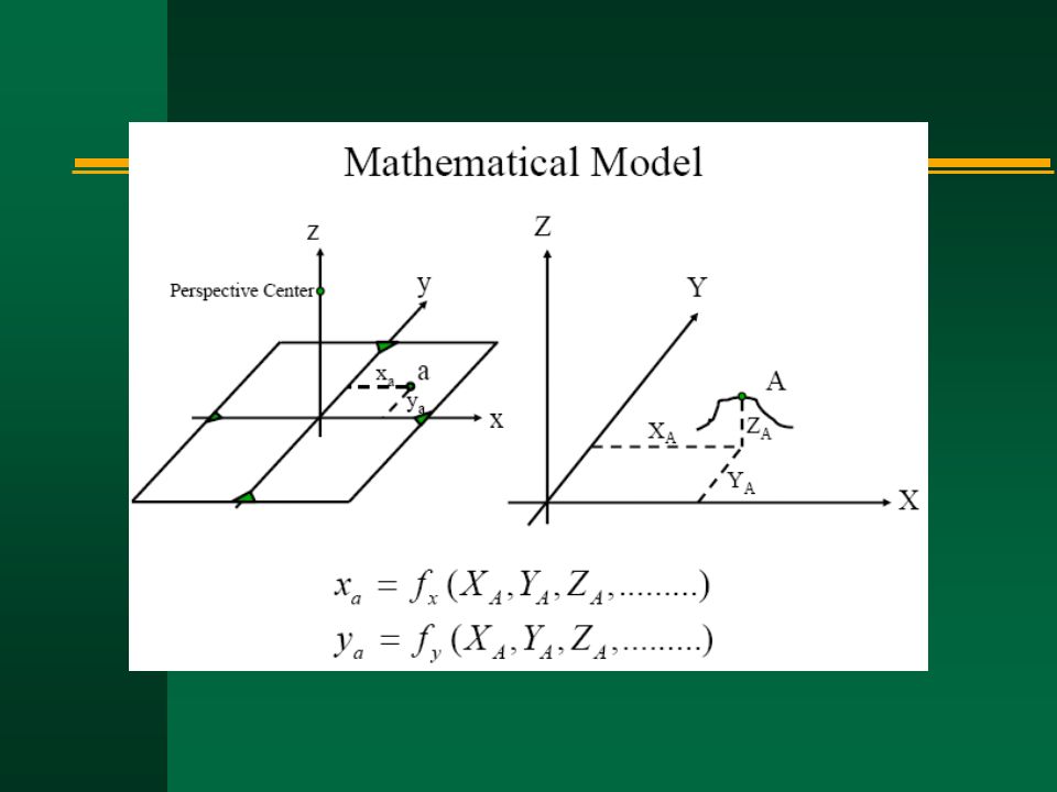
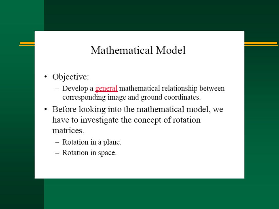
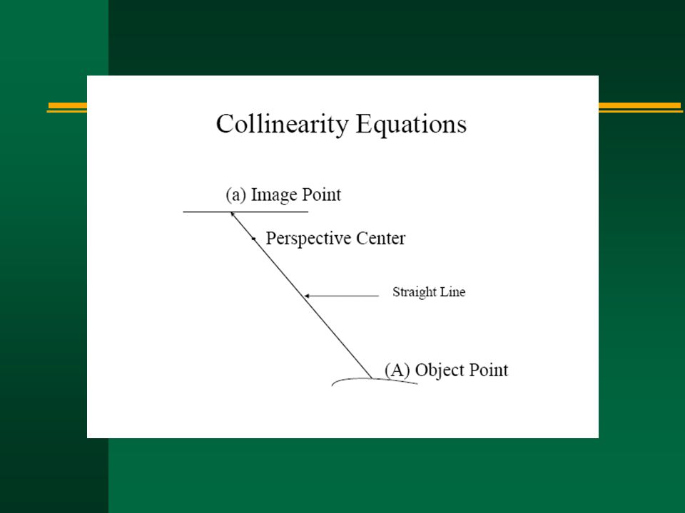
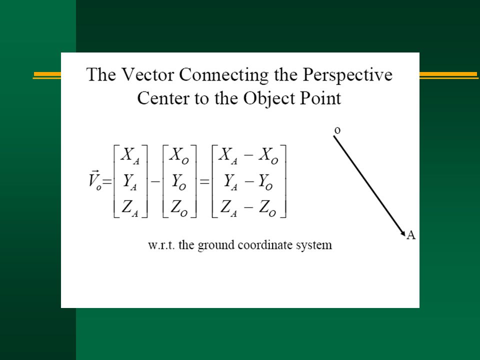
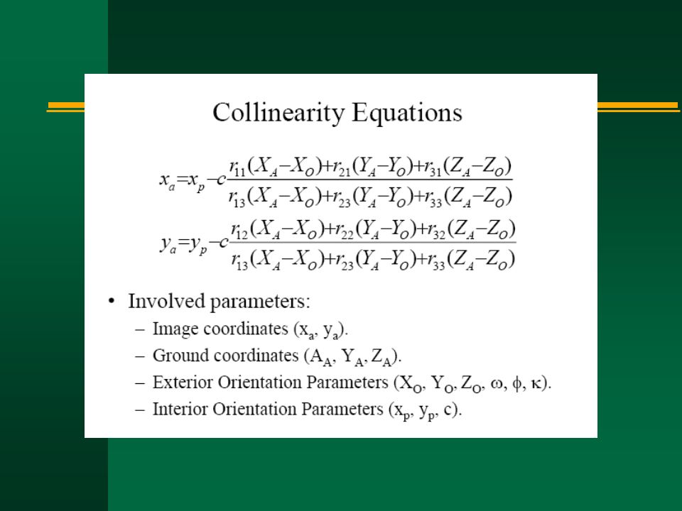
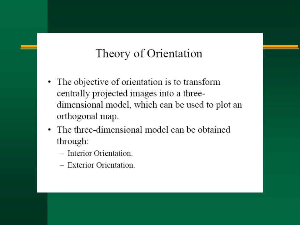
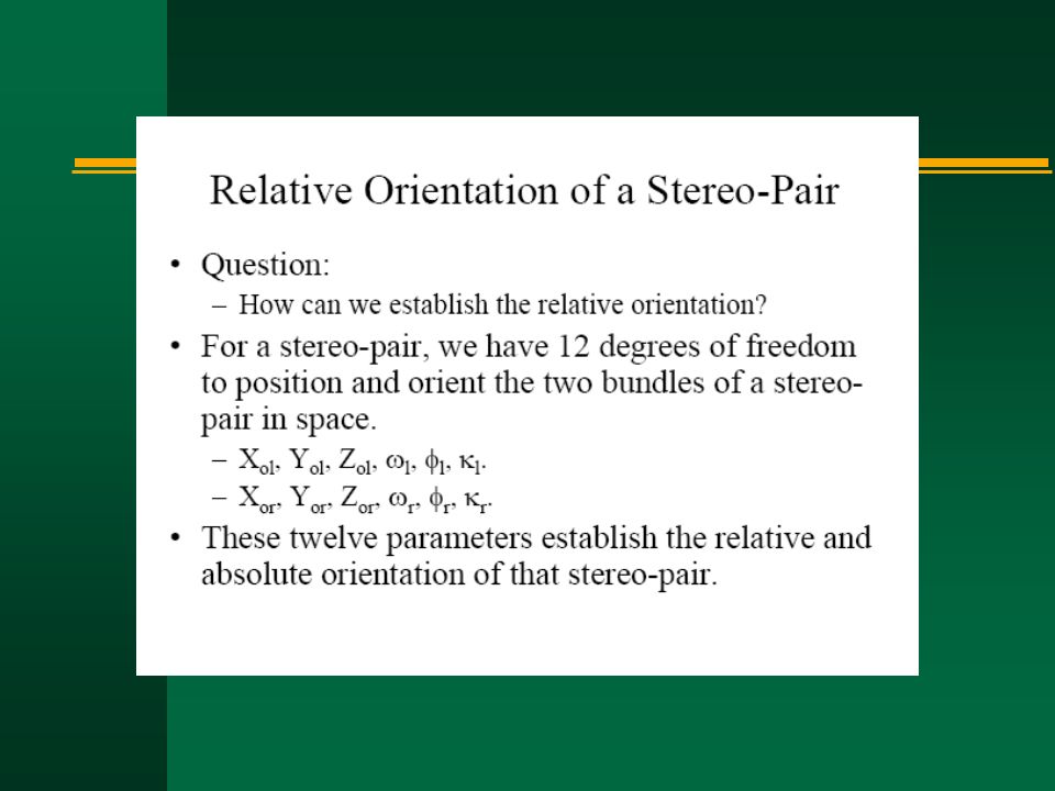
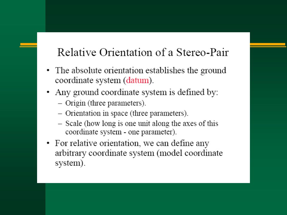
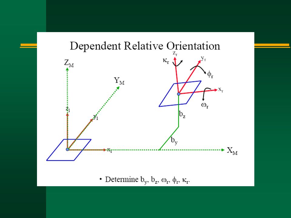
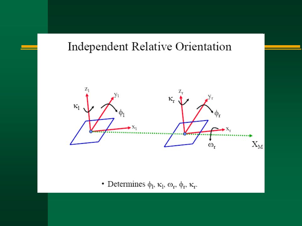
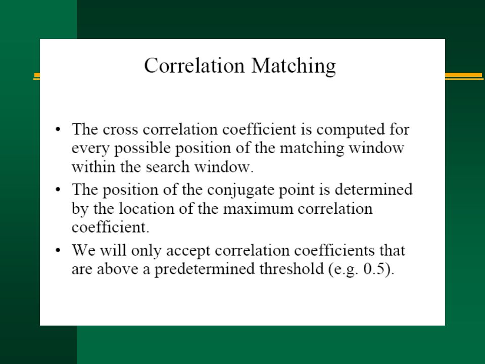
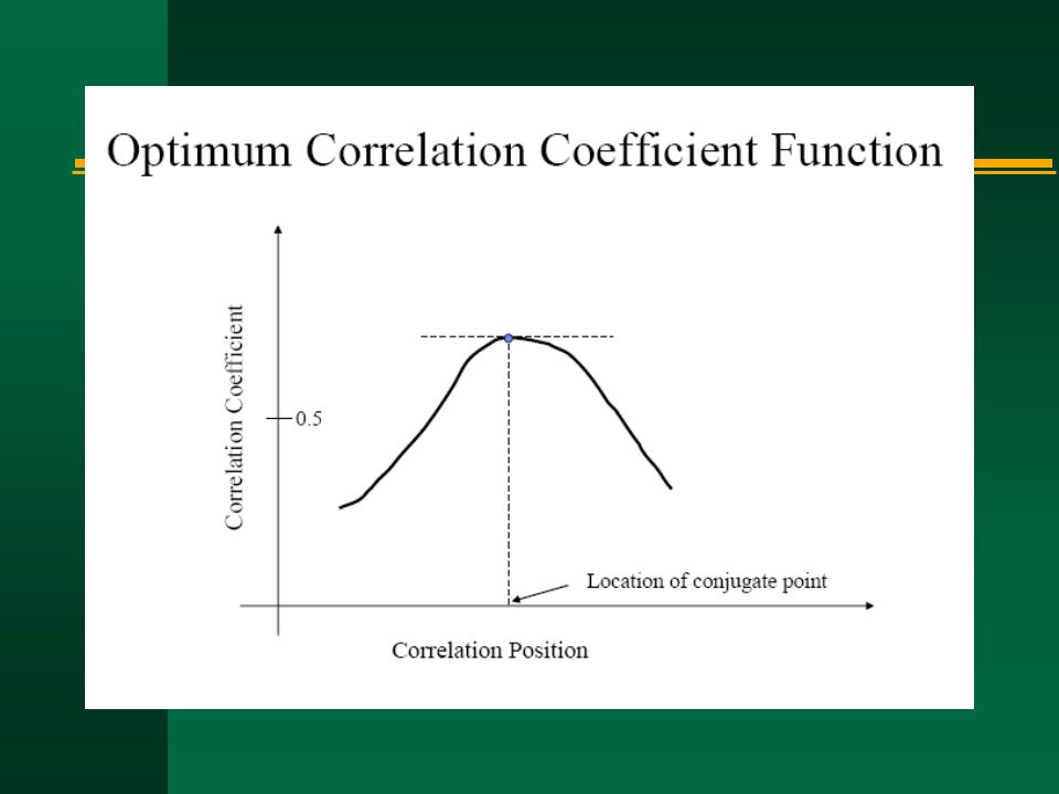
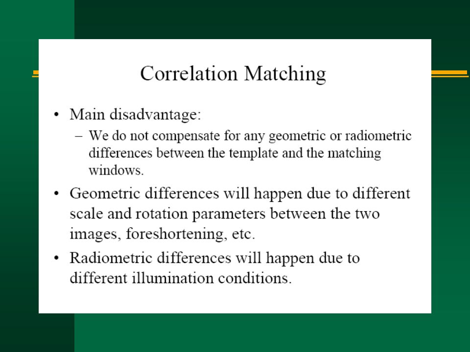
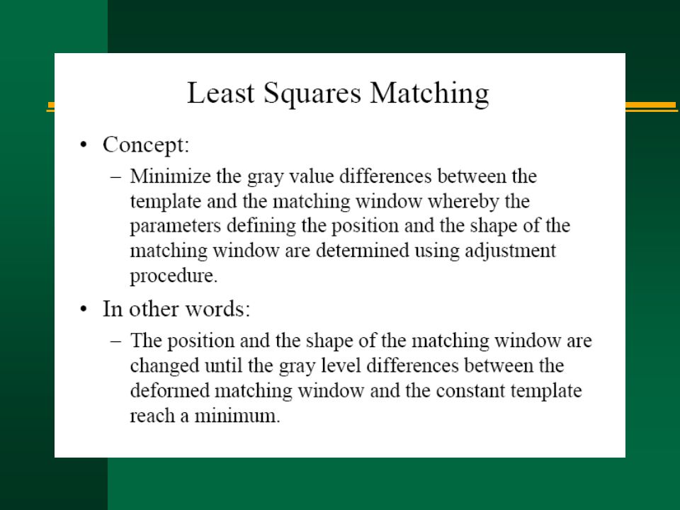
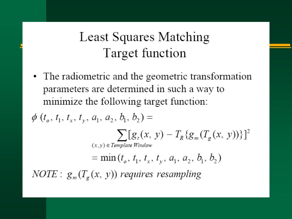
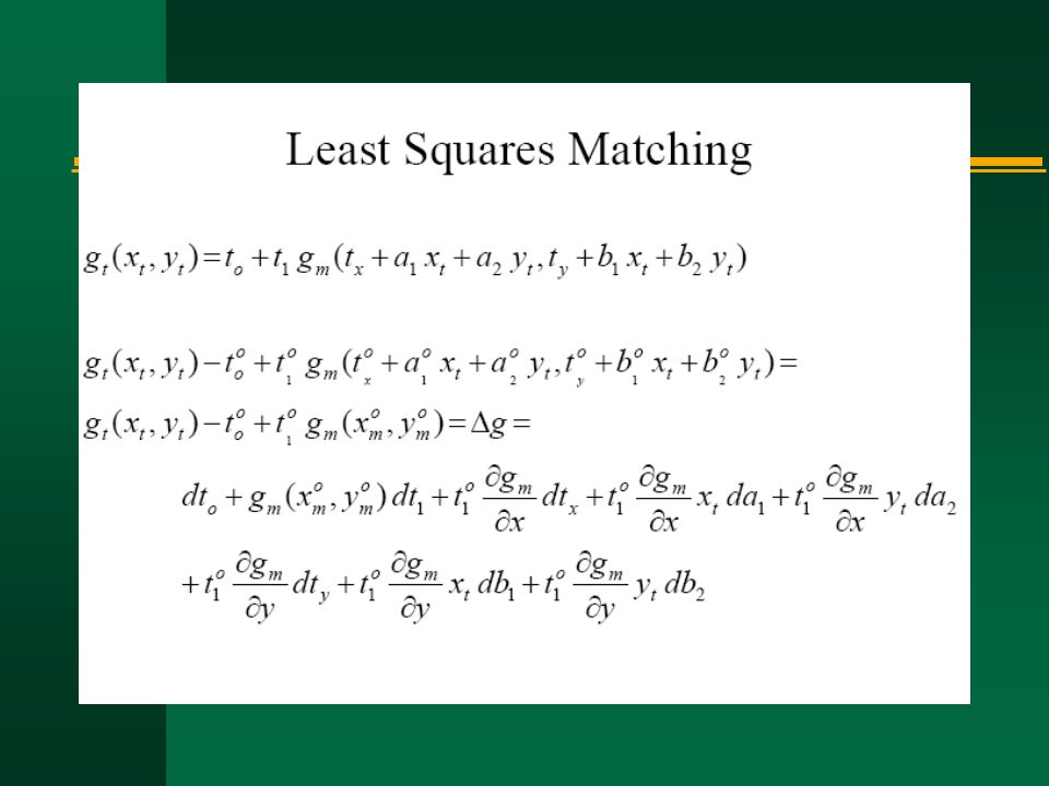
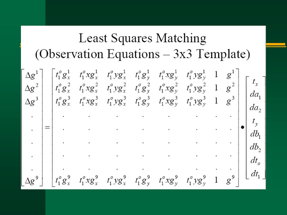
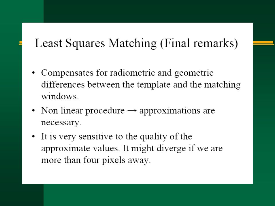
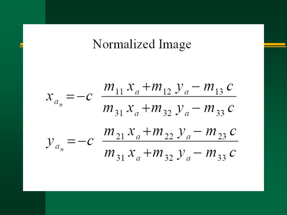
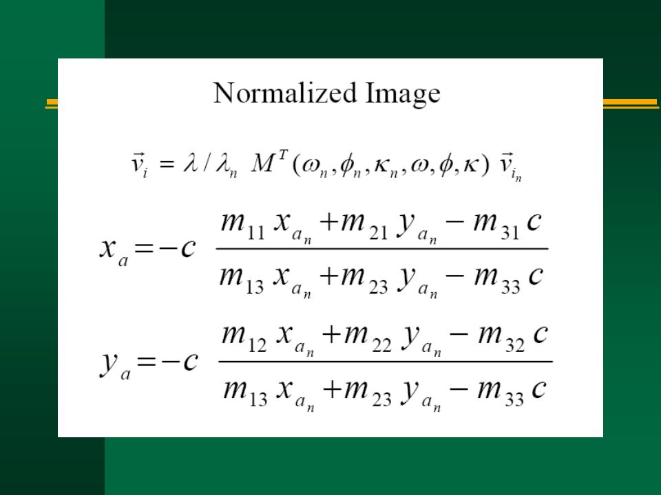
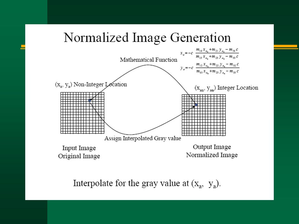
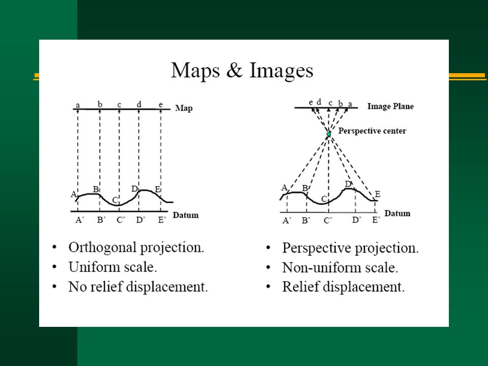
n Perspective (central) projection: aerial photographs vs. maps n Co-linearity equation n Photogrammetric orientation n Digital photogrammetry n Photo-interpretation Introduction

162
Photo-interpretation n Basic: tone/color n 2 nd order (geometric arrangements of tone/color): size, shape n 2 nd order (spatial arrangements of tone/color): texture, pattern n 3 rd order (positional elements): site, association n 3 rd order: height, shadow
: size, shape n 2 nd order (spatial arrangements of tone/color): texture, pattern n 3 rd order (positional elements): site, association n 3 rd order: height, shadow")
163
Elements of Image Interpretation Primary Elements Black and White Tone Color Stereoscopic Parallax Spatial Arrangement of Tone and Color Size Shape Texture Pattern Based on Analysis of Primary Elements Height Shadow Contextual Elements Site Association

164
Dot grid methodGrid square method Transect methodPolygon method Area measurement

165
References n Jensen, J.R., 2000, Remote Sensing of the Environment: An Earth Resource Perspective, Upper Saddle River, NJ: Prentice Hall, 544 pages. [Ch 5 pages119-135] Avery T. E. and G. L Berlin, 1992, Fundamentals of remote Sensing and Airphoto Interpretation, Fifth Edition, New York, Macmillan Publishing Company, 472 p. [pages 51-67] n Paine, D. E, 1981, Aerial Photography and Image Interpretation for Resource Management, New York, John Wiley and Sons, 571 p.

166
Mikail “ Modern Photogrammetry ” Wolf “ Photogrammetry ”

167
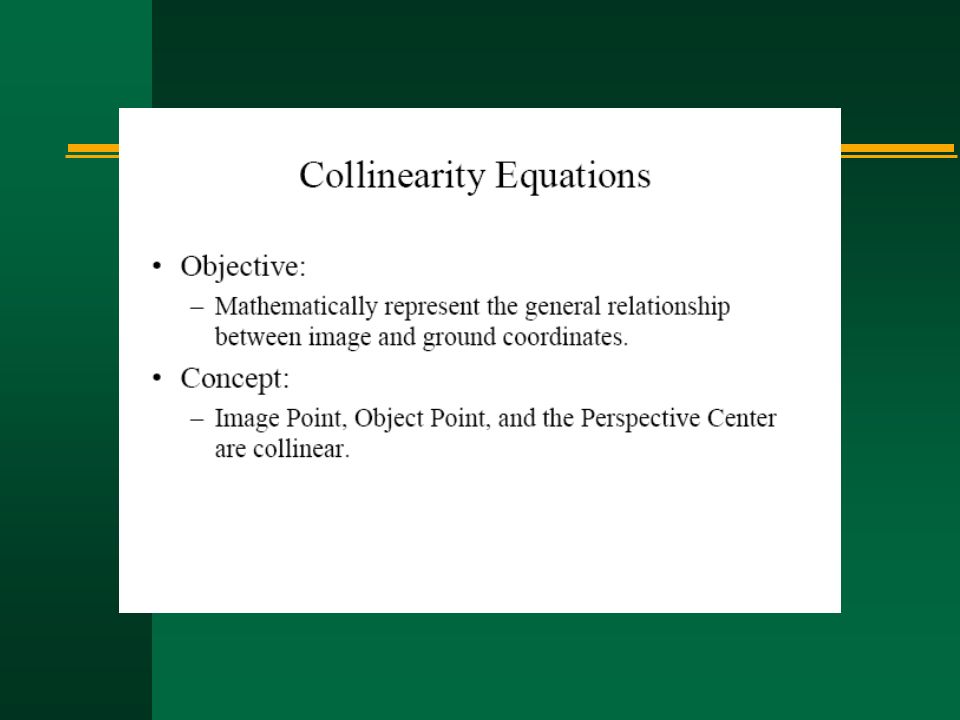
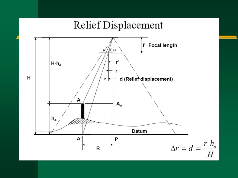
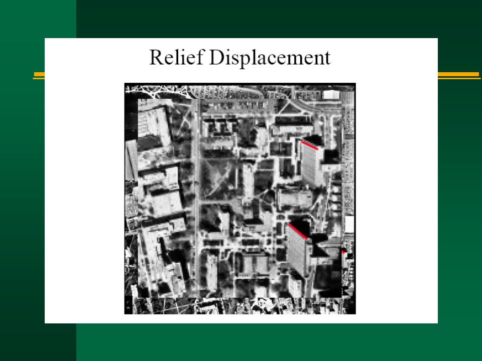
Questions 1. Discuss tilt and relief displacements based on collearity equations. 2. How do you think future developments in remote sensing and photogrammetry will affect each other and their integration with GIS?

Similar presentations


 11. (Definition) (Object) (Phenomena)>")


 4-20 © 1998 by Prentice Hall, Inc. A Simon & Schuster Company Upper Saddle.>")

