Download presentation
Presentation is loading. Please wait.

1
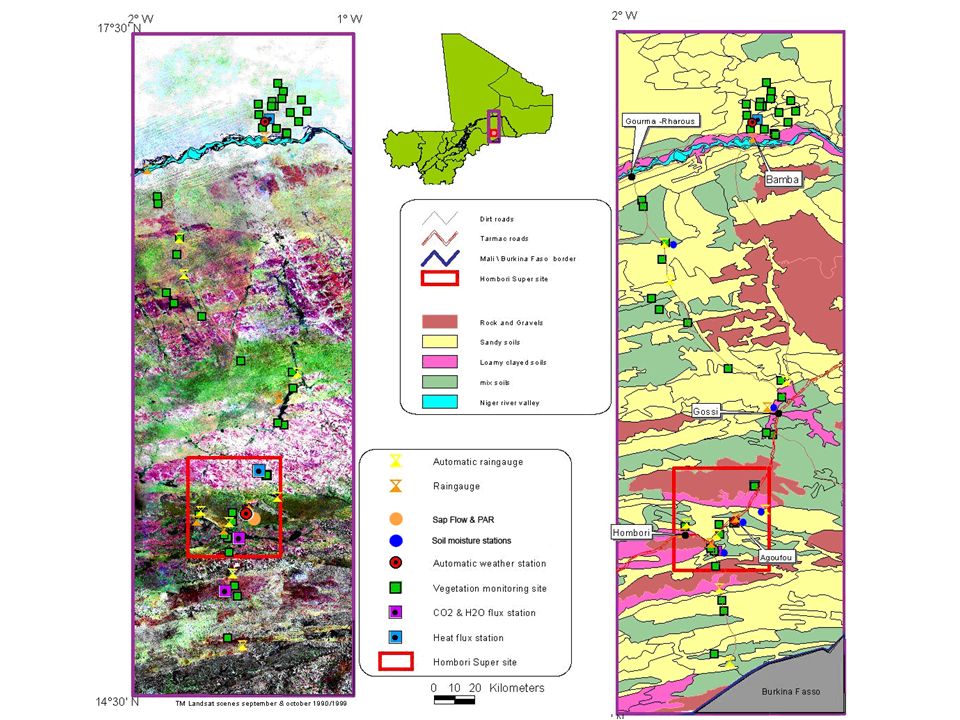
Hombori Supersite (15.4°N, 1.6°W) Agoufou local Site (15.3°N, 1.5°W) Bamba local Site (17.1°N, 1.3°W) Niger River Rainfall 50 mm 350 mm 450 mm 300 mm 100 mm Gourma mesoscale Site (3° x 1°)
 Agoufou local Site (15.3°N, 1.5°W) Bamba local Site (17.1°N, 1.3°W) Niger River Rainfall 50 mm 350 mm 450 mm 300 mm 100 mm Gourma mesoscale Site (3° x 1°)")
3
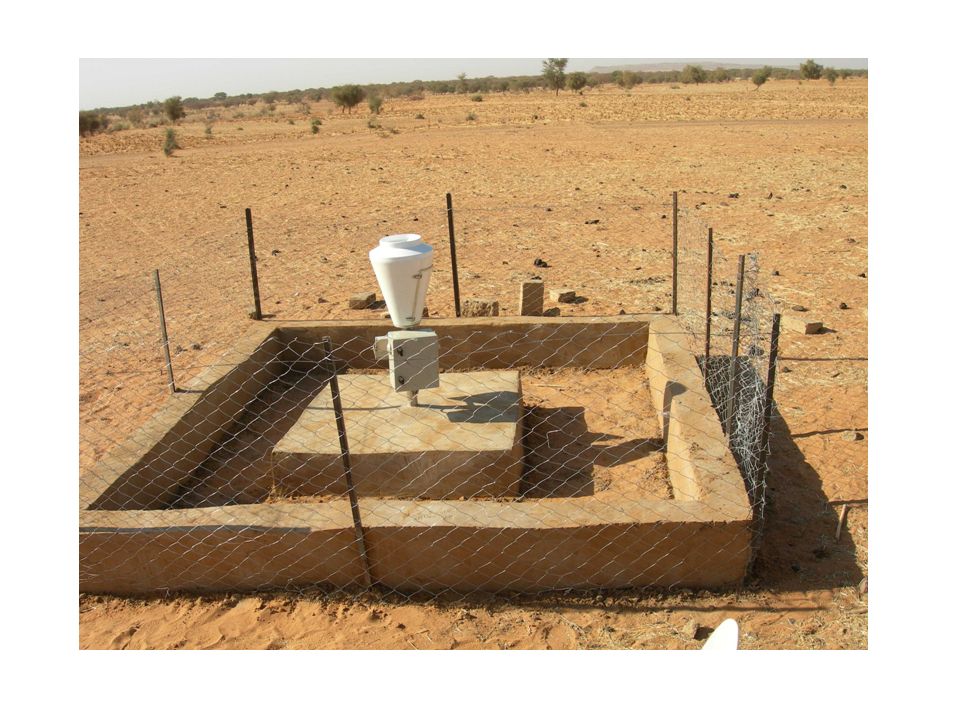
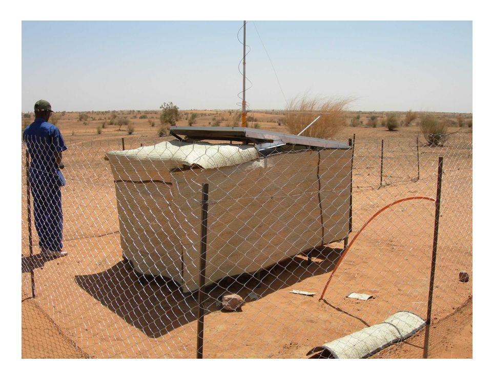
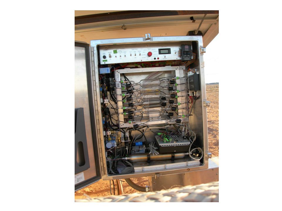
AMMA 2005 Measurements with Automatic stations Gourma - Haoussa 2 micro Météorological stations in Agoufou & Bamba Radiation – Soil and Air Temp and Moisrure – Soil Heat Flux – Rain – Wind speed and direction – pressure Missing data : PAR in July, Fire in November 2005 Calibration : Marrch 2006 Soil moisture stations network from Agoufou 15° to Bamba 17° N 5 to 250 cm deep, down to 500 cm in Agoufou Missing data : Tin Zaket from august to october 2005 An other calibration in july 1 Sap flow Granier & PAR station in Agoufou since february 2006 4 species, 12 PAR 1 « Classic » IRT surface temperatures station Missing data : From november to january Calibration : ? 2 sensible Heat flux stations + micro met Missing data : No data for Bamba in 2005, last 3 weeks in Hedgerit ?????? 2 LE (H 2 O), Fc (CO 2 ) & H stations + micro met H until ~18th of august in Agoufou ?????? Raingages network from 14° to 17° N Photometer PHOTON atmospherical chemistry IDAF CO2 precision N. Hanan F. Lavenu * No measure of gaz concentration * CR10x met data loggers don’t save data after few days
, Fc (CO 2 ) & H stations + micro met H until ~18th of august in Agoufou . Raingages network from 14° to 17° N Photometer PHOTON atmospherical chemistry IDAF CO2 precision N. Hanan F. Lavenu * No measure of gaz concentration * CR10x met data loggers don’t save data after few days.")
4
We have to do asap New soil moisture station close by the Met station in agoufou New IRT for the Agoufou Met station 9 PARs station with the Sap Flow station, Accacia Senegal 4 channels NDVI meter somewhere in Agoufou (SPOT VGT & MODIS) 8 meters hight measures of wind speed and wind direction ? Training session in metéorological measure with Campbell datalogger for : IER Gao (2 persons) IPR Katibougou (1 person) Direction de la Météo Nationale (2 persons)
 IPR Katibougou (1 person) Direction de la Météo Nationale (2 persons).")
5
2 stations météorologiques Agoufou et Bamba 9 pluviographes Nessouma Binantao Hekia Kinia Kobou Ebang Imalan Tin Tadeini Daribangui Tin Ahara 6 pluviomètres manuels Agoufou, Tara, Ecole Gallou Hombori, Daribangui, Ebang Imalan

Similar presentations
 E. Mougin, V. Demarez, P. Hiernaux, L. Kergoat, V. Le Dantec, M. Grippa, Y. Auda,>")


 Dr. C. H. Cho Meteorological Research Institute, KMA>")


