Download presentation
Presentation is loading. Please wait.

1
Metadata Understanding the Value and Importance of Proper Data Documentation Michael Moeller Metadata Specialist NOAA Coastal Services Center

2
What is Metadata?

3
Simply put, metadata is information about your data. What is Metadata?

4
This is the metadata for this. What’s Missing? Emily and Madison

5
Author(s) Boullosa, Carmen. Title(s) They're cows, we're pigs / by Carmen Boullosa Place New York : Grove Press, 1997. Physical Descr viii, 180 p ; 22 cm. Subject(s) Pirates Caribbean Area Fiction. Format Fiction Author(s) Boullosa, Carmen. Title(s) They're cows, we're pigs / by Carmen Boullosa Place New York : Grove Press, 1997. Physical Descr viii, 180 p ; 22 cm. Subject(s) Pirates Caribbean Area Fiction. Format Fiction This is the metadata for this. While the card-catalog entry is a form of metadata, it does not address topics such as quality, accuracy, or scale. Well-written geospatial metadata describes these and many more aspects of the data.
 They re cows, we re pigs / by Carmen Boullosa Place New York : Grove Press, Physical Descr viii, 180 p ; 22 cm. Subject(s) Pirates Caribbean Area Fiction. Format Fiction Author(s) Boullosa, Carmen. Title(s) They re cows, we re pigs / by Carmen Boullosa Place New York : Grove Press, Physical Descr viii, 180 p ; 22 cm. Subject(s) Pirates Caribbean Area Fiction. Format Fiction This is the metadata for this. While the card-catalog entry is a form of metadata, it does not address topics such as quality, accuracy, or scale. Well-written geospatial metadata describes these and many more aspects of the data..")
6
Identification_Information Citation Citation_Information Originator: NOAA Coastal Services Center Publication_Date: 19971131 Title: Hurricane Storm Surge Geospatial_Data_Presentation_Form: Map Publication_Information Publication_Place: Charleston, SC Publisher: NOAA Coastal Services Center Larger_Work_Citation Citation_Information Identification_Information Citation Citation_Information Originator: NOAA Coastal Services Center Publication_Date: 19971131 Title: Hurricane Storm Surge Geospatial_Data_Presentation_Form: Map Publication_Information Publication_Place: Charleston, SC Publisher: NOAA Coastal Services Center Larger_Work_Citation Citation_Information This is the metadata for this.

7
Metadata as a Component of Data

8
Properly documented data provides vital information to interested parties. A Component of Data

9
Metadata is that component of data which describes it. Environmental Sensitivity Index Data Metadata RARNUM - unique combination of species, concentration, and seasonality CONC (concentration) = Density species is found at location Season_ID = seasonality code like to the seasonal table Element - Biology group A Component of Data
 = Density species is found at location Season_ID = seasonality code like to the seasonal table Element - Biology group A Component of Data.")
10
It’s data about a data set. Title Scale Source Content Location Publication Access Title Scale Source Content Location Publication Access MetadataMetadata GIS files Imagery Geospatial databases GPS data GIS files Imagery Geospatial databases GPS data Data set A Component of Data

11
Metadata describes… CONTENT CONDITION QUALITY Characteristics of the data Characteristics of the data A Component of Data

12
Because metadata provides vital information about a dataset, it should never be viewed or treated as a separate entity.

13
Metadata Non-spatial or attributes Spatial Take Home Message A Component of Data Metadata is a critical and integral component of any complete data set. Metadata is a critical and integral component of any complete data set.

14
The Value of Metadata

15
The Value of Metadata The Current Concept Primary external value Discovery Assessment Access Use

16
The Value of Metadata The Current Concept Primary internal value “Inheritance” “Properly documenting a data set is the key to preserving its usefulness through time.”

17
The Value of Metadata An Emerging Concept An aid to data management Internal value Discovery Assessment Access Use

18
Additional data management benefits An Emerging Concept Data Currency Date of last edit/update Age of source files Data Utility Track source file usage Track distribution frequency

19
Monitoring Data Development Data processing steps Status of development Estimate Development Costs Data processing – time and extent Source file availability Additional data management benefits An Emerging Concept

20
To realize the full potential of metadata under this new concept, metadata creation must become integral to the data development process. The question is “How?” Make metadata part of the process

21
Approach metadata development from a business perspective Build administrative support Preserves data investment Limits liability Helps manage data resources Aids in external data acquisition Facilitates data access and transfer Provides for efficient data distribution Make metadata part of the process

22
Stress the individual benefits of metadata Build technical support Reduces workload over the long term Field fewer data inquiries Provides a means of documenting personal contributions Facilitates sharing of reliable information Make metadata part of the process

23
Develop strong staff support Incorporate metadata expectations into job descriptions and performance standards Build technical support Provide staff development opportunities The three “T’s” Training Tools Time Make metadata part of the process

24
Develop templates to facilitate efficient and consistent metadata creation Build organizational support Identify pertinent fields within the metadata structure Populate fixed fields Use standardized language Define distribution methods Cite standards used Build source and contact libraries Make metadata part of the process

25
Map metadata fields to the work flow Establish and assign responsibilities Distribute the effort Technicians – lineage Analysts – process and methodology Field Scientists – accuracy assessments I.T. Managers – tools, automated collection methods, information management Make metadata part of the process

26
Mandate the use of standards and templates Develop boilerplate metadata-deliverable language for data contractors Require publication of metadata Create and publish standard operating procedures to document metadata policies and procedures Establish standard policies Make metadata part of the process

27
Standardized Metadata

28
Why Have a Standard? Think for a moment how hard it would be to… … bake a cake without standard units of measurement. … put gas into your car without standard nozzle sizes. … plug a lamp into a socket without standard electrical outlets.

29
Why Have a Standard? The standard for metadata ensures a level of consistency in data documentation. Standards ensure consistency.

30
Establishing a Standard The Federal Geographic Data Committee (FGDC) was organized in 1990 under the Office of Management and Budget to promote the coordinated use, sharing, and dissemination of geospatial data on a national basis. The FGDC was tasked with creating a metadata standard to meet these objectives. The Metadata Standard

31
"... each agency shall document all new geospatial data it collects or produces, either directly or indirectly, using the standard under development by the FGDC, and make that standardized documentation electronically accessible to the Clearinghouse network." The Content Standard for Digital Geospatial Metadata (CSDGM) Executive Order 12906, 1994 Establishing a Standard
 Executive Order 12906, 1994 Establishing a Standard.")
32
This “Content Standard” serves as a uniform summary description of the data set. Establishing a Standard

33
The Content Standard utilizes... Common terms Common definitions Common language Common structure Access constraints Citation currentness entity attribute domain lineage Process step Establishing a Standard

34
The Content Standard… Establishes names of compound elements and data elements. Defines the information about the values that are to be provided for the data elements. Type=“free text” Domain=Real currentness entity attribute Citation lineage Establishing a Standard

35
The Content Standard helps the user determine... If a set of geospatial data is available and fit for a particular use. How to access and transfer the data set. Establishing a Standard

36
Who Who collected the data? Who processed the data? Who wrote the metadata? Who to contact for questions? Who to contact to order? Who owns the data? Where Where were the data collected? Where were the data processed? Where are the data located? What What are the data about? What project were they collected under? What are the constraints on their use? What is the quality? What are appropriate uses? What parameters were measured? What format are the data in? When When were the data collected? When were the data processed? How How were the data collected? How were the data processed? How do I access the data? How do I order the data? How much do the data cost? How was the quality assessed? Why Why were the data collected? Metadata written using the Content Standard answers these important questions: Establishing a Standard

37
Using the Content Standard

38
FGDC’s Metadata Workbook Defines the 334 metadata elements.

39
What do I use “The Workbook” for? It is the definitive resource for applying the FGDC Content Standard. However, it does not define the production rules. It describes element domain values, which are valid values that can be assigned to the data element. It provides section and element definitions.

40
It is a quick reference for production rules and structure. Use the “Graphical Representation” for quick access. You will still need to use the workbook to find the definition of a particular element and its domain.

41
The Content Standard is organized using numbered chapters called “sections.” There are 7 main sections and 3 supporting sections. Each section is organized into series of elements that define the information content for metadata to document a set of digital geospatial data. Organization of the Content Standard

42
Data Quality Information Spatial Data Organization Information Spatial Reference Information Entity and Attribute Information 4526731 Metadata The Three Supporting Sections 9 Time Period Information 10 Contact Information 8 Citation Information Distribution Information Metadata Reference Information Identification Information Organization of the Content Standard The Seven Main Sections

43
Organization of the Content Standard Each section begins with the name and definition of the section. These are followed by the component elements of the section. Each section provides the names and definitions of its component elements, information about the types of values that can be provided for the elements, and information about the elements that are mandatory or repeatable.

44
Interpreting the Graphical Production Rules The workbook uses graphics to illustrate the production rules of the standard. These graphics include most of the information provided by the production rules, including: How elements are grouped. What is mandatory and what is not. What elements can repeat and how many times they can repeat.

45
Interpreting the Graphical Production Rules Section Sections are depicted by this symbol. Compound Element Compound elements are depicted using a 2-dimensional box. Data Element Data elements are depicted using a 3-dimensional box with shadow.

46
Interpreting the Graphical Production Rules Data Element A data element is a logically primitive item of data. Data elements are the things that you “fill in.” The form for the definition of a data element is: Data element name -- definition. Type: (choice of “integer”, “real”, “text”, “date”, or “time”) Domain: (describes valid values that can be assigned) An example of the definition of a data element is: Abstract -- a brief narrative summary of the data set. Type: text Domain: free text Note: Data element definitions are contained in the text of the Content Standard, not in the graphical production rules.
 Domain: (describes valid values that can be assigned) An example of the definition of a data element is: Abstract -- a brief narrative summary of the data set. Type: text Domain: free text Note: Data element definitions are contained in the text of the Content Standard, not in the graphical production rules..")
47
Compound Element 1 Compound Element 1.1 Data Element 1.1.1 Data Element 1.1.2 Data Element 1.2 How Elements Are Grouped Compound elements are composed of other compound and data elements. The composition is represented by nested boxes.

48
Compound Element 1 Compound Element 1.1 Data Element 1.1.1 Data Element 1.1.2 Data Element 1.2 Compound Element 1 is composed of Compound Element 1.1 and Data Element 1.2. Compound Element 1.1 is composed of Data Element 1.1.1 and Data Element 1.1.2. How Elements Are Grouped

49
Mandatory - must be provided. Meaning Data Element Compound Element What’s Mandatory? What’s Not? Mandatory if Applicable - must be provided if the data set exhibits the defined characteristic. Optional - provided at the discretion of the data set producer.

50
If an element can be repeated independently from other elements, it will be indicated as such below the element name. Repeating Elements Compound Element 1 (can be repeated unlimited times) Compound Element 1.1 Data Element 1.1.1 Data Element 1.1.2 Data Element 1.2 This group of elements would repeat. Compound Element 1 Compound Element 1.1 Data Element 1.1.1 Data Element 1.1.2 Data Element 1.2
 Compound Element 1.1 Data Element Data Element Data Element 1.2 This group of elements would repeat. Compound Element 1 Compound Element 1.1 Data Element Data Element Data Element 1.2.")
51
Using the Graphics to Make Decisions All elements are colored yellow, so all are mandatory and must be reported. Compound Element 1 Compound Element 1.1 Data Element 1.1.1 Data Element 1.1.2 Data Element 1.2

52
Compound Element 1 is mandatory. Compound Element 1.1 is optional. If yes, Data Elements 1.1.1 and 1.1.2 are mandatory. If no, do not report Compound Element 1.1, Data Element 1.1.1 or 1.1.2, and skip to Data Element 1.2. Data Element 1.2 is mandatory. Compound Element 1 Data Element 1.1.1 Data Element 1.1.2 Data Element 1.2 Compound Element 1.1 Using the Graphics to Make Decisions

53
Compound Element 1 is mandatory. Compound Element 1.1 is mandatory. Data Element 1.1.1 is mandatory. Data Element 1.1.2 is mandatory if applicable. Data Element 1.2 is optional. Compound Element 1 Compound Element 1.1 Data Element 1.1.1 Data Element 1.1.2 Data Element 1.2 Using the Graphics to Make Decisions

54
Compound Element 1 is mandatory if applicable. If not applicable to the data set, do not report any elements. If applicable, it is mandatory and: Compound Element 1.1 is mandatory. Data Element 1.1.1 is mandatory if applicable. If not applicable, do not report it. If applicable, it is mandatory. Data Element 1.1.2 is mandatory. Data Element 1.2 is optional. Compound Element 1 Compound Element 1.1 Data Element 1.1.1 Data Element 1.1.2 Data Element 1.2 Using the Graphics to Make Decisions

55
Exercise 1 Using the Green Book

56
Review and Questions

57
Day Two

58
Let’s Review Metadata is a document that describes your data’s content, condition, and quality. Metadata is an integral component of your data. Metadata is also a powerful tool that an organization can utilize to build a strong internal data management structure. The current federal standard for metadata is the Content Standard for Digital Geospatial Metadata (CSDGM). Metadata’s traditional external value includes data discovery, assessment, access, and use. In order to be successful, this internal management structure requires building support at the administrative, technical, and organizational levels. Standardized metadata ensures consistency in documentation, and aids in the efficient discovery, access, transfer, and use of data.
. Metadata’s traditional external value includes data discovery, assessment, access, and use. In order to be successful, this internal management structure requires building support at the administrative, technical, and organizational levels. Standardized metadata ensures consistency in documentation, and aids in the efficient discovery, access, transfer, and use of data..")
59
Metadata as a Data Discovery Tool

60
The FGDC metadata clearinghouse is a decentralized system of Internet servers you can use to search for available geospatial data. Discovering Data Through Metadata Client FGDC Gateway Servers housing metadata

61
The descriptive information that fuels the FGDC clearinghouse is metadata, which is collected in a standard format to facilitate query and consistent presentation across the multiple participating sites. Discovering Data Through Metadata

62
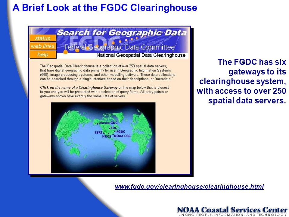
A Brief Look at the FGDC Clearinghouse The FGDC has six gateways to its clearinghouse system, with access to over 250 spatial data servers. www.fgdc.gov/clearinghouse/clearinghouse.html
63
Searches can be performed by using the NSDI Search Wizard, or by using a map interface with place names, or by place names alone. A Brief Look at the FGDC Clearinghouse

64
The new NSDI “Smart Select” Search Wizard bins servers by the types of metadata they house. A Brief Look at the FGDC Clearinghouse

65
Searches can be performed using a map interface that allows the user to define an area of interest. An area of interest can be defined by dragging an area of interest box on the map interface. A Brief Look at the FGDC Clearinghouse

66
The selected area defines the bounding coordinates that will be used in the search. A Brief Look at the FGDC Clearinghouse

67
You can search all the servers listed, or you can select only those that interest you. A Brief Look at the FGDC Clearinghouse

68
Select individual servers of interest to your search. A Brief Look at the FGDC Clearinghouse

69
Search criteria can be further refined by time period of content and keywords. A Brief Look at the FGDC Clearinghouse

70
The status of each selected node is displayed as the search is conducted. A Brief Look at the FGDC Clearinghouse

71
When the search is complete, the status window lets you know if you were successful in discovering metadata that matched your search criteria. A Brief Look at the FGDC Clearinghouse

72
Select a server to see what metadata is available. A Brief Look at the FGDC Clearinghouse

73
Metadata discovered by the search is shown by title. A Brief Look at the FGDC Clearinghouse

74
Metadata record returned in HTML format. Links take you to each of the seven main sections of the record. A Brief Look at the FGDC Clearinghouse

76
The Coastal Information Directory (CID) at the NOAA Coastal Services Center is similar to the FGDC gateway interface, but the CID searches only those spatial data servers that house metadata of a coastal nature. www.csc.noaa.gov/CID/ A Brief Look at the FGDC Clearinghouse

77
For more information on the clearinghouse system, visit the FGDC Web site (www.fgdc.gov). Here you can find information on how to establish your own clearinghouse node using free Isite software. On-line tutorials provide assistance for setting up and configuring this software. A Brief Look at the FGDC Clearinghouse

78
Perform a search using the keywords from the exercise “Searching for Metadata.” Access the FGDC Website at www.fgdc.gov. Click on the “Clearinghouse” link, and then click on “Search for Geospatial Data.” Choose a Clearinghouse Gateway. Decide how you are going to search. Searching for Metadata Exercise 2

79
Reading a Metadata File Exercise 3

80
Writing Metadata

81
First records are the hardest. Not all fields may need to be filled in. Tools are available. Training classes can be taken. Can often be produced automatically. Can (and should) be reviewed for updates. It’s not so bad!
 be reviewed for updates. It’s not so bad!.")
82
Writing Metadata Organize your information Write your metadata file Review your file Have someone else review ReviseRevise PublishPublish Six Steps for Writing Quality Metadata.

83
Before you begin writing, get organized. Document your data as you go. Write so others can understand. Always review your document. Writing Metadata

84
Items required Sense of Humor! Chocolate FGDC Workbook Metadata entry tool Coffee

85
Write simply but completely. Document for a general audience. Be consistent in style and terminology. Keep your readers in mind. Writing Metadata

86
Define all acronyms. Avoid using jargon. Clearly state data limitations. Writing Metadata Keep your readers in mind.

87
Write a complete title that includes: What Where When Scale Who Writing Metadata

88
The title is critical in helping others find your data. Which is better? Greater Yellowstone Rivers from 1:126,700 Forest Visitor Maps (1961-1983) Writing Metadata Rivers
 Writing Metadata Rivers.")
89
Be specific. Quantify when you can. Vague: We checked our work and it looks complete. Specific: We checked our work using 3 separate sets of check plots reviewed by 2 different people. We determined our work to be 95% complete based on these visual inspections. Writing Metadata

90
Select your key words wisely. Do not use ambiguous words. Use descriptive words. Fully qualify geographic locations. Writing Metadata

91
Have someone else read it. If you’re the only reviewer, put it away and read it again later. Check for clarity and omissions. Review your final product. Writing Metadata

92
Can a novice understand what you wrote? Are your data properly documented for posterity? When you review your work, ask: Writing Metadata

93
Does the documentation present all the information needed to use or reuse the data? Are any pieces missing? When you review your work, ask: Writing Metadata

94
Write so that others will understand. Writing Metadata

95
Metadata Creation and Validation Tool Time

96
A sample of some of the available tools for metadata creation, validation, and publication. CNS and MP “Chew ‘n spit,” checks and corrects structural errors, and “Metadata Parser”, which checks for errors in element compliance. NOAA CSC MetaScribe Allows you to create a template record that can be used to create large numbers of similar records. NOAA CSC ArcView Metadata Collector Extension for ArcView 3.x. TKME Text editor used for metadata entry. Commercially available software

97
Metadata Tools – Writing Metadata TKME An editor for formal metadata, TKME is intended to simplify the process of creating metadata that conform to the standard.

98
NOAA CSC ArcView ® Metadata Collector The ArcView® Metadata Collection Tool was developed by the National Oceanic and Atmospheric Administration (NOAA) Coastal Services Center in ArcView using the Avenue® scripting language. This tool collects and compiles Federal Geographic Data Committee (FGDC)-compliant metadata for ARC/INFO coverage's, shapefiles, grids and supported image formats. Metadata Tools – Writing Metadata
-compliant metadata for ARC/INFO coverage s, shapefiles, grids and supported image formats. Metadata Tools – Writing Metadata.")
99
NOAA CSC MetaScribe This new tool was also developed by the National Oceanic and Atmospheric Administration (NOAA) Coastal Services Center to aid in the creation of multiple sets of metadata that exhibit a high degree of redundancy. Metadata Tools – Writing Metadata

100
CNS (“Chew ‘n Spit”) A pre-parser for formal metadata designed to assist metadata managers convert records that cannot be parsed by mp into records that can be parsed by mp. Assumptions: The input file has metadata elements identified by name; elements always start with an element name, which is the first alphabetic string of characters on the line. CNS does not assume that you have used underscores in the standard element names, and if you have used nonstandard names for standard elements, you can tell CNS how to interpret them. Metadata Tools – Validating Metadata

101
CNS does not require indentation of any sort. It uses its knowledge of the standard and your arrangement of the elements to structure the metadata record. Because this method is not flawless, careful inspection of the output from CNS is the most prudent course of action. Metadata Tools – Validating Metadata

102
Usage C:>\cns [options] input_file Options: -v -c config_file -i info_file -a aliases -e leftovers -o output_file Metadata Tools – Validating Metadata
![Usage C:>\cns [options] input_file Options: -v -c config_file -i info_file -a aliases -e leftovers -o output_file Metadata Tools – Validating Metadata](http://images.slideplayer.com/33/8221811/slides/slide_102.jpg "Usage C:>\cns [options] input_file Options: -v -c config_file -i info_file -a aliases -e leftovers -o output_file Metadata Tools – Validating Metadata")
103
MP (Metadata Parser) A compiler to parse formal metadata, checking the syntax against the FGDC Content Standard for Digital Geospatial Metadata and generating output suitable for viewing with a web browser or text editor. Options: -c config-file -l language-code -e error-file -t text-file -h html-file -f faq-file -s sgml-file -x xml-file -d dif-file -fixdoc Usage C:>\mp [options] input_file Metadata Tools – Validating Metadata

104
TKME, CNS, and MP are available as free downloads from the United States Geological Survey (USGS) Website. (geology.usgs.gov/tools/metadata) TKME will run from a shortcut on the desktop, but both MP and CNS must be run from a command line in MS-DOS or UNIX. Metadata Tools – Validating Metadata
 TKME will run from a shortcut on the desktop, but both MP and CNS must be run from a command line in MS-DOS or UNIX. Metadata Tools – Validating Metadata.")
105
Finally... Remember, metadata is an integral component of your data. Metadata can provide many benefits at various levels within an organization by making the process of data management more streamlined and efficient.

106
Michael Moeller Mike.Moeller@noaa.gov www.csc.noaa.gov/metadata/

Similar presentations


>")


>")