Download presentation
Presentation is loading. Please wait.

1
DATA REQUIREMENTS ACCORDING TO THE SCIENTIFIC AND TECHNICAL GUIDELINES OF THE CLCS Harald Brekke

2
Types of data required Bathymetric (water-depth) data to delineate the foot of the continental slope and the 2500 meters isobath Seismic reflection and refraction data to determine the thickness of sedimentary rocks Magnetic and gravity field data when needed to support other data
 data to delineate the foot of the continental slope and the 2500 meters isobath Seismic reflection and refraction data to determine the thickness of sedimentary rocks Magnetic and gravity field data when needed to support other data")
4
Bathymetric map

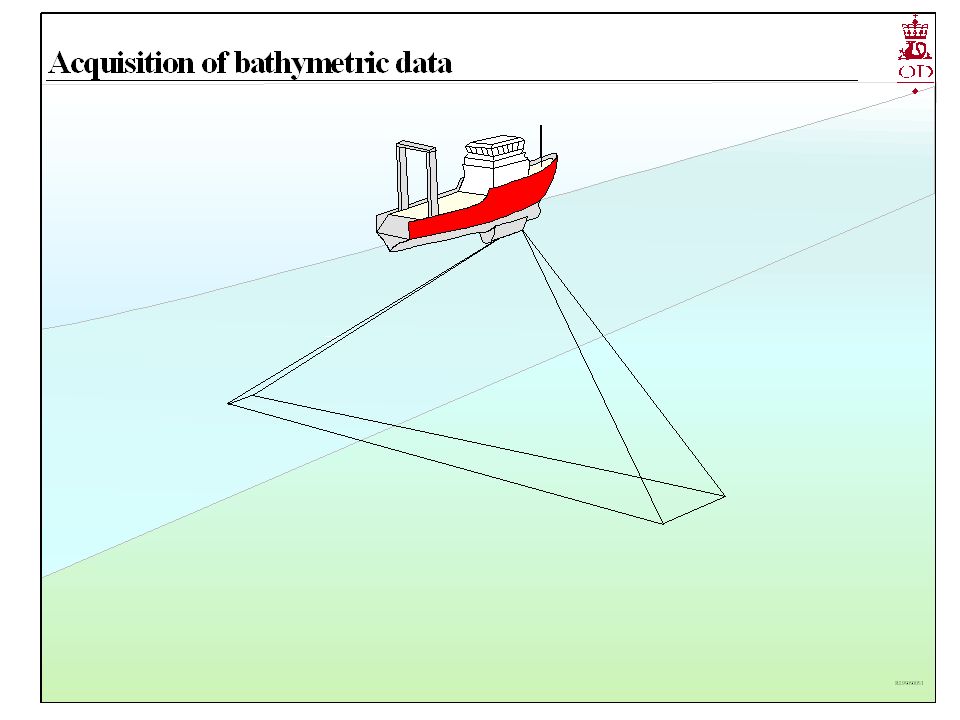
5
Multibeam bathymetry survey

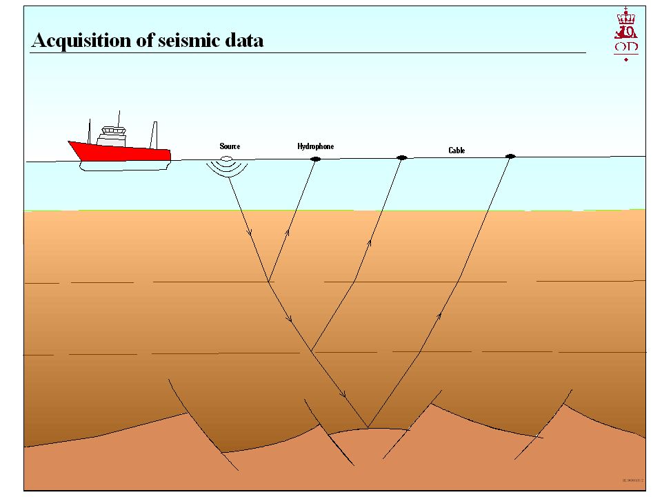
7
Seismic profile of continental margin

8
Seismic profile of sediment basin

9
Information requested in all cases Maps showing the overview and details of the limit of the continental shelf for the coastal State, and the criteria by which it is determined Map showing the location of the foot of the continental slope (FOS), and the locations of the seismic and bathymetric profiles used to determine the FOS Bathymetric contour maps where used to identify FOS and the 2500 metre isobath
, and the locations of the seismic and bathymetric profiles used to determine the FOS Bathymetric contour maps where used to identify FOS and the 2500 metre isobath")
10
Information requested in all cases (continued) Maps showing the baselines, the 200 nautical miles limit, and the 350 nautical miles possible maximum limit Map showing the 2500 meters isobath and the 100 nautical miles extension line defining possible maximum limit
 Maps showing the baselines, the 200 nautical miles limit, and the 350 nautical miles possible maximum limit Map showing the 2500 meters isobath and the 100 nautical miles extension line defining possible maximum limit")
11
Article 76 - Delineation principles

12
Information requested in all cases (continued) All bathymetric profiles (sections) referred to, annotated with locations of foot of the continental slope (FOS) Tables of the relevant bathymetric and seismic survey parameters for all surveys referred to
 All bathymetric profiles (sections) referred to, annotated with locations of foot of the continental slope (FOS) Tables of the relevant bathymetric and seismic survey parameters for all surveys referred to")
13
Information requested on applying sediment thickness formula All seismic profiles (two-way time sections) used to determine sediment thickness (interpreted and original versions) All depth-converted profiles used to determine the sediment thickness distribution on the basis of which the fixed limit line points are established
 used to determine sediment thickness (interpreted and original versions) All depth-converted profiles used to determine the sediment thickness distribution on the basis of which the fixed limit line points are established")
14
Information requested on applying sediment thickness formula (continued) Table of details of all velocity data used for converting two-way travel time to depth Map of location and type of all velocity data used for the depth conversion Full description of method(s) applied for the depth conversion
 Table of details of all velocity data used for converting two-way travel time to depth Map of location and type of all velocity data used for the depth conversion Full description of method(s) applied for the depth conversion")
15
Format of submission Executive summary Main body Annex containing all supporting scientific and technical data

16
Executive summary Maps in appropriate scale and coordinates showing the outer limit of the continental shelf, and the baselines when relevant Which provisions of article 76 are invoked Names of any CLCS member who may have given advice in the preparation of the submission Any disputes as referred to in rule 44 of the Rules of Procedure of CLCS

17
Main body Detailed description of all data sets, maps, technical procedures and scientific methodologies applied in the implementation of article 76 References to the basic data be made for documentation at each relevant step

18
Annex A copy of all data referred to in the main body, and in accordance with the requirements of Chapter 9 of the Scientific and Technical Guidelines ( CLCS/11 ) May be arranged as a set of several annexes All data submitted in support of a submission will be considered by the CLCS
 May be arranged as a set of several annexes All data submitted in support of a submission will be considered by the CLCS")
Similar presentations


>")


 “For the purposes of this Convention, the coastal State shall establish the outer edge of the continental margin wherever the.>")


 Harald Brekke. Categories of ridges in article 76 Oceanic ridges of the deep ocean floor (paragr. 3) – excluded from the continental.>")


 Title Column Headings (with units) Table Notes (footnotes) Data.>")


