Download presentation
Presentation is loading. Please wait.

1
Landforms of North Carolina

3
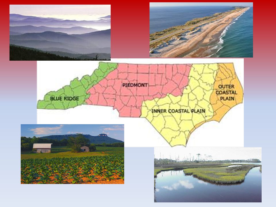
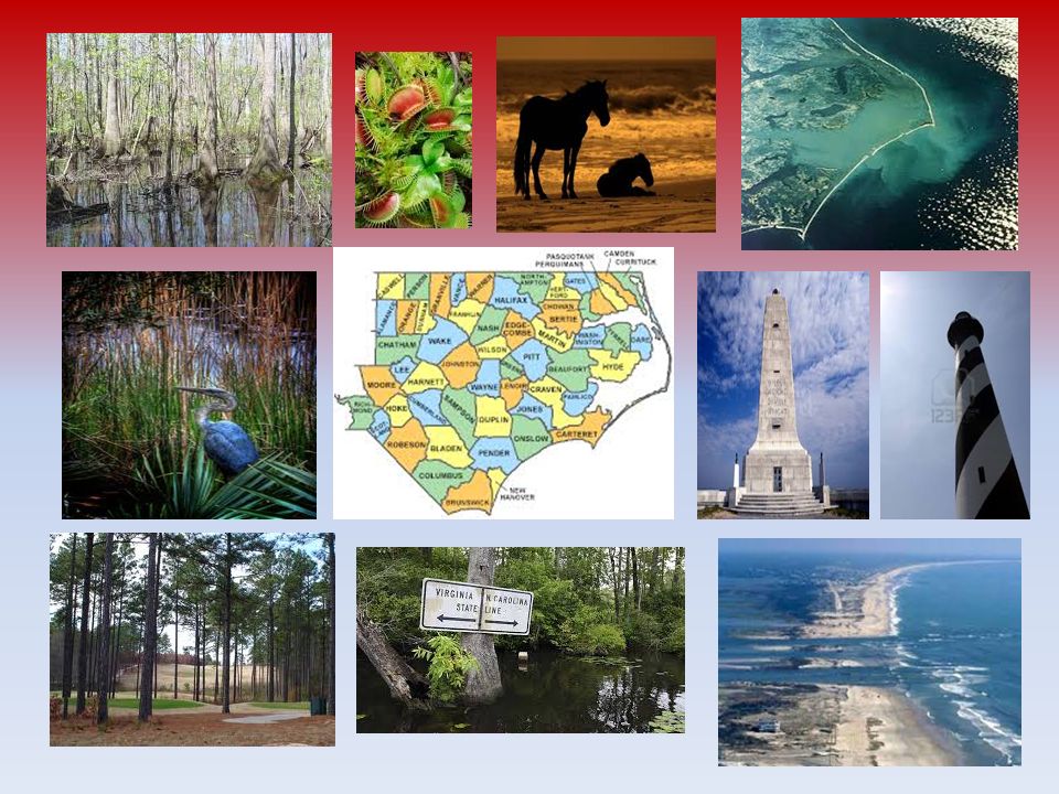
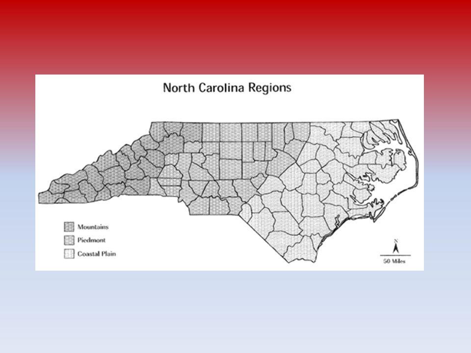
Coastal Plain low, flat land along the Atlantic Ocean divided into two parts - the Outer Coastal Plain and the Inner Coastal Plain – Outer Coastal Plain is made up of the Outer Banks and the Tidewater region Outer Banks - a string of barrier islands separated from the mainland by sounds or inlets – largest islands are Bodie, Hatteras, Ocracoke, Portsmouth, and the Core Banks – Cape Hatteras, Cape Lookout, and Cape Fear » Cape Hatteras is known as the Graveyard of the Atlantic because shifting sand has caused many ships to run aground – Stretch more than 175 miles along the coast Tidewater Region is the area along the coast close to sea level – There are seven sounds - Pamlico, Albemarle, Currituck, Croatan, Roanoke, Core, and Bogue – Characterized by wetlands – Only place in the world where the Venus Flytrap plant grows naturally – Inner Coastal Plain - higher, drier area west of the Tidewater rich, sandy soil is some of the state's best farmland southwestern corner of the Inner Coastal Plain are the Sandhills, a subregion of rolling, sandy hills Longleaf pines are native to this area.

5
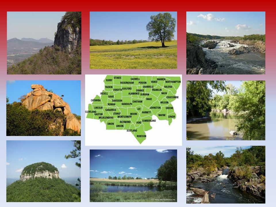
Piedmont Middle region of the state, located between the Coastal Plain and the Mountain regions Name comes from French word meaning "foot of the mountain” Monadnocks- outcrops of more resistant rock standing above mostly level terrain leveled by erosion and weathering Pilot Mountain Fall line (fall zone) - boundary between the Coastal Plain and the Piedmont rivers flow from the Paleozoic plateau of the Piedmont to the softer rocks of the Coastal Plain – Below the fall line, streams are usually sluggish and smooth- flowing. – Above the fall line, the streams are rocky and shallow, making boating difficult

7
Mountains Western part of the state Blue Ridge Mountains separate the Piedmont from the Mountain region – Other ranges include the Bald, Balsam, Black, Brushy, Great Smoky, Iron, Pisgah, Stone, and Unaka which are part of the Appalachian Mountains (over 480 million years old) possibly the oldest mountains in the United States – Mount Mitchell in the Black Mountain range is 6, 684 feet high Highest point in North Carolina and the highest point in the United States east of the Mississippi River – Eastern Continental Divide runs along the Appalachian Mountains and separates east and west flowing rivers Rivers on the eastern side of the divide flow east toward the Atlantic Ocean Rivers that run on the western side of the divide flow toward the Tennessee and Ohio rivers and into the Gulf of Mexico
 possibly the oldest mountains in the United States – Mount Mitchell in the Black Mountain range is 6, 684 feet high Highest point in North Carolina and the highest point in the United States east of the Mississippi River – Eastern Continental Divide runs along the Appalachian Mountains and separates east and west flowing rivers Rivers on the eastern side of the divide flow east toward the Atlantic Ocean Rivers that run on the western side of the divide flow toward the Tennessee and Ohio rivers and into the Gulf of Mexico")
9
Agriculture and Industry

10
Coastal Plain Agriculture – Tobacco – Sweet potato – Cotton – Peanuts – Blueberries – Watermelon Industry – Wood pulp production/Lumber – Tourism/Recreation – Fishing and shellfish – Hogs

11
Piedmont Agriculture – Wheat – Corn – Various vegetables Industry – Research and Development – Technology – Tourism/Recreation – Poultry (meat and eggs) – Cattle
 – Cattle")
12
Mountains Agriculture – Christmas trees (2 nd largest in US) – Trout – Apples Industry – Nursery and Greenhouse – Aquaculture – Tourism/Recreation
 – Trout – Apples Industry – Nursery and Greenhouse – Aquaculture – Tourism/Recreation")
Similar presentations


>")


 topographyPhysical terrain.>")


 region covers 12% of the state. The.>")