Download presentation
Presentation is loading. Please wait.

1
The Forms If you already have a spotter ID which starts with 2 letters (ST99), that will remain your spotter number (unless you moved). Otherwise, you will be assigned a new spotter number. If your mailing address is different from your physical address (911), please enter both. Thank you, and welcome!
, please enter both. Thank you, and welcome!.")
2
Skywarn Spotter Training Mike Cempa – Senior Forecaster National Weather Service Gray, ME Gray, ME

4
NWS Mission “To protect the lives and property of the citizens of the United States…” Watches and Warnings Watches and Warnings Outreach and Training Outreach and Training

5
NWS County Warning Areas

6
The Spotter’s Role Technology at the NWS – Radar Radar Satellites Satellites Automated Observing Equipment Automated Observing Equipment Lightning Detection Networks Lightning Detection Networks Computers Computers It’s all good, but…

7
The Spotter’s Role What we see at WFO Gray:

8
The Spotter’s Role Ground Truth - What’s really happening:

9
The Spotter’s Role To be the eyes of the NWS where severe weather is occurring or has occurred: Reporting storm type or structureReporting storm type or structure Reporting storm impactsReporting storm impacts Reporting damage, flooding or injury from stormsReporting damage, flooding or injury from storms This is the Ground Truth

10
The Spotter’s Role Ground Truth is the single most important type of information we can get at the NWS office. This is why spotters are so important.

11
Terms and Definitions Severe Thunderstorm – Thunderstorm producing winds of at least 58 mph (50 kts), and/or ¾” diameter hail (or greater). Severe Thunderstorm – Thunderstorm producing winds of at least 58 mph (50 kts), and/or ¾” diameter hail (or greater). Tornado – Violently rotating column of air, attached to a thunderstorm base, and in contact with the ground. Tornado – Violently rotating column of air, attached to a thunderstorm base, and in contact with the ground. Funnel Cloud – Rotating funnel-shaped cloud extending downward from a thunderstorm base, but not necessarily in contact with the ground. Funnel Cloud – Rotating funnel-shaped cloud extending downward from a thunderstorm base, but not necessarily in contact with the ground.
, and/or ¾ diameter hail (or greater). Tornado – Violently rotating column of air, attached to a thunderstorm base, and in contact with the ground. Tornado – Violently rotating column of air, attached to a thunderstorm base, and in contact with the ground. Funnel Cloud – Rotating funnel-shaped cloud extending downward from a thunderstorm base, but not necessarily in contact with the ground. Funnel Cloud – Rotating funnel-shaped cloud extending downward from a thunderstorm base, but not necessarily in contact with the ground..")
12
Terms and Definitions Downburst – Strong downdraft producing an outrush of damaging winds at or near the ground (Microburst – smaller scale, but wind may be more concentrated) Downburst – Strong downdraft producing an outrush of damaging winds at or near the ground (Microburst – smaller scale, but wind may be more concentrated) Flash Flood – A rapid rise in water, usually occurring in 12 hours or less. Flash Flood – A rapid rise in water, usually occurring in 12 hours or less.

13
Terms and Definitions Watch – Conditions are favorable for severe weather in and near the watch area. Watch – Conditions are favorable for severe weather in and near the watch area. Warning – Severe weather is imminent or occurring in the warned area. Warning – Severe weather is imminent or occurring in the warned area.

14
Reporting Criteria Tornado Hail (any size) Funnel Cloud Winds 50 mph or greater Rotating Wall Cloud Rain: 1” an hour or more Flash Flooding Rain: 2” or greater in < 6 hours
 Funnel Cloud Winds 50 mph or greater Rotating Wall Cloud Rain: 1 an hour or more Flash Flooding Rain: 2 or greater in < 6 hours")
15
We need your photos Many photos from the Great Plains, where the land is flat, the air is clear Many photos from the Great Plains, where the land is flat, the air is clear New England is hills and haze New England is hills and haze Send your photos to: Send your photos to: Mike.Cempa@noaa.gov Mike.Cempa@noaa.gov

16
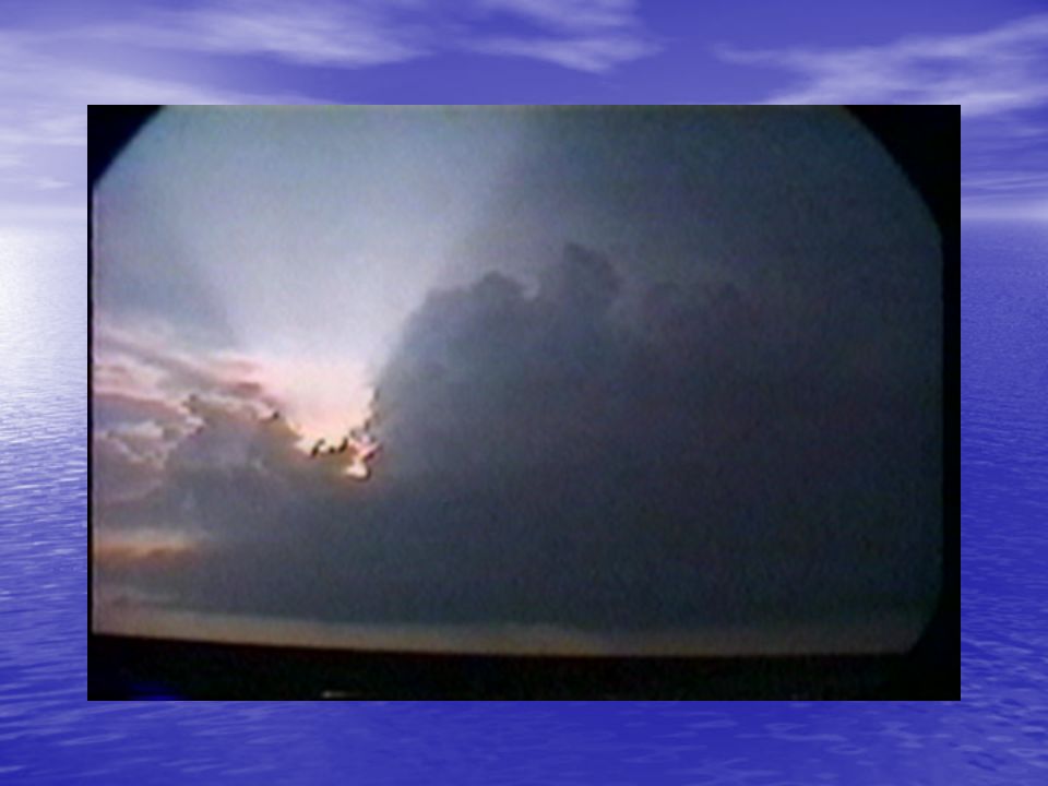
Thunderstorms

17
Thunderstorms

18
Thunderstorms Required for thunderstorm formation: 1.Moisture 2.Lift / Instability

19
Thunderstorms Moisture Sources Atlantic Gulf of Mexico Great Lakes (Pacific)
")
20
Thunderstorms Convergence: where winds from different directions meet, or fast winds meet slow winds. Mechanical Lift

21
Fronts: boundary between two air masses with different characteristics. Cooler (drier) air is more dense – acts as a wedge.
 air is more dense – acts as a wedge..")
22
Thunderstorms Terrain: forces air upward when wind blows toward higher terrain. Mechanical Lift

23
Instability (Non-mechanical Lift) Convection: The sun heats the earth’s surface, parcels of air rise like bubbles. They continue to rise as long as they remain warmer than the air around them. Moist air will react the same way in the presence of drier air

24
Weather balloons provide a vertical profile of the air, which help us “see” instability.

25
Thunderstorms

26
Thunderstorms Life Cycle

27
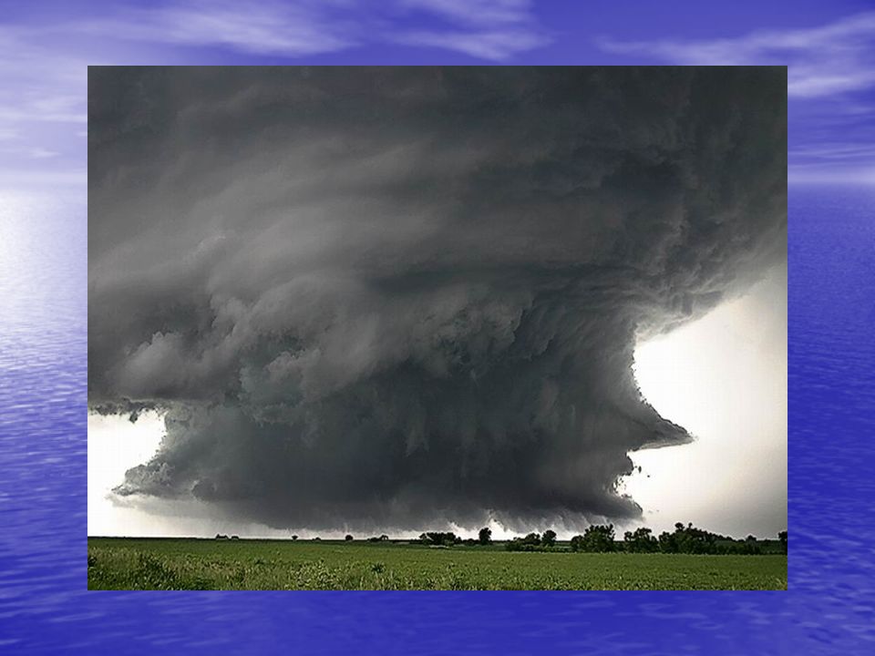
Developing Thunderstorm

28
Mature Thunderstorm

29
Thunderstorms Updraft development

30
Thunderstorms

31
Thunderstorms Anvil Overshooting Top Flanking Line

32
Thunderstorms Rain Free Base

33
Mature Thunderstorm Real Time/Time Lapse

34
Thunderstorms

35
Thunderstorms

36
Dissipating Thunderstorm

37
Important Thunderstorm Features MesocycloneMesocyclone Wall CloudWall Cloud Funnel/TornadoFunnel/Tornado Shelf CloudShelf Cloud Downburst/MicroburstDownburst/Microburst

38
Mesocyclone Rotation of updraft at or below cloud base

39
Mesocyclone in a Supercell Thunderstorm

40
Mesocyclone

41
Wall Cloud Lowering of the cloud base – enhanced condensation and inflow

42
Tilts downward toward the rain May or may not rotate - rotation is precursor to tornado development

43
Wall Cloud – give it a minute – watch for rotation

45
Funnel Cloud Recall: Rotating funnel-shaped cloud extending downward from a thunderstorm base, but not necessarily in contact with the ground.

46
Funnel Cloud - again, give it a minute

47
Tornado Violently rotating column of air, attached to a thunderstorm base, and in contact with the ground

48
View from Above

49
Look for the dust/debris to determine contact with ground

50
You make the call – Funnel or Tornado? Tornado? Maybe, but, not always obvious.

51
Multiple Vortices

52
Wanted a Front Row Seat?

53
Downbursts

54
Downburst (from outside)
")
55
Downburst (from inside)
")
56
Shelf Cloud Aaron Gilstad-ND Atmospheric Resource Board

57
Shelf Cloud Tilts away from rain

58
Maine Mall, South Portland 9 September 2006

59
Roll Cloud Roll Cloud: Not attached to thunderstorm Roll Clouds are long and tubular and rotate on a horizontal axis

60
Scud Tom Warner

61
Hail

62
Hail Formation Strong updraftStrong updraft Hail nucleus goes through ice accretion multiple timesHail nucleus goes through ice accretion multiple times Either gets blown out of updraft, or becomes too heavyEither gets blown out of updraft, or becomes too heavy

63
0.25” - Pea 0.25” - Pea 0.50” - Mothball 0.50” - Mothball 0.75” - Penny/Dime 0.75” - Penny/Dime 0.88” - Nickel 0.88” - Nickel 1.00” - Quarter 1.00” - Quarter 1.25” - Half Dollar 1.25” - Half Dollar 1.50” - Ping Pong (Walnut) 1.50” - Ping Pong (Walnut) 1.75” - Golf Ball 1.75” - Golf Ball 2.00” - Hen Egg 2.00” - Hen Egg 2.50” - Tennis Ball 2.50” - Tennis Ball 2.75” - Baseball 2.75” - Baseball 4.50” - Softball 4.50” - Softball Coins or Sports Balls (or candy?) (M&M)
 Ping Pong (Walnut) Golf Ball Golf Ball Hen Egg Hen Egg Tennis Ball Tennis Ball Baseball Baseball Softball Softball Coins or Sports Balls (or candy ) (M&M)")
64
Thunderstorm Safety Go indoors Go indoors Stay away from windows Stay away from windows If you are in a vehicle, point it into the wind If you are in a vehicle, point it into the wind If you are outside, get down as low as you can without laying on the ground. If you are outside, get down as low as you can without laying on the ground. Can be much more damaging than a tornado! Can be much more damaging than a tornado!

65
Tornado Go to a sturdy building Go to a sturdy building Basement, away from outer walls Basement, away from outer walls If no basement, interior closet, hallway, or bathroom If no basement, interior closet, hallway, or bathroom Stay away from windows Stay away from windows If outdoors, seek shelter If outdoors, seek shelter If driving, abandon your vehicle and seek shelter. Look for a nearby ditch or depression but watch out for flooding. If driving, abandon your vehicle and seek shelter. Look for a nearby ditch or depression but watch out for flooding. DO NOT seek shelter beneath an overpass. DO NOT seek shelter beneath an overpass.

66
Could be hit by debris Bad idea

67
Lightning

68
Kills 50-100 people annually Injures 500-1000 Go indoors to a sturdy shelter Stay away from tall objects In the ball park, send people to their vehicles Get out of the water!! Plan ahead for busy boat ramps Kills 50-100 people annually Injures 500-1000 Go indoors to a sturdy shelter Stay away from tall objects In the ball park, send people to their vehicles Get out of the water!! Plan ahead for busy boat ramps Lightning

69
Bad Decisions (Part 1)
")
70
Flash Flooding Johnstown, PA 20 July 1977 Las Vegas, 19 August 2003

71
Flash Flooding 1996 Flooding kills more people in the US and worldwide than any other weather hazard

72
Westbrook, ME Old Orchard Beach, ME Scarborough, ME October 1996

73
From the FEMA Web Page For each foot the water rises up the side of a typical car, 1500 lbs is displaced. 1.5-2 feet can carry away almost all cars.

74
Something a Little Bigger Width: 6 feet Width: 6 feet Length: 18 feet Length: 18 feet Ground Clearance: 18 inches Ground Clearance: 18 inches Weight: 5,040 pounds Weight: 5,040 pounds 1 foot of water displaced by this vehicle weighs: (6’ x 18’ x 1’ x 62.4 lbs./cu.ft.) = 6,739 pounds Bigger not always better
 = 6,739 pounds Bigger not always better")
75
Bad Decisions (Part 2)
")
76
Flooding Safety DO NOT cross flooded roadways DO NOT cross flooded roadways Be more vigilant at night during and after rainstorms. Be more vigilant at night during and after rainstorms. Climb to higher ground if necessary Climb to higher ground if necessary Beware areas of construction during rain! Beware areas of construction during rain! Turn Around Don’t Drown! Turn Around Don’t Drown!

77
Bad Decisions (Part 3)
")
78
Planning Ahead (A few days) Day 2 & 3 Convective Outlooks (SPC) Day 2 & 3 Convective Outlooks (SPC) Day 2-7 Hazardous Weather Outlook Day 2-7 Hazardous Weather Outlook Area Forecast Discussion (Long Term) Area Forecast Discussion (Long Term)
 Day 2 & 3 Convective Outlooks (SPC) Day 2 & 3 Convective Outlooks (SPC) Day 2-7 Hazardous Weather Outlook Day 2-7 Hazardous Weather Outlook Area Forecast Discussion (Long Term) Area Forecast Discussion (Long Term)")
79
Severe Weather Expected this Afternoon! Day 1 Convective Outlooks (SPC) Day 1 Convective Outlooks (SPC) Day 1 Hazardous Weather Outlook Day 1 Hazardous Weather Outlook Short Term Area Forecast Discussion Short Term Area Forecast Discussion
 Day 1 Convective Outlooks (SPC) Day 1 Hazardous Weather Outlook Day 1 Hazardous Weather Outlook Short Term Area Forecast Discussion Short Term Area Forecast Discussion.")
80
Convective Outlooks

81
Hazardous Weather Outlook (HWO) Issued before 6 AMIssued before 6 AM By local WFOBy local WFO
 Issued before 6 AMIssued before 6 AM By local WFOBy local WFO")
82
Area Forecast Discussion (AFD)
")
83
Mesoscale Discussion (MCD)
")
84
Convective Watches Counties – Public Box - Aviation

85
Warnings Severe Thunderstorm – 58 mph winds / ¾” hail Severe Thunderstorm – 58 mph winds / ¾” hail Special Marine – 34 knots / ¾” hail / waterspouts Special Marine – 34 knots / ¾” hail / waterspouts

86
Reporting Criteria Tornado Hail (any size) Funnel Cloud Winds 50 mph or greater Rotating Wall Cloud Rain: 1” an hour or more Flash Flooding Rain: 2” or greater in < 6 hours Storm Related Damage of Any Kind
 Funnel Cloud Winds 50 mph or greater Rotating Wall Cloud Rain: 1 an hour or more Flash Flooding Rain: 2 or greater in < 6 hours Storm Related Damage of Any Kind")
87
What not to report: Lightning Lightning -We have an accurate detection system “Dark Sky,” “It’s starting to rain,” “It’s raining hard,” “The winds are starting to blow,” etc. “Dark Sky,” “It’s starting to rain,” “It’s raining hard,” “The winds are starting to blow,” etc.

88
How to report: The best way is to call: The best way is to call:800-482-0913 E-mail: E-mail:gyx.skywarn@noaa.gov Report to the net Report to the net

89
NOAA Weather Radio

90
Thanks for coming, and becoming a spotter! www.weather.gov/gray Mike.Cempa@noaa.gov

Similar presentations


 Severe Storms. Severe Storm A thunderstorm must have one or more of the following to be considered a severe storm: (NWS classification)>")


 2.4 steps of lightning development. 3.How fast.>")

 Defines: A Severe Thunderstorm: One that produces hail at least three-quarters.>")