Download presentation
Presentation is loading. Please wait.

1
Hawaiian Islands Operational System Joao Marcos A C Souza Brian Powell Contributions: Dax Mattews Ivica Janekovic Jim Potemra – Data management

2
Hawaiian Islands Operational System PacIOOS is one of eleven regional observing programs in the U.S. that are supporting the emergence of the U.S. Integrated Ocean Observing System (IOOS®) under the National Oceanographic Partnership Program (NOPP). The PacIOOS region includes the U.S. Pacific Region (Hawaii, Guam, American Samoa, Commonwealth of the Northern Mariana Islands), the Pacific nations in Free Association with the U.S. (Republic of the Marshall Islands, Federated States of Micronesia, Republic of Palau), and the U.S. Minor Outlying Islands (Howland, Baker, Johnston, Jarvis, Kingman, Palmyra, Midway, Wake).
 under the National Oceanographic Partnership Program (NOPP). The PacIOOS region includes the U.S. Pacific Region (Hawaii, Guam, American Samoa, Commonwealth of the Northern Mariana Islands), the Pacific nations in Free Association with the U.S. (Republic of the Marshall Islands, Federated States of Micronesia, Republic of Palau), and the U.S. Minor Outlying Islands (Howland, Baker, Johnston, Jarvis, Kingman, Palmyra, Midway, Wake)..")
3
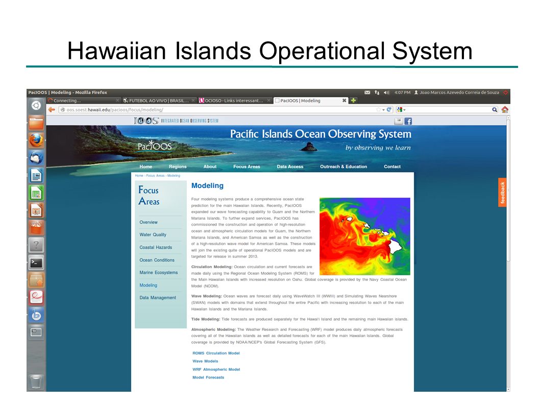
Hawaiian Islands Operational System http://oos.soest.hawaii.edu/pacioos/

4
Hawaiian Islands Operational System

6
~6km horizontal resolution ~2km horizontal resolution ~60m horizontal resolution 30 vertical layers WRF forcing TPXO tides NCOM Boundary Conditions

7
Hawaiian Islands Operational System The System assimilates (4DVar): Along track SLA Swath SST HF radar velocities Gliders, Argo floats and shipboard CTDs
: Along track SLA Swath SST HF radar velocities Gliders, Argo floats and shipboard CTDs")
8
Hawaiian Islands Operational System Along track SLA Envisat Jason 1 Jason 2 OSTM/Jason 2 map of sea-level anomalies from July 4 to July 14, 2008

9
SLA rmsd

10
Hawaiian Islands Operational System Swath SST Modis – 2 primary satellite passes per day

11
SST

12
SST Bias

13
Hawaiian Islands Operational System HF radars Koko Head Kaka'ako Kalaeloa (oos.soest.hawaii.edu/pacioos/voyager/index.html)
")
14
Radar radial mean currents Radar mean currents after data qualification process and merge of all available antennas.

15
Radar radial mean currents Radar mean currents after data qualification process and merge of all available antennas.

16
Radar radial currents rmsd HIIGHIOG

17
Radar radial mean currents cross-spectrum - HIOG HIOG Phase shift: M2: -0.04h K1: -0.24h Model Radar

18
Radar radial currents HIOG – Mean and standard deviation

19
Radar radial currents EOF 1 HIOG 48.11%31.52%

20
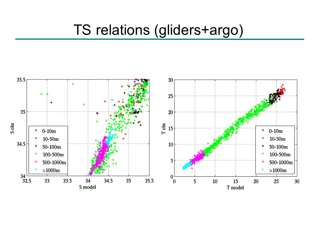
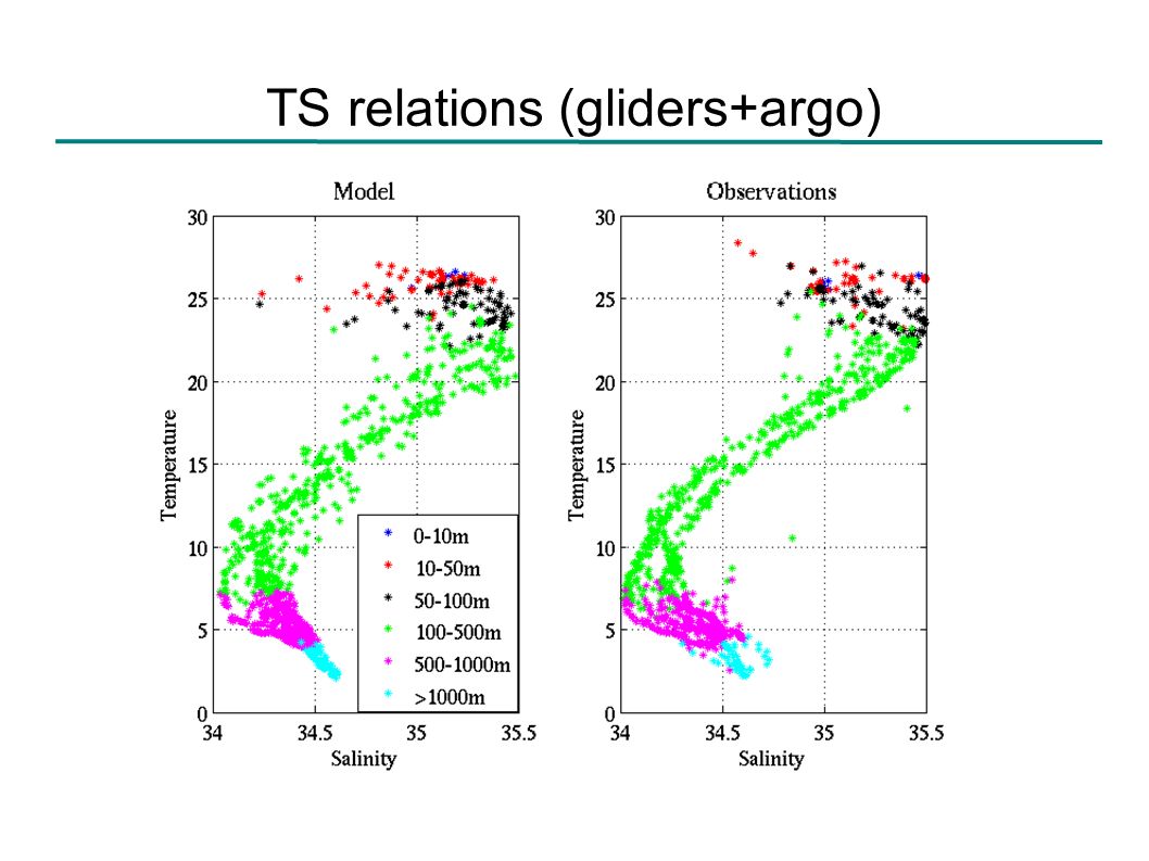
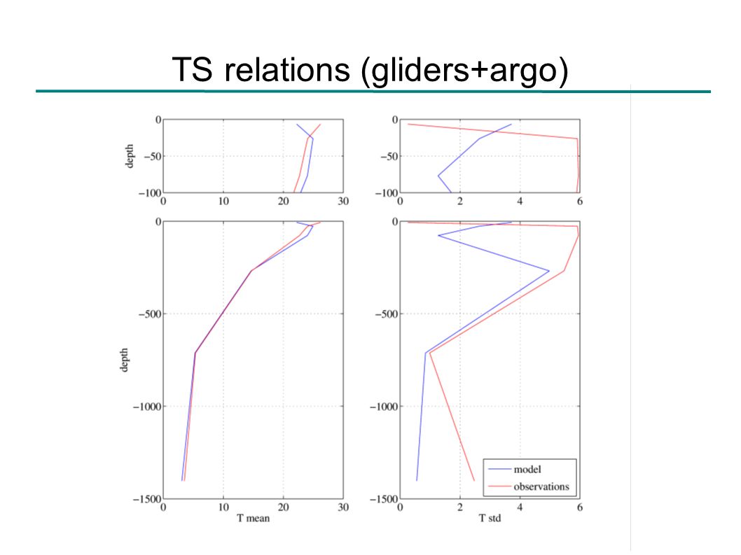
Hawaiian Islands Operational System Gliders (http://hahana.soest.hawaii.edu/seagliders/index.php), Argo floats, and shipboard CTD - station ALOHA – established in 1988. (http://aco-ssds.soest.hawaii.edu/ALOHA/)

21
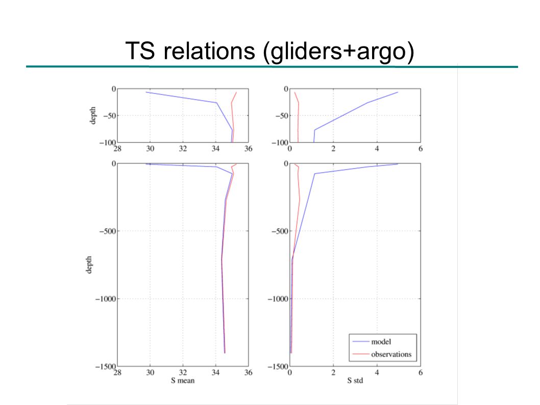
TS relations (gliders+argo)
")
26
T and S errors (model-observations) 0 - 10m10 - 50m Temperature Salinity 0 - 10m10 - 50m
 m m Temperature Salinity m m")
27
Validation conclusions More observed SLA variance on the windward side of the islands than shown by the model. Satellite tracks are too sparse in both time and space Analyze impact of gridded products assimilation Good representation of the water column structure, with problems concentrated near the surface. Good representation of the barotropic tides, but less energy in the low frequency than shown by the HF radars. Analyze the impact of the internal tides on the differences between model and observations – Expected to by large. SST diurnal variability is not accurately resolved by the simulation.

28
Modified vertical coordinate second order Legendre polynomial.

29
Modified vertical coordinate Quadratic σ, stretching 4; linear σ, stretching 4; linear σ, stretching 2; HIIG grid section at 19.28°N

30
Modified vertical coordinate Small variation of the first layer thickness !

Similar presentations


 Francis P. A. Earth System Sciences Organisation (ESSO) Indian National Centre for Ocean Information Services (INCOIS)>")
 at NCEP>")

 Patrick J. Hogan and Harley E. Hurlburt Naval Research Laboratory, Code 7323, Stennis Space Center,>")


, J.D. Paduan (2), L. K. Rosenfeld (2), S.>")
 Igor Shulman Stephanie Anderson Ocean Sciences Meeting Orlando, FL March 5, 2008.>")