Download presentation
Presentation is loading. Please wait.

1
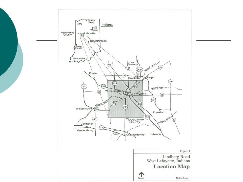
Lessons Learned Through Evaluation of a Road Construction Failure in Compressible Soils, Lindberg Road Improvement Project, West Lafayette, Indiana Terry R. West, Ph.D., P.E., CPG Professor of Engineering Geology Earth & Atmospheric Science Dept. Purdue University, West Lafayette, Indiana

3
Abstract Rapidly increasing population growth of West Lafayette, IN. adjacent to Purdue University has required the city to keep pace with the expansion of roadways and other infrastructure. One such expansion of an existing road over a marsh containing thick deposits of peat and marl has become an intriguing engineering problem since its completion. An embankment was required to raise the elevation of the road and to extend it from two lanes to four. The embankment failed as a classic rotational slump during construction; Some concerns, in retrospect, have arisen as to the thoroughness of the exploration program, laboratory testing prior to construction and the earthwork placement. Next, to stabilize the road, concrete piles were placed through the soft soils into glacial till below. However, the subgrade mat below the pavement failed to transfer loads onto the piles causing the road to develop a washboard effect. Work is underway to determine details of the slump failure and the cause of the load transfer problem.

4
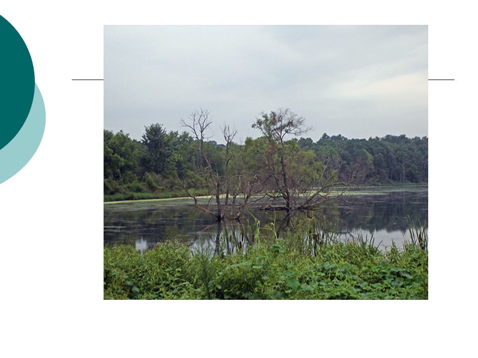
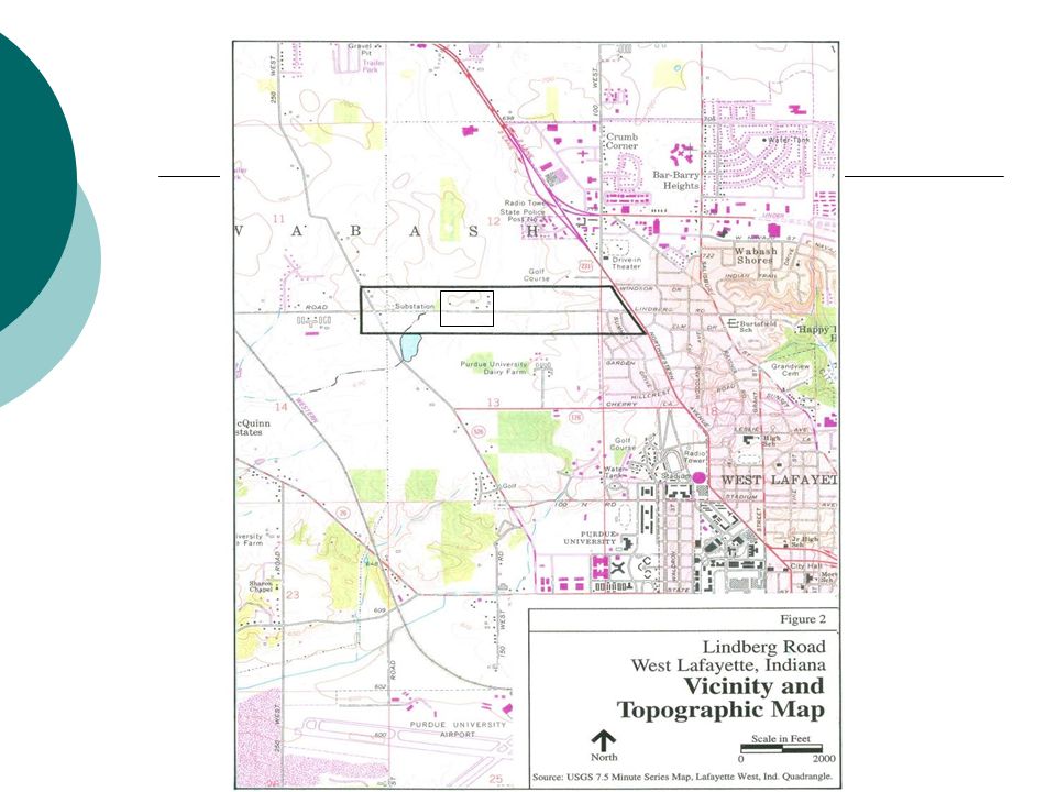
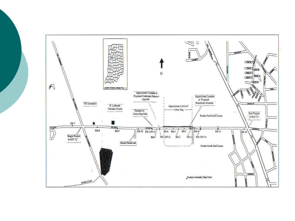
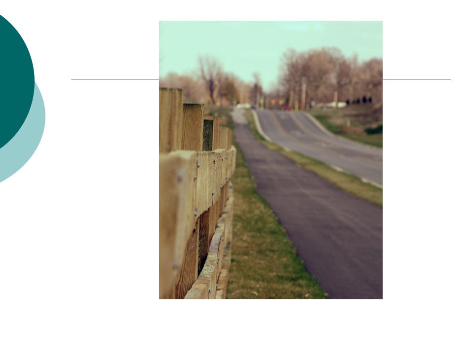
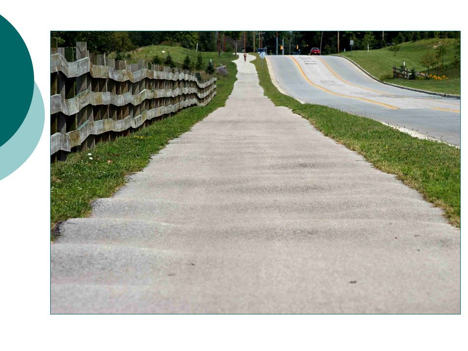
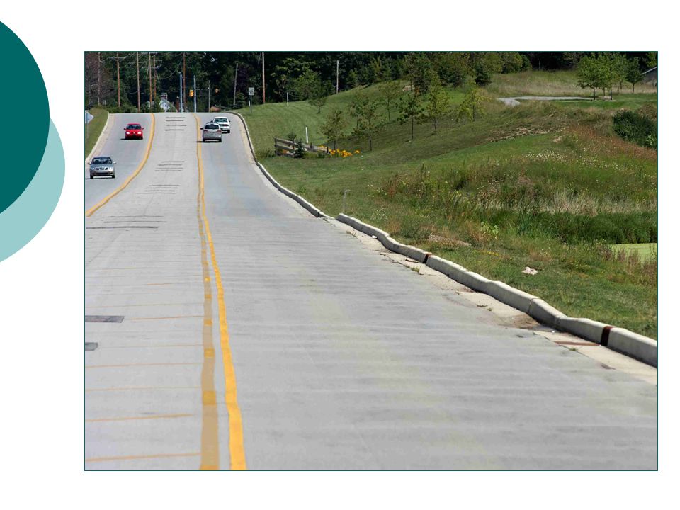
Site Description West Lafayette, Indiana (Tippecanoe County) Located on Wabash River upland Tipton Till Plain Kettle hole topography “Celery Bog” 100 acres of marshland Highly compressible, organic peat and marl soils from 5 to 25 feet deep (Houghton Muck) Lindberg Road Increased development required road improvement from 2 lanes to 4 lanes over a distance of ~6,350 feet from Northwestern Avenue to McCormick Road. Crosses bog for a distance of ~800 feet

10
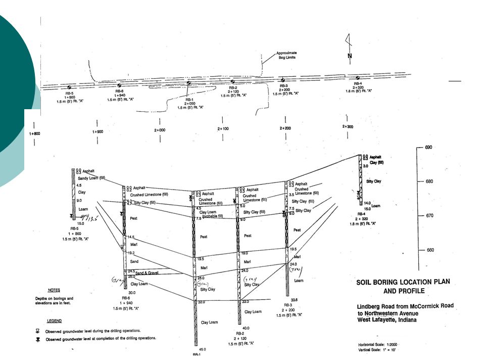
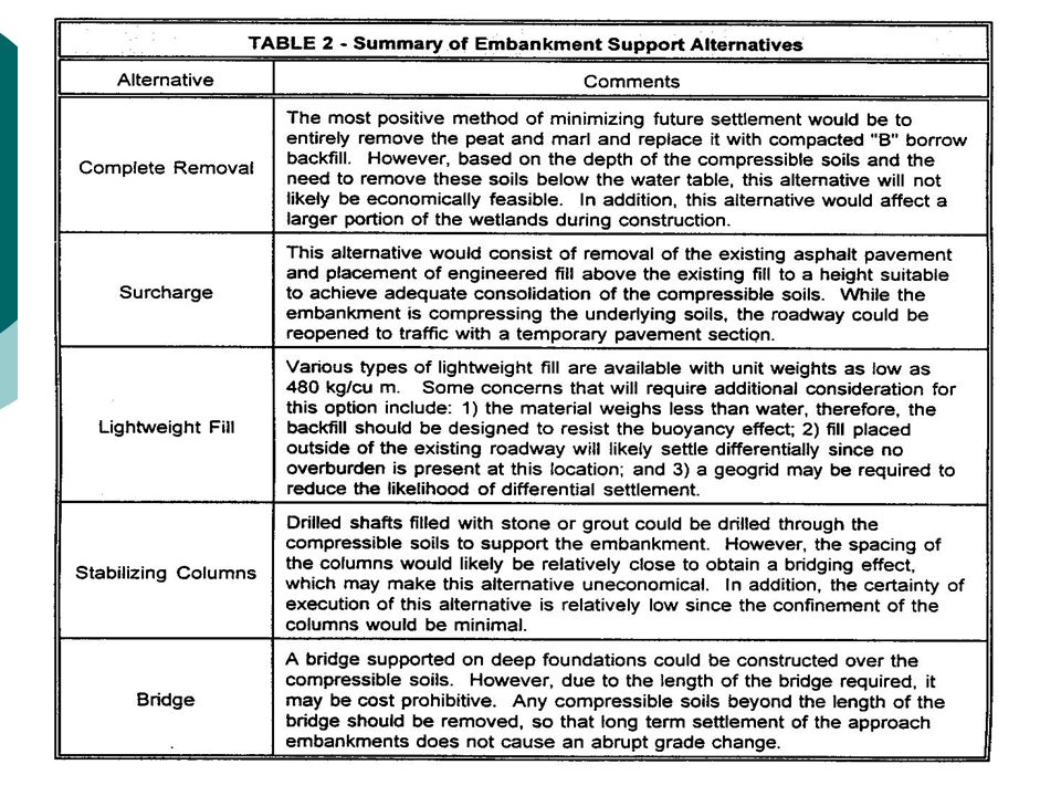
Project Description Proposed to raise road grade ~3 feet and widen from two lanes to four yielding a width of 70 feet Six soil borings made initially Crushed stone base (1.5 feet) Silty clay loam (4.5 feet) Fibrous peat (12 feet) (density=9 lb/cf and w=564%) Marl (6 feet) (density=21lb/cf and w=240%) Glacial till below 24 feet Sand and gravel layer found in one boring from 19-26 feet below surface Based on these borings and on lab tests, several alternatives were suggested in order to minimize settlement of the new road bed
 Silty clay loam (4.5 feet) Fibrous peat (12 feet) (density=9 lb/cf and w=564%) Marl (6 feet) (density=21lb/cf and w=240%) Glacial till below 24 feet Sand and gravel layer found in one boring from feet below surface Based on these borings and on lab tests, several alternatives were suggested in order to minimize settlement of the new road bed")
12
Project Timeline September 1993: Environmental Assessment and Preliminary Geotechnical Reports prepared by Woolpert (project mgmt.) and Earth Exploration (drilling consultant) respectively. January 1997: Geotechnical Evaluation provided by Earth Exploration July 2001: Earthwork begins under Atlas Excavating (primary contractor). Surcharge method selected. December 3, 2001: Rotational slump failure occurs on north side of Lindberg Road through thickest section of the marl layer. Likely caused by rapidly placed or overly thick soil fill. (power line poles) April 29, 2002: Second failure occurs on south side of Lindberg Road through marl layer.
. Surcharge method selected. December 3, 2001: Rotational slump failure occurs on north side of Lindberg Road through thickest section of the marl layer. Likely caused by rapidly placed or overly thick soil fill. (power line poles) April 29, 2002: Second failure occurs on south side of Lindberg Road through marl layer..")
13
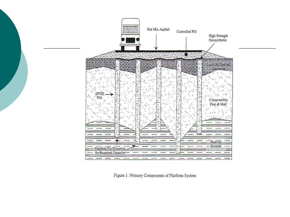
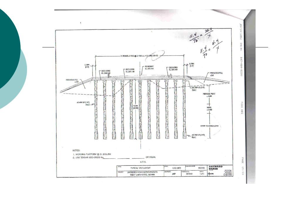
Project Timeline Continued… April 2002: Bernardin Lochmueller hired to replace Woolpert (project mgmt.). Earth Exploration and Atlas Excavating were kept on for continuity. August 2002: ATC (geotech. consultant) hired to obtain additional data and evaluate failure. Findings indicated that failure occurred in thickest section of marl (12.8’). Concluded that Auger Cast Concrete Pile Program with a geogrid below base course suggested by Earth Exploration would be satisfactory to stabilize area. Piles should extend at least 9.8’ (3m) into silty clay soil. Soils in vicinity were marginally stable and no soil filling should be accomplished without pile support.
 hired to obtain additional data and evaluate failure. Findings indicated that failure occurred in thickest section of marl (12.8’). Concluded that Auger Cast Concrete Pile Program with a geogrid below base course suggested by Earth Exploration would be satisfactory to stabilize area. Piles should extend at least 9.8’ (3m) into silty clay soil. Soils in vicinity were marginally stable and no soil filling should be accomplished without pile support..")
14
N

15
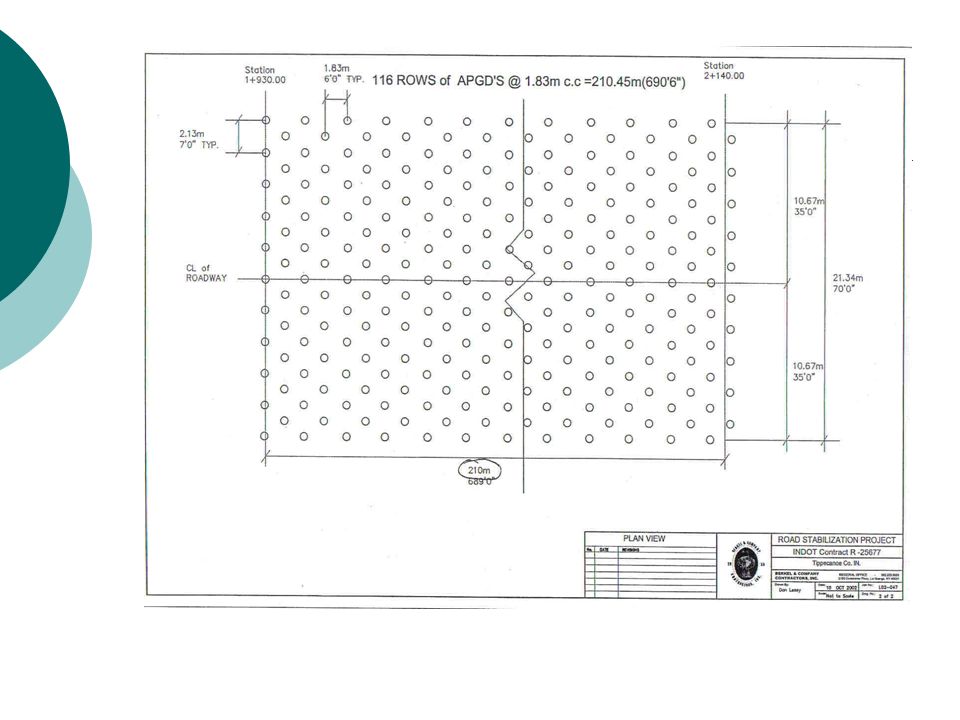
Project Timeline Continued… August 2002: A National Construction Company (Haywood Baker) was recommended to perform auger-cast concrete pile work by local experts. September 2002: Haywood Baker makes proposal for Vibro-Concrete Column construction (VCC). September 2002: Atlas Excavating requests proposal from a local construction company (Berkel & Co.) to accomplish column support. October 2002: Berkel makes proposal for Augered Pressure Grouted Displacement (APGD) piles. December 2002: H.C. Nutting (geotech. consultant) reviews the VCC and APGD proposals. Concludes both are feasible but gives preference to Haywood Baker. Spring 2003: Atlas Excavating selects Berkel & Co. to perform work using APGD; West Lafayette and INDOT approve.
. September 2002: Atlas Excavating requests proposal from a local construction company (Berkel & Co.) to accomplish column support. October 2002: Berkel makes proposal for Augered Pressure Grouted Displacement (APGD) piles. December 2002: H.C. Nutting (geotech. consultant) reviews the VCC and APGD proposals. Concludes both are feasible but gives preference to Haywood Baker. Spring 2003: Atlas Excavating selects Berkel & Co. to perform work using APGD; West Lafayette and INDOT approve..")
20
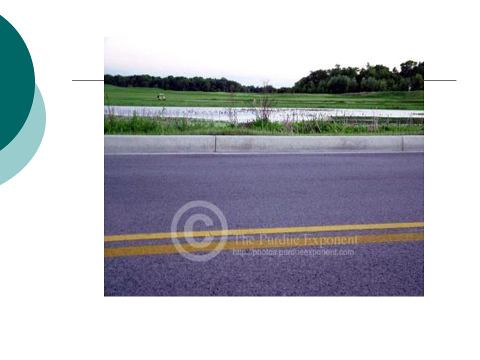
Project Timeline Continued… Spring 2004: Project completed. Surface settlement begins almost immediately. Road resembles washboard. Base course fails to transfer pavement loads to augered piles. Pile system not extended for full length of bog yielding sizeable settlement on east side of construction project. Fall 2005: City re-paves roadway in attempt to smooth surface. Hoped added weight would provide greater stiffness and accomplish load transfer from base course to columns. Fall 2006: Settlement continues. City monitoring settlement and will drill borings through road to determine grid material and composition of base course.

25
Lessons Learned More extensive preliminary site exploration was needed Insufficient laboratory testing on soils prior to construction Stage construction was poorly done Fill placed too rapidly (time pressures) and inappropriately (between poles) Insufficient inspection of work in progress (City, INDOT, Contractors) Post-failure residual strength of soil made surcharge method impossible Project supervisor was poorly qualified for geotechnical work involved Local contractor was ill-prepared for such a difficult project Was this cost effective? Loads did not transfer properly to pier system. Why? Unsure of the nature of the fill or the geogrid material and unsure how fill was placed. Pier system was not carried far enough to the east (50’ more needed)
.")
26
Further Research Topics History of Celery Bog and bogs in general (especially soils). Discuss project timeline in detail. Determine how many prior times the city had attempted to improve the road. Determine if the surcharge method had been done correctly, would the piers have been necessary? Following failure, soil was essentially at residual strength. What is residual strength? Surcharge fill schedule—Was it placed too quickly? Was fill placed incorrectly? (between the power line poles) Was there proper field inspection in place by the city, INDOT or the contractor? Did Atlas follow design suggestions for piezometers and settlement plates; monitoring? Determine extent/limits of failure planes. Compare, in detail the proposals provided by Berkel and Haywood Baker. Determine the type of fill material and geogrid used Cores to be taken in Spring 2007 Access settlement data and discuss rates Available from W.L. city engineer Research feasibility of replacing asphalt surface with reinforced concrete to eliminate settlement between the piers.
 Was there proper field inspection in place by the city, INDOT or the contractor. Did Atlas follow design suggestions for piezometers and settlement plates; monitoring. Determine extent/limits of failure planes. Compare, in detail the proposals provided by Berkel and Haywood Baker. Determine the type of fill material and geogrid used Cores to be taken in Spring 2007 Access settlement data and discuss rates Available from W.L. city engineer Research feasibility of replacing asphalt surface with reinforced concrete to eliminate settlement between the piers..")
Similar presentations


 19 August 2014.>")


 PRIVATE LIMITED FEDERATION.>")


