Download presentation
Presentation is loading. Please wait.

1
Topographic Maps

2
Warm Up 1.What is the reference line for longitude? 2.When plotting coordinates, which comes first? Latitude or Longitude? 3.How many centimeters are in 2.5 meters?

5
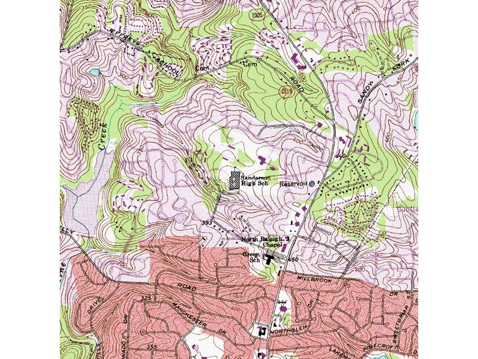
Topographic Maps Show elevation – How high or low the ground is Contour Lines: connects areas of equal elevation – Contour lines never cross!! Contour Interval: space between contour lines to show elevation change – Contour lines close together = steep elevation (like a mountain or hill)
.")
6
Topography A.Topography: the surface features of an area. B.This map shows the presence of an island but gives no clue how tall the island is. C.Topographic maps are 2 dimensional representations of 3 dimensional landforms.

7
Building a Topographic Map A.Always start at Sea Level: 0. B.Select an interval (on this map 10 ft). C.Trace the land contour at each interval.
. C.Trace the land contour at each interval..")
8
Building a Topographic Map D.When done, you have a topographic map. E.Now you know how high some features are compared to others.

9
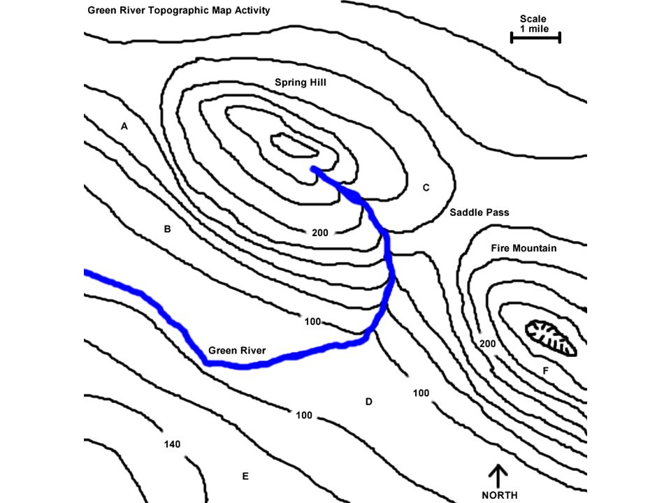
Reading a Topographic Map A.Contour interval: the difference in elevation between 2 lines. B.Index contour: elevation lines that are labeled and usually darker than others. C.What is the contour interval of this map? 1.Hint: pretend it’s a thermometer. 20 ft

10
What is the height difference between points C and D?

11
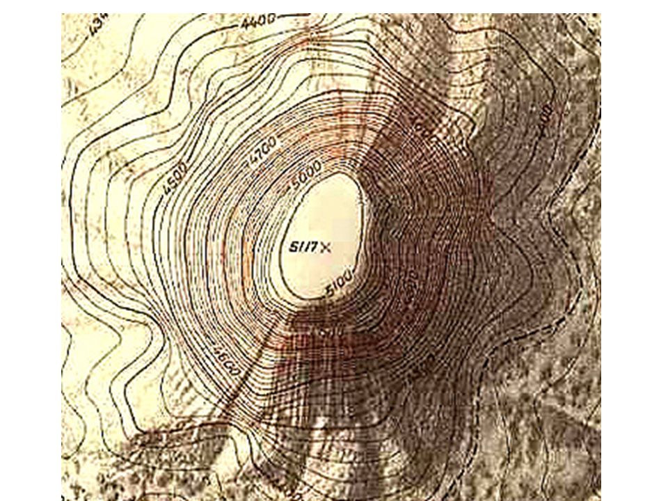
Special Symbols Closed circle = hill or mountain top Marks inside a circle= depression

13
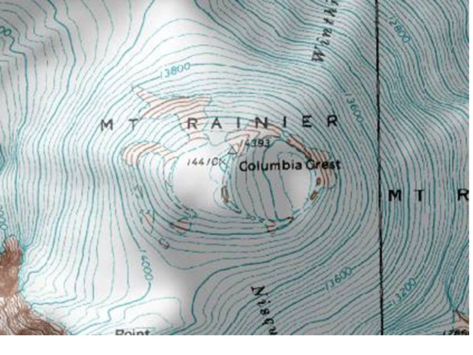
Mount Rainier Volcano, Washington State

18
BE SURE TO CREATE A COLOR CODED KEY Identify: – Prime Meridian – Equator – Quadrants: NE NW SE SW – 7 Continents – 5 Oceans – The latitude and Longitude of a place you’d like to visit.

19
END

Similar presentations


 1. How do contour lines show elevation, slope, and relief? 2. Why do contour lines never cross on a topographic map? 4. For an area.>")


>")


