Download presentation
Presentation is loading. Please wait.

2
California Seafloor and Coastal Mapping Program (CSCMP) Daniel Santillano Manager, CSCMP Ocean Protection Council
 Daniel Santillano Manager, CSCMP Ocean Protection Council")
3
from A Vision for Our Coast and Ocean OPC’s Five-Year Strategic Plan (2012 – 2017): John Laird, Secretary of Natural Resources Cat Kuhlman, Deputy Secretary for Coastal and Marine Policy
: John Laird, Secretary of Natural Resources Cat Kuhlman, Deputy Secretary for Coastal and Marine Policy")
4
A changing Ocean requires that California adapt

5
Malibu, CA August 27, 2014

6
Venice, CA Coastal Flooding due to Hurricane Marie August 27, 2014

7
2014 Eastern Pacific Tropical Storm activity is 60% higher than the 1980 – 2010 average

9
End-Users Desired Access to Ocean Data -Geospatial Data -Distribution of Habitats -Marine Protected Areas -Location of Sediments -Geological maps -Sea-Level Rise maps

10
Issue 1, Task 1: Improving the Use and Sharing of Scientific and Geospatial Information “improve decision-making through use of best available science by state entities and agencies charged with ocean and coastal stewardship; and capitalize on and leverage the scientific community to support management and policy directions.”

11
California Coastal Geoportal (v. 1.0) Where decision makers can visualize and download scientific and marine geospatial data layers
 Where decision makers can visualize and download scientific and marine geospatial data layers.")
13
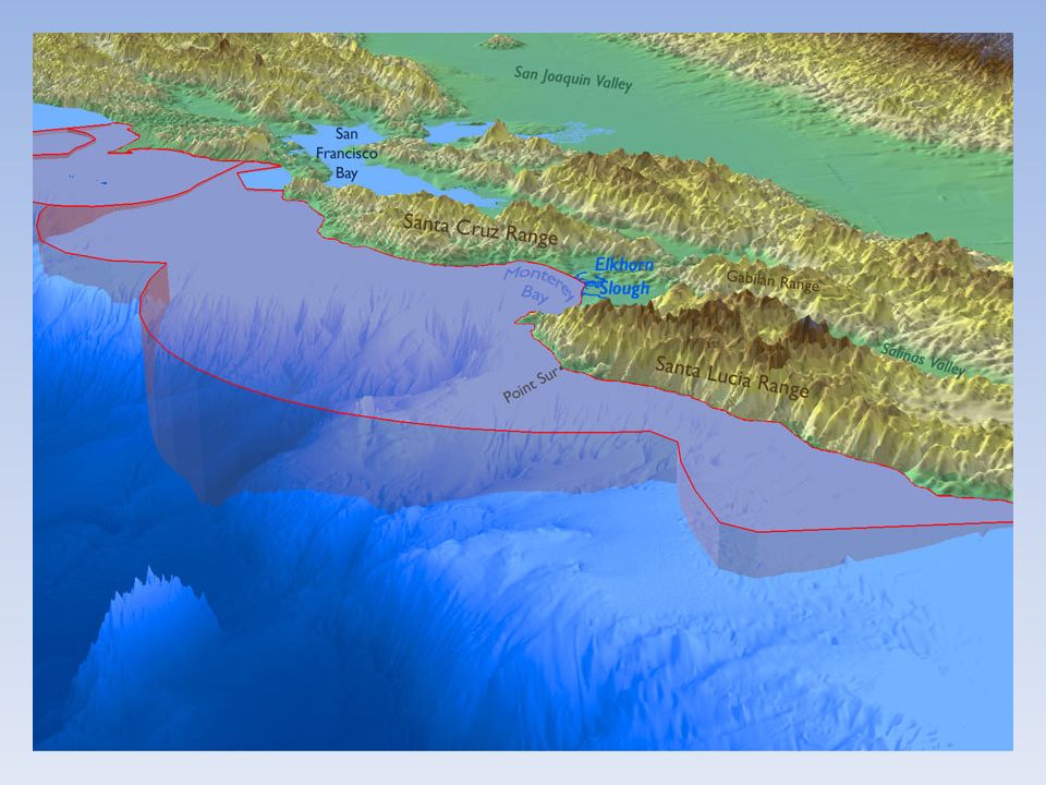
Interpretive Seafloor Maps for the California coast represent the most advanced mapping effort on the planet.

14
Geology Biology Habitat Distribution (scientifically rigorous) OPC Partnership with the United States Geological Survey (USGS) Product: highly detailed and scientific maps (30% of CA Coast) pelagic rock fish on rocky outcrop
 OPC Partnership with the United States Geological Survey (USGS) Product: highly detailed and scientific maps (30% of CA Coast) pelagic rock fish on rocky outcrop")
15
Geology Biology Habitat Distribution (scientifically rigorous) OPC Partnership with the United States Geological Survey (USGS) Product: highly detailed and scientific maps (30% of CA Coast) pelagic rock fish on rocky outcrop October 22/23, 2014 Santa Cruz, USGS Stakeholder Meeting
 OPC Partnership with the United States Geological Survey (USGS) Product: highly detailed and scientific maps (30% of CA Coast) pelagic rock fish on rocky outcrop October 22/23, 2014 Santa Cruz, USGS Stakeholder Meeting")
17
Questions? Daniel Santillano Manager, California Seafloor and Coastal Mapping Program Ocean Protection Council Daniel.santillano@resources.ca.gov (916) 653-0538
")
Similar presentations


 David.>")

