Download presentation
Presentation is loading. Please wait.

1
Global Positioning Systems Agriscience

5
OnStar Navigation System

11
Terms to Know Antenna – Needed to receive signal from satellites and differential source. Antenna – Needed to receive signal from satellites and differential source. Attribute – A characteristic that describes a Feature. They can be thought of as questions which are asked about the Feature. Attribute – A characteristic that describes a Feature. They can be thought of as questions which are asked about the Feature.

12
Terms Channel – A channel of a GPS receiver consists of the circuitry necessary to track the signal from a single GPS satellite. Channel – A channel of a GPS receiver consists of the circuitry necessary to track the signal from a single GPS satellite. Degree – Unit of angular measurement used to measure Latitude and longitude. Degree – Unit of angular measurement used to measure Latitude and longitude. Department of Defense (DoD) – Created Global Positioning System Department of Defense (DoD) – Created Global Positioning System
 – Created Global Positioning System Department of Defense (DoD) – Created Global Positioning System.")
13
Terms Differential Correction (DGPS) – Technique comparing GPS data collected in the field to data at a known point. By collecting data at a known point a correction factor can be determined and applied. Differential Correction (DGPS) – Technique comparing GPS data collected in the field to data at a known point. By collecting data at a known point a correction factor can be determined and applied. Dilution of Precision (DOP) – An indicator of satellite geometry for a unique constellation of satellites used to determine a position. Positions tagged with a higher DOP value have poorer accuracy than those with a lower DOP Dilution of Precision (DOP) – An indicator of satellite geometry for a unique constellation of satellites used to determine a position. Positions tagged with a higher DOP value have poorer accuracy than those with a lower DOP
 – Technique comparing GPS data collected in the field to data at a known point. By collecting data at a known point a correction factor can be determined and applied. Dilution of Precision (DOP) – An indicator of satellite geometry for a unique constellation of satellites used to determine a position. Positions tagged with a higher DOP value have poorer accuracy than those with a lower DOP Dilution of Precision (DOP) – An indicator of satellite geometry for a unique constellation of satellites used to determine a position. Positions tagged with a higher DOP value have poorer accuracy than those with a lower DOP.")
14
Terms Ephemeris – The predicted changes in the orbit of a satellite that is transmitted to the GPS receiver from the individual satellites. Ephemeris – The predicted changes in the orbit of a satellite that is transmitted to the GPS receiver from the individual satellites. Ephemeris Errors – Errors that originate in the data transmitted by a GPS satellite. Ephemeris errors are removed by differential correction. Ephemeris Errors – Errors that originate in the data transmitted by a GPS satellite. Ephemeris errors are removed by differential correction. Feature – The object which is being mapped for the use in a GIS system. Features may be points, lines, or areas. Feature – The object which is being mapped for the use in a GIS system. Features may be points, lines, or areas.

15
Terms Geographic Information System (GIS) – A mapping system that combines positional data with descriptive information to form a layered map. Geographic Information System (GIS) – A mapping system that combines positional data with descriptive information to form a layered map. Global Positioning System (GPS) – A system providing precise location which is based on data transmitted from a constellation of 24 satellites. Global Positioning System (GPS) – A system providing precise location which is based on data transmitted from a constellation of 24 satellites. Raw GPS signal is only accurate to 100 meters. Raw GPS signal is only accurate to 100 meters. U.S. runs its GPS program out of Colorado Springs, CO U.S. runs its GPS program out of Colorado Springs, CO
 – A mapping system that combines positional data with descriptive information to form a layered map. Global Positioning System (GPS) – A system providing precise location which is based on data transmitted from a constellation of 24 satellites. Global Positioning System (GPS) – A system providing precise location which is based on data transmitted from a constellation of 24 satellites. Raw GPS signal is only accurate to 100 meters. Raw GPS signal is only accurate to 100 meters. U.S. runs its GPS program out of Colorado Springs, CO U.S. runs its GPS program out of Colorado Springs, CO.")
16
Terms Latitude – The angular distance north or south of the equator measured by lines circling the earth parallel to the equator Latitude – The angular distance north or south of the equator measured by lines circling the earth parallel to the equator Degrees from 0 to 90 Degrees from 0 to 90 Longitude – The angular distance east or west of the prime meridian Longitude – The angular distance east or west of the prime meridian Measured by lines perpendicular to the parallels and converging at the poles Measured by lines perpendicular to the parallels and converging at the poles 0 to 180 degrees 0 to 180 degrees

17
Lines of Latitude

18
Lines of Longitude

20
Terms Minute – Unit of angular measurement subdivision of Degrees. Each degree is divided into 60’ (minutes). Minute – Unit of angular measurement subdivision of Degrees. Each degree is divided into 60’ (minutes). One minute of latitude anywhere on the earth and one minute or longitude at the equator equals 1.15 miles or 1 nautical mile. One minute of latitude anywhere on the earth and one minute or longitude at the equator equals 1.15 miles or 1 nautical mile. Second – Unit of angular measurement subdivision of minutes. Each minute is divided into 60” (seconds). Second – Unit of angular measurement subdivision of minutes. Each minute is divided into 60” (seconds). One second of latitude anywhere on the earth and one second of longitude at the equator is equal to 33.82 yards. One second of latitude anywhere on the earth and one second of longitude at the equator is equal to 33.82 yards.
. Minute – Unit of angular measurement subdivision of Degrees. Each degree is divided into 60’ (minutes). One minute of latitude anywhere on the earth and one minute or longitude at the equator equals 1.15 miles or 1 nautical mile. One minute of latitude anywhere on the earth and one minute or longitude at the equator equals 1.15 miles or 1 nautical mile. Second – Unit of angular measurement subdivision of minutes. Each minute is divided into 60 (seconds). Second – Unit of angular measurement subdivision of minutes. Each minute is divided into 60 (seconds). One second of latitude anywhere on the earth and one second of longitude at the equator is equal to yards. One second of latitude anywhere on the earth and one second of longitude at the equator is equal to yards..")
21
Terms Multi-path – The interference to a signal that has reached the receiver antenna by multiple paths. Multi-path – The interference to a signal that has reached the receiver antenna by multiple paths. Usually caused by the signal being bounced or reflected. Signals from satellites low on the horizon will have high multi-path error. Precision Farming – Carefully tailoring soil and crop management to fit the different conditions found in each field. Usually caused by the signal being bounced or reflected. Signals from satellites low on the horizon will have high multi-path error. Precision Farming – Carefully tailoring soil and crop management to fit the different conditions found in each field.

22
Precision Farming Yield Map

23
Terms Pseudo range – An uncorrected measurement of the distance between a GPS satellite and a GPS receiver Pseudo range – An uncorrected measurement of the distance between a GPS satellite and a GPS receiver Receiver – Hardware component needed to process signals received by antenna. Receiver – Hardware component needed to process signals received by antenna.

24
Garmin GPS Handheld Receiver

25
GPS receivers GPS receivers Most today are very good Most today are very good

26
Satellite Constellation – The group of 24 GPS satellites from which data is used to determine a position.

30
Terms Select Availability (SA) – Government- induced signal error. Select Availability (SA) – Government- induced signal error. SNR – Signal to noise ratio. Measure of signal quality. SNR – Signal to noise ratio. Measure of signal quality.
 – Government- induced signal error. SNR – Signal to noise ratio. Measure of signal quality. SNR – Signal to noise ratio. Measure of signal quality..")
31
Terms Spatial Data – Data pertaining to the location, shape, and relationship among geographical features. Spatial Data – Data pertaining to the location, shape, and relationship among geographical features. Value – Descriptive information about a Feature. Value – Descriptive information about a Feature. Variable Rate Technology (VRT) – Instrument used for varying the rates of application of fertilizer, pesticides, and seed as one travels across a field. Variable Rate Technology (VRT) – Instrument used for varying the rates of application of fertilizer, pesticides, and seed as one travels across a field.
 – Instrument used for varying the rates of application of fertilizer, pesticides, and seed as one travels across a field. Variable Rate Technology (VRT) – Instrument used for varying the rates of application of fertilizer, pesticides, and seed as one travels across a field..")
32
Examples of Variable Rate Technology

35
Harvesting with VRT

37
Variable Rate Anhydrous Ammonia

38
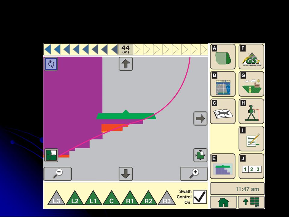
Parallel Tracking

39
Terms Yield Monitoring – Regular intervals where a harvested weight has been obtained along with a GPS reading. A display of the weights translated to bushels/acre or yield provides a yield map. Yield Monitoring – Regular intervals where a harvested weight has been obtained along with a GPS reading. A display of the weights translated to bushels/acre or yield provides a yield map.

40
2004 Corn Yield Map

41
2003 Soybean Yield Map

42
What is GPS? GPS (Global Positioning System) GPS (Global Positioning System) Created by US Dept. of Defense Created by US Dept. of Defense Operates 24 hrs/day Operates 24 hrs/day Started in early 1980’s Started in early 1980’s Fully operational April 27, 1995 Fully operational April 27, 1995 24 NAVSTAR satellites (Navigation with Satellite timing and ranging) 24 NAVSTAR satellites (Navigation with Satellite timing and ranging)
 24 NAVSTAR satellites (Navigation with Satellite timing and ranging).")
43
What is GPS? Orbit 10,900 miles above earth surface Orbit 10,900 miles above earth surface Each orbits every 12 hours Each orbits every 12 hours 6 orbital paths, 4 satellites per path 6 orbital paths, 4 satellites per path At least 4 satellites always visible At least 4 satellites always visible Transmit radio waves which travel at a rate of 186,300 miles/sec. (speed of light) Transmit radio waves which travel at a rate of 186,300 miles/sec. (speed of light)
 Transmit radio waves which travel at a rate of 186,300 miles/sec. (speed of light).")
44
What are the Satellites Like? Weight: 1900 lbs. Weight: 1900 lbs. Size: 17 feet Size: 17 feet Power: 80 watts – 480 watts Power: 80 watts – 480 watts Signal: Signal: Send two signals Send two signals Civilian use (SPS)(L1) 1575 MHz Civilian use (SPS)(L1) 1575 MHz Military use (PPS)(L2) 1227.6 MHz Military use (PPS)(L2) 1227.6 MHz
(L1) 1575 MHz Civilian use (SPS)(L1) 1575 MHz Military use (PPS)(L2) MHz Military use (PPS)(L2) MHz.")
45
How are the Satellites Controlled? The Department of Defense The Department of Defense The US Air Force controls Satellites The US Air Force controls Satellites Main tracking station: Falcon Air Force Base Main tracking station: Falcon Air Force Base Colorado Springs, CO 5 tracking stations around the Earth 5 tracking stations around the Earth Satellites are tracked Satellites are tracked New orbits predicted New orbits predicted Clock errors modeled Clock errors modeled This data is uploaded to the satellites for rebroadcast to the user’s receiver. This info is called the almanac This data is uploaded to the satellites for rebroadcast to the user’s receiver. This info is called the almanac

48
How do we Communicate with the Satellites Basic Components Required Basic Components Required Antenna – Receives signal from satellites Antenna – Receives signal from satellites Two required for certain differentially corrected systems (may be housed in one unit) Two required for certain differentially corrected systems (may be housed in one unit) Receiver – Processes information contained in signal Receiver – Processes information contained in signal This information is refereed to as almanac This information is refereed to as almanac PDA – Personal Decision Aid (ex. computer) PDA – Personal Decision Aid (ex. computer) Includes software needed to visualize information Includes software needed to visualize information Power Source Power Source
 PDA – Personal Decision Aid (ex. computer) Includes software needed to visualize information Includes software needed to visualize information Power Source Power Source.")
50
Factors Affecting GPS Accuracy Selective availability Selective availability Technique used by the DoD to reduce accuracy Technique used by the DoD to reduce accuracy Satellite clocks Satellite clocks Each satellite has an atomic clock but they are not completely accurate Each satellite has an atomic clock but they are not completely accurate An error of one millisecond would produce an error or 186 miles An error of one millisecond would produce an error or 186 miles Satellite orbits Satellite orbits Orbit changes due to gravitation from sun and moon. Known as Ephemeris Orbit changes due to gravitation from sun and moon. Known as Ephemeris

51
Continued… Earth’s atmosphere Earth’s atmosphere Slows radio signals Slows radio signals Occurs mostly in ionosphere Occurs mostly in ionosphere (50 to 250 miles up) blanket of charged particles (50 to 250 miles up) blanket of charged particles Also in troposphere – from water vapor Also in troposphere – from water vapor
 blanket of charged particles (50 to 250 miles up) blanket of charged particles Also in troposphere – from water vapor Also in troposphere – from water vapor")
53
Continued…. Multi-path errors –Signal bounce off near objects

55
Improving Accuracy Differential Correction Uses a stationary station of a known location Uses a stationary station of a known location The base station calculates the pseudo range and determines the amount of error of each measurement and then calculates the true distance The base station calculates the pseudo range and determines the amount of error of each measurement and then calculates the true distance

57
Applications In Ag Soil sampling Soil sampling Yield mapping Yield mapping Variable rate planting/fertilizer application Variable rate planting/fertilizer application Weather data Weather data Production costs Production costs Variable rate chemicals Variable rate chemicals Field scouting Field scouting Others??? Others???

Similar presentations


 for Precision Farming>")


. NAVSTAR Global Positioning System (GPS) Globally.>")


>")

 work>")