Download presentation
Presentation is loading. Please wait.

1
USGS Activities on Big Cypress Creek J. Bruce Moring U.S. Geological Survey Austin, Texas 512.927.3585 jbmoring@usgs.gov

2
-Estimate sediment budget and better characterization of sediment composition along entire creek -Collect baseline geomorphological data to better assess the responses during and following flow releases (includes sediment characteristics, channel cross section and general assessment of channel condition) -Duration of off-channel connectivity and persistence of water in floodplain required for fish and other aquatic organisms. -Floodplain habitat mapping and tie to geomorphic features and historical development -Floodplain inundation and bankfull discharge levels (also see Aquatic ecology) Research Priorities from May 2005 Workshop Fluvial Geomorphology
 Research Priorities from May 2005 Workshop Fluvial Geomorphology.")
3
Research Priorities from May 2005 Work Shop Aquatic Ecology - How much of floodplain is inundated and how much fish access is available at various flow levels (>2000 cfs?) in various reaches of the creek? (including bankfull discharge level) - Paddlefish and bluehead shiner ecology (including, is enough spawning area left in Big Cypress Bayou to support viable populations of each) - Assessment of in-stream habitat availability at different low-flow levels - Survey of non-game fishes (including 14 spp. of fish not documented recently) and benthic invertebrates (especially mussels) throughout basin.
 - Paddlefish and bluehead shiner ecology (including, is enough spawning area left in Big Cypress Bayou to support viable populations of each) - Assessment of in-stream habitat availability at different low-flow levels - Survey of non-game fishes (including 14 spp. of fish not documented recently) and benthic invertebrates (especially mussels) throughout basin..")
4
Data Collection and Research Needs USGS and CLI Prioritized for 1 st Year -Characterize segment and reach-scale channel geomorphologic features and sediment composition in Big Cypress Creek downstream of Lake O the Pines in advance of prescribed releases. -Conduct baseline reach-based assessments of the fish assemblage through the Big Cypress segment in advance of prescribed releases. -Establish instrumented cross-sections at non-gaged locations for continuous monitoring of stage and temperature in advance of prescribed releases. -Evaluate building-block prescribed flows in low-flow (i.e., below bankfull) channel in relation to channel features and aquatic habitat.
 channel in relation to channel features and aquatic habitat..")
5
Site Reconnaissance (October 18-21, 2005) Instrumented Cross Sections (February 7-9, 2006) Baseline Fish Assemblage Survey (April 24-27, 2006) Survey of Channel Features and Cross-Sections (September 18-22, 2006)
 Instrumented Cross Sections (February 7-9, 2006) Baseline Fish Assemblage Survey (April 24-27, 2006) Survey of Channel Features and Cross-Sections (September 18-22, 2006)")
6
BC00 BC00 – Big Cypress below Jefferson (Raineys) BC01 – Big Cypress above Hwy 59 (Sanders) BC02 – Big Cypress near Vickie Lynn Field (Lockes) BC03 – Big Cypress below Lake O The Pines (Thomas Camp)
 BC01 – Big Cypress above Hwy 59 (Sanders) BC02 – Big Cypress near Vickie Lynn Field (Lockes) BC03 – Big Cypress below Lake O The Pines (Thomas Camp)")
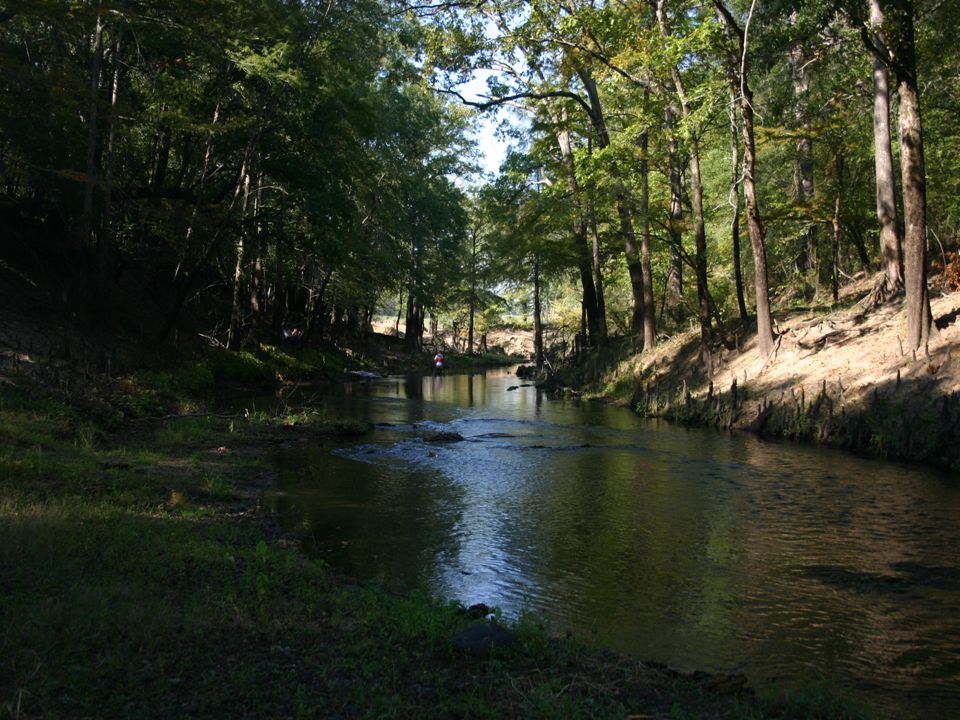
7
Pressure Transducer Installation -Continuous recording (every 20 min) of stage and temperature. -Began recording in March 2006. -Battery check and data download every 2-3 weeks. -Use stage data to help develop stage to discharge rating for site.

8
Stage time series for same period (April 4 – 20 th, 2006) at each site BC01 BC02 BC03
 at each site BC01 BC02 BC03")
9
Fish Assemblage Surveys Cataraft electofishing Boat electrofishing Barge electrofishing Seining At each site - Reach-based fish assemblage survey - Equal sampling effort for electrofishing and seining - Fish Identified and counted on site. - Non-game species vouchered and problematic IDs submitted to University of Texas for verficiation.

10
Cumulative total of 34 species Will probably add 5-10 more species when final IDs are completed Bigmouth buffalo, Blackstripe topminnow, Blacktail shiner, Bluegill, Bowfin, Brook silverside, Chain pickerel, Channel catfish, Common carp, Dusky darter Flathead catfish, Freckled madtom, Freshwater drum, Gizzard shad, Golden topminnow, Grass pickerel, Green sunfish, Largemouth bass, Logperch, Longear sunfish, Pirate perch, Pugnose minnow, Red shiner, Redbreast sunfish, Redear sunfish, Smallmouth buffalo, Spotted bass, Spotted gar, Spotted sucker, Spotted sunfish, Threadfin shad, Warmouth, Western mosquitofish, White crappie BowfinDusky darterRedbreast sunfish Pirate perchFlathead catfish

15
Channel Morphology and Aquatic Habitat Reach- and transect-based assessments Surveyed channel cross-sections to determine - Bankful ht. - Bankfull width - Bank slope or angle - X-section profile for general channel form and HEC-RAS modeling Transect measures (4 per reach) - Depth, width, habitat cover, velocities, canopy closure, bed substrate Surveyed Channel and Aquatic Habitat Features - Thalweg profile, mesohabitats, snags, Cypress knees, etc. … Surveying using total station Aquatic habitat assessment along a transect
 - Depth, width, habitat cover, velocities, canopy closure, bed substrate Surveyed Channel and Aquatic Habitat Features - Thalweg profile, mesohabitats, snags, Cypress knees, etc. … Surveying using total station Aquatic habitat assessment along a transect.")
16
BC01 BC00 Canopy Closure of Channel

17
Current Velocities (from transect assessment) BC00 – Velocity and habitat assessment from boat BC03 – Wading discharge measurement
 BC00 – Velocity and habitat assessment from boat BC03 – Wading discharge measurement")
18
Velocity Profile from Acoustic Doppler (BC00)
")
19
BC00 BC01 Bankfull Height

20
BC00 -Thalweg channel profile using acoustic doppler unit BC03 - Thalweg channel profile using total station, rod and prism

21
Sediment: Particle Size by Site

22
Evaluating Flow Building Blocks for the Low-Flow Channel

24
Riffle Top of riffle elevation (= 7.2 cfs) Pool
 Pool")
25
40 cfs 90 cfs

26
40 cfs 536 cfs (40-536 cfs)
")
27
Whats Next in Big Cypress Big Cypress? Complete fish IDs Compare observed vs. expected fish assemblages. Calc.IBI for each site. Continue transducer monitoring and data downloads (every 3 – 4 wks). Complete channel morph. and habitat assessments (one site remaining). Short Term
. Complete channel morph. and habitat assessments (one site remaining). Short Term.")
28
Whats Next in Big Cypress, cont. …. Sediment budget and sediment characterization. Benthic invertebrate surveys (possible emphasis on mussels). Get instantaneous discharge measurement during higher flows for developing site ratings (will coordinate with USGS Forth Worth to chase events with a doppler boat or tethered doppler unit). Additional fish surveys –Bluehead shiner occurrence and available spawning habitat –Meshohabitat-specific fish surveys. Longer Term
. Get instantaneous discharge measurement during higher flows for developing site ratings (will coordinate with USGS Forth Worth to chase events with a doppler boat or tethered doppler unit). Additional fish surveys –Bluehead shiner occurrence and available spawning habitat –Meshohabitat-specific fish surveys. Longer Term.")
Similar presentations


 LOWER MISSISSIPPI RIVER (Louisiana) Dugan Sabins, Louisiana Department of Environmental Quality Gary.>")