Download presentation
Presentation is loading. Please wait.

1
Electrical Resistance Imaging Looking beneath the surface… Or Finding where the bodies are buried without a backhoe… And Looking for buried ice on the side of a mountain… Dr. Greg Gaston, Department of Geography, University of North Alabama Dr. George Makowski, Department of History, University of North Alabama Changing lives. Creating futures. Looking beneath the surface… Or Finding where the bodies are buried without a backhoe… And Looking for buried ice on the side of a mountain… Dr. George Makowski, Department of History, University of North Alabama

2
Remote Sensing? Subsurface targets Simple technology with high order data processing

3
Significance? Big target technology searching for small targets Potentially a significant tool in exploring the impacts of climate change Identification of historical and recent archeological sites without damage High resolution images Flexibility

4
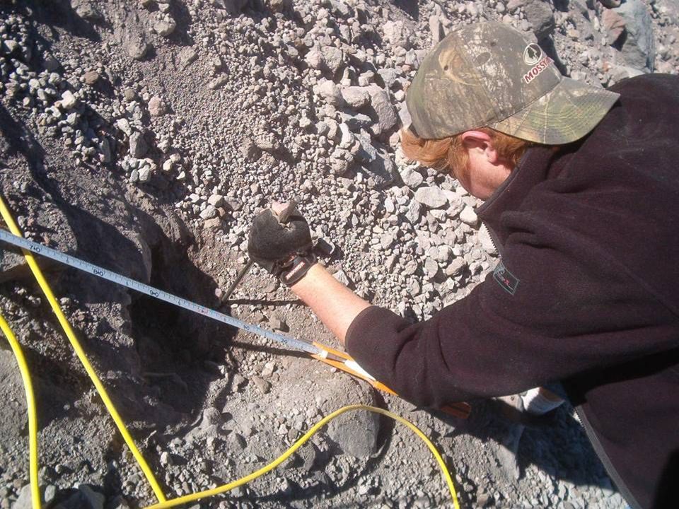
Why Electrical Resistance (ER) Imaging? Non-invasive Widely used tool in archeological investigations ER tools are more capable of recording data where sub-surface water is present (Ground Penetrating RADAR [GPR] has difficulty penetrating saturated ground conditions) Relatively low cost Buried ice has very high electrical resistance
 Relatively low cost Buried ice has very high electrical resistance.")
5
The physical principles…

6
Penetration is a function of the length of the electrode line and the distance between electrodes. Functionally, depth is 10-20% of the total length of the electrode array and the minimum target discrimination is ½ the electrode spacing.

7
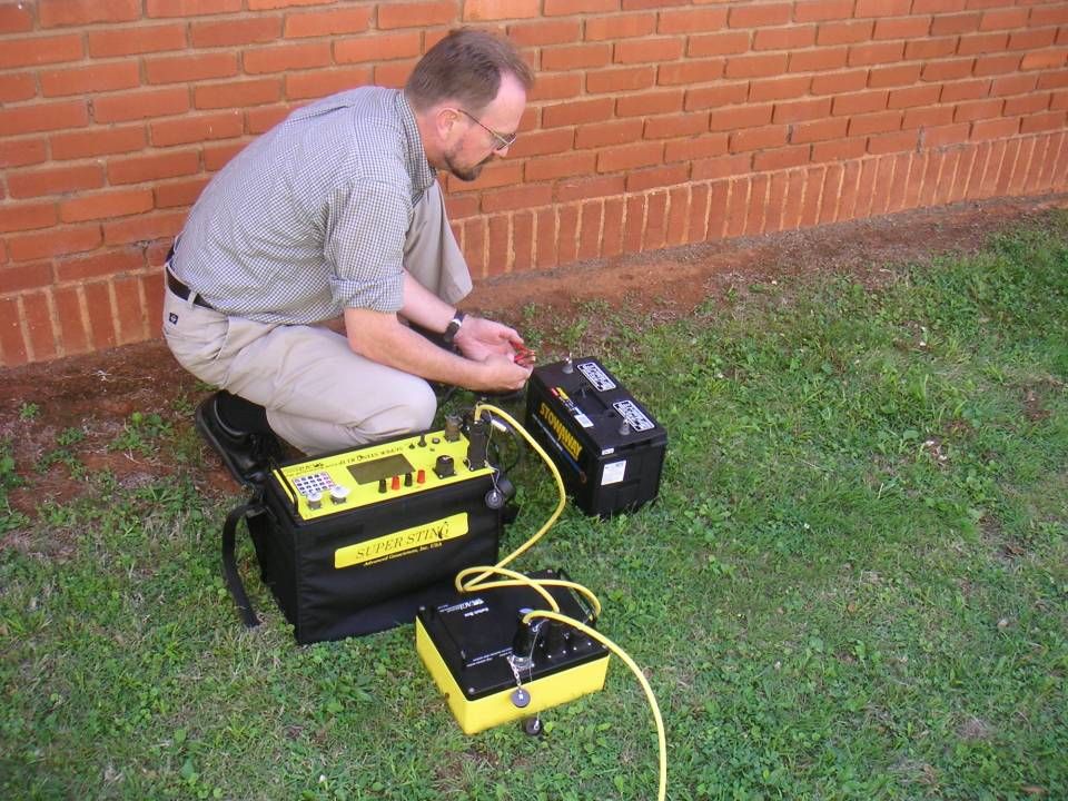
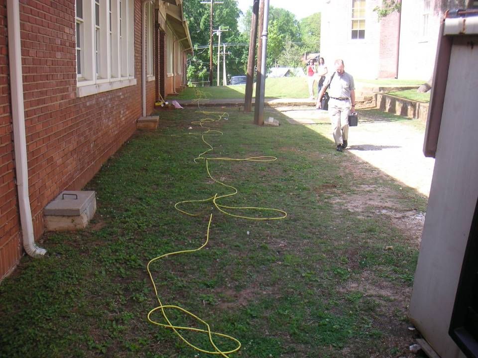
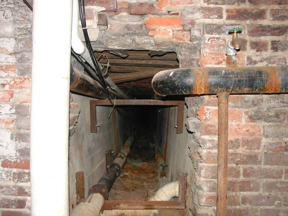
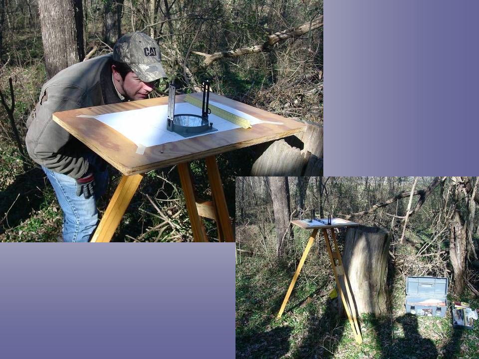
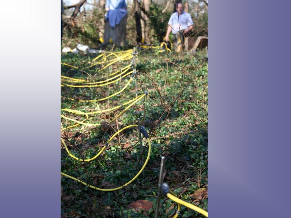
Testing the ER system

11
Known Steam Tunnel Steam Tunnel to adjoining building Compaction and moisture near sidewalk

12
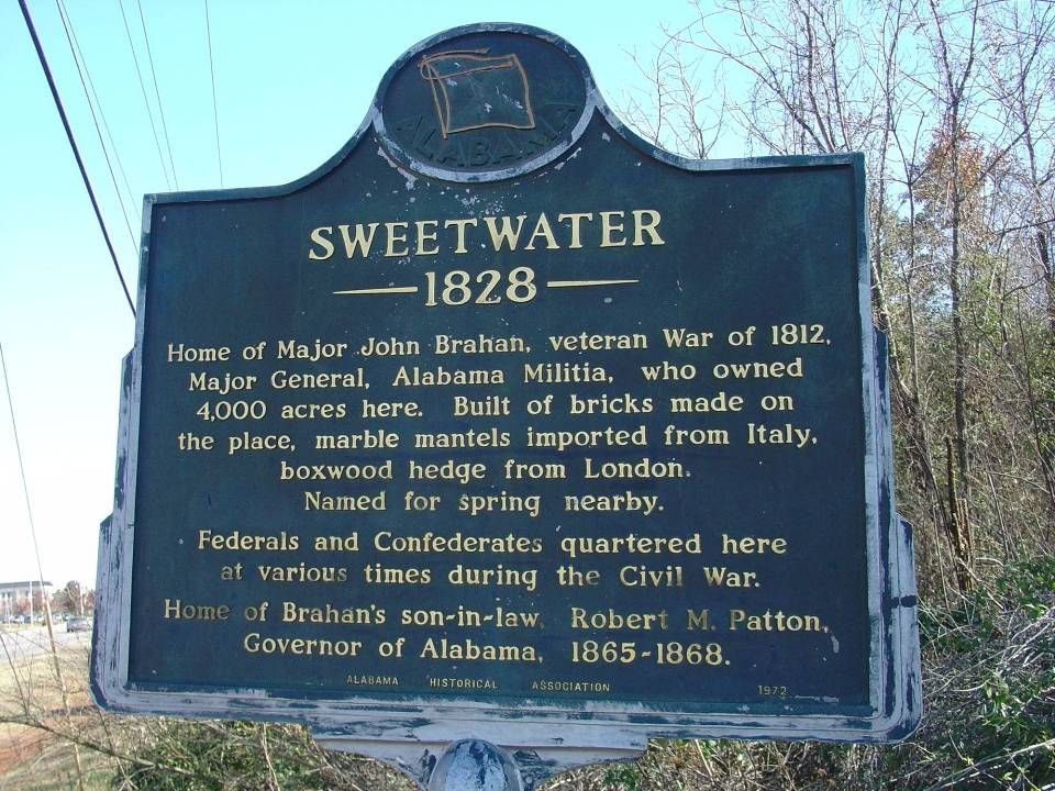
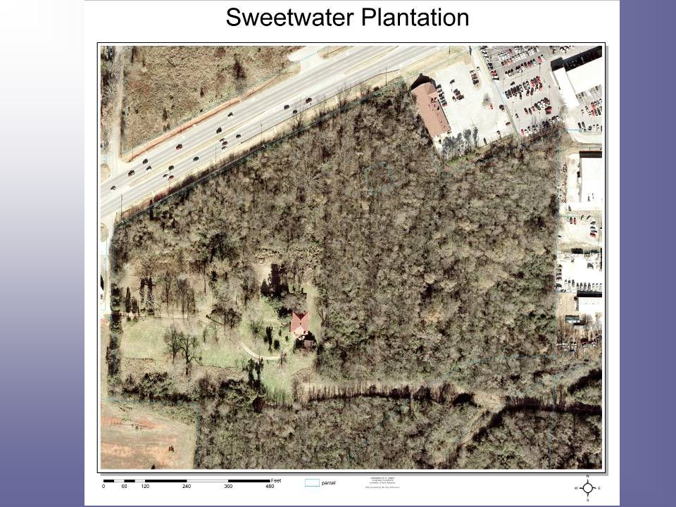
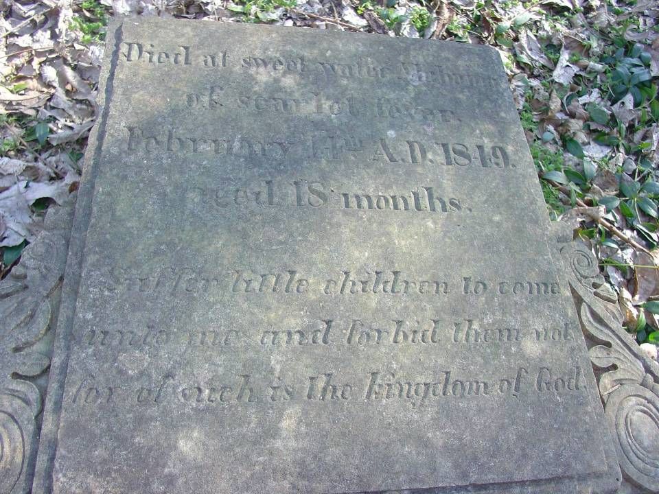
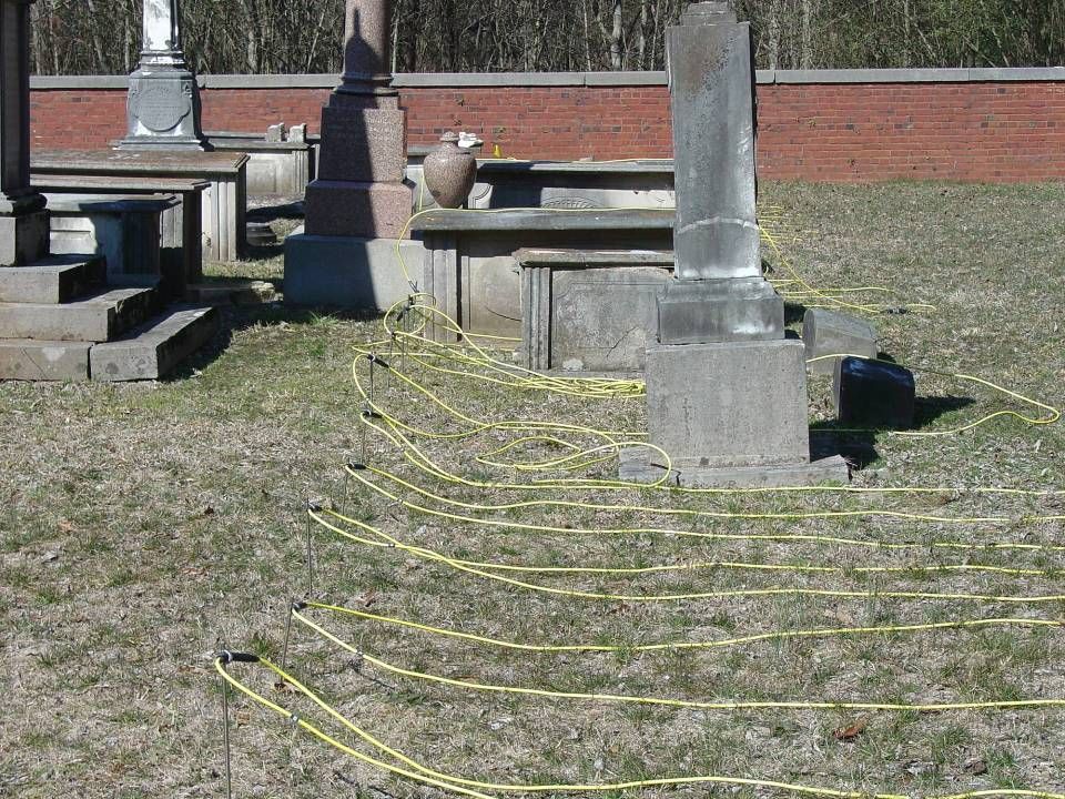
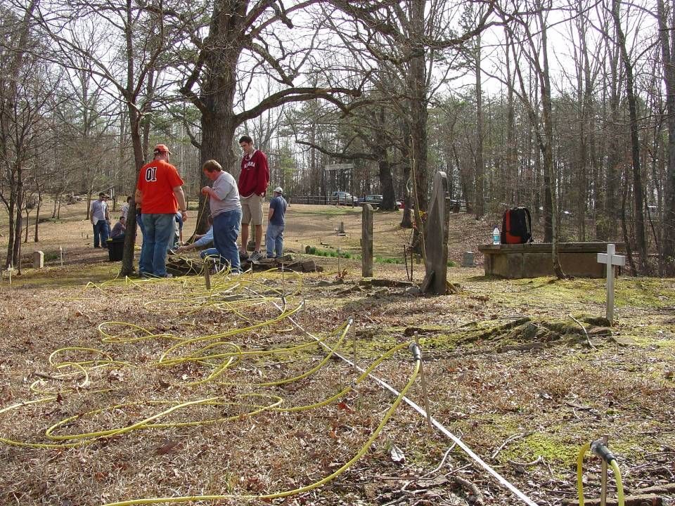
Case Study 1 Sweetwater Plantation ER Data collected 15 December ‘06 Additional Field Mapping 16 Feb. ‘07 Historical Applications:

15
Cemetery Site (Approximately 450 feet from the house)
")
19
Survey Lines

21
Survey Line 3 Data line 5 Schlumberger electrode firing pattern

22
Survey Line 4 Data line 7 Schlumberger electrode firing pattern

23
Case Study 2: Coffee Plantation

25
Coffee Cemetery Line 8

26
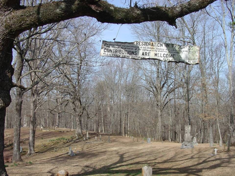
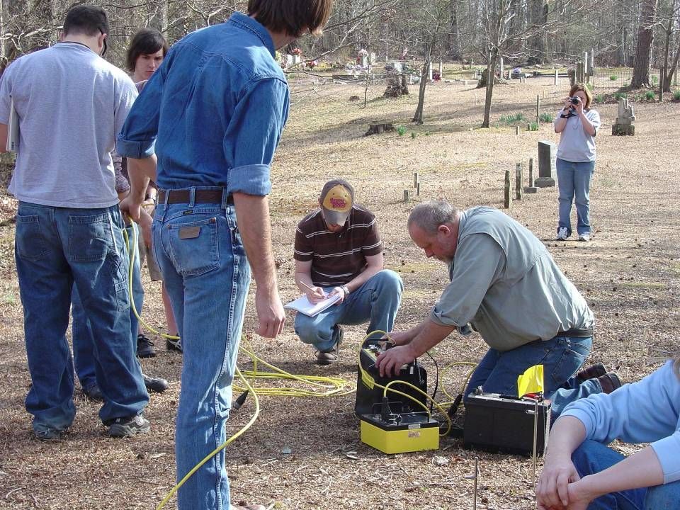
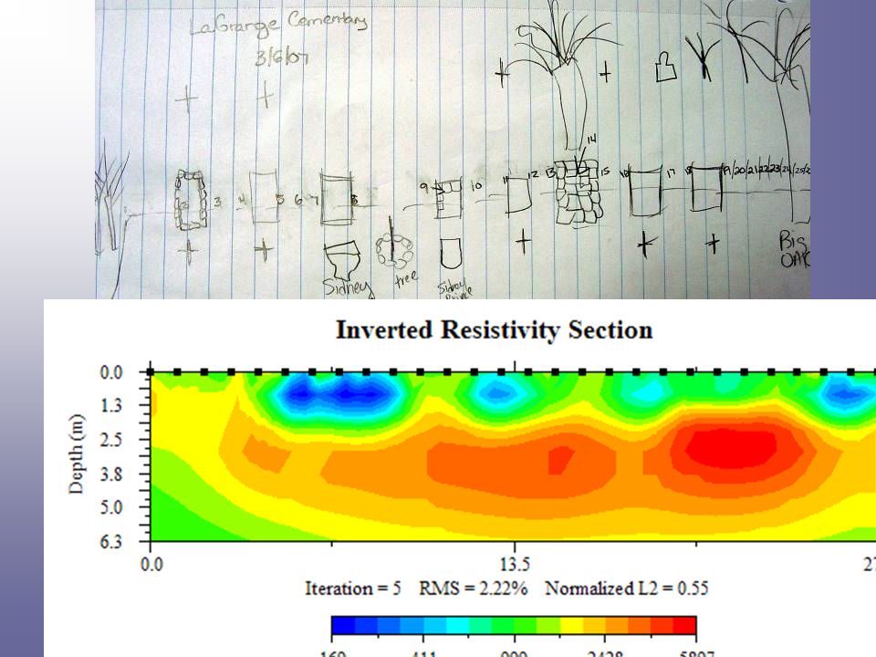
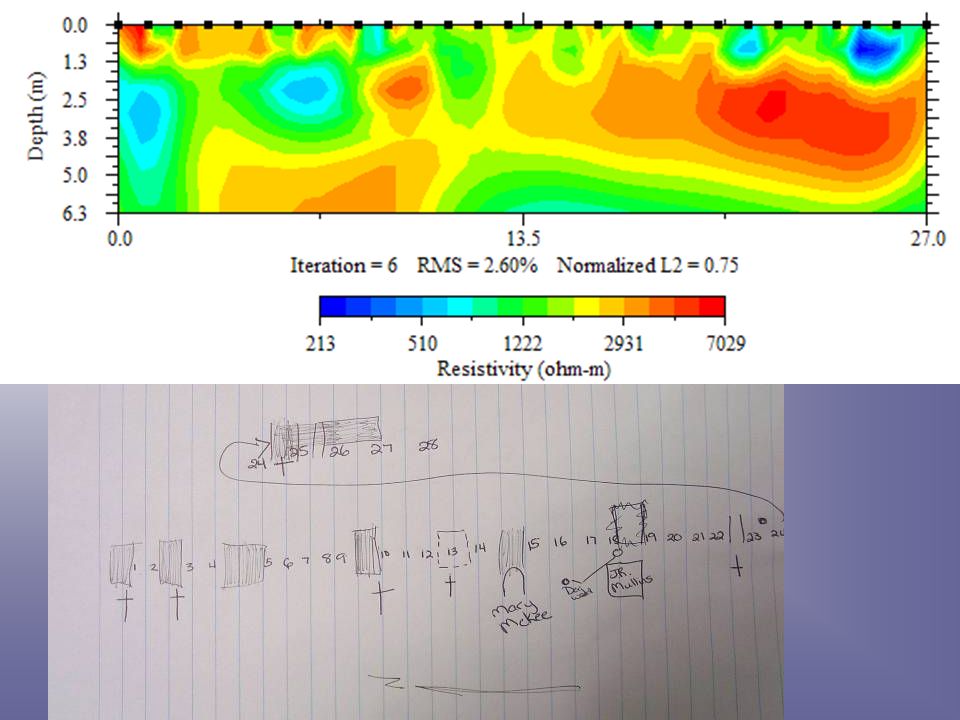
LaGrange Mountain Cemetery Experimental Data Collection Field Methods Class 6 March 2007

33
Results: Initial results at the Sweetwater Plantation site are encouraging. Results from the Coffee Plantation site are not as expected. The interpretation of ER images can change with different environmental conditions. The ‘Art’ rather than the ‘Science’ of image interpretation and analysis

34
Next steps in the research program: Test ER imaging at additional sites with known and suspected burial sites. We will retest Coffee cemetery with drier conditions.

35
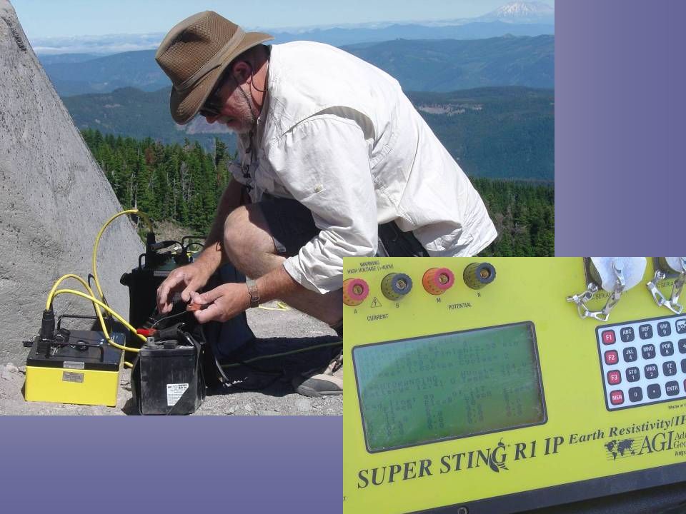
Changes in glacial ice and ice marginal features of the Cascades Research sponsored by a grant from the College of Arts and Sciences at the University of North Alabama. Thanks also to the UNA Department of Physics and Earth Science for the loan of the Electrical Resistance Imaging equipment.

36
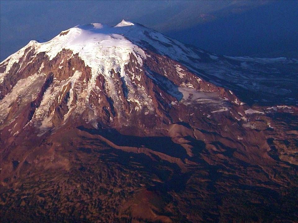
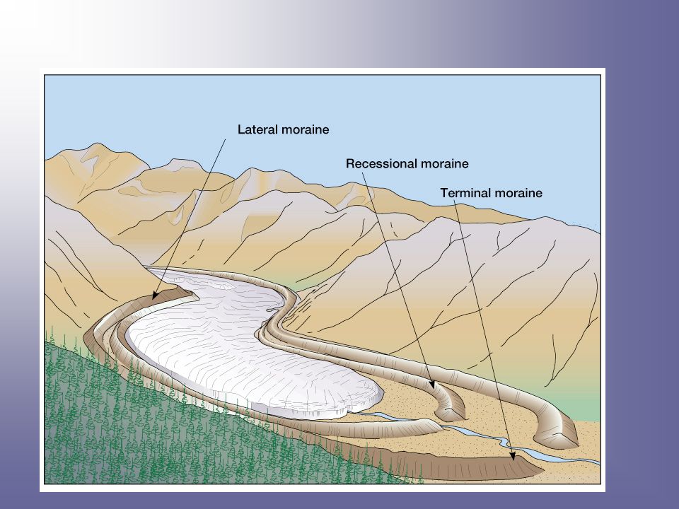
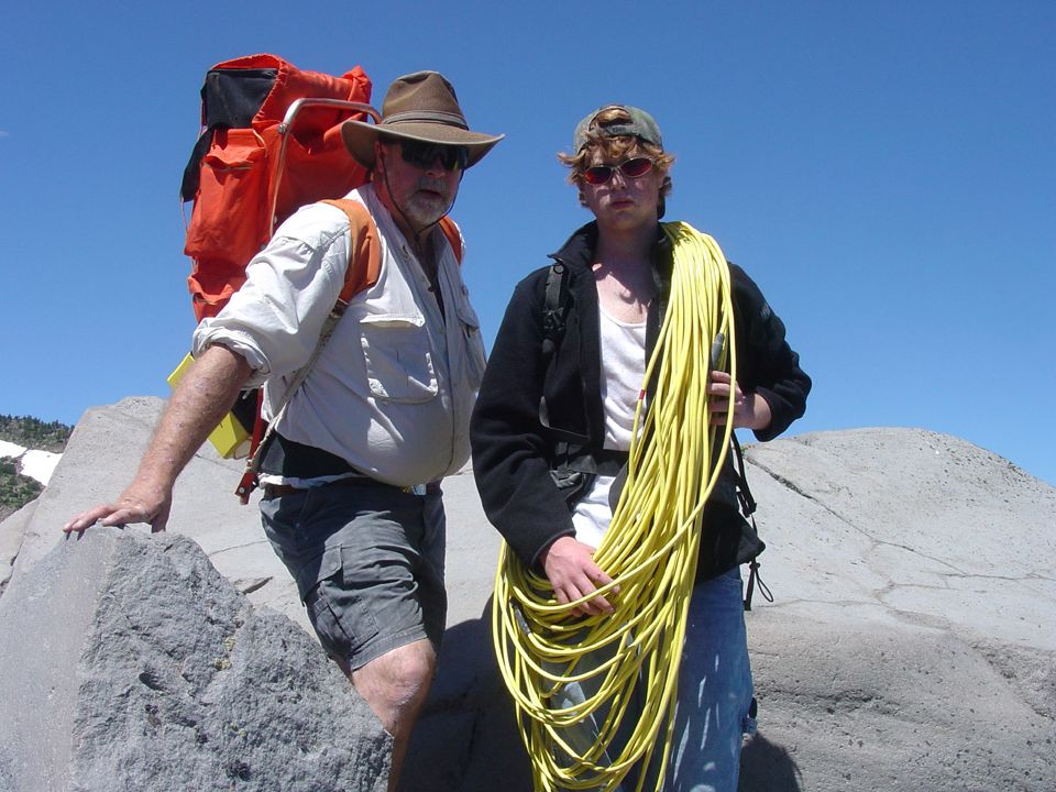
Why glacial features in the Cascades? Glaciers exist at comparatively low elevations It is possible to measure moraine features at 6000-7000 feet Changes in ice and ice marginal features are fairly well documented including a long record of aerial photography A wide variety of glacial features have (relatively) easy accessibility Previous Research Experience
 easy accessibility Previous Research Experience.")
37
The Pacific Northwest

41
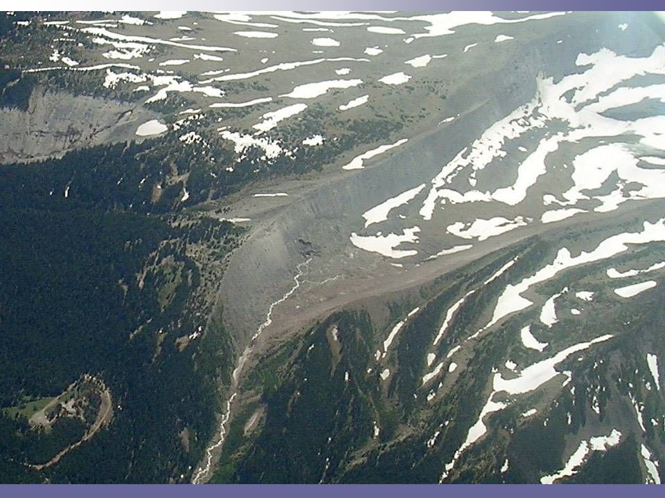
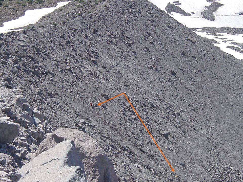
The angle of repose of dry earth materials is generally 25-40 degrees. 35 degrees is the accepted ‘normal’ angle of repose A steeper angle implies some sort of cohesion between particles.

42
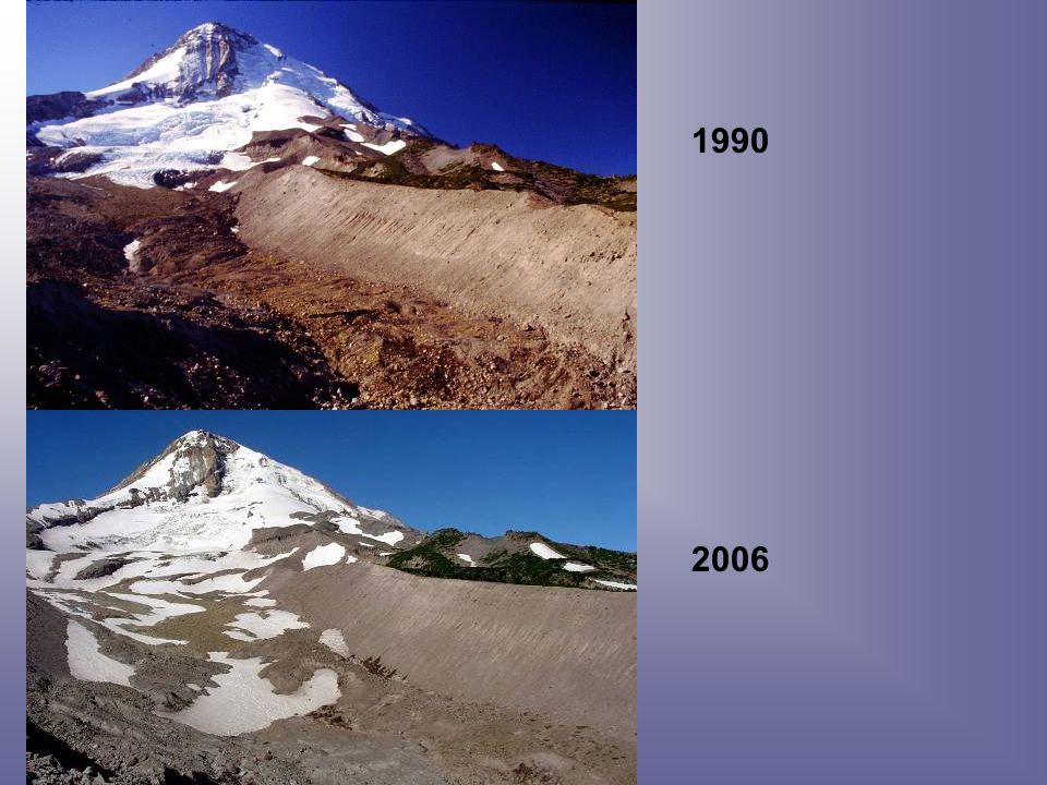
1990 2006
43
http://glaciers.pdx.edu/gdb/maps/oregon_website/or_glaciers.html 1901

45
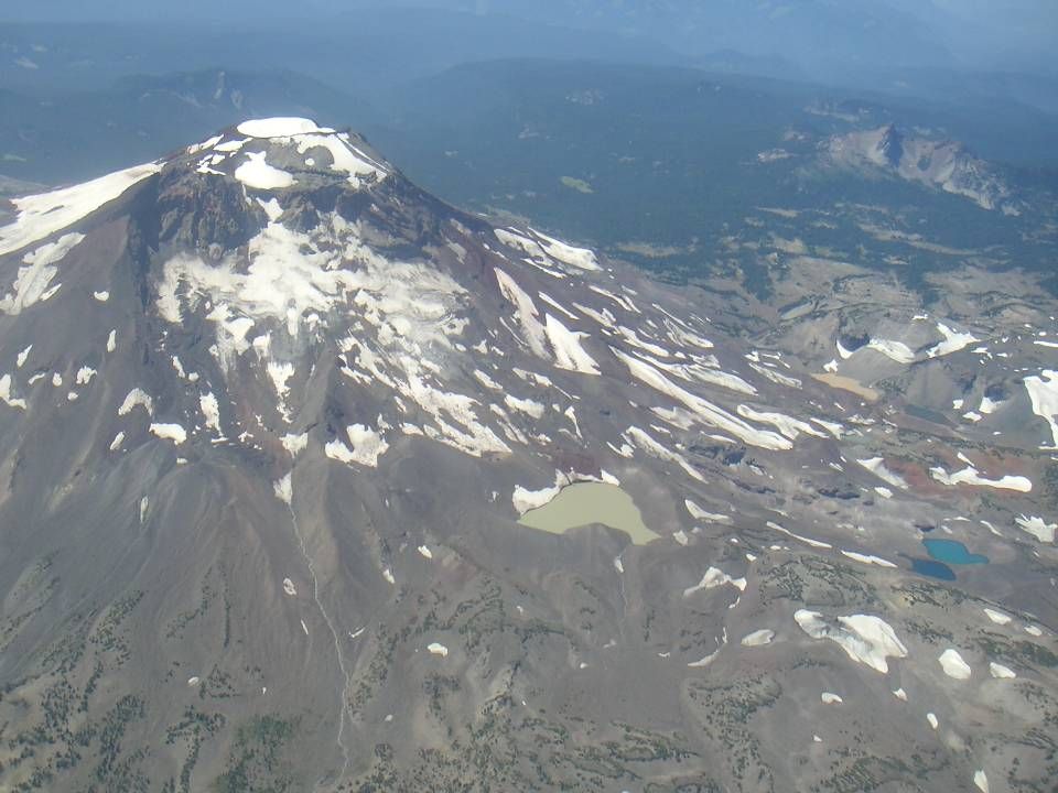
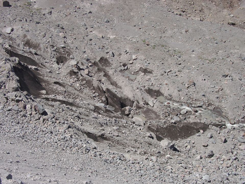
Carver Lake… An example of a glacial lake created by ice cored moraines.

53
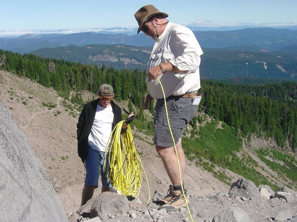
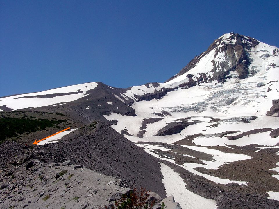
Site 2: Known Glacial Ice Site 1: Suspected Ice Cored Moraine

54
Conclusions The steeper angle of repose in many of the moraines of the Cascades is caused by an ‘ice core’. Electrical resistance imaging equipment was useful in confirming the presence of ice in the moraine. Interpretation of the levels of resistance suggest discontinuous ice lenses rather than a solid mass of ice. Lakes in the Cascades dammed by moraines with similar slope are likely to fail as ice in the Cascades continues to melt. Mountains are taller and gravity appears to have dramatically increased over the last 16 years!

Similar presentations


 ** National Remote Sensing Centre, Hyderabad(NRSC)>")


 is the first mission in NASA's Vision for Space Exploration, a plan to return to the moon and then to travel to.>")


