Download presentation
Presentation is loading. Please wait.

1
The State of The Sound How the Puget Sound was formed and its current state.

2
Glaciation 2-3 Million years ago, 4 successive waves of glaciation*. This advance and retraction of ice gouged out the valleys we now know as the Puget Sound and many of the river valleys in the Puget Sound area.

3
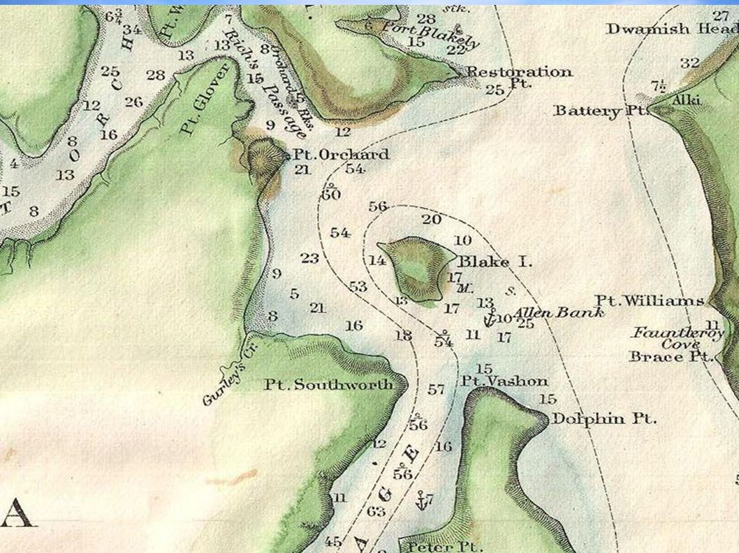
Depth of the Puget Sound The Puget Sound has a relatively constant depth and sea-bottom profile at about 205 ft. The deepest part is off of Point Jefferson at 930 ft. There are parts of the seafloor called sills, these are leftover deposits from glaciation at key points in the sound. These sills are located at all the major boundaries of the Sound and range in depth from 150 ft to 375 ft deep. Map on next slide (depth in fathoms*) *1 fathom equals 6 feet
 *1 fathom equals 6 feet.")
5
Present Boundaries and Basins The Puget Sound's major boundary is from the Admiralty Inlet and Deception Pass south. This includes the Hood Canal. There are over 1300 miles of shoreline and a total surface area of 1000 Sq miles. Puget Sound contains 4 major basins: Central Basin (Admiralty Inlet to the Tacoma Narrows), Whidbey Basin ( east of Whidbey Island to Deception Pass), South Basin ( Tacoma Narrows to Olympia), and the Hood Canal Basin ( Hansville to south end of the Canal.
, Whidbey Basin ( east of Whidbey Island to Deception Pass), South Basin ( Tacoma Narrows to Olympia), and the Hood Canal Basin ( Hansville to south end of the Canal..")
6
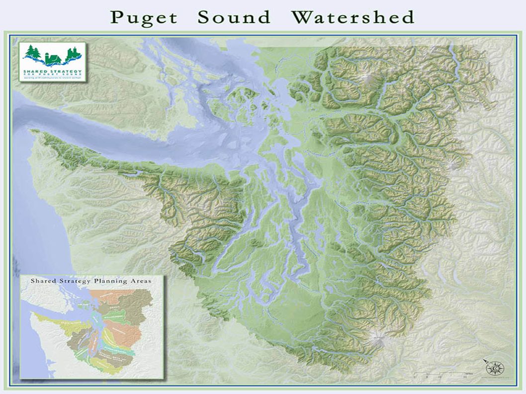
Puget Sound Watershed The Puget Sound region has over 10,000 Sq Miles of drainage area, this includes 10 major and 14 minor rivers. All told there are 8000 rivers and streams emptying into the sound. Total there are 45 trillion gallons of water pouring into the sound every year. Drainage Basin map on next slide

8
Circulation in the Sound The Puget Sound is constantly in motion. 5% of the total volume of the Sound is moved out and fresh seawater full of nutrients flows back in with the daily tides. The major source of 'fresh seawater' is from pulsed input during the neap tides (avg 500ft deep). During these neap tides, cool, dense seawater gets 'pulsed in' while on the surface there is a continual outflow of warm fresh water from rivers and streams (avg 165 ft deep). Circulation model on next slide
. During these neap tides, cool, dense seawater gets pulsed in while on the surface there is a continual outflow of warm fresh water from rivers and streams (avg 165 ft deep). Circulation model on next slide.")
9
SILLS ON SEA-BOTTOM

Similar presentations


![PART ONE : HYDROSPHERE [Section 6] Topics CoveredSlide Numbers 6 Hydrosphere [2-4] 6.1Tides [5] 6.2 Ocean currents[6] 6.3Shipping canals[7-8] 6.4Major.](/13/3937661/big_thumb.jpg "PART ONE : HYDROSPHERE [Section 6] Topics CoveredSlide Numbers 6 Hydrosphere [2-4] 6.1Tides [5] 6.2 Ocean currents[6] 6.3Shipping canals[7-8] 6.4Major.>")


 end ~9PM.>")
>")


 circulation –tidal circulation –mixing - where, when, consequences.>")