Download presentation
Presentation is loading. Please wait.

1
Physical Geography of Europe
Chapter 12

2
Chapter 12 Vocabulary Words
Fjords- steep u-shaped valleys that connect to the sea and that filled with seawater after glaciers melted. Uplands- hills or low mountains that may also contain mesas and high plateaus. North Atlantic drift-a current of warm water from the tropics, flows near europe’s west coast

3
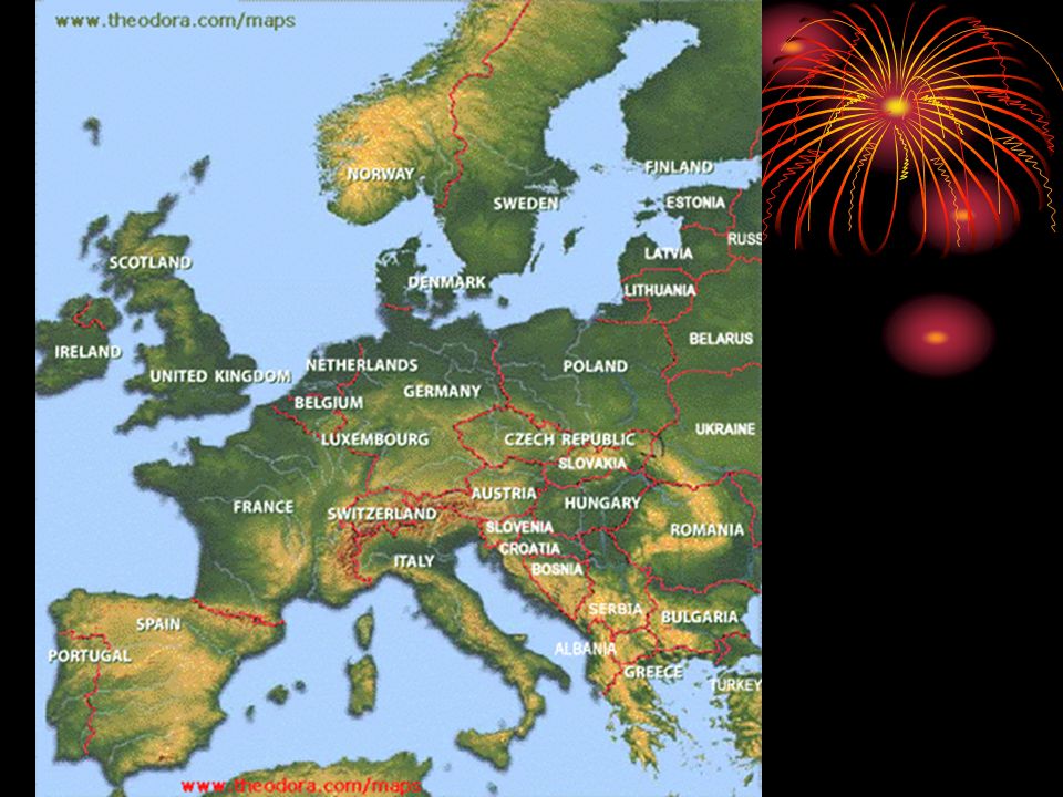
Landforms and Resources
Major Peninsulas Scandinavian – Norway and Sweden Jutland -Denmark Iberian –Spain and Portugal Italian -Italy Balkan –Adriatic, Mediterranean, Aegean Sea’s

4
Major Mountains Alps Pyrenees
Stretch across France, Italy, Germany, Switzerland, Austria and Northern Balkans Pyrenees Border between France and Spain

6
Major Rivers Rhine –flows south to north from the Alps bordering Switzerland , through Germany and entering the North Sea through the Netherlands Danube –cuts through the heart of Europe from West to East, linking Europe to the Black Sea

7
Resources Europe is known for the following resources: Petroleum
Copper Iron ore Lead Silver Uranium and Zinc

8
Climate of Europe North Atlantic Drift Mistral Sirocco
Current of warm water from the tropics Mistral Cold, dry wind from north Sirocco Hot, steady wind from North Africa (this is why the Mediterranean Sea is so warm)
")
10
Human Environment Interaction
Waterways for Commerce: Venice’s Canals Builders sunk wooden pilings into the ground to help support the structures above. The city is gradually sinking due to compressions of these pilings and rising sea levels.

Similar presentations


 Locate on a world and regional political‐ physical map: the Danube River,>")


 Jutland Peninsula (Denmark.>")


