Download presentation
Presentation is loading. Please wait.

1
Height measurements Using vertical aerial photography to establish the ‘z’ value of objects.

2
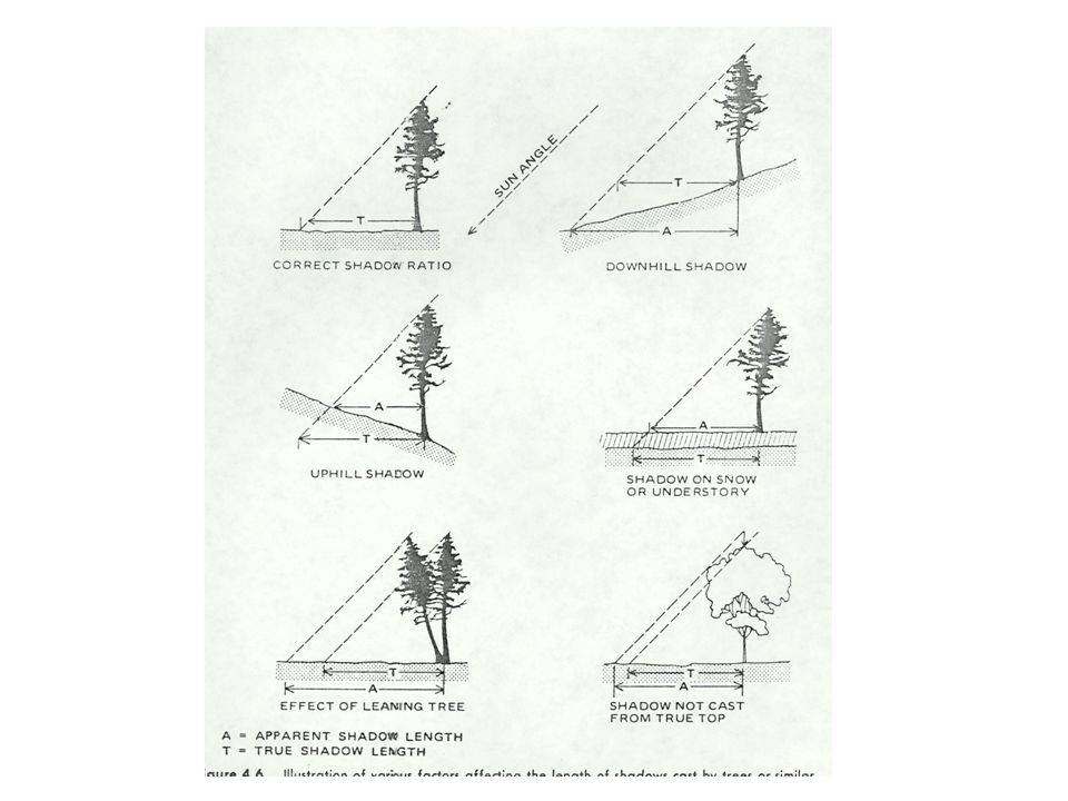
Shadow length… a moderately useful tool, best used to compare objects in a single photograph

3
Solar Ephemeris

5
1 2 3

6
Establishing height of objects from a single photograph

7
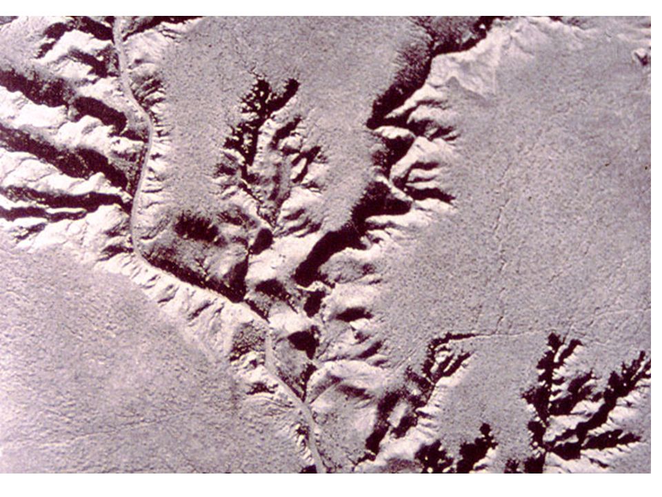
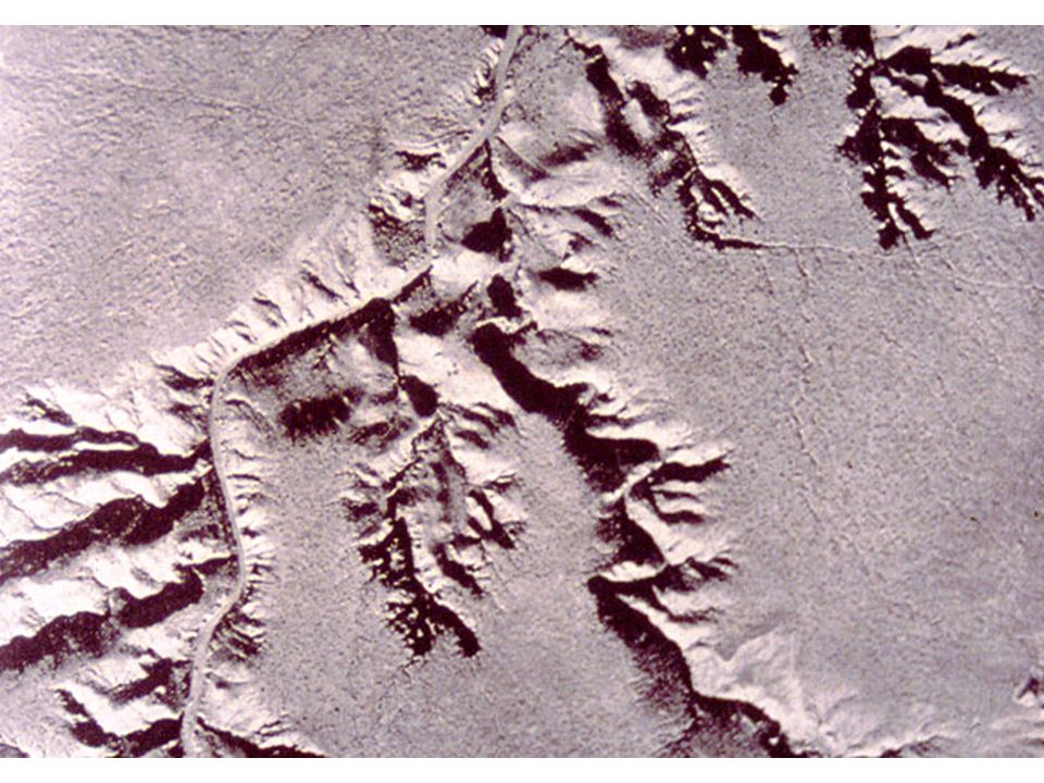
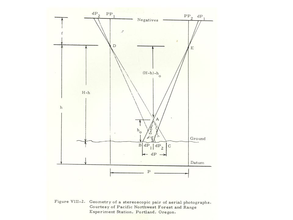
Stereo Vision Powerful advantage for vertical imagery Works with any photo pair with certain characteristics e.g 6-8 degrees of seperation Accurate measurement of ‘z’ values A stereo pair is usually specified to have 60% overlap… stereo viewing is possible ONLY in the overlap portion.

8
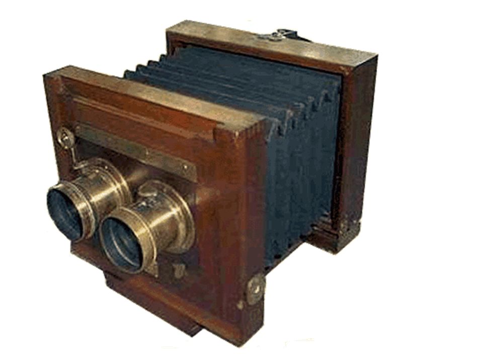
Virtually any subject was used in the parlor stereo viewer….. By separating the location of the photo by approximately 6-8 degrees…. A stereo pair is created. Oblique air photos… take exposures 3-5 seconds apart… depending on altitude/platform speed. (light aircraft ~5sec, jet aircraft ~2-4 seconds)
.")
10
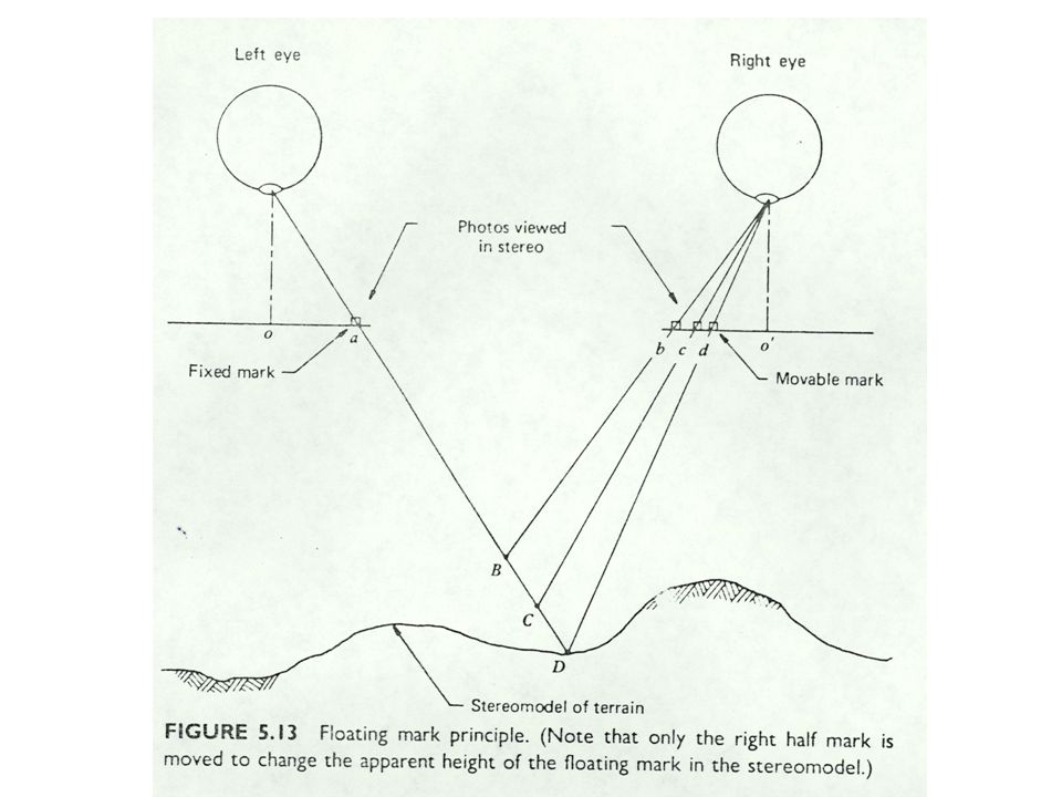
Why does stereo vision happen? Parallax. The path that reflected light travels is slightly different for each eye… with practice, it is possible to evaluate this change in path and judge distance. Predators and baseball players Using a pair of photographs… the effect is to increase the intraocular distance to the equivalent of having one eyeball on the aircraft at station 1 and the other eyeball on the aircraft at station 2….. Only one eye… stereo vision is impossible…. Depth perception is still possible using monocular clues*, but true stereo is not possible. *size, sharpness of detail, superposition, brightness

12
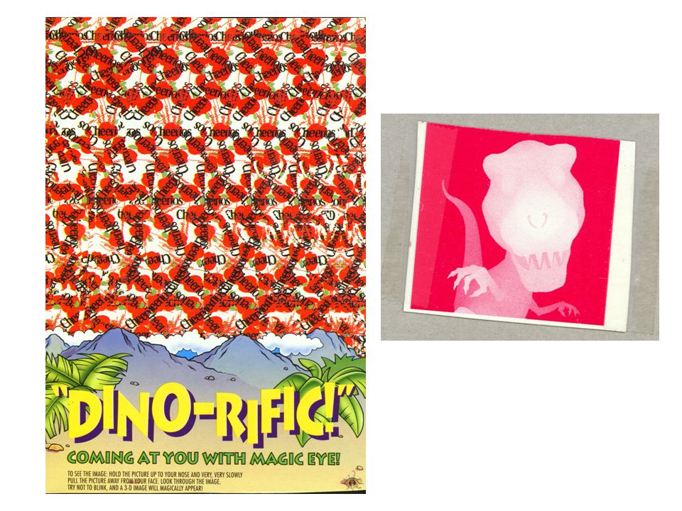
Standard Stereo test…

13
The human eye at birth does not ‘track’… converge on a single object… this is learned behavior (accommodation and convergence). (crib training) The eyes can be trained to overcome this convergence training and an individual can use a stereo pair with no additional equipment… It give me a headache and some claim that once the training has been overcome… the habit can be lost…
 The eyes can be trained to overcome this convergence training and an individual can use a stereo pair with no additional equipment… It give me a headache and some claim that once the training has been overcome… the habit can be lost….")
15
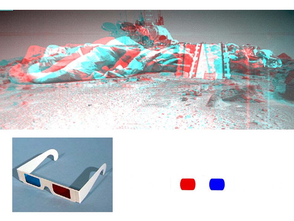
Tools to help stereo viewing Anaglyph Red-blue images are offest and using red/blue lenses on a pair of ‘3D glasses’ it is possible to see three dimensional images from 2 dimensional images. By using the colors, each image is kept separate and the brain creates a 3 dimensional stereo model.

17
stereoscopes Mirror stereoscope: Allows full separation of photo pairs Large and expensive **first surface mirrors** Don’t touch!!! Pocket stereoscope: Cheap Easy to use in the field Often requires bending photos…as only 1/3 to ½ photo is visible at one time

18
Softcopy stereo….

19
The analytical stereo plotter BIG, expensive and (usually) highly accurate. WW II surplus… new machines, digital. Direct conversion of data to GIS line files. Lots of demand for skilled operators.. 8 hours/day of ‘chasing the dot’ The tool used to create topographic maps

20
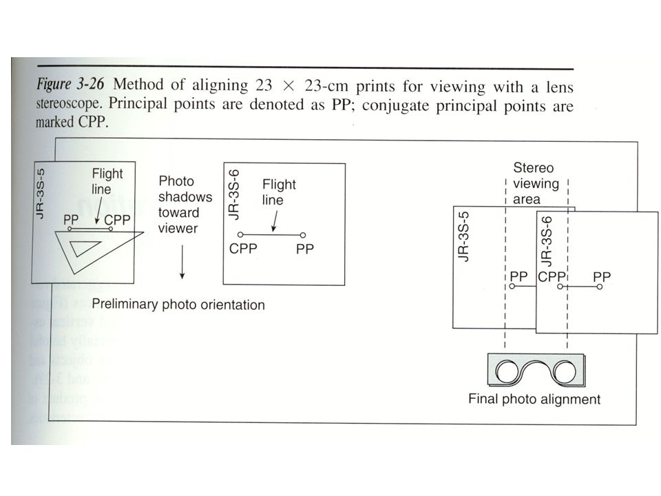
Viewing a stereo pair…. Locate PP’s and CPP’s Establish the flightline Place photos so a recognizable object is at the approximate inter-ocular distance (this depends on the stereoscope being used… use your fingers to help with rough location. Keep the shadows towards you, if the shadows fall away … you may experience stereo inversion. WORKS ONLY ALONG THE FLIGHT LINE! PRACTICE!!! This is a learned skill that only gets better with practice. Headaches come with this… the eye muscles are not used to this type of activity… its not damage, its fatigue.

27
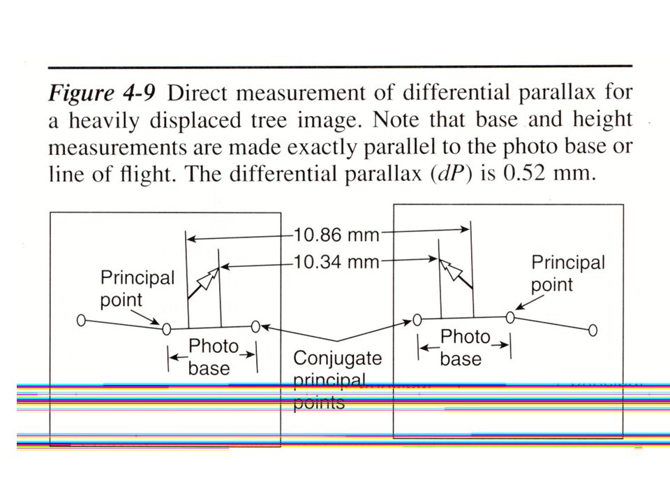
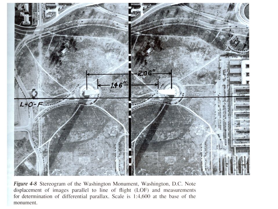
For P it is common to substitute the photo base (distance from PP to CPP)
")
Similar presentations


 FORM (3-D) SHAPE (2-D) FORM (3-D) VALUE VALUE COLOR COLOR TEXTURE TEXTURE SPACE SPACE.>")


