Download presentation
Presentation is loading. Please wait.

2
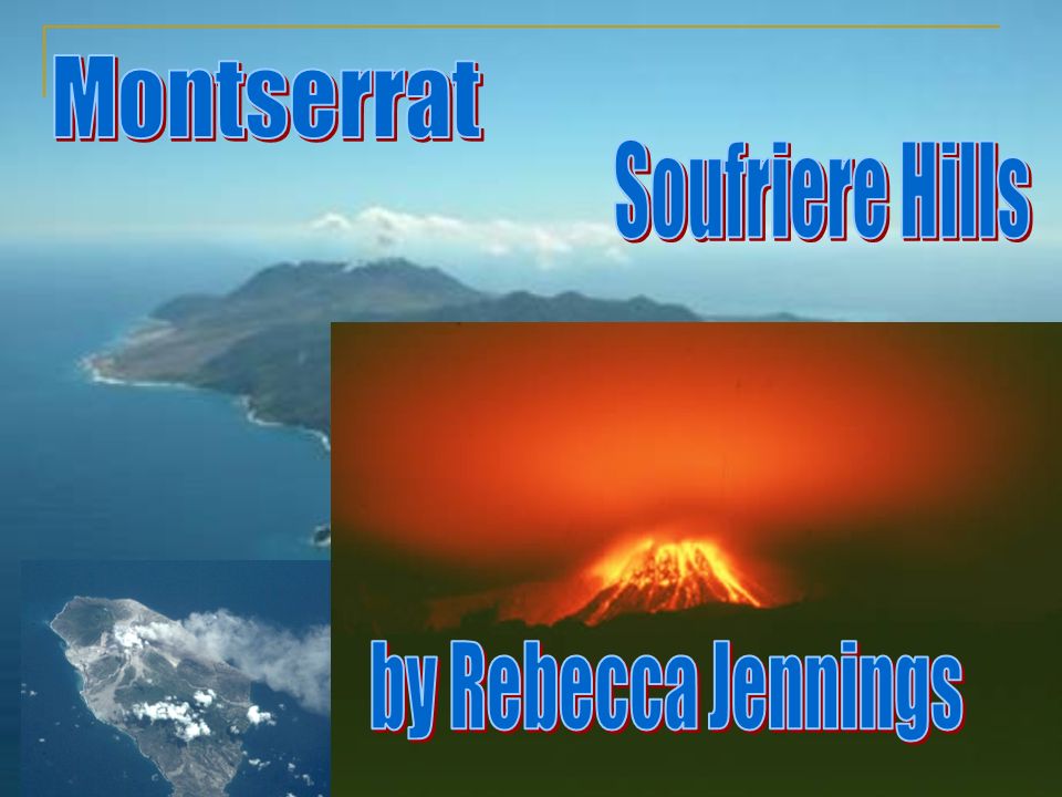
Location of Montserrat in the Caribbean Islands The Island of Montserrat Montserrat in relation to South America and the world

3
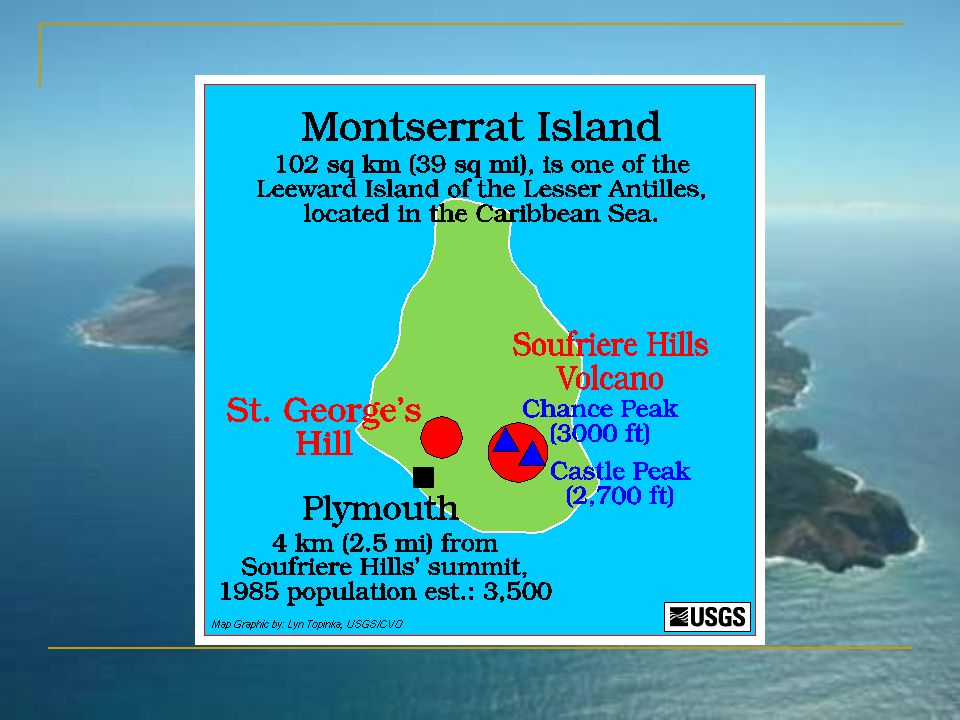
Population5000, was 18000 before the eruption Ethnic GroupsBlack, White, Mixed ReligionsChristian LanguagesEnglish Literacy rate97% Area102km 2 IndustriesTourism, rum, textiles, electronic appliances. CurrencyEast Caribbean dollar Natural ResourcesSun, volcano, sea and surf ClimateTropical

4
1493 – Sighted by Christopher Columbus, and named after a Spanish Abbey. 1632 – England takes over Montserrat. 1782 – French take over. 1783 – England reclaims the island. 1989 - Hurricane Hugo causes widespread damage. 1995 18 July - Chances Peak volcano erupts for the first time in 350 years. August - Government declares a state of emergency. December - Britain grants millions of pounds in development aid. 1996 April – Montserrat inhabitants have opportunity to move to Britain for two years. 1997 25 June - Soufriere Hills volcano erupts with devastating effects. Two-thirds of the island is left uninhabitable and 19 people are killed. Plymouth, the capital, is abandoned. Montserrat's airport is closed, the island is accessible only by helicopter or boat. 2001 July - Eruption of the Soufriere Hills volcano causes widespread disruption. 2003 July - Largest volcanic eruption since Chances Peak in 1995 destroys many buildings on the edge of the safe zone.

5
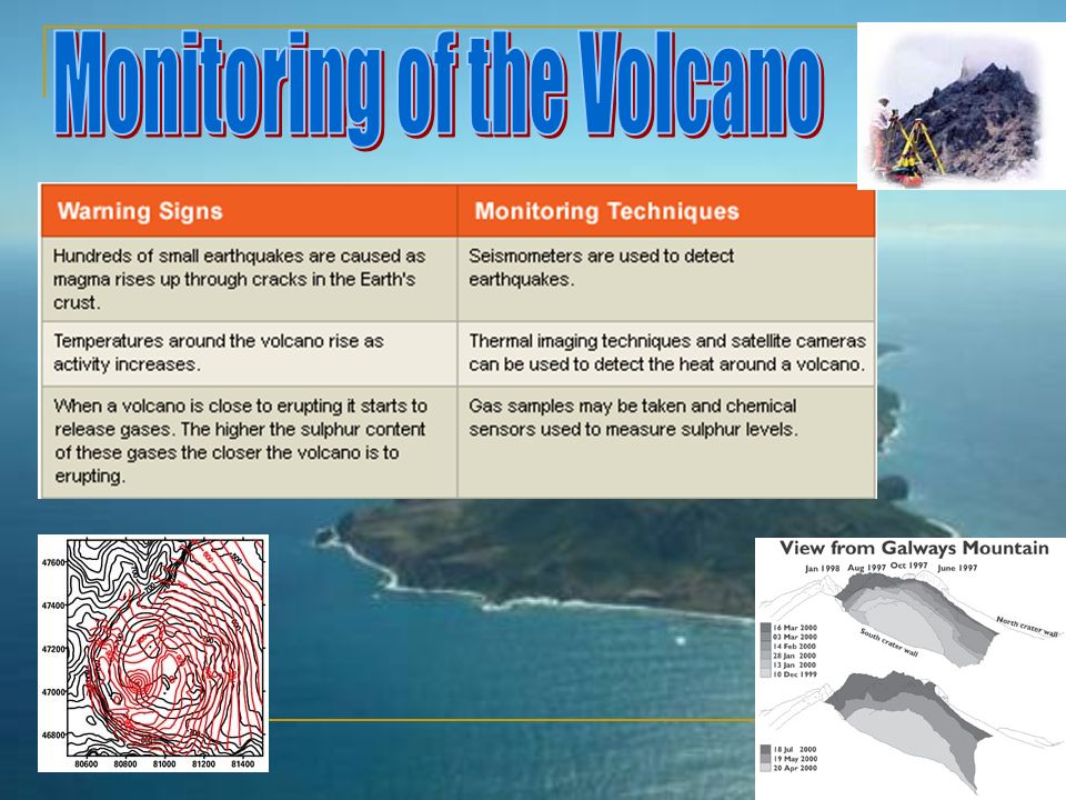
Warning Signs of the Eruption Small earthquakes Small eruptions of dust and gas

6
Montserrat is an island prone to volcanoes and earthquakes because The South American Plate and the Caribbean plate move towards each other, and the South American Plate goes under the Caribbean plate, and causes earthquakes. Magma rises, and under extreme pressure, erupts in the form of a volcano.

7
July 18 th 1995 Southern half of the island had to be evacuated as they were covered in ash and lava. Over 2/3 rd ’s of the population left to go to a nearby island, or the UK, where the government offered temporary living areas.- an estimated 11000 moved away. Main city Plymouth was destroyed, including the airport. Plymouth was covered in 40 feet of mud.

8
June 25 th 1997 19 people died Pyroclastic flows reaching temperatures of 1000 o C and flowing at 120 km/h. Debris was showered into the zone marked safe Large ash clouds regularly being erupted above the island, sometimes being up to 70-10 thousand feet. Dome inside the volcano growing and therefore will collapse. The collapse later in the year led to large and destructive pyroclastic cloud and flows down the White River, and hence creating a new delta. During 1998, there were many small earthquakes leading to the dome collapsing again, and so more eruptions lasting 2 hours 30 minutes.

9
During September 2000, there were many large eruptions of gas clouds in the air, forming polluted areas, and covering the surrounding areas in gas.

10
Main transport networks lost-airport closed, due to being covered in ash Capitol city was destroyed Many people were left homeless No food or water. The infrastructure of the south of the island was lost. Docking facilities in Plymouth also destroyed, therefore the most popular industry (fishing) became harder to do, and so there was a shortage of food and drink 19 people died Main university had to be relocated. Mudslides also caused devastation
 became harder to do, and so there was a shortage of food and drink 19 people died Main university had to be relocated. Mudslides also caused devastation.")
11
Many people left the island, going to countries as far away as the United Kingdom where they were granted full residential rights is 1998, and citizenship in 2002. Tourist industry was destroyed, leaving many with little money. Even now, few tourists visit the island. Land was destroyed, meaning that all of the trees etc had be burnt down due to the extreme temperatures of the lava flow. Loss of wildlife, due to the speed and temperature of the lava flow.

13
Following the first eruption in 1995, all the others were predicted, due to more technology and the ability to predict them. Before the first eruption, Montserrat was thought to be almost extinct, but now it is active, so it is constantly being closely monitored by both the British and the American government. Due to the dangers and the monitoring of the volcano, the south of the island was marked as an exclusion zone, so that people would be safe. Even if the monitoring system was wrong, few people would be injured. However, this wasn’t the case in 1997, as many people thought that the volcano wouldn’t erupt and that they would be safe, so ignored the warnings, because they were so frequent.

Similar presentations


 and responses to the eruption.>")


 Montserrat Volcano Haiti Earthquake Christchurch Earthquake (New Zealand) Atmosperic Hazards Hurricane.>")