Download presentation
Presentation is loading. Please wait.

1
South Asia Chap 25 & 26 Unit 8

2
I. Natural Environment of India
The Ganges at night

3
A. Physical Characteristics of South Asia
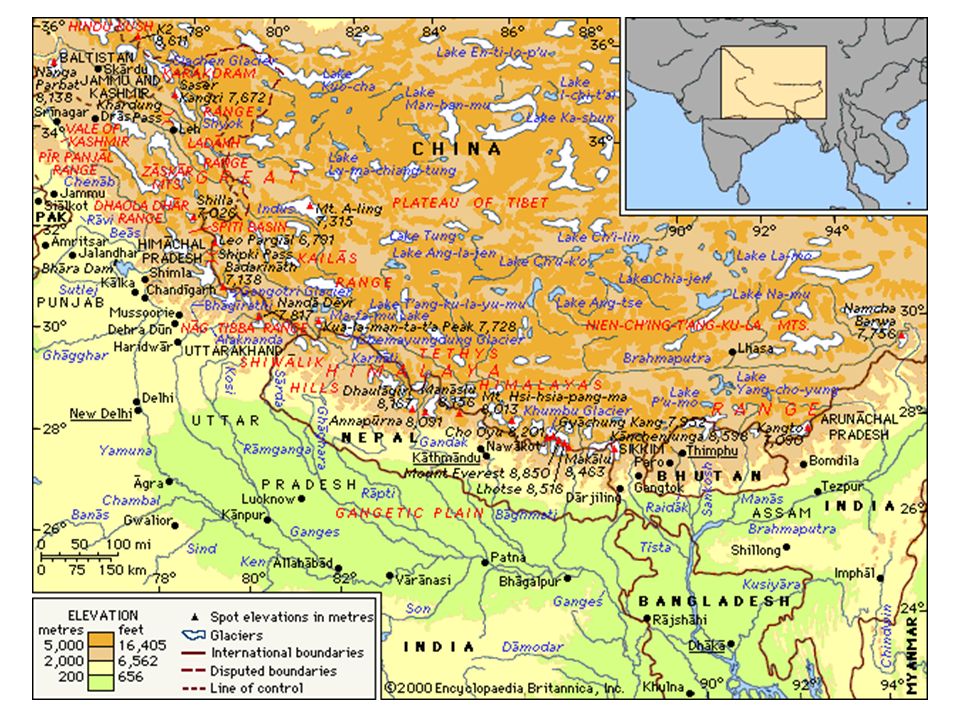
South Asia is a subcontinent – large landmass that forms distinct part of a continent Himalayas separate South Asia from the rest of Asia Highest mts in the world – includes more than 30 of world’s highest mts – often referred to as the “rooftop of the world” Mt. Everest highest mt in world at 29,000+ ft.

4
d. They are covered in snow all year long
d. They are covered in snow all year long. Some of the snow melts in the spring. The water runs off the mountains, creating rivers. e. Relatively young mts – have not eroded much – continue to shift, move, rise - Contains some of world’s largest glaciers – thus, India contains the world’s largest body of ice outside subpolar regions.

6
World’s Highest Peaks - numbered

7
3. Three Great Rivers of South Asia
a. Indus - rises in the snowy mts of the Himalayas & flows down to the hot, dry lands below. - Every spring, the mt. snows melted & the river flooded. When the water drained away, it left behind a rich mud (alluvial soil). This was good for planting crops. - Today the river is controlled by dams and canals.
. This was good for planting crops. - Today the river is controlled by dams and canals.")
8
- headwaters in Himalayas - Functions of the Ganges:
Drinking water & fish Irrigate crops Trade & transportation route - Hinduism’s holy river Goddess Ganga Healing powers Many temples along its banks Ghats lead down to the water

10
Brahmaputra - source is Himalayas
- flows from SW Tibet, China, through India, into Bangladesh, where it empties into the Bay of Bengal - not navigable between the mountains of Tibet and the plains of India. - In its lower course, the river is both a creator and a destroyer— depositing huge quantities of fertile alluvial soil but also causing disastrous and frequent floods.

11
Ghats a. two mountain ranges forming the eastern and western edges of the Deccan plateau of peninsular India b. In Hindi ghat means “river landing stairs” or “mountain pass” c. Western Ghats receive heavy rain from summer monsoons

12
5. Deserts stretch across Afghanistan and Pakistan

13
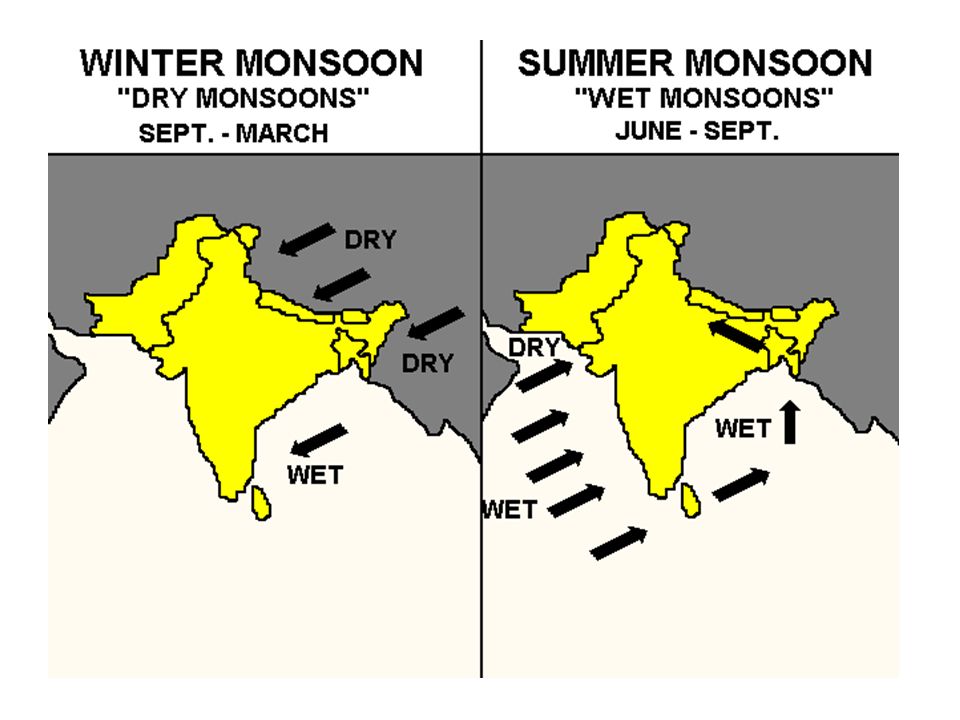
B. Climates of South Asia
Altitude and distance from the Indian Ocean affect climates in South Asia. Monsoons are important - carry moisture from SW in summer - blow dry from NE in winter

16
Tropical wet covers parts of India, Bangladesh, and Sri Lanka.
Tropical wet and dry extends over parts of India and northern Sri Lanka. Humid subtropical stretches over northern India. Arid and Semiarid cover much of Pakistan and Afghanistan and parts of India. Highlands lies in a thin ribbon in the north along the Himalayas.

17
C. Ecosystems of South Asia
South Asia’s size and varied elevations and landforms give the region a wide range of ecosystems Tropical grassland stretches over most of India. Tropical rain forest extends over Bangladesh, Sri Lanka, and parts of southern and western India. Temperate grassland lies in most of Afghanistan and parts of Pakistan. Desert scrub covers parts of Pakistan and India. Vegetation varies with altitude in the Himalayas. Poaching & loss of habitat are serious threats to many animals

19
II. History and Culture

20
A. Historical Overview of South Asia
BC : Indus Valley Civilization Flourished One of the world’s oldest civilizations The people of the Indus Valley civilization carved words and pictures on soapstone seals. The seals are now in the National Museum of India in New Delhi.

21
Religions and Ancient Empires
a BC + - Aryans from C. Asia settle in N. India - use Sanskrit. Modern Hindi developed from Sanskrit - Hinduism was the 1st religion to emerge in S. Asia. pantheon (all the gods) Social Class System: Caste
 Social Class System: Caste.")
22
Pariahs [Harijan] Untouchables
Varna (Social Hierarchy) Brahmins Kshatriyas Vaishyas Shudras Pariahs [Harijan] Untouchables
![Pariahs [Harijan] Untouchables](http://slideplayer.com/slide/6552863/23/images/22/Pariahs+%5BHarijan%5D+%EF%83%A0+Untouchables.jpg "Varna (Social Hierarchy) Brahmins. Kshatriyas. Vaishyas. Shudras. Pariahs [Harijan] Untouchables.")
23
b. 500 BC: Buddhism, derived from
b. 500 BC: Buddhism, derived from Hinduism, is founded in India (Siddhartha Gautama). c. Invaders from Central Asia & Afghanistan founded and conquered empires here. Map showing Mahāyāna Buddhism in Asia today
. c. Invaders from Central Asia & Afghanistan founded and conquered empires here. Map showing Mahāyāna Buddhism in Asia today.")
24
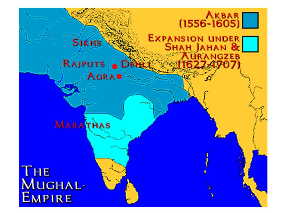
Muslim Dominance a. 700s AD: Arab conquerors brought Islam to the area now known as Pakistan b. By 1206 AD: Muslim invaders established sultanate in Delhi (India) c. The Mughal Empire controlled most of S. Asia by the 1600s - The Mughals were Muslim, but they allowed the majority Hindu population into their power structure
 c. The Mughal Empire controlled most of S. Asia by the 1600s. - The Mughals were Muslim, but they. allowed the majority Hindu population. into their power structure.")
26
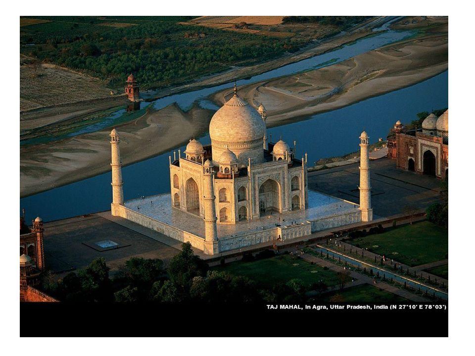
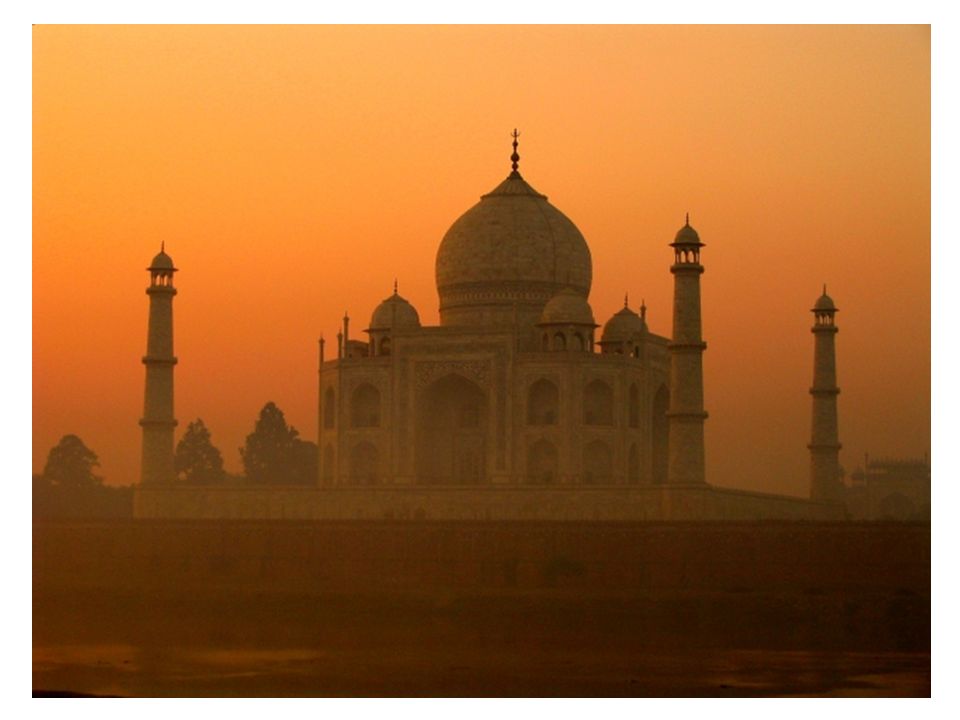
The Taj Mahal built by the Mughal emperor Shah Jahān (reigned 1628–58) to immortalize his wife Mumtaz who died in childbirth (14th child!) in 1631 considered the finest example of Mughal architecture. In 1983, the Taj Mahal became a UNESCO World Heritage Site

29
British Imperialism a AD: English East India Company (a company, not a gov’t!!) set up trading posts along coast of India - It had a fleet of 130 twelve hundred ton ships - commanded an army of 200,000 troops that came to dominate the Indian subcontinent. - funded governments, toppled princes - generated spectacular amounts of money from trading textiles and spices. - The East India Company, founded in 1600, lasted for 258 years before the British state gained full control of its activities. b. built colonial empire across S. Asia – only Afghanistan remained independent

30
c. British in India Despotic and corrupt Mogul Empire in India ignores British gains British soon control India Export cotton from India to Britain Machine cotton spinning in Britain starts industrial revolution India’s successful textile industry destroyed – see next slide

31
British Imperialism

32
d. Benefits of British Colonization
Infrastructure! Brits constructed RRs, telegraphs, dams, bridges, ports, and irrigation canals Sanitation and health improved Schools improved (infrastructure) English language, system of law, gov’t
 English language, system of law, gov’t.")
33
e. Problems w/ Colonization
British had all the power - best positions in gov’t & military Cash crops led to a dependency on the British Famines in the late 1800’s

34
Resistance and Independence
Resistance to British Rule 1885: Indian National Congress formed to protest British rule 1906: Muslim League formed to represent Muslim minority Mohandas Gandhi Beginning in 1920s, used nonviolent civil disobedience to protest British rule. Boycotts and peaceful demonstrations were especially effective Independence in 1947 India divided due to tensions btwn Hindus & Muslims. India had majority Hindu population; West & East Pakistan had majority Muslim population East Pakistan gains independence from West Pakistan and becomes Bangladesh in 1972. Most S. Asian countries were non-aligned during Cold War India is currently the world’s largest democracy

35
Before/After British Rule

36
III. The Region Today

37
India’s Economy 1. Agriculture – the basis of India’s economy
a. 25% of GDP b. Farms = 50% land area c. Labor force by occupation 60% ag 12% industry 28% services c . Major crops: rice, wheat, tea, sugar cane, sorghum

38
d. ½ of all farms are small (less than 2
d. ½ of all farms are small (less than 2.5 acres) - land divided up among sons so, become smaller and less profitable e. Much ag depends on summer monsoons - increased gov’t efforts to develop new ag techniques
 - land divided up among sons so, become smaller and less profitable e. Much ag depends on summer monsoons - increased gov’t efforts to develop new ag techniques")
39
2. The Green Revolution (1967-1978)
a. 3 main goals 1) cultivated land 2) harvest 2 crops/yr 3) yield w/ better seeds b. Food production thanks to irrigation projects c. Negatives? - irrigation projects/dams displace people & disrupt environment - more use of pesticides/fertilizers - not affordable for all - not possible in water-starved areas
 cultivated land. 2) harvest 2 crops/yr. 3) yield w/ better seeds. b. Food production thanks to irrigation projects. c. Negatives - irrigation projects/dams displace people & disrupt environment. - more use of pesticides/fertilizers. - not affordable for all. - not possible in water-starved areas.")
41
3. Industry a. India’s industrial production = top 10, but
GDP per capita is very low. b. Cottage industries thrive in India - especially important for women c. Major exports - textiles, jute, some steel d. Industrial challenges - need increased power supply - need to expand infrastructure to attract foreign investment

42
e. Importance of high-tech industry - ex
e. Importance of high-tech industry - ex. Bangalore - leads to a growing middle class

44
B. Cities & Villages 1. Urbanization a. 29% Urban (CIA Factfile)
b. Cities growing 2X faster than small towns c. Largest cities - Mumbai (Bombay) - Kolkata (Calcutta)
 - Kolkata (Calcutta)")
45
Bombay Slums 2. City Life a. Crowded, noisy, smog, traffic etc.
b. Variety of jobs: factories, offices c. More opportunities for women d. Class divisions - rich biz people/landowners - growing middle class - most in poverty Bombay Slums

46
e. India’s major cities 1) Mumbai (Bombay) (18 m +)
- home to Bollywood 2) Kolkata (Calcutta) (12 m +) - busy seaport - City of Joy 3) Delhi (New & Old) - New = National capital 4) Chennai (Madras) - SE Coast 5) Varanasi - on the Ganges - holy city for Hindus Varanasi
 Kolkata (Calcutta) (12 m +) - busy seaport. - City of Joy. 3) Delhi (New & Old) - New = National capital. 4) Chennai (Madras) - SE Coast. 5) Varanasi. - on the Ganges. - holy city for Hindus. Varanasi.")
47
3. Village Life a. Traditional - limited infrastructure
- poor sanitation - lack drinking water - poor health care - illiteracy b. Large families - for farms - Hindus & Muslims value lrg families - try to have at least 2 boys as girls become property of husband’s family at marriage

48
The Bindi The bindi or tikka on the forehead used to signify a married woman, but today it is a beauty mark worn by married and unmarried alike. It can be of any color, size, shape and there can be more than one. Philosophically, it represents the third eye of Shiva, the portal of intuition leading directly to the brain. Indian society long ago recognized that women usually have the edge when it comes in to intuition and they wear it routinely while men usually only wear it to the temple. The red in the hair however, means the woman is married.

49
C. Challenges Intro a. South Asia is one of the most densely populated areas on earth b. India has a population growth rate of %, which will lead to the doubling of the nation’s population in 36 years. c. Current population of India: 1,166,079,217 (July est.) - the gov’t attempts to address the overpopulation issue with various programs - unsuccessful
 - the gov’t attempts to address the overpopulation issue with various programs - unsuccessful.")
50
2. Population & Poverty a. See population statistics
- Population growth b/c of improved health care and sanitation b. Large population overwhelms transp. & communications network c. Lack of education opportunities

52
2. Environmental Concerns
a. Water pollution (70% surface water) - lack biz regulations - inadequate sewer system b. Environmental damage - deforestation (1/2 cut down since ) - overgrazing - soil erosion c. Endangered species - gov’t does support conservation efforts Endangered species in India
 - lack biz regulations. - inadequate sewer system. b. Environmental damage. - deforestation (1/2 cut down since 1948) - overgrazing. - soil erosion. c. Endangered species. - gov’t does support conservation efforts. Endangered species in India.")
53
Conservation Efforts

54
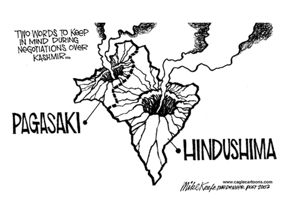
3. Political Issues a. Kashmir Kashmir conflict Pakistan India

55
Where is Kashmir? Himalayan region in Northern India bordering Pakistan to the west & China to the east Indian Kashmir is the only majority Muslim state in majority Hindu India

56
What’s the problem with Kashmir?
Pakistan and India both claim sovereignty over Kashmir Pakistan & India have gone to war 2X over it since 1947 Considered by many to be the most dangerous place in the world The rivalry for it could lead to the world’s 1st nuclear war

57
Background info Kashmir Conflict
Kashmir was one of many 'princely states' during the British rule of India. Independence from British 1947. After independence the region was partitioned – Muslims states joined Pakistan while Hindu states joined India Kashmir – unique Muslim state ruled by a Hindu maharaja India before partition after

58
Maharajah tried to keep Kashmir independent – plan failed.
Kashmir was ceded to India in 1947, but Pakistani soldiers invaded. Each control a portion of Kashmir – even China controls an area which was seized in 1962 Pakistan and India both claim sovereignty over Kashmir Some Kashmiri separatists are seeking an independent state

59
Economic importance of Kashmir
Indus River – flows through Kashmir Tributaries originate in this territory Indus is a crucial source of drinking water for Pakistan - Pakistan unwilling to let India control it Kashmir is a strategic prize that neither country will give up Kashmir = tourist $$ too

60
Nuclear Nightmare 1998 India and Pakistan tested nuclear weapons
World is horrified – especially China Possibility of nuclear war has made the dispute dangerous Millions of dollars have been spent on troops, arms, and nuclear programs

62
Tourism in Kashmir

63
Dal Lake in Srinigar – Kashmir state of India

65
Herdsmen gather in a village of wooden huts inhabited only during the summer while their herds of goats graze the mountain slopes. Because they are semi-nomadic people, a lightweight flute is just the perfect sized musical instrument. This mill house is powered by a small but rapid stream. Local farmers bring their grain to be milled and enjoy music while they wait.

66
Floating Garden Dal Lake, Kashmir Man-made floating gardens in Kashmir are more than 500 years old. The majority of the people living on these gardens are Shia Muslims. They are experts in preparing paper mache and wood carved articles. In recent years floating gardens have virtually choked the lake. The material used for laying floating gardens are the rootstocks of emergent water plants common in shallow parts of the lake. The roots are detached from the mud, allowed to come to water surface and covered with layers of sediment and decaying plants before vegetable cultivation is started. Because of natural buoyancy in roots it is east to form a mat like structure, which is the starting base of a floating garden/island

67
A grocer sits in his tiny storefront puffing on a water pipe, and holds in his right hand a basket of glowing coals to keep warm. He is smoking "hukkah" and has nicotine powder or other plant leaves in it.

68
Accomodations in Kashmir
Houseboats

69
The people of Kashmir

70
b. Hindu/Muslim Tensions - Historic Scenerio: Muslims=landless; Hindus = landowners : Independence from Brits, but must decide on one form of gov’t - to ease tensions, Brits decide to partition (Hindu India & Muslim Pakistan) - 12 million people moved (1 million dead) – one of history’s GREAT MIGRATIONS - Three wars since violence continues today A group migrates to its new homeland after the partition of India in 1947

71
Partition of India Partition of India in the areas in red show the regions of conflict at the time of partition

72
11/26/2008 Mumbai News Footage

73
c. Sikhs - demand more political power in Punjab - some extremists call for complete independence (would be named Khalistan meaning “land of the pure”) - terrorism/violence
 - terrorism/violence .")
74
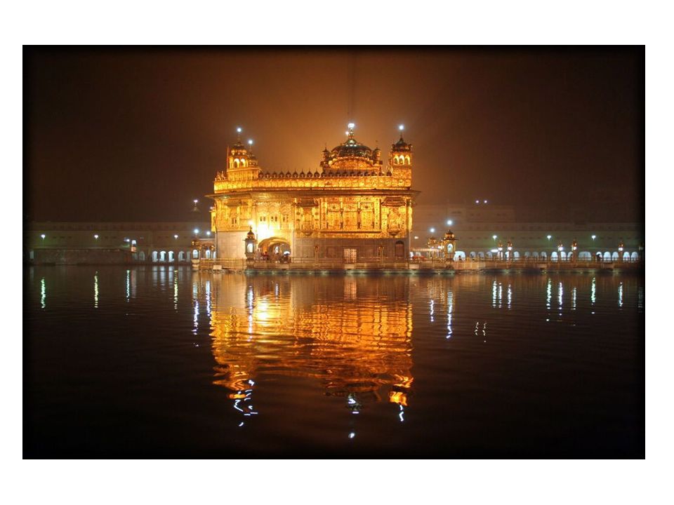
Golden Temple Amritsar
The Golden Temple, or Harimandir Sahib, is the holiest temple of the Sikh religion. Built under the guidance of Guru Arjun Dev, the foundation was laid down on January 1589 by Mian Mir, a muslim saint and the temple was completed in This historical and beautiful temple with gold exterior is a must see for any visitor to Amritsar. Approached through the old city (walled city), and only a ten-minute drive from Ranjit's Svaasá, we highly recommend the night visit to experience the 'Night Palki' ceremony.
, and only a ten-minute drive from Ranjit s Svaasá, we highly recommend the night visit to experience the Night Palki ceremony.")
76
Chapter 26 The Indian Perimeter

77
I. Pakistan Flag Description: green with a vertical white band (symbolizing the role of religious minorities) on the hoist side; a large white crescent and star are centered in the green field; the crescent, star, and color green are traditional symbols of Islam
 on the hoist side; a large white crescent and star are centered in the green field; the crescent, star, and color green are traditional symbols of Islam.")
78
A. Pakistan’s Population Data Statistics
Population: 176,242,949 (July 2009 est.) Literacy Rate: total population: 50% male: 63% female: 36% (2005 est.) IMR: 65/1000 Life Expectancy: 64 years Growth Rate: 1.9% (2009 est.) GDP/capita: $2,600 (2008 est.) Official Language : Urdu (many other languages spoken, however) Lingua Franca: English Government: federal republic
 Literacy Rate: total population: 50% male: 63% female: 36% (2005 est.) IMR: 65/1000. Life Expectancy: 64 years. Growth Rate: 1.9% (2009 est.) GDP/capita: $2,600 (2008 est.) Official Language : Urdu (many other languages spoken, however) Lingua Franca: English. Government: federal republic.")
79
Physical Geography 1. 3 Regions a. NW: dominated by Hindu Kush range - Several passes make transp possible - Khyber Pass most famous (links Pakistan & Afghan.)
")
80
b. West Pak: Baluchistan Plateau - Thar desert to east c
b. West Pak: Baluchistan Plateau - Thar desert to east c. Indus Valley - large fertile plain - sediment deposited by river - productive thanks to irrigation - site of 1 of earliest civilizations

81
2. Climate a. Mostly arid b. Mts block cold air from C
2. Climate a. Mostly arid b. Mts block cold air from C. Asia from reaching subcontinent – so temps except at high elev. Are warm-hot Climate Graph for Karachi, Pak.

82
1. most live in rural villages (only 36% urban)
Culture 1. most live in rural villages (only 36% urban) 2. Major cities = Islamabad(capital); Lahore, Karachi 3. Language: Urdu(official); Punjabi, English(lingua franca) 4. Religion: 97% Muslim How is Urdu different from Hindi? Urdu written in Persian Script and is read from L to R
 2. Major cities = Islamabad(capital); Lahore, Karachi. 3. Language: Urdu(official); Punjabi, English(lingua franca) 4. Religion: 97% Muslim. How is Urdu different from Hindi Urdu written in Persian Script and is read from L to R.")
83
97% of Pakistanis are Muslim

84
5. Traditional a. Women have few freedoms & economic opportunity (36% literacy vs 63% for men) b. Many women avoid contact w/ men outside home & veil in presence of strangers c. BUT… Pakistan has had a woman Prime Minister (we haven’t) Benazir Bhutto assassinated 12/27/2007

85
- rely on Indus R. for irrigation & hydroelectricity (Tarbela Dam)
6. Challenges a. Water! (or lack of it) - rely on Indus R. for irrigation & hydroelectricity (Tarbela Dam) b. Population growth (1.9% - yikes!) - low standard of living - strains gov’t ability to provide basic services c. Relationship w/ India (Kashmir Issue) d. Role of Islam – fundamentalism on the rise - increased discrimination of non- Muslims
 - rely on Indus R. for irrigation & hydroelectricity (Tarbela Dam) b. Population growth (1.9% - yikes!) - low standard of living. - strains gov’t ability to provide basic services. c. Relationship w/ India (Kashmir Issue) d. Role of Islam – fundamentalism on the rise. - increased discrimination of non- Muslims.")
86
Tarbela Dam World’s Largest Embankment Dam (made of soil & rock)
")
87
e. Political Instability - Since gaining independence in 1947, Pakistan has veered back and forth between democratically- elected and authoritarian military leaders - lack of control over Federally Administered Tribal Areas (FATA) - controlled by tribal elders - unstable relationship with neighboring India and Bangladesh
 - controlled by tribal elders - unstable relationship with neighboring India and Bangladesh .")
88
FATA

89
II. Bangladesh Flag Description: green field with a large red disk shifted slightly to the hoist side of center; the red disk represents the rising sun and the sacrifice to achieve independence; the green field symbolizes the lush vegetation of Bangladesh

90
A. Pakistan’s Population Data Statistics
Population: 156,050,883 (July 2009 est.) Literacy Rate: total population: 43% male: 54% female: 32% (2003est.) IMR: 59/1000 Life Expectancy: 60 years Growth Rate: 1.3% (2009 est.) GDP/capita: $1,500 (2008 est.) Official Language : Bengali Lingua Franca: English Government: Parliamentary Democracy
 Literacy Rate: total population: 43% male: 54% female: 32% (2003est.) IMR: 59/1000. Life Expectancy: 60 years. Growth Rate: 1.3% (2009 est.) GDP/capita: $1,500 (2008 est.) Official Language : Bengali. Lingua Franca: English. Government: Parliamentary Democracy.")
91
Physical Geography 1. located within the delta of the Ganges and Brahmaputra Rivers - World’s largest delta 2. Most of its elevation is near sea level. Thus about 1/3 of this extremely poor country floods annually during the monsoon rainy season and during typhoons

92
Ganges Delta

93
3. Climate a. Mostly Tropical Wet - heavy rain during summer monsoons - flooding common b. Mts block cold air from C. Asia from reaching subcontinent – so temps except at high elev. are warm-hot

95
Agricultural (monsoons)
Population growth b/c of improved health care and sanitation Landlocked: Afghanistan, Nepal, Bhutan Poorest: Bangladesh, Pakistan

96
Hinduism Reincarnation Karma Dharma Soul is born again
Positive or negative force can control person’s actions Dharma Must do one’s duty

97
Afghanistan Dry, with continental extremes
Mujahadeen: “holy warrior: rebel Muslim groups against communist government in the 1980s. Khyber Pass:

98
Bangladesh Tropical, with very heavy rainfall
Delta-flooding, cyclone-driven tidal waves Jute, used to make rope and sack-cloth

99
Bhutan Monarchy Very wet, temperatures relative to altitude
“Land of Dragons” Most people live in the foothills and river valleys

100
India Tropical with cool, hot, and wet seasons
World’s largest democracy Caste System Untouchables: Dalit (15%) Reincarnation Sacred cows Northern and Southern (different cultures)
 Reincarnation. Sacred cows. Northern and Southern (different cultures)")
101
Alluvial plain- just south of the Himalayas in the north
Sacred Ganges Taj Majal- Islamic tomb for Indian prince’s favorite wife Mohandas Gandhi (American civil rights) Kashmir
 Kashmir.")
102
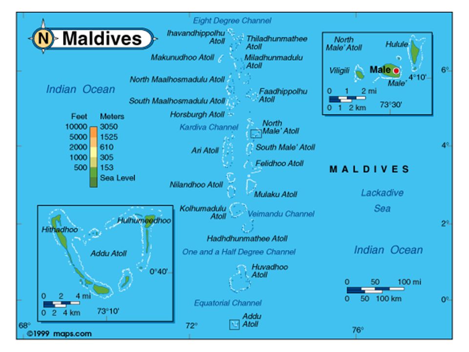
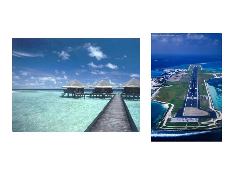
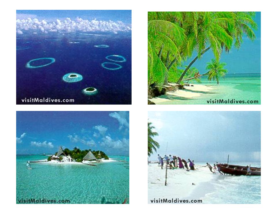
The Maldives 2,000 coral atolls 200 islands 330,000 people
Fish, coconuts, tourism

108
Nepal Alpine to tropical 90%- Himalayas Buddha (560 BC)
Sherpas- mountain guides Gurkhas- Nepal soldiers able to resist British control

109
Kathmandu Mt. Everest (8,850 meters; 29,035 feet) Sherpa
 Sherpa")
110
Mt. Everest – from Space

111
Attack Monkeys of Nepal

112
Pakistan Very dry and continental Indus river Cotton Benazir Bhutto

113
Indus River Hindu Kush Mts

114
Sri Lanka Ceylon Tamil (Hindu)- independent northern state
Most people wet and hilly southwest region Tea and graphite

115
The Countries of South Asia
Chapter 29 The Countries of South Asia

116
I. Road to Independence Summary British Imperialism
Textile “outsourcing” Rise of Indian Nationalism, individual rights, self-government

117
B. Gandhi English education in law Mahatma “the Great Soul”
Nonviolent resistance Boycotted British cloth Spiritual leader

118
Caste System Brahmins Kshatriyas Vaisyas Sudras Harijan Brahmins

119
Pariahs [Harijan] Untouchables
Varna (Social Hierarchy) Brahmins Kshatriyas Vaishyas Shudras Pariahs [Harijan] Untouchables
![Pariahs [Harijan] Untouchables](http://slideplayer.com/slide/6552863/23/images/119/Pariahs+%5BHarijan%5D+%EF%83%A0+Untouchables.jpg "Varna (Social Hierarchy) Brahmins. Kshatriyas. Vaishyas. Shudras. Pariahs [Harijan] Untouchables.")
120
Split from Pakistan West Pakistan & East Pakistan
Different Language/Ethnicity West Pak = economic & political pwr * factories, national $ spent, government East- agricultural, taxes (India) 1970 tidal wave/cyclone
 1970 tidal wave/cyclone.")
121
Other Countries of South Asia

122
B. Afghanistan Flag Description: three equal vertical bands of black (hoist), red, and green, with a gold emblem centered on the red band; the emblem features a temple-like structure encircled by a wreath on the left and right and by a bold Islamic inscription above
, red, and green, with a gold emblem centered on the red band; the emblem features a temple-like structure encircled by a wreath on the left and right and by a bold Islamic inscription above.")
123
Afghanistan’s Pop. Data Statistics
Population: 33,609,937 (July 2009 est.) Literacy Rate: total population: 28% male: 43% female: 13% (2000 est.) IMR: 152/1000 Life Expectancy: 45 years Growth Rate: 2.6% (2007 est.) GDP/capita: $800 (2008 est.) Religion: 99% Muslim Government: Islamic republic Official Language : Dari; Pashtu
 Literacy Rate: total population: 28% male: 43% female: 13% (2000 est.) IMR: 152/1000. Life Expectancy: 45 years. Growth Rate: 2.6% (2007 est.) GDP/capita: $800 (2008 est.) Religion: 99% Muslim. Government: Islamic republic. Official Language : Dari; Pashtu.")
Similar presentations


 ~1500BC -Alexander Great ~326BC -Mongols/Ghenghis.>")

>")


