Download presentation
Presentation is loading. Please wait.

1
DCDB Workshop ACT Rene de Kiefte & Ron Jarman Surveying & Spatial Data

2
Outline Unique features of ACT system Critical elements of DCDB Database process DA / EDP approval Data format & database updates Issues Challenges

3
Unique features of ACT system Small jurisdiction Relatively young Land tenure - Leasehold Planned City Self Government (1989) Surveyor-General’s office
 Surveyor-General’s office")
4
Critical Elements Single source of data Completeness, currency, accuracy Lifecycle stage of parcels Mathematical model Surveyors peg dcdb ACTMAPi is effectively ‘live’

5
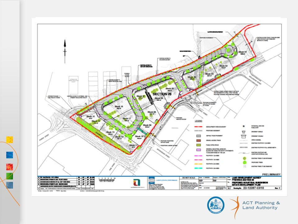
Database Process Intergraph Geomedia with Oracle DB Planning approval by ACTPLA – advantage of being in-house Estate Development Plan (EDP) Development Application (DA) Data format ACTMAPi
 Development Application (DA) Data format ACTMAPi")
6
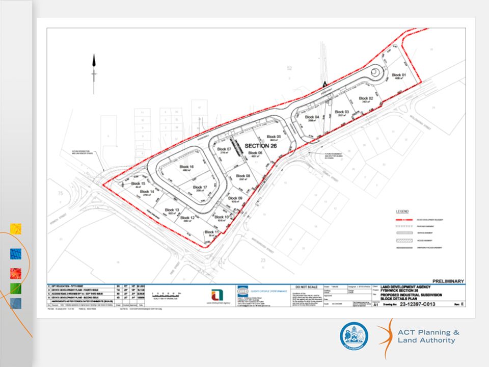
DA/EDP Approval Governments Land release program EDP circulated to agencies and may involve several rounds of comments/corrections Approves section/block and road layout Survey control adequate for development Starts the Nomenclature process -trigger for researching street names

9
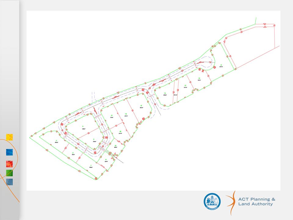
Data Format CAD Drawings (Autocad 2009 dwg or earlier) Stromlo Grid New/changed data needs to be supplied with some existing surrounding data Sections, blocks, road centrelines, kerbs, islands, driveways
 Stromlo Grid New/changed data needs to be supplied with some existing surrounding data Sections, blocks, road centrelines, kerbs, islands, driveways")
10
Data Format (continued) Use the layer naming specified SECTION, SECTION_TXT BLOCK, BLOCK_TXT EASEMENT, EASEMENT_TXT CENTRELINE, KERB_NEW, DRIVEWAY,CARPARK Comp sheets for Green fields Diagram showing new boundaries
 Use the layer naming specified SECTION, SECTION_TXT BLOCK, BLOCK_TXT EASEMENT, EASEMENT_TXT CENTRELINE, KERB_NEW, DRIVEWAY,CARPARK Comp sheets for Green fields Diagram showing new boundaries")
12
Database Updated Sections/Blocks added using survey data – checked against dimensions & area from supplied comp sheet/diagram Road data – Road names are Gazetted, centreline, kerbs, road polygon and name added Addresses added

13
Advantages of the system Data is available to builders, developers, suppliers and the public well in advance of any development Addresses available to Real Estate agents and the public Data for emergency services while construction under way

14
Follow on (once database is updated) Survey plan may be lodged for examination once blocks created in database Road opening/closure gazettal initiated DP registration Approved blocks are changed to Registered, Easements and Footprints are added. Lease registration

15
Issues DCDB - mathematical model draped over geodetic network Not an observational database Level of maturity of cadastre –Graphical cadastre –Upgraded graphical cadastre –Survey accurate cadastre –Reinstated cadastre –Legal cadastre

16
Challenges Resources –Funding & people Customers expectations –Increased technology 3D cadastre –Presentation / visualization ePlan development (we’ll be looking to beg, borrow or steal from the larger jurisdictions –particularly from NSW)
")
17
Questions?

18
More Information ACTPLA Website has links to ACTMAPi and Digital Data standards http://www.actmapi.act.gov.au/ http://www.actpla.act.gov.au/__data/as sets/pdf_file/0003/6384/Digital_Data_S tandards.pdfhttp://www.actpla.act.gov.au/__data/as sets/pdf_file/0003/6384/Digital_Data_S tandards.pdf

Similar presentations


 (paper.>")


 OTB, Delft University.>")


