Download presentation
Presentation is loading. Please wait.

1
Physical Science Research: Geomorphological impact and fluvial system response to the Cumbria floods November 2009 Jeff Warburton, Danny Donoghue (Durham University) Andy Large, Andy Russell (Newcastle University) Stuart Dunning (Northumbria University) Structure: Background Current Research Upland impacts Lowland impacts Mapping Change Challenges
 Andy Large, Andy Russell (Newcastle University) Stuart Dunning (Northumbria University) Structure: Background Current Research Upland impacts Lowland impacts Mapping Change Challenges")
2
Background: Recent upland flood events Shetland, Scotland September 2003 North York Moors, England June 2005 Northern England January 2005 Northern England October 2008

3
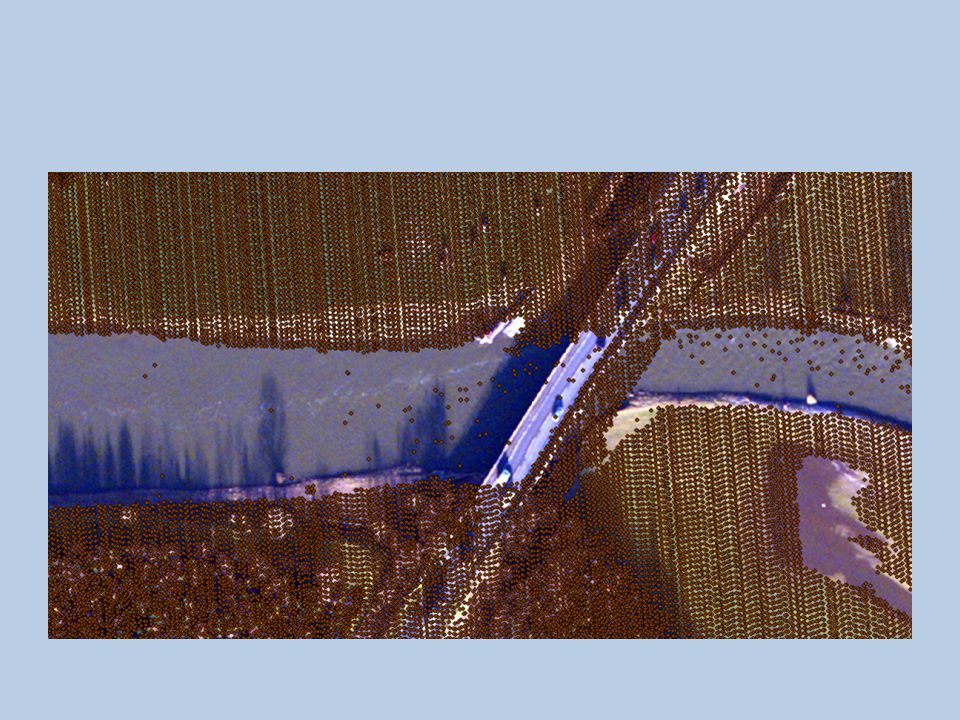
Valley erosion and deposits Flood extent image, 23 June 2005 Rollei ARSF NERC digital camera

4
From: Watkins and Whyte (2008) – ‘updated’ Cumbria floods – ‘flood rich’ periods
 – ‘updated’ Cumbria floods – ‘flood rich’ periods")
5
Ouse Bridge - Largest flood on ‘record’

6
Dissection & Gullying Mass Movements & debris flows Sheet & Wash Erosion Suspended Load Wind Erosion Slope Deposits Stream Course & Bank Erosion Pipe erosion Scar & Peat Margin Erosion Bedload Channel Sediments Lakes & Reservoirs HILLSLOPE CHANNEL Streambank Solute & Flotation Load storage process Background – contemporary sediment budgets UPLANDUPLAND LOWLANDLOWLAND

7
Objectives: 1.Structured field inventory of the geomorphic impact on the River Derwent river corridor 2.Provide a rapid geomorphic assessment of the role of scour and sedimentation in the river 3.Identify areas of risk for remobilisation of flood-deposited sediments; delivery of hillslope sediments and hotspots of erosion 4.Compare post-flood field-derived data with pre-existing surveys to quantify/ areas of greatest geomorphic change 5.Work with stakeholders in designating catchment zones that are ‘at risk’ from erosion and sedimentation Aim: to examine flood impacts the whole river corridor of the river Derwent from the headwaters, through Bassenthwaite Lake to the Lowland agricultural/urban catchment

8
Scale of river and catchment management (Newson, 1992)
")
9
1.Survey headwater impacts - Coledale, Newlands and Borrowdale areas 2.Bassenthwaite Lake - collect a series of short cores and grab samples from the Lake and compared with a survey undertaken in 2008. 3.Lowland channel change in the floodplain downstream of Bassenthwaite Lake - focussing on ‘typical’ reaches e.g. Isel and Camerton. 4.Support field survey with low-level high- resolution aerial surveys carried out using a UAV (Unmanned Aerial Vehicle) - provide rapid repeat, high resolution aerial imagery and Digital Elevation models of key sites (cf. larger scale ARSF and EA remote sensing data). Plan of Research:
 - provide rapid repeat, high resolution aerial imagery and Digital Elevation models of key sites (cf. larger scale ARSF and EA remote sensing data). Plan of Research:.")
10
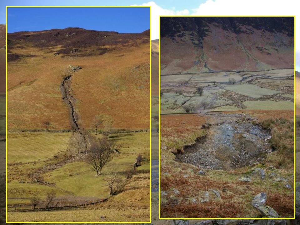
Upland Impacts Seathwaite, Borrowdale 2009

11
Coledale, 2009

12
Goldscope Valley, Northern Lake District 2009

14
Mapping elements Source area 1 Runout Source area 2 Runout Debris fan

15
Map and sediment budget Landslide erosion 518 m 3 Deposition 400 m 3 Sediment loss 118 m 3

16
Completed inventory of erosion / deposition Coledale flood 2008 Shallow landslide Landslide deposition Surface wash Sediment deposition Stream erosion Stream deposition Dam pond deposition Debris flow Slope undercutting Fan deposition Torrent erosion

17
Channel erosion Debris flows Landslides Slope undercutting Footpath wash Delivery to main fluvial system Channel deposition Debris flow fans Landslide deposits Slope wash deposit Summary sediment budget (Coledale, 2008) Values in t 817 183 195 102 7 189 933 92 97 7 14 %
 Values in t %")
18
Bassenthwaite Lake Coring and Sampling

19
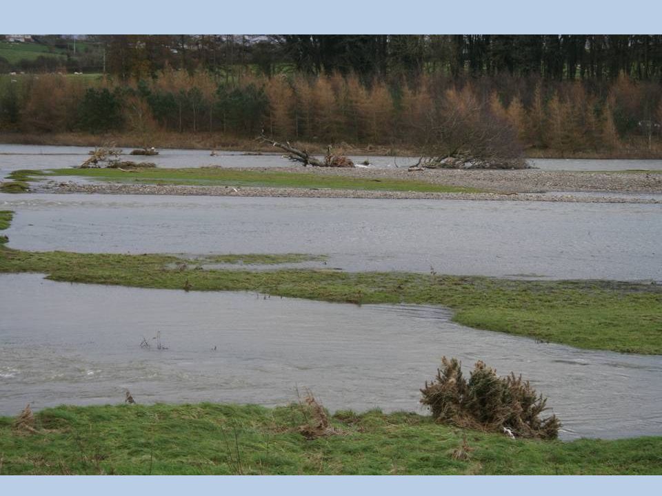
Ouse Bridge & Herdwick Croft Lowland Impacts

20
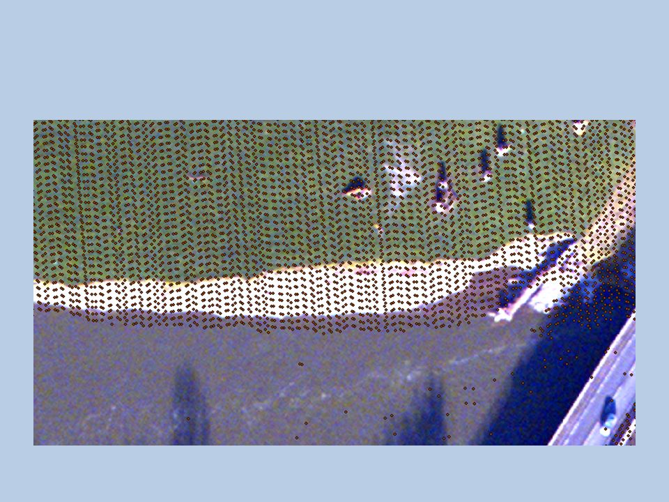
Ouse Bridge Gauging Station

21
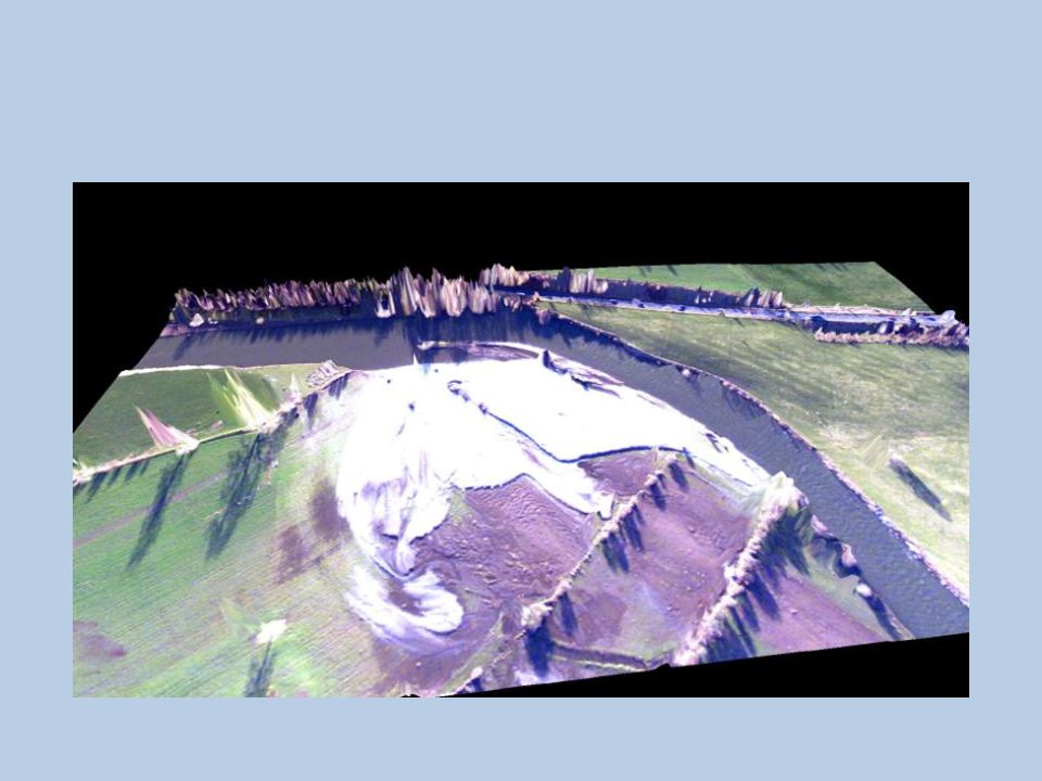
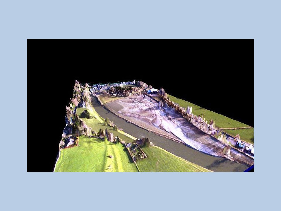
Ouse Bridge

22
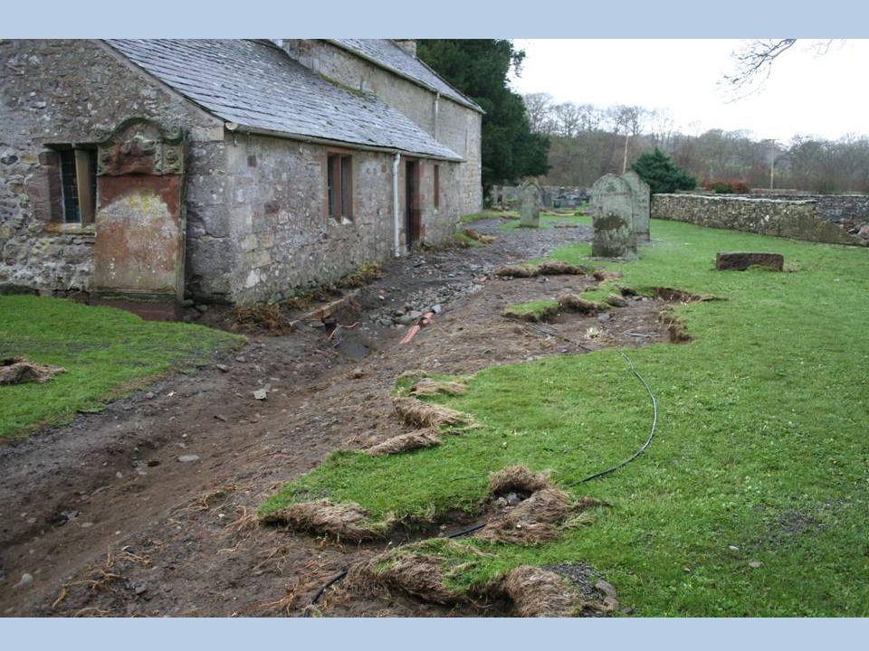
Isel Church

24
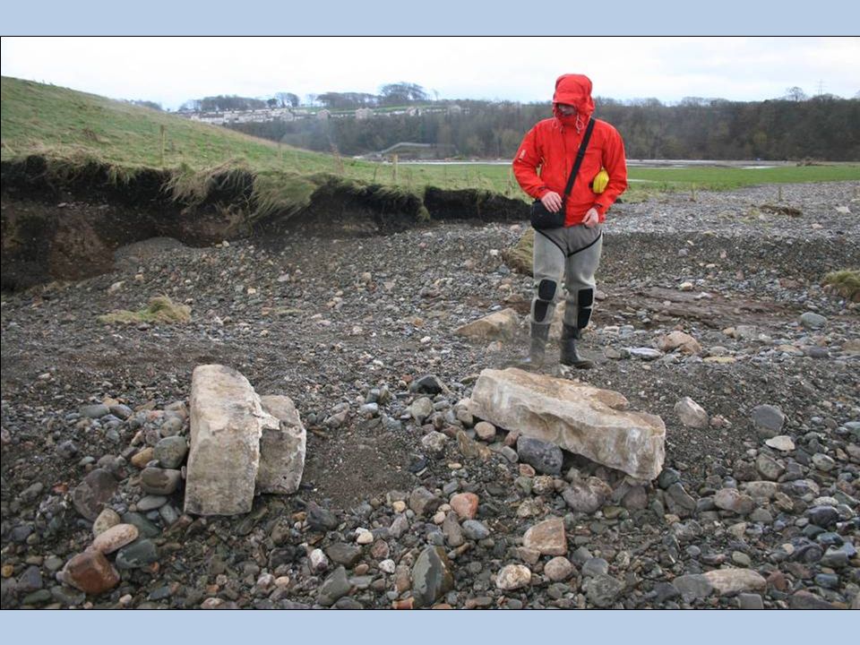
Sediment supply: landslides

25
Sediment supply: erosion of coarse gravel sediment

26
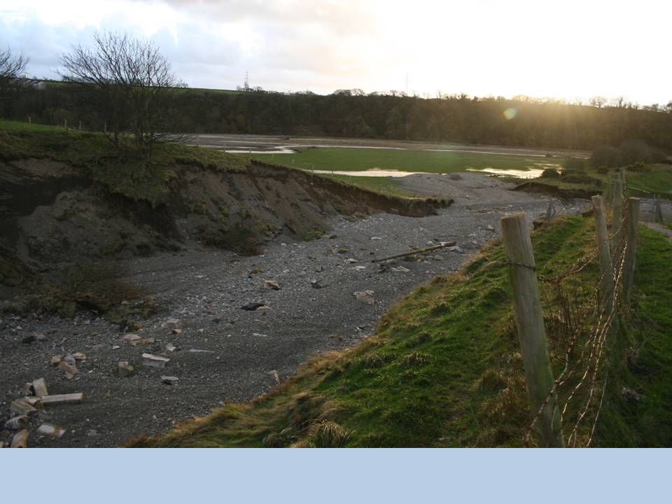
‘Hidden’ scour of river bed

27
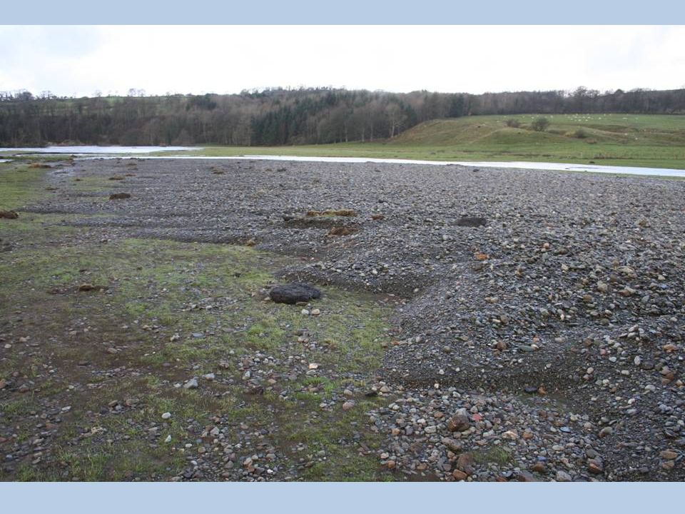
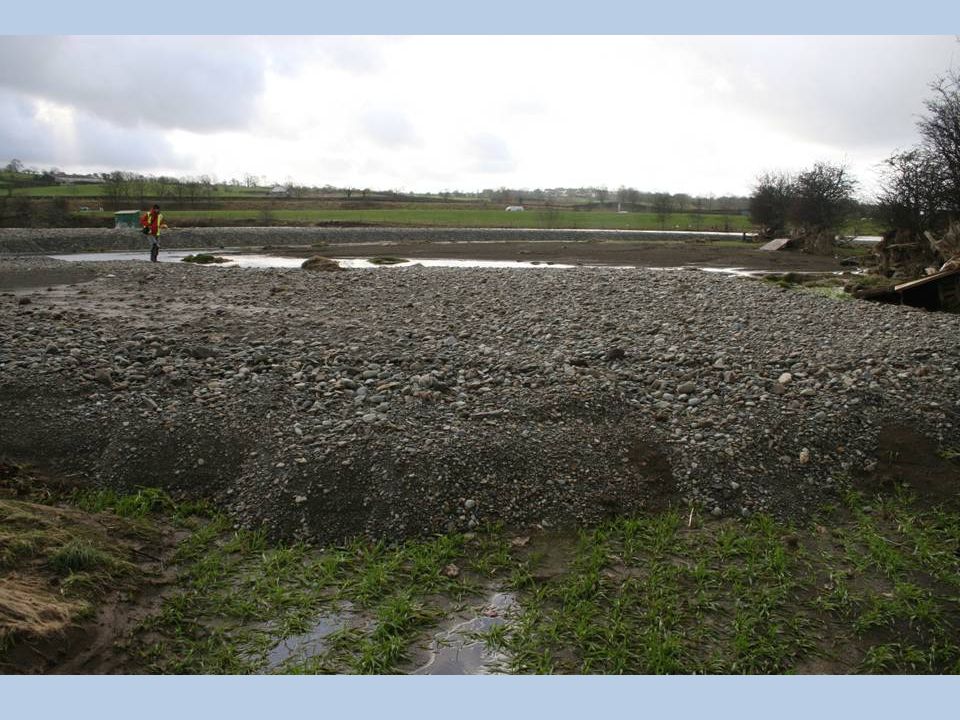
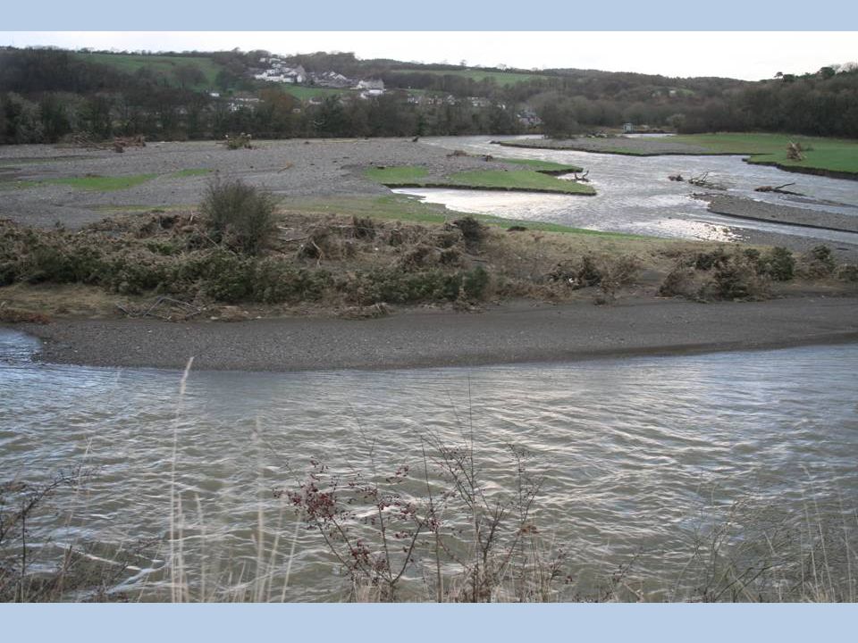
New gravel bar: Downstream of Isel Hall

29
Downstream of A595 Bridge below Cockermouth

32
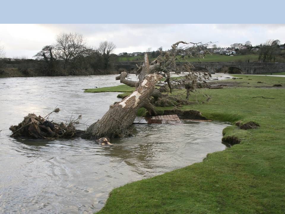
Flood debris

33
Sediment supply: localised scour around trees

36
Camerton

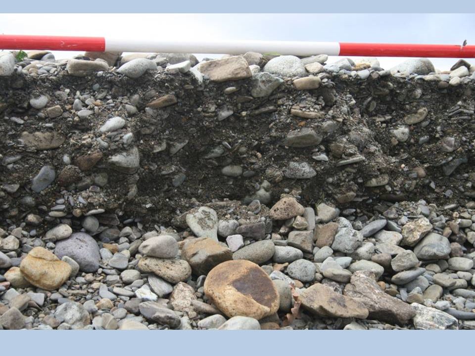
40
Sediment supply: erosion of river deposits

41
Sediment supply: localised bridge pier scour

42
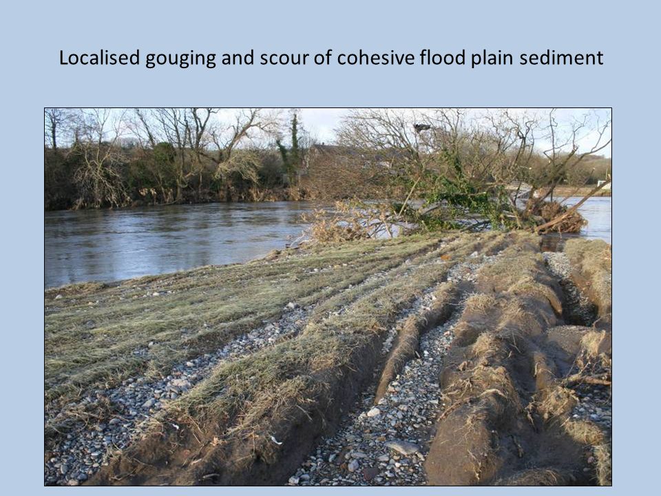
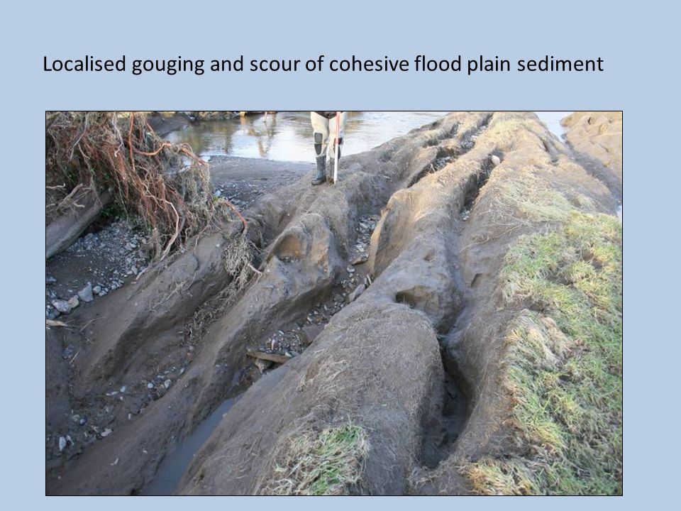
Localised gouging and scour of cohesive flood plain sediment

45
Ground survey: ‘Reach-based’ assessments

46
Mapping flood limits

47
Mapping change – Airborne Remote Sensing

48
Downstream impacts - Workington

49
Papcastle

57
Future challenges / research problems? 1.Assembling an evidence base a)Determining the sources of catchment sediment and linkages b)Assessing the role of lakes in flood routing and timing c)Investigate the impact of gravel management on flood impact 2.Determining whether current problems are ‘natural’ or human-driven 3.Recognising flood impacts are space and time specific 4.Establishing the ‘whole catchment’ context 5.Turning case studies into policy - impact
Determining the sources of catchment sediment and linkages b)Assessing the role of lakes in flood routing and timing c)Investigate the impact of gravel management on flood impact 2.Determining whether current problems are ‘natural’ or human-driven 3.Recognising flood impacts are space and time specific 4.Establishing the ‘whole catchment’ context 5.Turning case studies into policy - impact.")
Similar presentations


 Flow to and/or gather in basin Evapotranspiration into air Condensation.>")


