Download presentation
Presentation is loading. Please wait.

1
Esri International User Conference | San Diego, CA Technical Workshops | ArcGIS Server for the Java Developer Dan O’Neill @jdoneill Ajit Dharmik Eric Bader @ECBader July 12, 2011

2
Agenda Quick Introductions A Java Developer’s Overview Extending ArcGIS Server Extending the existing Java EE infrastructure Building client applications Summary Q & A

3
Overview Eric Bader

4
ArcGIS 10 — A Complete System Cloud Enterprise Local DiscoverDiscover CreateCreate ManageManage VisualizeVisualize AnalyzeAnalyze CollaborateCollaborate Mobile Desktop Web Many opportunities for Java developers… The System is Extensible and Integratable

5
DiscoverCreateManageVisualizeAnalyzeCollaborate Cloud Enterprise Local Mobile Desktop Web ArcGIS 10 — A Complete System Many opportunities for Java developers… Web Clients The System is Extensible and Integratable Android Java SDKs Web Services Java SOEs

6
Java and ArcGIS More...

7
Keep in mind Know what it is you are building Know the differences between the Java Esri SDKs

8
Extending ArcGIS Server with Custom Web Services Ajit Dharmik

9
DiscoverCreateManageVisualizeAnalyzeCollaborate Cloud Enterprise Local Mobile Desktop Web Extending ArcGIS Server Web Clients Android Java SDKs Web Services Java SOEs

10
Why extend ArcGIS Server? Server Objects (SOs)- coarse grained objects - Provide access to data and analysis - Map, GP, Image Services are based on SOs - Map service, GP service, Image service SOs have generic capabilities If more capabilities are required, extend SO
- coarse grained objects - Provide access to data and analysis - Map, GP, Image Services are based on SOs - Map service, GP service, Image service SOs have generic capabilities If more capabilities are required, extend SO.")
11
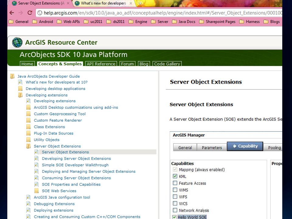
Server Object Extensions ArcObjects based Extend Map Service only Exposed via SOAP and REST Inproc access to map service’s layers Customizable startup and shutdown behavior Access to map service logs

12
Other ways to extend Server Geoprocessing tools SOEsGP Solution only for ServerSolution for all Engine, Desktop, Server No runtime overhead Runtime overhead for GP initialization and input/output data validation Complete control over information exchanged with client (for REST SOEs) Clients must send info to service via gp data types. Software development required Software development required only if custom tools are needed VsVs

13
Demo

15
Working with ArcGIS Server Java Web Services (AgsJWS)
")
16
DiscoverCreateManageVisualizeAnalyzeCollaborate Cloud Enterprise Local Mobile Desktop Web Extending the Java EE Infrastructure… Web Clients Android Java SDKs Java SOEs Web Services

17
WebService Clients and API’s ArcGIS Server API (ArcObjects) ArcGIS Java Web Services API (SOAP) ArcGIS Server REST API
 ArcGIS Java Web Services API (SOAP) ArcGIS Server REST API")
18
SOAP Web Services Easily accessible from Java,.NET, Python, etc. Cross Platform support, Windows/Linux Standard Object Orientated programming Fully integrated into IDE’s

19
AgsJWS Toolkit Independent Web Services toolkit SOAP requests are handled by WS Handler and forwarded to appropriate Server Object AgsJWS implements it’s own custom SOAP stack and framework for XML serialization for ArcObjects through JAX-B. Two functions 1. Serialize and Deserialize between Java and XML (JAXB) 2. Packing as SOAP, transporting SOAP messages and protocol specific information, handling faults and exceptions through SAAJ and JAXWS. ArcGIS Server Server Object ArcObjects XML XML Deserialize Serialize SOAP Request SOAP Response
 2. Packing as SOAP, transporting SOAP messages and protocol specific information, handling faults and exceptions through SAAJ and JAXWS. ArcGIS Server Server Object ArcObjects XML XML Deserialize Serialize SOAP Request SOAP Response.")
20
AgsJWS Toolkit Proxy Objects - Communication with server and endpoints. - Call methods on the proxy to execute server-side logic Value Objects - Native types designed to support input & output from proxy objects.

21
Extending the Java EE Infrastructure The AgsJWS Toolkit - Pure Java Web Services library for ArcGIS SOAP Services - Eclipse plug-in - Generates WSDL and client stubs Useful for: - Bringing GIS into the application server environment - Distributed Java computing environment - Geo Analytics, less visual mapping

22
Demos Online SOAP SDK Download the AgsJWS Set up the development environment Building the LocateMSOE client app Extra demo: Joplin Tornado path analysis Java EE Server ArcGIS SOE client Business object

23
Client Applications and APIs Dan O’Neill

24
DiscoverCreateManageVisualizeAnalyzeCollaborate Cloud Enterprise Local Mobile Desktop Web Building and using Web applications Web Clients Android Java SDKs Web Services Java SOEs

25
Building Web Applications - Migrating Java Web ADF applications from local to remote connections - Existing tools to have a complete wizard driven experience - AgsJWS API is the core API

26
Migrating Web ADF Applications to web services Set up Eclipse Faces Config visual editor - http://blogs.esri.com/Dev/blogs/arcgisjava/archive/2009/ 11/25/Using-Eclipse-Faces-Config-Visual-Editor.aspx Modify your Local Map Resource to be a AgsMapResource - This will modify your connection to ArcGIS Server as web service endpoint URL allowing you to use the AgsJWS API in your Java Web ADF application. - http://blogs.esri.com/Dev/blogs/arcgisjava/archive/2010/07/2 3/Migrating-to-Web-Service-enabled-Java-Web-ADF.aspx

27
Risks Editing Tasks Custom features using ArcObjects in ADF Solution - Server Object Extensions exposed through SOAP - AgsJWS Business component

28
Map Widget for ArcGIS BI + GIS = GBI (Geographic Business Intelligence) GBI is the integrated inclusion of the geographic/spatial perspective with your organization's important business information. You care because nearly every significant aspect of your business has a location

29
Map Widget for ArcGIS – Java Enterprise Mashup Map Widget for ArcGIS - Simple component model for GIS using ArcGIS API for JavaScript and iWidget specification - Can be extended to enhance operability - Coordination - Sharing information with other components in real time - Shared state with other components

30
Map Widget for ArcGIS – MapViewer Features Features - Send/Receive events to other components - Configure basemaps from ArcGIS Online, Bing Maps, & ArcGIS Server - Add operational layers from ArcGIS Online & ArcGIS Server - Rich user interactive operations

31
Map Widget for ArcGIS Map Widget for ArcGIS in Enterprise Mashups - IBM Specfication - Integration with widgets which meet the spec - WebSphere 7 ArcGIS iWidget for Enterprise Portals - Java Portlet Spec 2.0 (JSR 286) compliant - Backwards compatibility for Portlet spec 1.0 (JSR 168) - Support for Portal Server 6.1 Feature Pack 6.1.5 - Increased support in Portal Server 7
 compliant - Backwards compatibility for Portlet spec 1.0 (JSR 168) - Support for Portal Server 6.1 Feature Pack Increased support in Portal Server 7")
32
Demo

33
Extending the widget iWidget Design - Simplicity - Simple to create and add features - Extensibility - Well defined means for iWidget feature support and feature leverage - Independence - The iWidget does not need to know what technology was used to implement - Style - Defines javascript (EcmaScript) interfaces and declarative markup
 interfaces and declarative markup")
34
Extending the widget Open Source - Beyond specification extensibility model - Full source provided - Opportunity to share with ESRI development

35
ArcGIS 10.1 for Java Developers

36
The ArcGIS Runtime Runtime SDK - Toolkit for building focused ArcGIS apps and embedding ArcGIS functionality - Work with both local data and remote REST services - Subset, streamlined functionality - For Lightweight devices: Laptops, tablets - Linux and Windows – 64-bit and 32-bit - Java/WPF/QT flavors of API - Eclipse integration Mobile: Android – part of the Runtime family - SDK for native Android apps - Freely downloadable app

37
Solid Foundation for Developers Moving Forward - Designed for Desktop and Online Development Developers Are Productive on the Desktop and Online MyApp.jar ArcGIS Online ArcGIS Server ArcGIS Runtime API

38
The 10.1 ArcGIS Runtime at the UC… Road Ahead – ArcGIS 10.1 Overview - Tuesday 8:30am - 9:45am room 10 - Wednesday 1:30pm – 2:45pm room 10 - Friday 9:00am – 10:15am room 5a/b Road Ahead – ArcGIS Runtime - Thursday 2:20pm – 2:40pm 24a Demo Theater: Building Java Applications with ArcGIS Runtime - Wednesday 9:00am Exhibit Hall D Desktop Developer Island

39
Summary Custom Web Services – Extending the ArcGIS Server Extending existing Java EE infrastructures with the AgsJWS SOAP Toolkit Building Web Applications Mashup Center and Portal applications ArcGIS Web API based applications Migrating Java Web ADF applications from local to HTTP connections Continuing to build opportunities for Java-GIS developers at 10.1 Lightweight GIS - Runtime SDK - Mobile: Android

40
Thank you! Any Questions?

Similar presentations