Download presentation
Presentation is loading. Please wait.

1
MGIS Candidate: Collin Strine-Zuroski Advisor: Dr. Jay Parrish

2
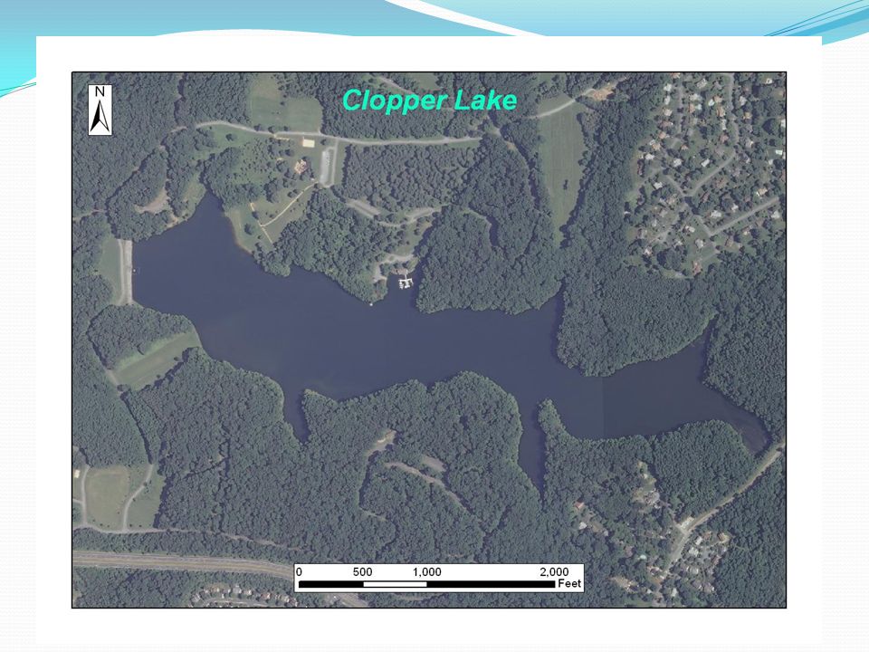
Clopper Lake Located in Seneca Creek State Park in Montgomery County, MD. Dam built in 1975. Lake Created for Recreation and Flood Control. 86.70 Acres.

3
Clopper Lake: Then and Now 19742010 *Photos Courtesy of Gaithersburg, Then and Now: http://www.gaithersburghistory.com. Pictures are reproduced here for educational purposes only.http://www.gaithersburghistory.com

5
Outline: Goals Mapping Sediment Deposits Bathymetric Mapping Sub-Bottom Profiling Data Analysis Sediment Calculations Mapping Subaqueous Soil Landform Identification Boolean Overlay Additional Analysis Timeline

6
Goals: Map the geographic distribution of sediment deposits that have accumulated in the lake. Identify the location of potential subaqueous soils capable of supporting plant life.

7
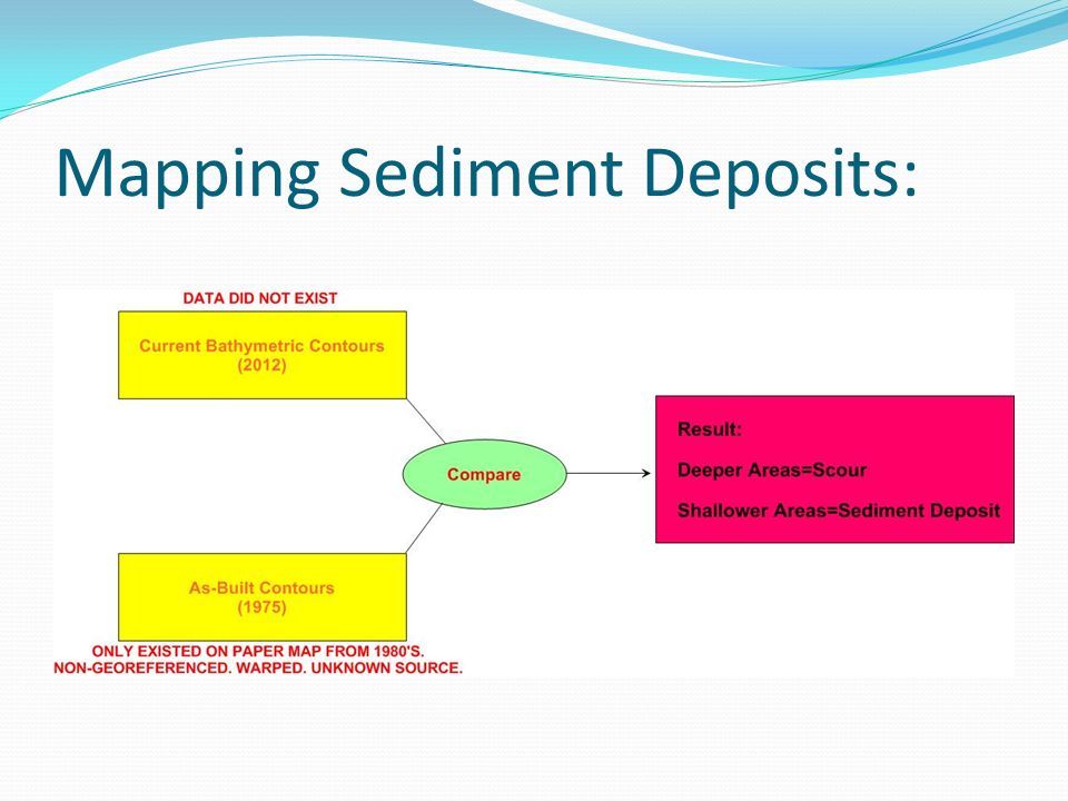
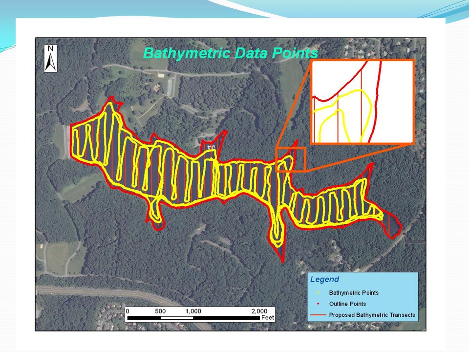
Mapping Sediment Deposits:

9
Creating Bathymetric Contours: Hydrolite-TM Single Beam, Sonar Transducer Figures 2 and 3 acquired from http://www.globalspec.com/reference/66292/203279/10-10-gps-for-seafloor-mapping and http://www.seafloorsystems.com/hydrolite_tm.html respectively, and have been reproduced here for educational purposes only.http://www.globalspec.com/reference/66292/203279/10-10-gps-for-seafloor-mapping http://www.seafloorsystems.com/hydrolite_tm.html Figure 2 Figure 3

10
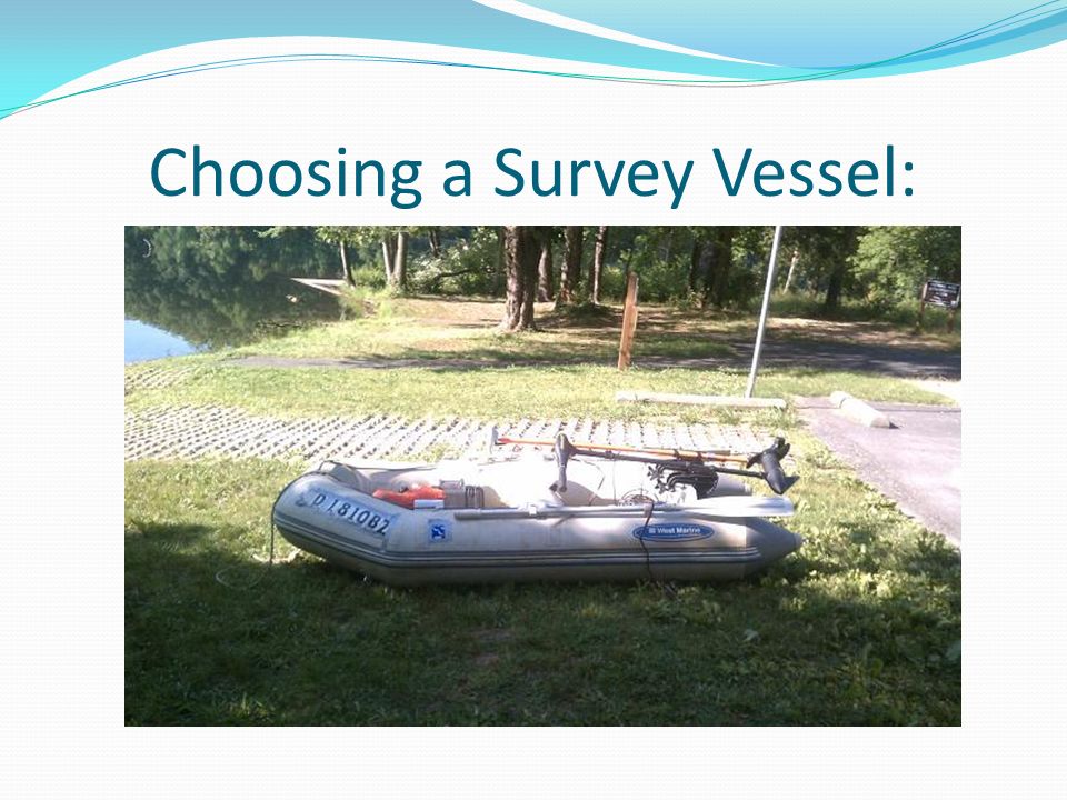
Choosing a Survey Vessel:

14
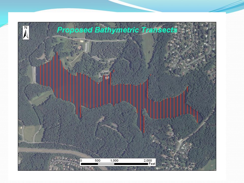
Bathymetric Data 39,013 Data Points Transducer Draft (0.85 feet) added to all raw depth soundings.
 added to all raw depth soundings.")
16
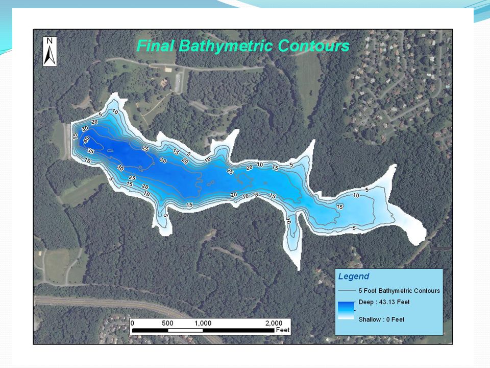
Calculations 63,819,030.011 Cubic Feet of Water 1,465.08 Acre Feet of Water Mean Depth=15.97 Feet Deepest Point= 44.92 feet

17
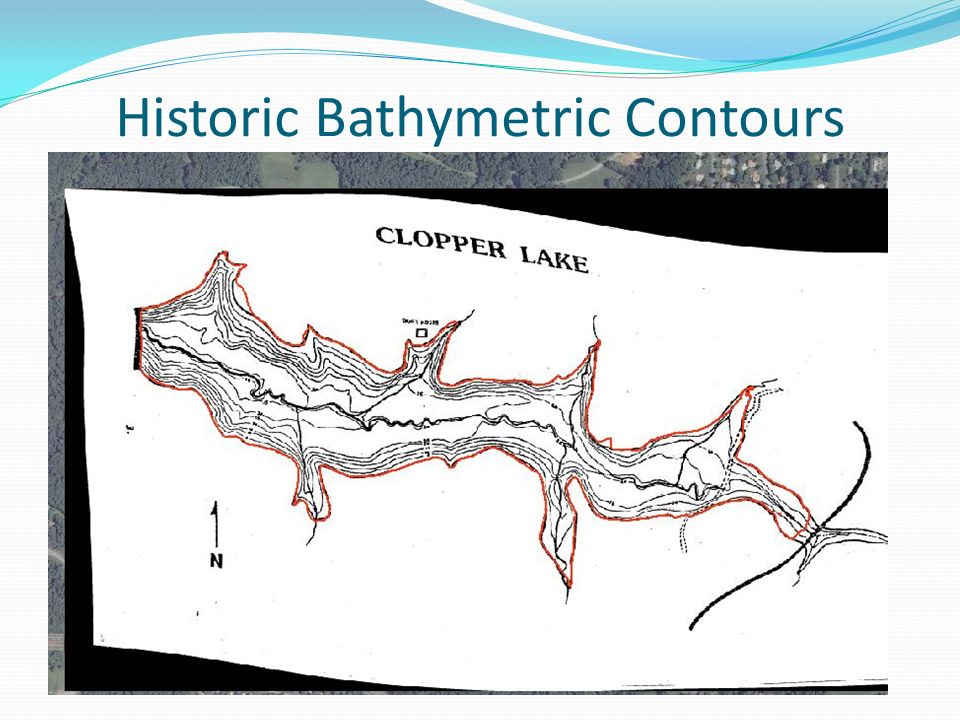
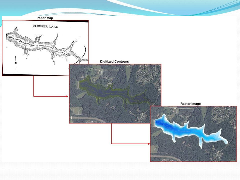
Historic Bathymetric Contours

20
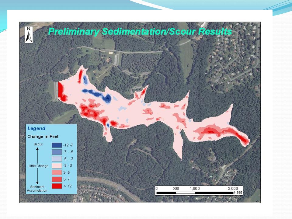
Sediment Calculations:

22
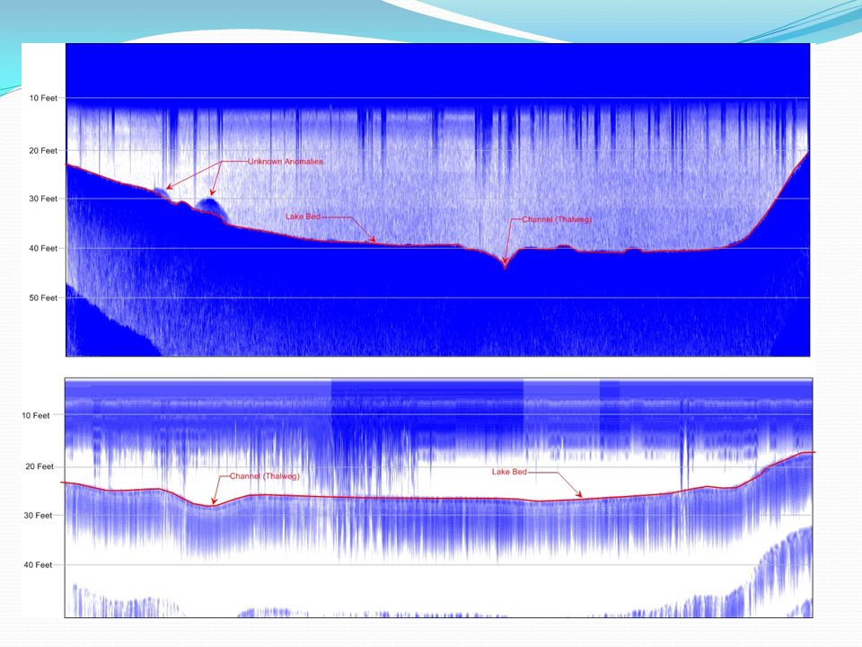
Sub-Bottom Profiling Method for imaging marine sediment layers. Active acoustic sensor (10Khz). A portion of the induced acoustic signal penetrates the lake bottom and a small portion is reflected back each time it reaches the boundary of two layers with different acoustic impedance.
. A portion of the induced acoustic signal penetrates the lake bottom and a small portion is reflected back each time it reaches the boundary of two layers with different acoustic impedance..")
23
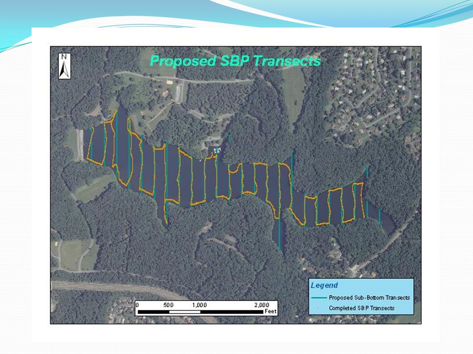
Field Work

26
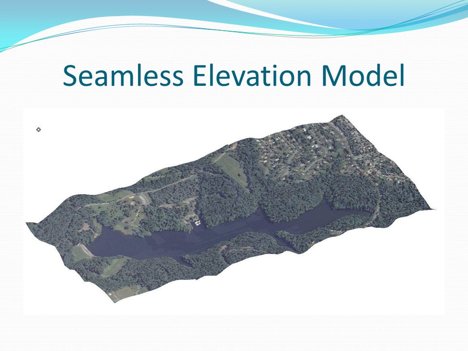
Seamless Elevation Model

28
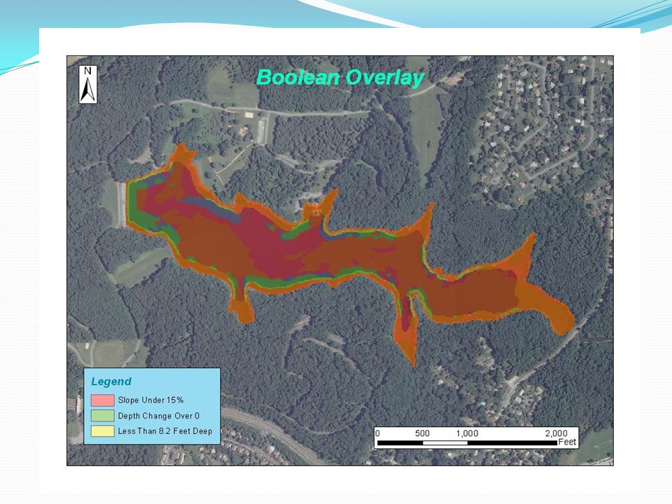
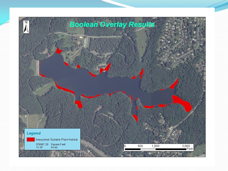
Subaqueous Soils (SAS) Soils that form in shallow water environments and are capable of supporting plant life. Usually found in water less that 2.5meters (8.20 feet) deep**. Found in both fresh and saltwater environments. Relatively new field of Pedology (soil science). Important distinction between subaqueous and submerged soils.
 deep**. Found in both fresh and saltwater environments. Relatively new field of Pedology (soil science). Important distinction between subaqueous and submerged soils..")
29
Surrounding Area Soil Types

32
Potential Additional Analysis: Side Scan Sonar Image Existing Plant Life in lake. Determine if areas with depths greater than 2.5 meters are currently supporting plant life. Images Courtesy of: http://texasfishingforum.com/forums/ubbthreads.php/topics/3143150/LOWRANCE_SIDE_IMAGING_ANNOUNCE and are reproduced here for educational purposes only.http://texasfishingforum.com/forums/ubbthreads.php/topics/3143150/LOWRANCE_SIDE_IMAGING_ANNOUNCE

33
Timeline: Continue to process data and identify the distribution of Subaqueous soils in the lake. Complete side-scan survey to produce a more comprehensive map of existing aquatic plants. Refine report and produce final presentation. Final Presentation 4-6 Weeks Sept/Oct 2-4 Weeks

34
Special Thanks To: Exploration Instruments Seafloor Systems, Inc. Hypack, Inc. URS Corporation Dr. Jay Parrish Dr. Patrick Drohan

35
References: Bradley, M.P. and M.H. Stolt. (2002). “Evaluating methods to create a base map for a subaqueous soil Inventory”. Soil Sci., 167: 222-228. Rabenhorst, Martin C. "Case Study: Soil Mapping in Chincoteague Bay Maryland." N.p., n.d. Web. 12 June 2012. Rubinstein, Michael I. "LIDAR FOR SUBAQUEOUS AND TERRESTRIAL SOIL LANDSCAPE." University of Maryland, n.d. Web. 5 June 2012 Turenne, Jim. "Subaqueous and Submerged Soil Information Sheet." Subaqueous and Submerged Soil Information Sheet. N.p., n.d. Web. 24 May 2012.. USDA-FSA-APFO Aerial Photography Field Office (2010). NAIP09 - National Agricultural Imagery Program 2009 1 meter Nat Color. Salt Lake City, Utah. URL: U.S. Department of Agriculture, Natural Resources Conservation Service (2006). Digital General Soil Map of U.S. Tabular digital data and vector digital data. Fort Worth, Texas. URL:
. NAIP09 - National Agricultural Imagery Program meter Nat Color. Salt Lake City, Utah. URL: U.S. Department of Agriculture, Natural Resources Conservation Service (2006). Digital General Soil Map of U.S. Tabular digital data and vector digital data. Fort Worth, Texas. URL:.")
36
Questions? Contact Information: Collin Strine-Zuroski cps170@psu.edu Collin.strine.zuroski@gmail.com (412) 335-0294
")
Similar presentations

 Presentation for the U. S. Geological Survey Eastern Region Geography State Cooperators.>")


 developed during WW II –Sound pulses emitted reflected off metal objects with characteristic.>")


