Download presentation
Presentation is loading. Please wait.

1
Geology and Remote Sensing of Mt. Pinatubo & Taal Volcanoes, the Philippines Peter Mouginis-Mark University of Hawaii pmm@pgd.hawaii.edu Work funded by NASA’s Solid Earth and Natural Hazards Program

2
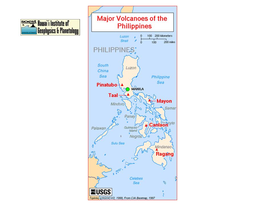
LOCATION OF VOLCANOES IN THE PHILIPPINES

4
Landsat 7 coverage (obtained over 3 different days)
")
5
Mt. PINATUBO ERUPTIONS June 1991

6
Prior to eruption

7
Fumaroles on flanks, April 1991

8
June 12th, 1991 eruption

9
Giant pyroclastic flows, June 15th 1991 form off of collapsing eruption column

10
The view from space via the Japanese GMS-5 geostationary satellite

11
Early effects on the ground

12
Sediment-laden rivers destroy roads & bridges

13
Major landscape changes: Pyroclastic flows in-filled pre-existing river valleys (the peaks in two views below are the same feature)
")
14
AIR PHOTOS

15
Summit caldera of Mt. Pinatubo, Nov. 1999. The low-point in the rim is a future hazard as the lake will eventually over-top here.

16
Typical view of eastern flank, Nov. 1999

17
Erosion of ignimbrite fan on NW. flank, November 1999

18
Erosion of river valley on the northern flank, Nov. 1999

19
Sediment fills valley floor downslope on lower E. flank November 1999

20
Detail of lahar-filled valley E. flank, Nov. 1999

21
GROUND PHOTOS

22
Exploring eroded valley, SW flank Nov. 1999

23
Crossing the sediment-laden streams is a real challenge! So much sediment is in these streams that they easily knock you over.

24
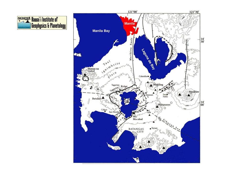
Valley erosion can be extreme in places: Up to 20 m down-cutting during one typhoon! This mosaic shows the remains of the 1991 deposit (white unit) that has been cut by younger flash floods
 that has been cut by younger flash floods.")
25
Erosion within the 1991 deposit

26
Erosion of 1991 deposit

27
Amazing landscapes!

28
Vegetation is starting to grow back on western fan. Summit of Mt. Pinatubo in background

29
“LAHARS” (MUDFLOWS) AND THE RESULTANT DAMAGE
 AND THE RESULTANT DAMAGE")
30
Major changes in valley floor elevation after single lahar has formed after typhoon.

31
The impact on villages within the path of a lahar can be extreme

32
While old houses are buried, new homes are built on stilts to try to avoid the next lahar

33
An old church has been partially-buried so that you now enter on the 2nd floor. Ronnie Torres shows the church prior to the lahars.

34
Giant dikes made from old lahar and covered with concrete now try to protect areas from new lahars

35
The contrast between areas protected by the dikes and unprotected is striking -- and it’s all an issue of insurance for redevelopment!

36
Some homes, once buried by lahar, and now being exposed by recent erosion

37
REMOTE SENSING DATA

38
Landsat 7 Path 116 Row 50

39
RADARSAT radar backscatter image of Mt. Pinatubo, February 1998

40
SPOT image of Mt. Pinatubo December 1991

41
RADARSAT radar backscatter image of western fan of Mt. Pinatubo

42
Clark Air Base: RADARSAT standard beam data set (25 m/pixel)
")
43
SPOT data of Mt. Pinatubo summit area soon after the eruption

44
Comparison of NW Summit from SPOT data obtained between 1991 and 1998 Red shows vegetation, the ash deposits are light blue Summit is at lower right

45
Changes in Mt. Pinatubo lahar deposits. Lower Pasig-Potrero River 1991 - 1996

46
ERS-1 radar backscatter image of Pasig-Potrero River showing low-backscatter lahar deposits

47
Shaded relief image of lahar fans SE of Mt. Pinatubo summit from NASA TOPSAR topographic data

48
Nighttime Landsat 7 thermal data of Mt. Pinatubo shows warm streams

49
TAAL VOLCANO (just south of Manila)
")
51
RADARSAT scansar beam 1 (50 m/pixel) image of Taal Volcano and surrounding area
 image of Taal Volcano and surrounding area")
52
Space Shuttle radar (SIR-C/X-SAR) multi-wavelength (3, 5.6 and 24 cm) image of northern part of Taal Volcano
 multi-wavelength (3, 5.6 and 24 cm) image of northern part of Taal Volcano")
53
View of Lake Taal and Volcano Island from north rim, Nov. 1999

54
NW corner of Lake Taal

55
Over 4,000 people live without permission on the shores of Volcano Island

56
In the event of an eruption of Taal, all the population would have to leave Volcano Island via small boats

57
View of the volcanic lake in middle of Volcano Island (middle of Lake Taal)
")
58
In Fall 1999, this vent on Volcano Island was actively geysering. It was quiet in November 1999.

59
Close-up view of recently active vent on Volcano Island, in the middle of Taal Volcano

60
Even around the rim of Lake Taal, people and their fish farms are at risk from tsunamis generated by eruptions.

Similar presentations


 Dormant – (sleeping) has erupted within the past few thousand.>")

