Download presentation
Presentation is loading. Please wait.

1
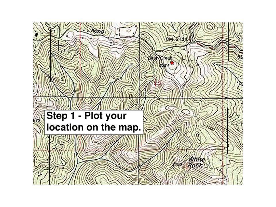
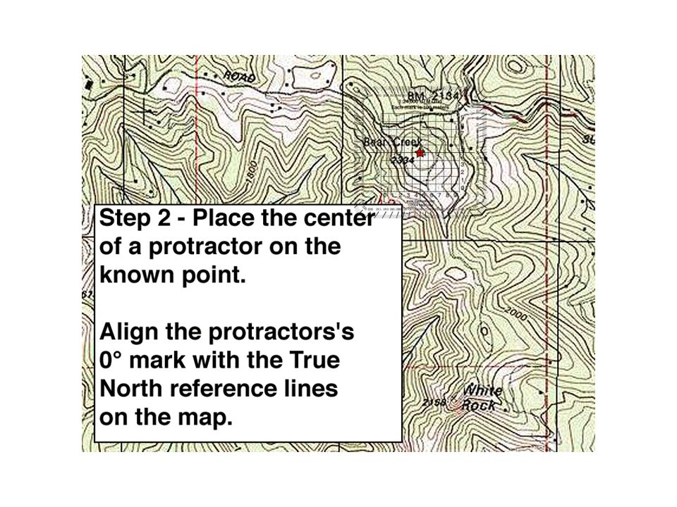
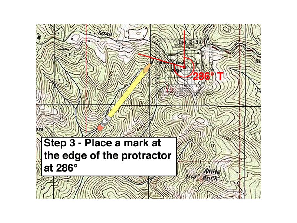
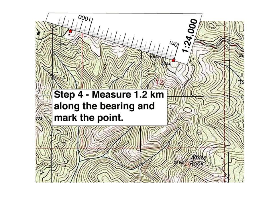
Plotting a bearing on your map You have just located the first point in an orienteering course. The clue indicates that the next location is 1.2km away on a bearing of 286° True. Your GPS indicates that you are currently at 586362m E 4113408m N. Use the Castle Rock Quad and follow along as we locate our next course point. Castle Rock Quad

6
You can use your compass as a protractor

7
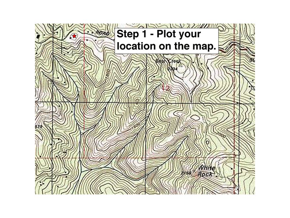
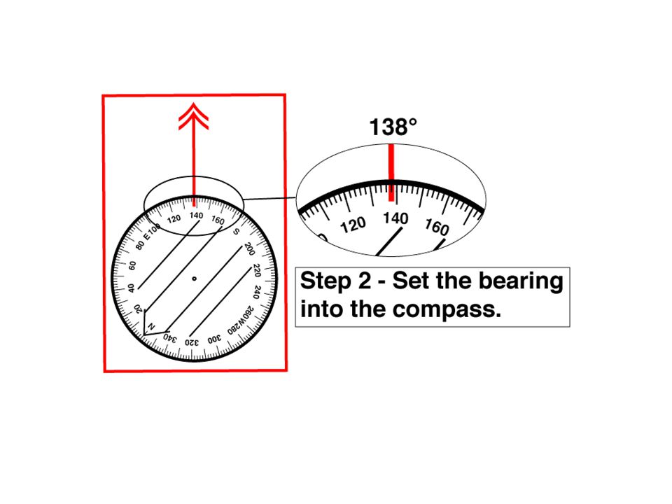
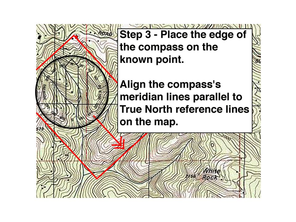
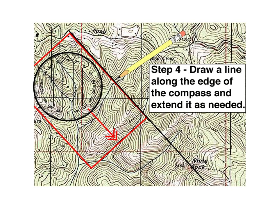
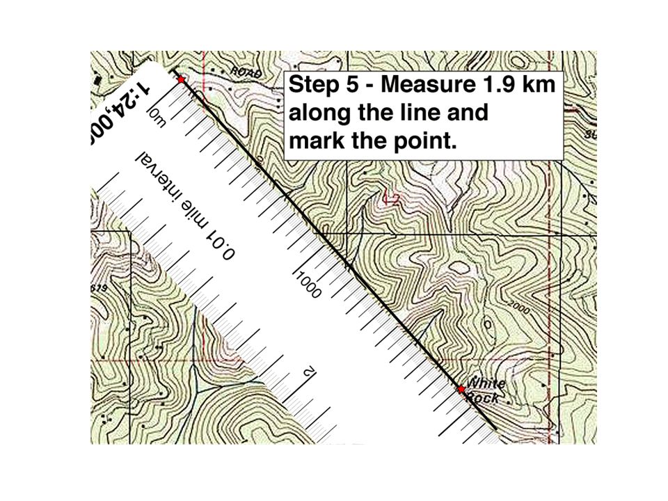
Plotting a bearing on your map You have just located the second point in an orienteering course. The clue indicates that the next location is 1.9km away on a bearing of 138° True. Your GPS indicates that you are currently at 585220m E 4113710m N. Use the Castle Rock Quad and follow along as we locate our next course point.

13
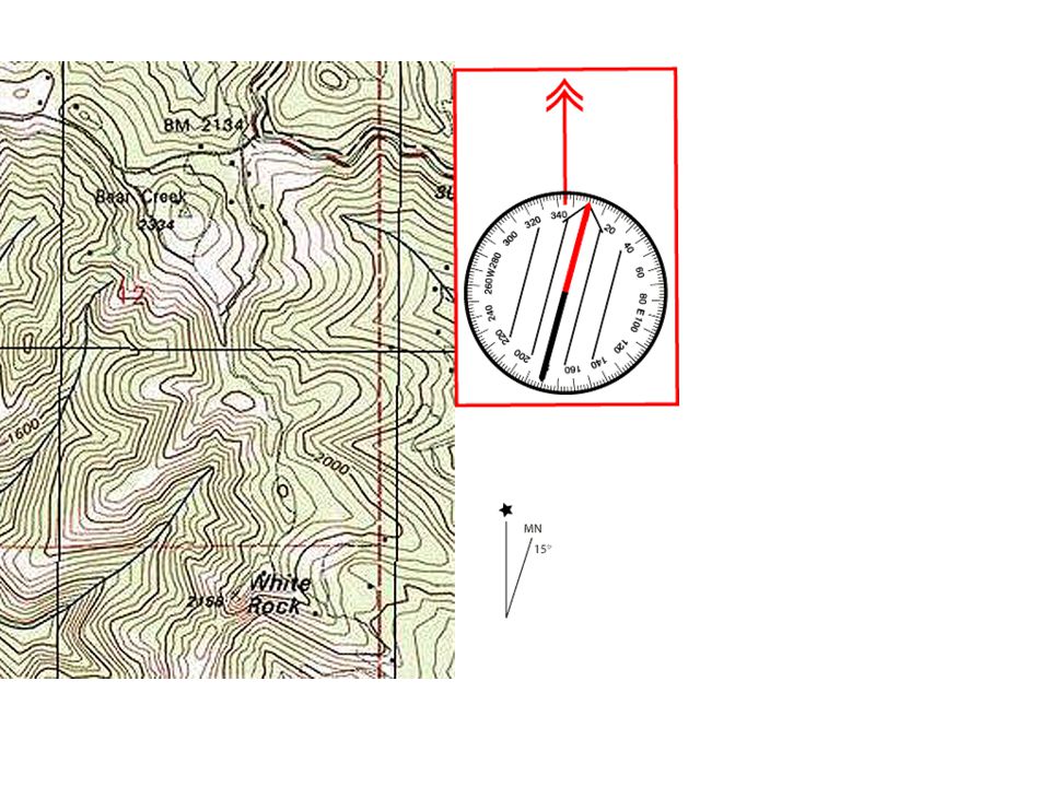
Plotting a Magnetic Bearing Standing at a known road junction, we sight a bearing to a nearby mountain top. We get 234° Magnetic as our bearing. The local declination is 15°E so we add 15° to 234° to get 249° True.

14
Plotting a Magnetic Bearing We set our compass to 249° We line the north-south parallel lines in the bezel up with a north-south line on the map. We move the compass until the edge is on the road junction. We draw the bearing line onto the map.

15
Plotting a Magnetic Bearing

16
Getting a Bearing from the Map Place the edge of the compass along the desired line of travel. Rotate the bezel until it is lined up with true north. Read the true bearing Convert to magnetic by subtracting the 15° declination.

17
Compass Plotting Exercise Castle Rock USGS Quadrangle What is the true bearing from White Rock to the small pond just west of Zayante Road? What is the magnetic bearing? What water feature might you be looking at from White Rock at a bearing of 208° M?

18
Orienting your map using your compass Adjust the compass to look like the declination diagram. Set the compass down on the map with its edge parallel to a true north line. Rotate the map and compass until the magnetic needle is boxed. Don’t do this on a metal surface.

Similar presentations