Download presentation
Presentation is loading. Please wait.

1
Thunderstorms

2
Thunderstorms: Some Key Facts Produced by cumulonimbus clouds and are accompanied by lightning and thunder. Occurs when the atmosphere becomes unstable—when a vertically displaced air parcel becomes buoyant and rises on its own. The ideal conditions include warm, moist air near the surface and a large change in temperature with height (large lapse rate)
.")
3
Thunderstorm Climatology

4
Thunderstorm Amazing Facts Some can extend as high as 40,000-65,000 ft! The are capable of releases tremendous amounts of energy (equivalent to several hydrogen bombs) Some are associated with tornados, heavy rain, and hail. Some of winds gusting to over 100 mph!
 Some are associated with tornados, heavy rain, and hail. Some of winds gusting to over 100 mph!.")
5
Types of Thunderstorms Air mass thunderstorms—usually harmless and short-lived (less than an hour). The kind we get here! Severe thunderstorms – can last for hours and can become very strong. Associated with strong winds, tornadoes and hail. Examples include: supercell storms and squall lines. We rarely get these!

6
The Life Cycle of Air Mass Thunderstorms We understood very little about the inside of thunderstorms before the famous Thunderstorm Project of the late 1940s when armored aircraft (P-61) were flown in thunderstorms in Ohio and Florida.
 were flown in thunderstorms in Ohio and Florida.")
7
M Hail Damage! P-61 Squadron

8
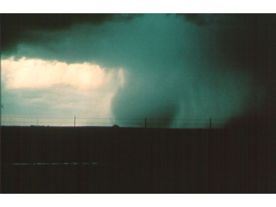
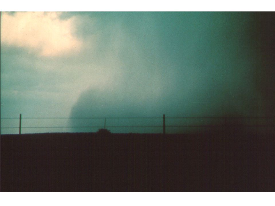
Fig. 10-1, p. 265 Single Cell Air Mass Thunderstorm

9
Air Mass thunderstorms are SUICIDAL. The cool downdraft kills the updraft…that is why they don’t live long enough to become severe.

10
Major Thunderstorm Structures Cirrus Anvil, Gust Front, Updraft, Downdraft updraft

13
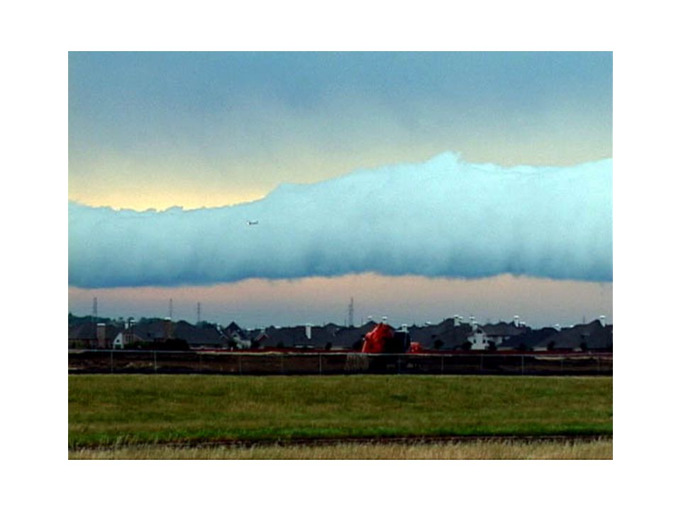
Roll or Arcus Cloud

17
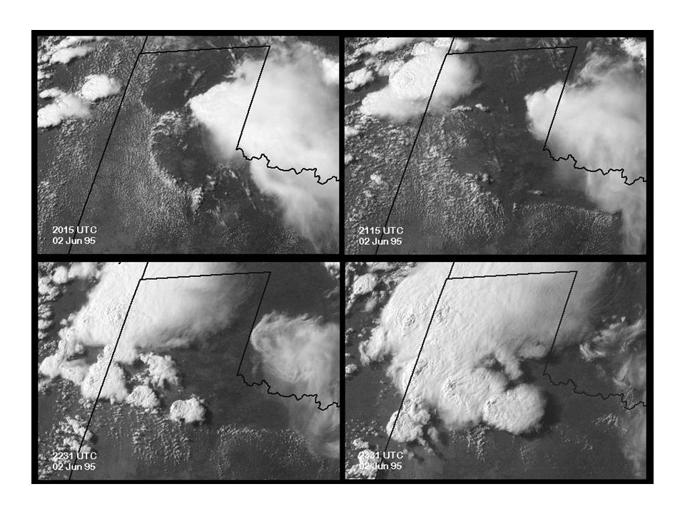
Air Mass Thunderstorms Can have several cells at various stages in their life cycle Updrafts of 2-20 knots Cells generally 3-6 miles across Radar Image of Air Mass Thunderstorm

18
Thunderstorms on the Cascades

19
Severe Thunderstorms Can last for hours and produce strong winds, large hail, flash flooding, tornadoes. Have found the secret of longevity (will reveal later!) Most important types are supercell storms, squall lines, and bow echo storms.
 Most important types are supercell storms, squall lines, and bow echo storms..")
20
Supercell Thunderstorm

21
Supercell Storms One giant updraft that can have upward speeds as high as 60-100 mph Large size: 30-50 miles in diameter. The large updraft is often rotating: called a mesocyclone.

23
Fig. 10-37, p. 291

24
Fig. 10-35, p. 290

26
Fig. 10-4, p. 268

28
Tornado Spotters Guide http://www.youtube.com/watch?v=ZCztW1xpbA0

29
Supercells on Radar In weather radars, supercell storms are usually apparent as hooked echos. The mesocyclone can be seen with the Doppler winds..

30
Fig. 10-36, p. 290

33
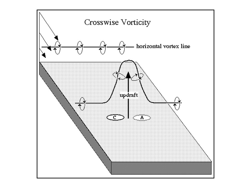
Origin of rotation in the mesocyclone Why mesocyclones? Why is wind shear important?

35
What is the secret of the strength and longevity for severe thunderstorms? They all grow in environments with large vertical instability. But they also grow in an environment of large wind shear—wind changing significantly with height. What difference does that make?

36
Need to stop the rotation of cold air in front of storm

37
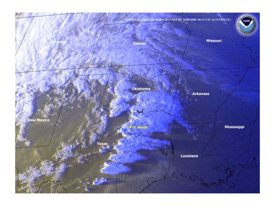
Squall Lines Long, linear lines of strong thunderstorms Strong narrow convective line, followed by a wide region of stratiform precipitation Mainly in the central and eastern U.S.

39
Fig. 10-6, p. 269

40
Squall Line

41
Bow Echos Can occur when a squall line or group of thunderstorms “bow out” Can produce strong (60-100 mph) straight- line (non-rotating) winds.
 straight- line (non-rotating) winds.")
42
Fig. 10-16, p. 273

43
Bow Echo Development

44
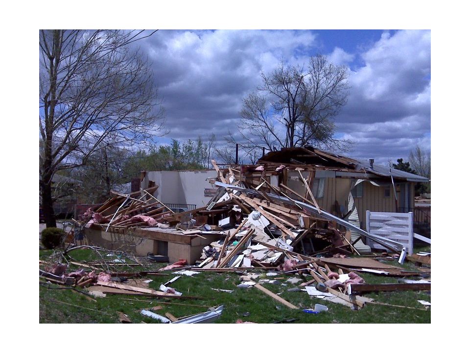
Many Bow Echos Assoiated with Strong Straight-Line Winds Called Derechos Winds can reach 85-100 mph Can produce extensive damage http://www.youtube.com/watch?v=EGJmO eDEBtwhttp://www.youtube.com/watch?v=EGJmO eDEBtw

47
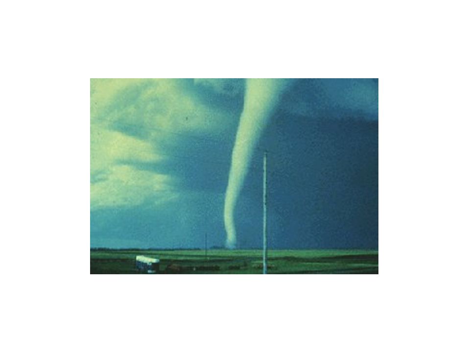
Tornado

51
Fig. 10-32, p. 288

52
Fig. 10-33, p. 289

53
Annual Number of Tornadoes per State (upper number)
")
54
Average Number of Tornadoes by Month in US

55
Table 10-2, p. 288

56
New Enhanced Fujita Scale

57
Tornado Videos http://www.youtube.com/watch?v=xCI1u05KD_s http://www.youtube.com/watch?v=iJ26HnnUuO0 Joplin Tornado

58
Origin of rotation in tornadoes Severe thunderstorms associated with mesocyclones (strongest tornadoes) Weaker thunderstorms associated with fronts and shear lines (weaker ones)
 Weaker thunderstorms associated with fronts and shear lines (weaker ones)")
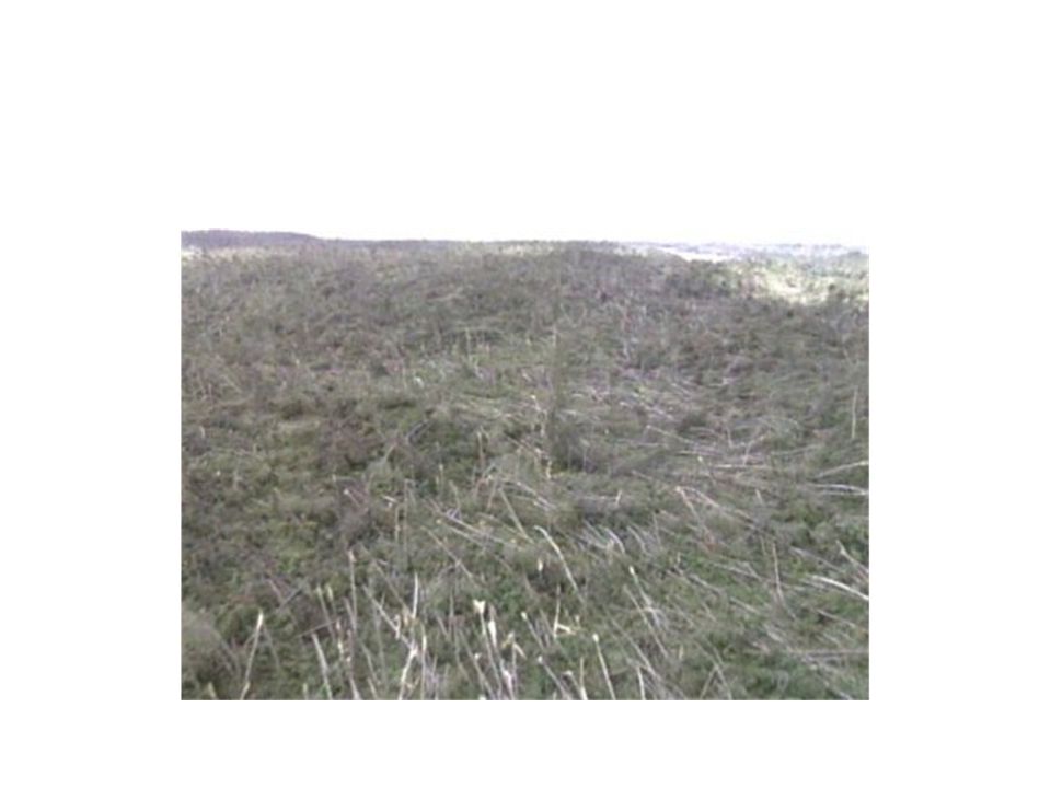
59
Origin of rotation in the mesocyclone Why mesocyclones? Why is wind shear important?

61
Fig. 10-34, p. 289 Stepped Art

62
Final Spin-Up: Conservation of Angular Momentum Angular momentum= mvr=constant

63
Fig. 10-40, p. 293 Weaker Tornadoes on Fronts and Shear Lines Another way to get rotation

64
Northwest Tornadoes

65
NW F3 Tornado

67
A Tornado Almost Took Out Bill Gates!

68
Large Hail

69
Hail Occurs in Strong Thunderstorms with Very Large Upward Velocities

70
Some Hail Facts Range in size from 0.2 to 6 inches in diameter. Large hailstones are often characterized by alternating layers of clear and opaque ice, caused by cycles of riming and freezing. Hail produces substantial damage to buildings, cars, and crops. Major agricultural problem in areas of the midwest and some overseas locations with strong thunderstorms.

71
Car Damage

72
Crop Damage

73
Average Number of Days with Hail

74
Thunderstorm and Cumulus Downbursts/Microbursts: A Major Threat to Aviation

76
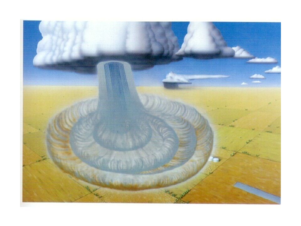
Downbursts can be Divided into Two Main Types MACROBURST: A large downburst with its outburst winds extending greater than 2.5 miles horizontal dimension. Damaging winds, lasting 5 to 30 minutes, could be as high as 134 mph. MICROBURST: A small downburst with its outburst, damaging winds extending 2.5 miles or less. In spite of its small horizontal scale, an intense microburst could induce damaging winds as high as 168 mph.

77
Fig. 10-14, p. 273

83
Research by NCAR and collaborators in the 1980s uncovered the deadly one-two punch of microbursts: aircraft level off when they encounter headwinds, then find themselves pushed to the ground by intense downdrafts and tailwinds.

84
Fig. 10-15, p. 273

85
Stepped Art

86
Eastern Air Lines 66 June 24, 1975 New York – Kennedy Airport 112 killed 12 injured Crashed while landing Boeing 727

87
Pan Am 759 July 9, 1982 New Orleans Airport 145 passenger/crew killed 8 on ground killed Crashed after takeoff Boeing 727

88
Delta 191 August 2, 1985 Dallas-Fort Worth Airport Crashed on landing 8 of 11 crew members and 128 of the 152 passengers killed, 1 person on ground killed Lockheed L-1011

89
USAir 1016 July 2, 1994 Charlotte/Douglas Airport Crashed on landing 37 killed 25 injured McDonnell Douglas DC-9

90
August 1, 1983 the strongest microburst recorded at an airport was observed at Andrews Air Force Base in Washington DC. The wind speeds may have exceeded 150 mph in this microburst. The peak gust was recorded at 211 PM – 7 minutes after Air Force One, with the President on board, landed on the same runway.

91
Wisconsin on the 4th of July, 1977, with winds that were estimated to exceed 115 mph, and completely flattening thousands of acres of forest Macroburst Microburst

92
Low Level Windshear Alert System (LLWAS)
")
93
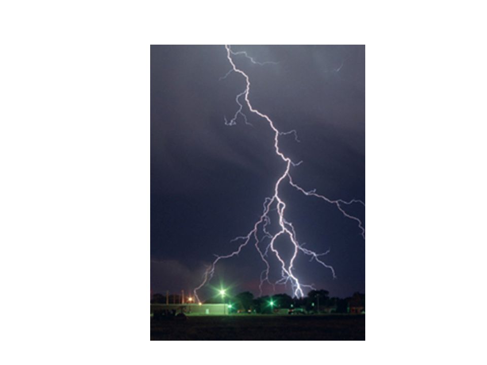
Lightning

96
Fig. 10-23, p. 280

97
Mean Annual Lightning Strikes

99
Lightning Kills!

100
Lightning is attracted to this Lightning Rod Metal Cleat Shoes…good grounding

102
Lightning can occur cloud to cloud, cloud to ground, cloud to air, or within a cloud

103
Lightning Facts The majority of lightning occurs within clouds…only about 20% between cloud and ground. The lightning strokes heats a narrow channel to roughly 54,000 F—much hotter than the surface of the sun. Causes air to expand explosively—producing thunder. Light from lightning moves at the speed of light (186,000 miles per second), while sound of thunder only moves at 1/5 mile per second. Can use the difference to determine how far the lightning stroke is: for every 5 second difference-one mile away
, while sound of thunder only moves at 1/5 mile per second. Can use the difference to determine how far the lightning stroke is: for every 5 second difference-one mile away.")
104
Benjamin Franklin was the first to suggest that lightning originated in sparks between static charges.

105
Before Lightning Strikes: Development of Areas of Charge in Clouds and Surface

106
Charge Separation in Clouds NOT WELL UNDERSTOOD! Charge separation appears to depend on strong updrafts, ice crystals, and supercooled water. Large ice crystals fall rapidly and collect the smaller, slower, supercooled water drops in their path. The drops freeze on the surface of the falling ice crystals, building graupel particles. When graupel particles fall through supercooled water and ice crystals, they acquire one charge, and the water-ice mix acquires the opposite charge. Or so we think!

107
Typical Cloud to Cloud Lightning Stroke (a) Negative charge descends the cloud in a series of steps (roughly 50-100 long)—called a “stepped leader”
 Negative charge descends the cloud in a series of steps (roughly long)—called a stepped leader")
108
Typical Cloud to Cloud Lightning Stroke (b) As the stepped leader approaches the surface, positive charges moves upwards to meet it. When the potential gradient (volts per meter) increases to about one million volts per meter, the insulating properties of the air begins to break down
 increases to about one million volts per meter, the insulating properties of the air begins to break down.")
109
Typical Cloud to Cloud Lightning Stroke (negative lightning) (c) With break down, a return stroke begins, with negative charge surging downward in the cloud.
 (c) With break down, a return stroke begins, with negative charge surging downward in the cloud.")
110
Positive Lightning Some lightning originates in the cirrus anvil or upper parts near the top of the thunderstorm, where a high positive charge resides. In this case, the descending stepped leader carries a positive charge while its subsequent ground streamers will have a negative charge. These bolts are known as "positive lightning" because there is a net transfer of positive charge from the cloud to the ground. Positive lightning makes up less than 5% of all strikes. However, positive lightning is particularly dangerous for several reasons. –Since it originates in the upper levels of a storm, the amount of air it must move through to reach the ground usually much greater. Therefore, its electric field typically is much stronger than a negative strike. –Its flash duration is longer, and its peak charge and potential can be ten times greater than a negative strike; as much as 300,000 amperes and one billion volts!

111
Positive Lightning!

112
Lightning Detection Networks Sensors detect the radio waves emitted by lightning strokes

113
Recent Example

114
What do you do when lightning is around Cars are very safe! Stay away from trees!

115
Figure 2, p. 282

116
A car struck by lightning on the 520 bridge

117
What to do? No more golf! If out in the open go to a low spot and crouch down—the lightning crouch!

118
Fig. 10-24, p. 281

Similar presentations


 and fronts. Describes.>")

 process 3.Ice multiplication.>")


