Download presentation
Presentation is loading. Please wait.

1
How to Analyze Maps & Atlases

2
What is a map? As a class, try to agree on the word’s definition.

3
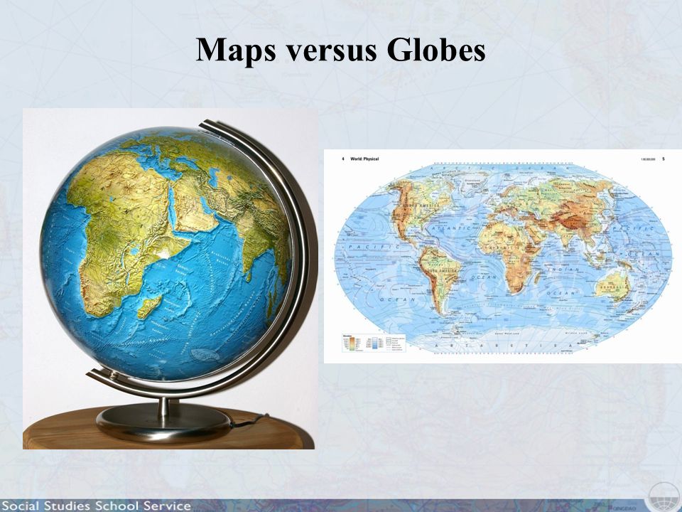
What is the difference between a globe... Maps versus Globes

4
...and a map? Maps versus Globes

6
Mercator projection Map Projections

7
Robinson projection Map Projections

8
Interrupted Goode homolosine projection Map Projections

9
What advantage does the Mercator map have, and what disadvantages?

10
In a Mercator projection, directions and shapes are accurate near the equator, but shapes far from the equator grow increasingly distorted in size. Map Projections

11
A graphic representation of stretching in the Mercator projection Map Projections

12
In a Robinson projection, angles and areas do not conform to reality, but gently curving meridians avoid extreme distortion except close to the poles. Map Projections

13
Compare the above projections with the interrupted Goode homolosine projection to the right. Map Projections

14
Atlases What is an atlas? What would you expect to find in an atlas?

15
You may have studied latitude and longitude in other classes. Do you remember which is which? Latitude and Longitude

16
What is the black arrow pointing to? How many degrees of latitude is this line?

17
Latitude and Longitude What is the black arrow pointing to? How many degrees of longitude is this line?

18
Latitude and Longitude Which measurement—latitude or longitude—gives us more information about the climate and weather in a place? Why?

19
Latitude and Longitude Which place do you think would have a warmer climate: 10° south or 20° north?

20
Latitude and Longitude What does jet lag have to do with latitude and longitude?

21
What type of map is this? What kinds of information does this map provide? Different Types of Maps

22
What type of map is this? What kinds of information does this map provide?

23
What type of map is this? Who might find this map useful? Different Types of Maps

24
What are some of the first things you notice about this map? What do you think this map is telling you? Different Types of Maps: Thematic Maps

25
Thematic maps generally have legends that explain what the maps show. Map Legends

26
According to this legend, what do the different colors on the map represent? Map Legends

27
What do you think this part of the legend means? Map Legends

28
What are the population densities of these regions?

29
Map Legends What factors might explain why northern India is so densely populated?

30
Map Legends How densely populated is Alaska?

31
Discuss the world’s patterns of population density. Map Legends

32
What is the scale of this world map? Map Scale

33
What is the scale of this Soviet map of the Tora Bora region of Afghanistan? Map Scale

34
What is the scale of this CIA map of Iran?

35
What is the scale of this map of New Orleans? Map Scale

36
Deciphering Maps: Ecozones Look at another thematic map. This one shows Earth’s ecozones.

37
Deciphering Maps: Ecozones What patterns do you notice?

38
Deciphering Maps: Ecozones Ecozones map legend

39
Deciphering Maps: Ecozones Tundra

40
Deciphering Maps: Ecozones Where do you see the tundra ecozone? What do you think the tundra ecozone might look like? What clues do you see on the map to help answer this question?

41
Deciphering Maps: Ecozones Tundra

42
Deciphering Maps: Ecozones Deserts and xeric shrublands

43
Deciphering Maps: Ecozones Deserts and xeric shrublands

44
Deciphering Maps: Ecozones Deserts and xeric shrublands

45
Deciphering Maps: Ecozones Ecozones map legend

46
Deciphering Maps: Ecozones

47
Tropical rain forest Deciphering Maps: Ecozones

48
Mediterranean zone

49
How do you think this map might be useful? Deciphering Maps: Ecozones

50
Tropical grasslands

51
What do you think the bars on this map mean? Deciphering Maps: Energy Consumption

52
What does this legend tell you about the bars on the map? Deciphering Maps: Energy Consumption

53
Compare energy use in the United States and the European Union. Deciphering Maps: Energy Consumption

54
Who uses the most soft (brown) coal? Deciphering Maps: Energy Consumption
 coal Deciphering Maps: Energy Consumption")
55
Who uses the most hard coal? Deciphering Maps: Energy Consumption

56
Comparing Maps Predict which ecozones are most populated. Least populated?

57
Comparing Maps: Ecozones and Population Density Which ecozones are most populated? Least populated?

58
Comparing Maps How good were your predictions?

59
Comparing Maps Do the most populated regions use the most energy?

60
Comparing Maps Compare India and the U.S. in terms of population and energy use.

61
Comparing Maps Can you imagine a life in a village with little or no electricity?

62
Comparing Maps Predict what the colors on this map might mean.

63
Comparing Maps Carbon dioxide emission map legend

64
Comparing Maps Who emits the most carbon dioxide? Least?

65
Comparing Maps Compare and discuss.

66
Comparing Maps Compare and discuss.

67
Comparing Maps Compare and discuss.

68
Comparing Maps Compare and discuss.

69
Comparing Maps Compare and discuss.

70
Deciphering Maps: Health Now try deciphering a map of world health. Predict what the colors in this map might mean.

71
Examine and discuss the legend for the world health map. Deciphering Maps: Health

72
Now look at the map. What does it tell you about infant mortality rates in different parts of the world?

73
Deciphering Maps: Health Which Middle Eastern countries have the highest infant mortality rates? Why?

74
Comparing Maps Before you compare the world health map to a map of the world’s educational levels, make predictions about what you might find.

75
Comparing Maps What patterns do you notice?

76
Comparing Maps Fully discuss this map legend.

77
Comparing Maps Do you know why this graph is on the map?

78
Comparing Maps Compare and analyze the health and education maps.

79
Comparing Maps Compare and analyze the health and education maps.

80
Comparing Maps: Health and Education Summarize your observations on the health and education maps.

81
The End

Similar presentations