Download presentation
Presentation is loading. Please wait.

1
Lesson 15B: Storm Avoidance

2
AGENDA: –Storm Avoidance –Weather Reporting –Weather Prediction Applicable reading: Hobbs WB, App A

4
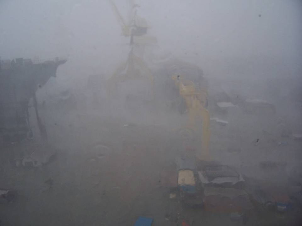
Storm Avoidance 1. Hurricane Season - June through November 2. Procedure - Safest with respect to tropical cyclones is avoidance. 3. Key Elements to Determine: - Position relative to storm center & axis - Path & velocity of storm’s travel

5
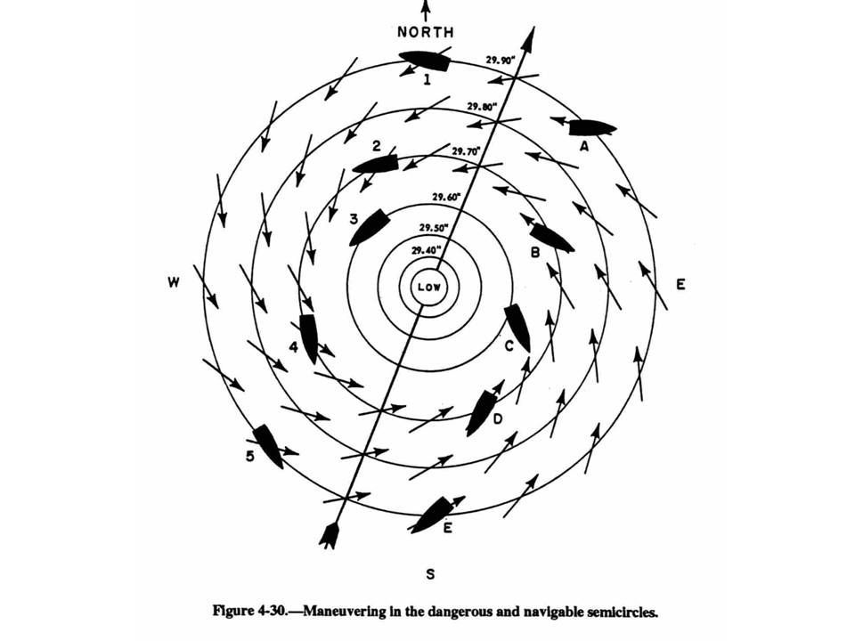
Storm Avoidance 4. Cyclonic Storms - Deflected by the corriolis effect travel in a clockwise direction (Northern Hemisphere). 5. Storm Division - Storm is divided into 2 parts: - Most Dangerous Semi-circle - side that is right of storm center and direction of path - Least Dangerous (Navigable) Semi-circle - side that is left of storm center and direction of path
. 5. Storm Division - Storm is divided into 2 parts: - Most Dangerous Semi-circle - side that is right of storm center and direction of path - Least Dangerous (Navigable) Semi-circle - side that is left of storm center and direction of path.")
6
Least Dangerous Semi-circle Most Dangerous Quadrant More Dangerous Semi-circle Northern Hemisphere

7
Storm Avoidance 6. Safe Passage - in the Northern Hemisphere - Avoid crossing the “T”: avoid passing in front of a storm going from Most to Least Dangerous semi-circle - Most Dangerous Semi-Circle: Bring the wind on STBD bow, hold course & make best speed.

8
Storm Avoidance 6. Safe Passage - in the Northern Hemisphere - Least Dangerous Semi-Circle: Bring the wind on STBD qtr, hold course & make best speed. - On Storm Track (ahead): Bring the wind to 160 deg R until a backing is noted in the wind (indicating you are in the Least Dangerous Semi-circle), then bring the wind on STBD quarter, hold course &make best speed.
: Bring the wind to 160 deg R until a backing is noted in the wind (indicating you are in the Least Dangerous Semi-circle), then bring the wind on STBD quarter, hold course &make best speed..")
9
Storm Avoidance 6. Safe Passage - in the Northern Hemisphere - On Storm Track (behind): Avoid the center by best practical course (southerly).
: Avoid the center by best practical course (southerly)..")
11
Ship Observation & Reporting Weather Observations - Ships are required to take regular weather observations: - Observations taken hourly IAW NAVOCEANINST. - Ships in company, OTC may designate one ship to report observations - In port with no manned weather facility within 50NM

12
Ship Observation & Reporting Synoptic - Formatted weather message: - Every 6 hours PRIORITY if: surface wind speeds < 33 kts, seas < 12 feet. - Every 3 hours IMMEDIATE if: surface winds > 33 kts sustained, seas > 12 feet. - Via plain voice: first indications of a tropical cyclone, unusual or hazardous weather.

13
Ship Observation & Reporting Weather Observations - prepared by OOD: - Type of observation - Cloud Cover - Prevailing visibility - Weather & obstructions to visibility - Sea level pressure in millibars

14
Ship Observation & Reporting Weather Observations - prepared by OOD: (cont.) - Dry bulb temp in degrees fahrenheit - Dew point temp in degrees fahrenheit - True wind direction & speed - Altimeter setting (if aircraft embarked) - Remarks
 - Dry bulb temp in degrees fahrenheit - Dew point temp in degrees fahrenheit - True wind direction & speed - Altimeter setting (if aircraft embarked) - Remarks")
15
Ship Observation & Reporting Weather Observations - prepared by OOD: (cont.) - Station pressure in inches of mercury - Sea water temp (at sea water injection) - Sea height, direction and period - Ice (if applicable) - Clouds by type, quantity, & height
 - Station pressure in inches of mercury - Sea water temp (at sea water injection) - Sea height, direction and period - Ice (if applicable) - Clouds by type, quantity, & height")
16
Services Available 1.Tropical Cyclone Alert 2. High Wind and Sea Warning 3. Local Severe-Storm Warning 4. WEAX 5. OTSR - Optimum Track Ships Routing

17
Weather Prediction Broadcast WEAX Messages –High Seas Warnings –Offshore Marine Forecasts –Coastal Marine Forecasts –OPAREA Forecasts OTSR (Optimum Track Ship Routing) –Tailored track recommendations National Data Buoy Collection Center –Provides real-time conditions throughout coastal U.S.
 –Tailored track recommendations National Data Buoy Collection Center –Provides real-time conditions throughout coastal U.S.")
18
Weather Prediction 42039 PENSACOLA –56 NM South of Panama City, FL Measures: –Wind direction, speed –Wave height, period –Atmos. Pressure –Air/Water Temperature –Dew Point

19
Weather Prediction Heuristics Look for changes in wind direction –Veering: clockwise movement –Backing: counter-clockwise movement Watch 3 hour trend of barometer Note cloud type and direction Monitor dew point spread

20
Weather Prediction Heuristics Buys Ballot Law –To locate High or Low use: Stand with your back to the wind Turn 15º to the right The LOW is on your left, the HIGH on your right Red sky at night … sailor’s delight Red sky at morning... sailors take warning

21
Review/Summary Describe the difference between the dangerous semi-circle and the navigable semi-circle. What is OTSR used for?

22
Questions?

Similar presentations