Download presentation
Presentation is loading. Please wait.

1
Geography of Europe

2
Essential Question: Where are the major physical features and nations of Europe located?
Standards: SS6G8a. Locate on a world and regional political- physical map: the Danube River, Rhine River, English Channel, Mediterranean Sea, European Plain, the Alps, Pyrenees, Ural Mountains, Iberian Peninsula, and Scandinavian Peninsula. SS6G8b. Locate on a world and regional political-physical map the countries of Belgium, France, Germany, Italy, Poland, Russia, Spain, Ukraine, and United Kingdom.

3
Where is Europe? [Use Google Earth]
![Where is Europe [Use Google Earth]](http://slideplayer.com/slide/5290016/17/images/3/Where+is+Europe+%5BUse+Google+Earth%5D.jpg "Where is Europe [Use Google Earth]")
4
Satellite View of Europe

5
Size Comparison of Europe to the United States

6
Activating Strategy Use the Europe Physical Features and Nations summarizer to activate student’s prior knowledge of the physical features and nations located in Europe.

7
Use the European Physical Features Map

8
What do you notice is different about the physical features of Europe on your map?
In general, you want students to notice that there are some differences in the features on this map and the one they are using. Point out to students that we are only going to learn the specific physical features identified in the state standards; however, Europe has many more features than those identified in the standard.

9
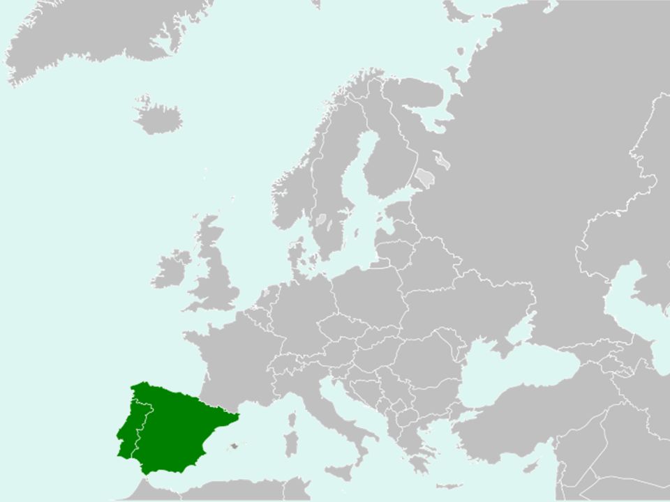
Mediterranean Sea 1

13
Iberian Peninsula 2

15
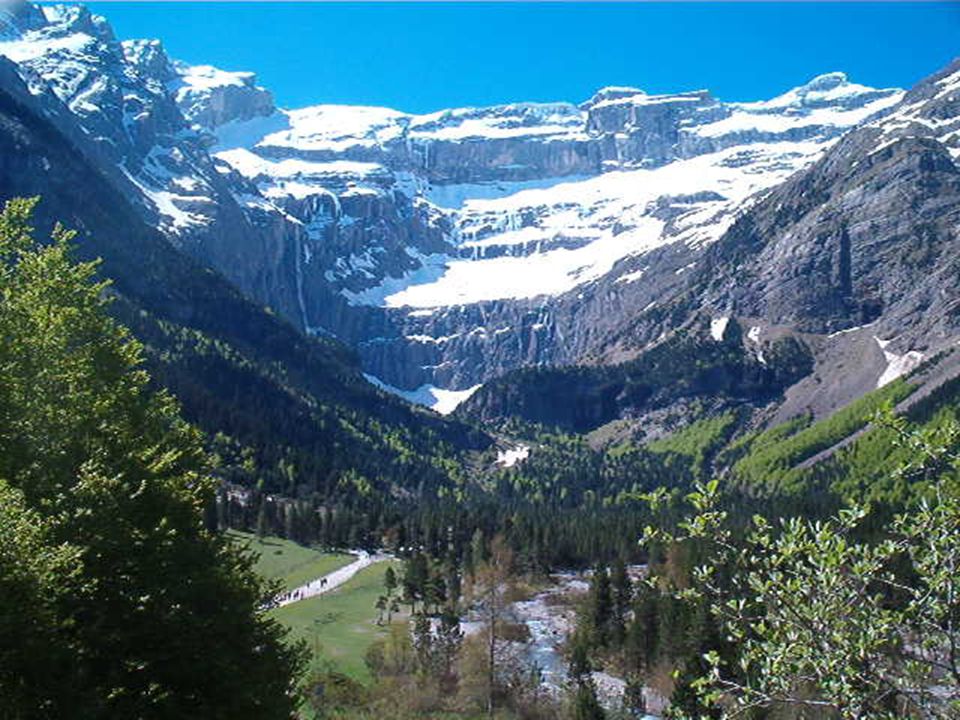
Pyrenees [Mountains] 3
![Pyrenees [Mountains] 3](http://slideplayer.com/slide/5290016/17/images/15/Pyrenees+%5BMountains%5D+3.jpg "Pyrenees [Mountains] 3")
17
Alps [Mountains] 4
![Alps [Mountains] 4](http://slideplayer.com/slide/5290016/17/images/17/Alps+%5BMountains%5D+4.jpg "Alps [Mountains] 4")
19
It’s the highest mountain in the Alps: 15,771 feet
Mt. Blanc in the Alps It’s the highest mountain in the Alps: 15,771 feet

21
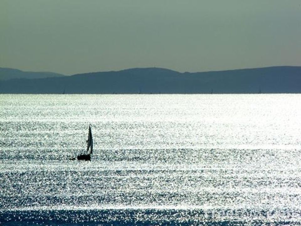
English Channel 5

25
Rhine River 6

28
European Plain 7

29
European Plain

31
Danube River 8

33
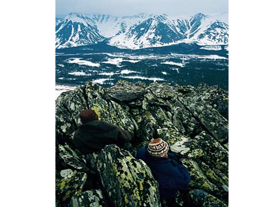
Ural Mountains 9

34
It divides the European and Asian sections of Russia.
Ural Mountains: “The Great Divide” 1500 miles It divides the European and Asian sections of Russia.

37
Scandinavian Peninsula
10

40
There are two important oceans surrounding Europe that are not listed in the standards. However, knowing the location of these oceans is beneficial when describing the location of other physical features in Europe.

41
Arctic Ocean 11

42
Atlantic Ocean 12

43
Europe Physical Features Foldable
Use your labeled physical features map to: *Mark each feature on a small map *Write a description of where the feature is located in Europe *Write a method for remembering the location of the physical feature

44
Distributed Summarizing:
Imagine that you took a European vacation and followed the path shown on the map below. Write a letter to a friend describing the physical features that you visited or crossed during your trip. Starting Point Ending Point

45
Political Map of Europe
We will identify the nations in color.

46
Use the European Political Identification Map

47
Spain 1

48
France 2

49
United Kingdom 3

50
Belgium 4

51
Germany 5

52
Poland 6

53
Russia 7

54
Ukraine 8

55
Italy 9

56
Portugal 10

57
Starting Point Ending Point
Distributed Summarizing: Use your Distributed Summarizing European vacation handout. Identify the European nations that you would have traveled through on your vacation. Write or draw arrows to identify the countries. Which countries did you not visit? Starting Point Ending Point

58
Use the Europe Physical Features and Nations PPT Review to quiz students on the location of Europe’s Physical Features and Nations.

59
Summarizing Strategy

Similar presentations


 Locate on a world and regional political‐ physical map: the Danube River,>")


