Download presentation
Presentation is loading. Please wait.

1
Geophysical Mapping of Freshwater- Saltwater Interfaces: Examples from the Coastal Plain Aquifer System of North Carolina Lewis Land New Mexico Bureau of Geology and Mineral Resources

3
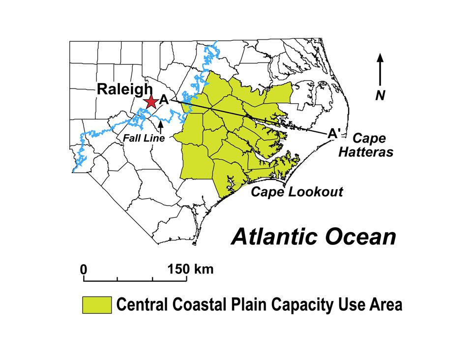
Central Coastal Plain Capacity Use Area (CCPCUA) Encompasses 15 counties in eastern North Carolina, within which ground water use will be regulated to protect long-term productivity of aquifers beneath the coastal plain. 100,000 GPD threshold for permitting ground water withdrawals from Cretaceous and Tertiary aquifers.

13
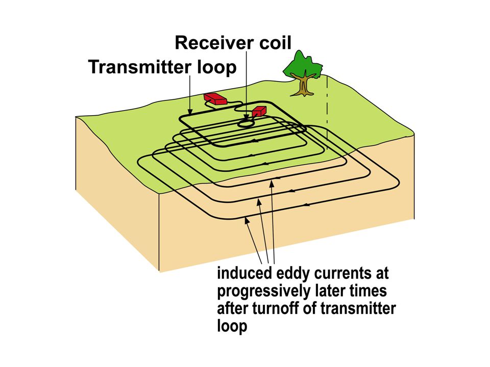
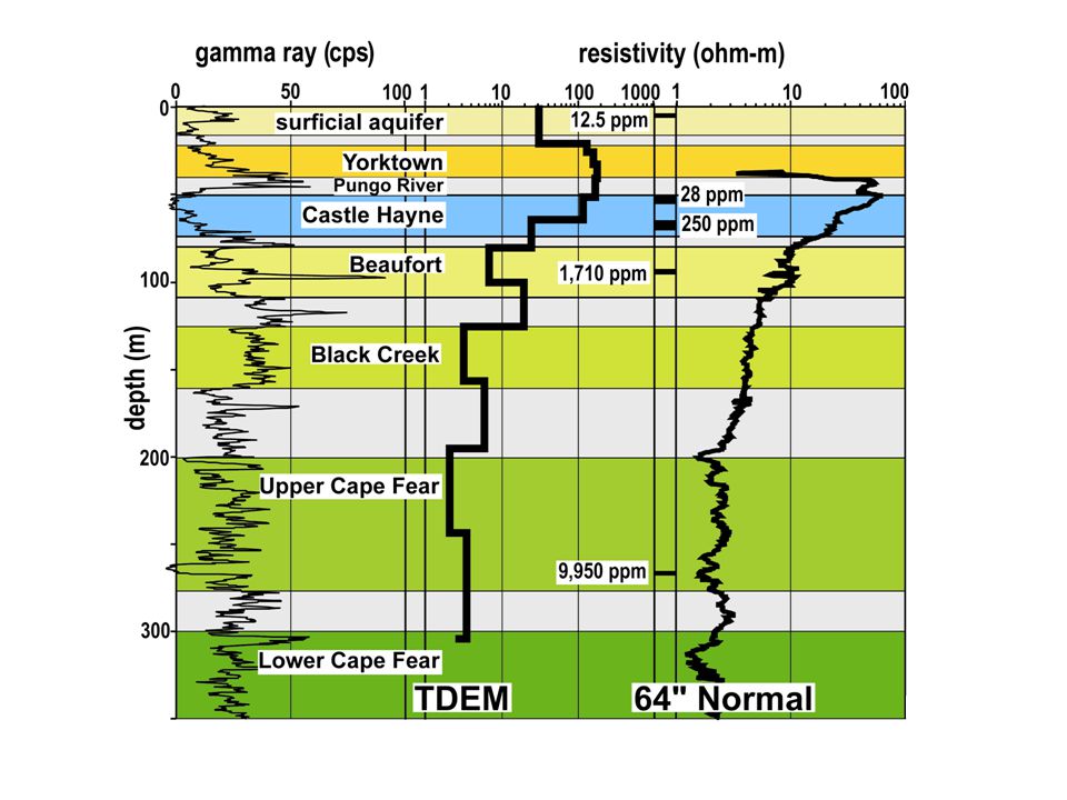
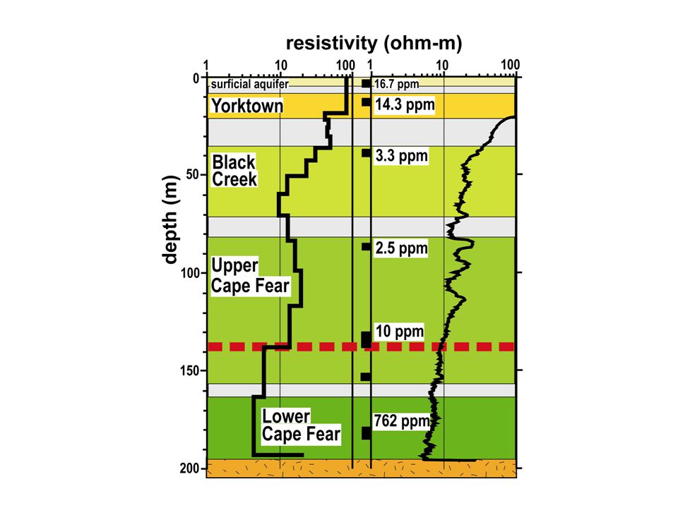
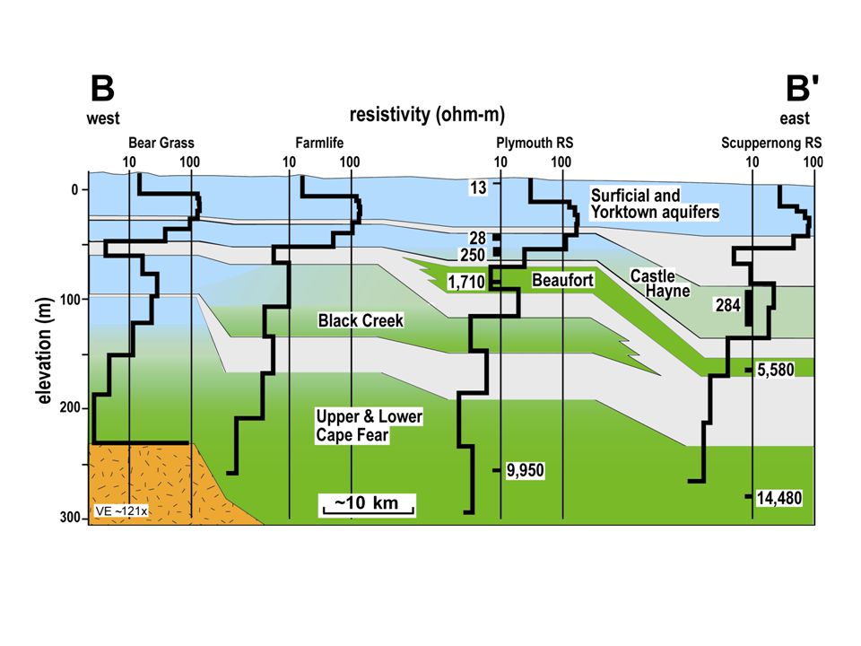
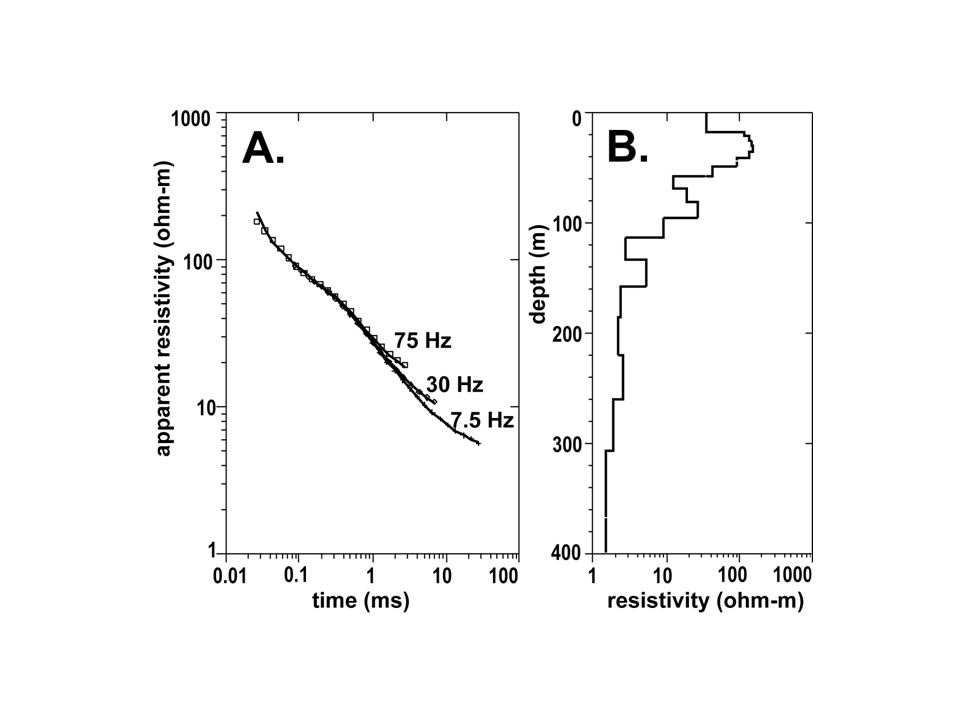
Summary A TDEM sounding used alone does not provide the same degree of vertical resolution as a borehole record. However, a much higher effective level of precision can be attained when TDEM soundings are integrated with existing borehole data, effectively increasing the density of subsurface information by several hundred percent.

17
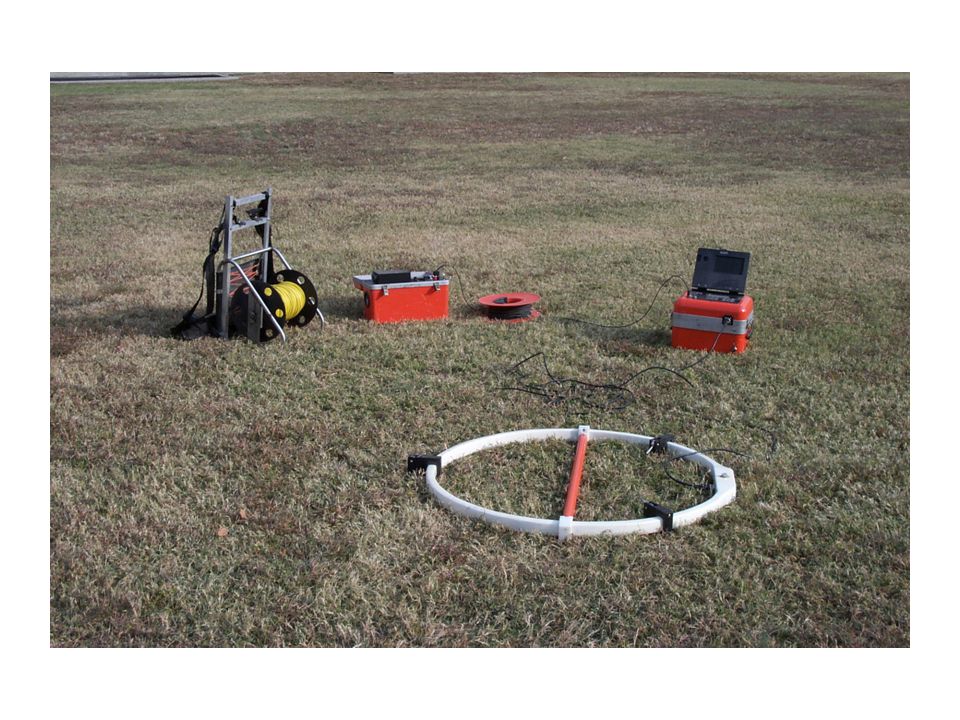
Summary Electromagnetic soundings provide an efficient, inexpensive, and semi-quantitative method for evaluating ground water resources in coastal aquifers, on both local and regional scales.

Similar presentations


 July 25, 2013.>")
Bent Creek Research.>")


