Download presentation
Presentation is loading. Please wait.

1
Application of HEC- HMS for Hydrologic Studies Texas A&M University Department of Civil Engineering CVEN689 – Applications of GIS in CE Instructor: Dr. Francisco Olivera Logan Burton 3/14/03

2
Outline HMS and GIS HMS and GIS Project Overview Project Overview Challenges Challenges Solutions Solutions Methodology Methodology Results Results

3
HEC-HMS HMS Hydrologic Modeling System HMS Hydrologic Modeling System Developed by the U.S. Army Corp of Engineers Developed by the U.S. Army Corp of Engineers A numerical model that can help predict runoff volumes, peak flows, and timing of flows by simulating the behaviors of the watersheds, channels, and reservoirs. A numerical model that can help predict runoff volumes, peak flows, and timing of flows by simulating the behaviors of the watersheds, channels, and reservoirs.

4
HEC-HMS Advantages Can be applied to a variety of watersheds with different shapes, sizes and characteristics Can be applied to a variety of watersheds with different shapes, sizes and characteristics Graphical User Interface makes the program user friendly Graphical User Interface makes the program user friendly Software is public domain Software is public domain - Can be downloaded from HEC website at no cost

5
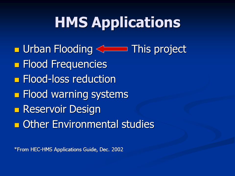
HMS Applications Urban FloodingThis project Urban FloodingThis project Flood Frequencies Flood Frequencies Flood-loss reduction Flood-loss reduction Flood warning systems Flood warning systems Reservoir Design Reservoir Design Other Environmental studies Other Environmental studies *From HEC-HMS Applications Guide, Dec. 2002
6
Advantages of Using GIS in Hydrologic Studies Effective and efficient delineation of watersheds and streams Effective and efficient delineation of watersheds and streams Quick extraction of watershed and stream parameters Quick extraction of watershed and stream parameters DEMs can define the drainage basin boundaries DEMs can define the drainage basin boundaries

7
Urban Flooding What is an Urban Flooding Study? What is an Urban Flooding Study? A hydrologic study in an urban area to analyze or predict flooding problems. Common Characteristics Short response times Short response times Drainage systems in place Drainage systems in place Development plays large role watershed behavior Development plays large role watershed behavior

8
Scope of Urban Flooding Model and analyze existing basin Model and analyze existing basin Edit model to simulate urbanization Edit model to simulate urbanization Analyze new model to help predict impact of future development Analyze new model to help predict impact of future development

9
Salado Creek Basin Location: Location: Bexar County San Antonio, TX San Antonio

10
Urbanized Watershed

11
Salado Creek

12
Required Information Peak Flows Peak Flows Runoff Volume Runoff Volume Flow Timing Flow Timing Peak Stage* Peak Stage* Floodplain Delineation* Floodplain Delineation* *HEC-RAS is used to calculate these All of this information is required for current and future development

13
Required Data for Analysis DEM (30 meter) DEM (30 meter) NHD files NHD files USGS Gauging Stations USGS Gauging Stations HUC boundaries HUC boundaries Optional: DRG topographic map
 DEM (30 meter) NHD files NHD files USGS Gauging Stations USGS Gauging Stations HUC boundaries HUC boundaries Optional: DRG topographic map")
14
GIS Challenges Gathering Data – different sources Gathering Data – different sources Type of Data Source DEMTNRIShttp://www.tnris.state.tx.us/digital.htm NHD files USGShttp://nhd.usgs.gov/ Gauging Stations USGS http://water.usgs.gov/lookup/getspatial?re alstx Huc Boundaries USGShttp://water.usgs.gov/GIS/huc.html

15
GIS challenges Managing and Organizing Data - Different Sources = Different Projections - Very Important to keep the metadata with the downloaded files These problems can be easily solved by using the available tools and extensions

16
Extensions and Tools CRWR-Vector* - project vector data CRWR-Vector* - project vector data ArcInfo – project raster data ArcInfo – project raster data CRWR-Raster* - merge grids CRWR-Raster* - merge grids CRWR-PrePro* - data pre-processor CRWR-PrePro* - data pre-processor HEC-GeoHMS could have been used in place of PrePro HEC-GeoHMS could have been used in place of PrePro *Programs written by Dr. Francisco Olivera

17
Projecting Shapefiles CRWR-Vector is used to project shapefiles (points, lines, polygons) Use the project tool in the pull down menu
 Use the project tool in the pull down menu")
18
CRWR-PrePro Can be downloaded from Dr. Olivera’s website Can be downloaded from Dr. Olivera’s website Predecessor to GeoHMS Predecessor to GeoHMS

19
HEC-GeoHMS Can be downloaded from HEC website Can be downloaded from HEC website Menu is very similar to CRWR-Prepro Menu is very similar to CRWR-Prepro

20
Methodology 1. Projected all data to UTM27 – Zone 14 2. Ran CRWR-PrePro to delineate watershed - Problem appeared

21
Problem PrePro requires that stream lengths be greater than 1 cell PrePro requires that stream lengths be greater than 1 cell Cell size is 28.85 m Cell size is 28.85 m

22
Solution: Step 1 Add point theme Add point theme

23
Step 2 Add “Elevation” Field to attribute table Add “Elevation” Field to attribute table

24
Step 3 Convert the point theme to a grid Convert the point theme to a grid

25
Step 4 Merge original DEM to new grid using CRWR- Raster Merge original DEM to new grid using CRWR- Raster

26
Step 5 Re-run CRWR-PrePro with fixed grid Re-run CRWR-PrePro with fixed grid

27
Process Data Calculate Attributes Calculate Attributes HMS Schematic HMS Schematic

28
HMS Components Basin Model Basin Model Meteorological Model Meteorological Model Control Specifications Control Specifications

29
Basin Model Imported from ArcView Imported from ArcView

30
Imported Basin Model

31
Basin Characteristics Initial/Constant Loss Rate Initial/Constant Loss Rate Initial loss = 0.39 in Initial loss = 0.39 in Constant loss = 0.20 in Constant loss = 0.20 in - From local soil parameters Before Development: Before Development: Northern basins – 10-25% imperviousness Southern basins - 75% imperviousness - HMS Reference Manual

32
Meteorological Model Input from TxDot Hydraulic Manual for Bexar County

33
Control Specifications Rainstorm of October 17-18, 1998 was used Rainstorm of October 17-18, 1998 was used

34
Calibration USGS Fact Sheet FS- 147-99

35
Calibration

36
Effects of Urbanization After Development: After Development: Entire basin model = 75% imperviousness

37
Results Development increased flow 10,000 cfs (16%) at this gauging station Undeveloped Basin Developed Basin
 at this gauging station Undeveloped Basin Developed Basin")
38
Floodplains Input channel geometry and roughness data into HEC-RAS Input channel geometry and roughness data into HEC-RAS Import peak flows from developed basin into HEC-RAS to calculate water surface elevations and floodplains Import peak flows from developed basin into HEC-RAS to calculate water surface elevations and floodplains

39
Questions? Salado Creek

Similar presentations

 fusion into DEM raster (burning in) - Sink removal - Flow direction - Flow.>")


 was chosen as the area of study for this project. The three phases described in the methodology above was used for this area. Six.>")


 Drainage Lines Corrected Stream Lines Filled DEM Burned DEM Flow Area Accumulation.>")


