Download presentation
Presentation is loading. Please wait.

1
© 2011 Pearson Education, Inc. CHAPTER 7 Ocean Circulation

2
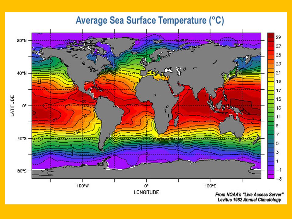
What is the temperature of the water in the deepest oceans?

3
© 2011 Pearson Education, Inc. Chapter Overview Ocean currents are moving loops of water. Surface currents are influenced by major wind belts. Currents redistribute global heat. Thermohaline circulation affects deep currents. Currents affect marine life.

4
© 2011 Pearson Education, Inc. Types of Ocean Currents Surface currents –Wind-driven –Primarily horizontal motion Deep currents –Driven by differences in density caused by differences in temperature and salinity –Vertical and horizontal motions

5
Three-Cell Model of Atmospheric Circulation Remember this wind info from the last chapter???

6
Density

7
Waters of different densities form a layered ocean

8
Global Ocean Currents

9
© 2011 Pearson Education, Inc. Measuring Surface Currents Direct methods –Floating device tracked through time –Fixed current meter Indirect methods –Pressure gradients –Radar altimeters –Doppler flow meter

10
© 2011 Pearson Education, Inc.

11
Global Surface Current Flow

12
© 2011 Pearson Education, Inc. Measuring Deep Currents Floating devices tracked through time Chemical tracers –Tritium –Chlorofluorocarbons Characteristic temperature and salinity Argo

13
© 2011 Pearson Education, Inc. Argo

14
© 2011 Pearson Education, Inc. Surface Currents Occur above pycnocline Frictional drag between wind and ocean Generally follow wind belt pattern Other factors: –Distribution of continents –Gravity –Friction –Coriolis effect

15
© 2011 Pearson Education, Inc. Subtropical Gyres Large, circular loops of moving water Bounded by: –Equatorial current –Western Boundary currents –Northern or Southern Boundary currents –Eastern Boundary currents Centered around 30 degrees latitude

16
© 2011 Pearson Education, Inc. Five Subtropical Gyres North Atlantic – Columbus Gyre South Atlantic – Navigator Gyre North Pacific – Turtle Gyre South Pacific – Heyerdahl Gyre Indian Ocean – Majid Gyre

17
© 2011 Pearson Education, Inc. Subtropical Gyres and Currents

18
© 2011 Pearson Education, Inc. Ekman Spiral Surface currents move at an angle to the wind. The Ekman spiral describes speed and direction of seawater flow at different depths. Each successive layer moves increasingly to the right in the Northern Hemisphere –Coriolis effect

19
© 2011 Pearson Education, Inc. Ekman Transport Average movement of seawater under influence of wind 90 degrees to right of wind in Northern hemisphere 90 degrees to left of wind in Southern hemisphere

20
© 2011 Pearson Education, Inc. Geostrophic Flow Ekman transport piles up water within subtropical gyres. Surface water flows downhill and to the right. Geostrophic flow – balance of Coriolis Effect and gravitational forces Ideal geostrophic flow Friction generates actual geostrophic flow

21
GYRES

22
© 2011 Pearson Education, Inc. Ocean Currents and Climate Warm ocean currents warm the air at the coast. –Warm, humid air –Humid climate on adjoining landmass Cool ocean currents cool the air at the coast. –Cool, dry air –Dry climate on adjoining landmass

23
© 2011 Pearson Education, Inc. Ocean Currents and Climate August February

24
© 2011 Pearson Education, Inc. Upwelling and Downwelling Upwelling – Vertical movement of cold, nutrient-rich water to surface –High biological productivity Downwelling – Vertical movement of surface water downward in water column

25
© 2011 Pearson Education, Inc. Coastal Upwelling Ekman transport moves surface seawater offshore. Cool, nutrient-rich deep water comes up to replace displaced surface waters. Example: U.S. West Coast

26
© 2011 Pearson Education, Inc.

27
Coastal Downwelling Ekman transport moves surface seawater toward shore. Water piles up, moves downward in water column Lack of marine life

30
© 2011 Pearson Education, Inc. Atlantic Ocean Circulation North Atlantic Subtropical Gyre –North Equatorial Current –Gulf Stream –North Atlantic Current –Canary Current –South Equatorial Current –Atlantic Equatorial Counter Current

31
© 2011 Pearson Education, Inc.

32
Gulf Stream Best studied of all ocean currents Meanders and loops Merges with Sargasso Sea – Circulates around center of North Atlantic Gyre – Unique biology – Sargassum

33
© 2011 Pearson Education, Inc. Gulf Stream Meanders or loops may cause loss of water volume and generate: – Warm-core rings – warmer Sargasso Sea water trapped in loop surrounded by cool water – Cold-core rings – cold water trapped in loop surrounded by warmer water Unique biological populations

34
© 2011 Pearson Education, Inc. Climate Effects of North Atlantic Currents North-moving currents – warm Gulf Stream warms East coast of United States and northern Europe North Atlantic and Norwegian Currents warm northwestern Europe South-moving currents – cool Labrador Current cools eastern Canada Canary Current cools north African coast

35
© 2011 Pearson Education, Inc. La Niña Conditions

36
© 2011 Pearson Education, Inc. La Niña – ENSO Cool Phase Increased pressure difference across equatorial Pacific Stronger trade winds Stronger upwelling in eastern Pacific Shallower thermocline Cooler than normal seawater Higher biological productivity

37
© 2011 Pearson Education, Inc. El Niño – Southern Oscillation (ENSO) High pressure in eastern Pacific weakens Weaker trade winds Warm pool migrates eastward Thermocline deeper in eastern Pacific Downwelling Lower biological productivity –Peruvian fishing suffers
 High pressure in eastern Pacific weakens Weaker trade winds Warm pool migrates eastward Thermocline deeper in eastern Pacific Downwelling Lower biological productivity –Peruvian fishing suffers.")
38
© 2011 Pearson Education, Inc. ENSO Conditions in the Pacific Ocean

39
La Nina El Nino

40
© 2011 Pearson Education, Inc. Occurrence of ENSO Events El Niño warm phase about every 2–10 years Highly irregular Phases usually last 12–18 months 10,000-year sediment record of events ENSO may be part of Pacific Decadal Oscillation (PDO) –Long-term natural climate cycle –Lasts 20–30 years
 –Long-term natural climate cycle –Lasts 20–30 years.")
41
La Nina El Nino

42
© 2011 Pearson Education, Inc. ENSO Occurrences

43
© 2011 Pearson Education, Inc. ENSO has Global Impacts

44
© 2011 Pearson Education, Inc. Deep-Ocean Currents Thermohaline Circulation – deep ocean circulation driven by temperature and density differences in water Below the pycnocline 90% of all ocean water Slow velocity

45
© 2011 Pearson Education, Inc. Conveyor Belt Circulation

46
© 2011 Pearson Education, Inc. Power From Currents Currents carry more energy than winds Florida–Gulf Stream Current System Underwater turbines –Expensive –Difficult to maintain –Hazard to boating

47
© 2011 Pearson Education, Inc. End of CHAPTER 7 Ocean Circulation

Similar presentations


>")

 EarthsClimate_Web_Chapter.pdfEarthsClimate_Web_Chapter.pdf, p. 22-24.>")


