Download presentation
Presentation is loading. Please wait.

1
GIS Data Sources

2
GIS Data: Primary Sources
Primary data sources Created “in house” Through your own or your team’s field data collection By transforming data from sources not yet available digitally For use by the same organization High level quality control Often customized for specific project/application Costly

3
Example of Primary Data: GPS Data Input
Supports development of highly accurate geodetic control Links field data collection to locations Cost & accuracy vary

4
GIS Data: Secondary Sources
Secondary data sources Outside data providers Government Third party vendors Transformations and/or conversion often required Formats (e.g., ASCII to GRID) Projections Units of measurements (e.g., feet to meters)
 Projections. Units of measurements (e.g., feet to meters)")
5
GIS Data: Secondary Sources (cont.)
Datasets may be difficult to find Data costs & sensitivity may limit access Need to be aware of vendor’s quality control procedures to be able to judge data quality What type of information included about data (i.e., metadata)? Scale, resolution, field names & descriptions, codes & meaning Need enough info to be able to make decisions about whether data use is appropriate
 Scale, resolution, field names & descriptions, codes & meaning. Need enough info to be able to make decisions about whether data use is appropriate.")
6
Examples of Government Data Providers
U.S. Census Bureau TIGER U.S. Geological Survey (USGS) Imagery, DEMs, DRGs, DLGs Natural Resource Conservation Service STATSGO (U.S. General Soil Map) National Oceanic & Atmospheric Agency Coastal management Oil & chemical spills Coral reef conservation
 Imagery, DEMs, DRGs, DLGs. Natural Resource Conservation Service. STATSGO (U.S. General Soil Map) National Oceanic & Atmospheric Agency. Coastal management. Oil & chemical spills. Coral reef conservation.")
7
Data Sources: U.S. Census Bureau
Charged with the Constitutional responsibility of carrying out the decennial census Census of Population and Housing Very large mapping component involved in undertaking a U.S. national census!

8
U.S. Census Data The U.S. Census acquires data from households about:
Demographic info Race Population Disabilities Migration Economic info Living quarters Occupation Income Social info Languages spoken School enrollment Family structure in the home Marital status Ancestry Foreign-born population

9
Making Census Data Spatial
Census data collected by household Geographic location of the household must be known To find household to deliver questionnaire To relate the questionnaire to a place

10
U.S. Census Data & TIGER/Line Files
The “geography” of the census Topologically Integrated Geographic Encoding & Referencing Examples of layers of this massive dataset: Streets Address ranges of households Landmarks for census-taking County/city/block boundaries

11
U.S. Census Data & TIGER/Line Files
TIGER designed to: Support pre-census functions in preparation for Census of Population and Housing Support census-taking efforts Evaluate success of the Census Provide geographic framework for analysis of Census data

12
Before TIGER/Line TIGER/Line files used in the 1990 and 2000 censuses
Will be used in the future by the Census Bureau Before TIGER/Line files was GBF/DIME system GBF/DIME Created in 1967 Used for the 1970 and 1980 censuses

13
Enumeration Units for TIGER/LINE Files
Census data are not available to public by household Data aggregated to larger geographic units This is why you used blocks and block groups in your lab The data still allow for useful geographic data summaries Prevents breaches of privacy

14
Census Geographic Hierarchy
Hierarchical tabulation systems, e.g.: USA Region Division State County Tract Block Group Block 2000 Census tallies for entire US: 65,443 tracts 208,790 block groups 8,205,582 blocks In North Carolina: 1,563 tracts 5,271 block groups 232,403 blocks

15
TIGER/LINE Files Supporting geography Roads/streets/highways
Basic hydrography Point & area landmarks

16
TIGER Area (Polygon) & Landmark Data
Point and polygon landmarks Census geography (tracts, blocks, etc.) used for reporting Census data ID linkage from polygons in TIGER/Line data to Census attribute data
 used for reporting Census data. ID linkage from polygons in TIGER/Line data to Census attribute data.")
17
TIGER line and address data
Roads Attributes include: Basic road type Address ranges

18
TIGER Address Data Address ranges: street address numbers at the beginning and the end of all arcs/lines in the database Allows address geocoding Match data with address to a spatial location using an interpolated estimate Problem: still some incomplete address range data, esp. in rural areas

19
Using Census data Lets us merge a tremendously rich source of detailed socioeconomic data (Census) with a comprehensive geography for the entire country Orange County, NC block groups w/ median income data (darker green = higher income)
 with a comprehensive geography for the entire country. Orange County, NC block groups w/ median income data (darker green = higher income)")
20
Base Maps “Background framework on which a thematic map is drawn”
For example: the background layer on a GIS that provides a frame of reference for the data being displayed Can be maps of natural features, human-made objects, or both

21
National Topographic Maps
Also called “base maps” These are the starting point of a GIS project E.G., the background data on which you overlay your GIS analysis results Most countries have federal agencies charged with mapping national resources & infrastructure… E.g., United States Geological Survey (USGS) – established 1879 Many European countries far earlier Also previously created by colonial powers for colonies These topographic “base” maps valuable spatial data source Finding and getting access can be difficult if working abroad Contact the national agencies
 – established Many European countries far earlier. Also previously created by colonial powers for colonies. These topographic base maps valuable spatial data source. Finding and getting access can be difficult if working abroad. Contact the national agencies.")
22
National Topographic Maps
The name refers to information (contour lines) about terrain & elevation (topography) However, “topographic maps” generally contain much more than just elevation info Topographic base map info increasingly digital Many developed countries are well into the conversion process U.S. nearly complete Less-developed countries much less so Even with digital source data we may still need to be able to gain access, import data format, etc. from the original maps
 about terrain & elevation (topography) However, topographic maps generally contain much more than just elevation info. Topographic base map info increasingly digital. Many developed countries are well into the conversion process. U.S. nearly complete. Less-developed countries much less so. Even with digital source data we may still need to be able to gain access, import data format, etc. from the original maps.")
23
USGS Topographic Maps Complete coverage of the U.S. (not at all scales) Large-scale - 1:24,000 Occasional maps at 1:25,000 (metric) “7.5-minute quadrangle” map sheets ,000 to cover contiguous U.S. and Hawaii Alaska only available as 1:63,360 Maps include: Contour lines, roads, railroads, hydrography, cemeteries, schools, etc… Smaller-scale 1:100,000 and 1:250,000 topographic map series Same basic things on the map, but much less detail

24
Digital Versions of USGS Topographic Maps
USGS topographic maps were used to make several different digital products Scales 1:24,000 (large scale) + 1:63,360 for Alaska 1:100,000 (intermediate scale) 1:2,000,000 (small scale)
 + 1:63,360 for Alaska. 1:100,000 (intermediate scale) 1:2,000,000 (small scale)")
25
USGS Data: Digital Raster Graphics (DRG)
Raster images of standard topographic maps Scanned and georeferenced Pixel attribute = color

26
USGS Data: Digital Line Graphs (DLG)
Linear features from standard topographic maps May include: Boundaries (state, county, city, national parks/preserves) Hydrography (rivers, streams, lake shores Transportation (roads, streets, railroads) Elevation contours and spot elevation values Image of USGS 1:24,000 West Rapid City (South Dakota) DLG quadrangle. Hydrography shown in cyan, roads in red, pipelines/transmission lines in green, & railroads in blue. (GIF image from USGS.)
 Hydrography (rivers, streams, lake shores. Transportation (roads, streets, railroads) Elevation contours and spot elevation values. Image of USGS 1:24,000 West Rapid City (South Dakota) DLG quadrangle. Hydrography shown in cyan, roads in red, pipelines/transmission lines in green, & railroads in blue. (GIF image from USGS.)")
27
USGS Data: Digital Elevation Models (DEM)
Raster-format elevation data derived from scanned topographic maps Elevation samples at regularly-spaced intervals Raster resolution (i.e., cell size) is limited by the scale of the original topographic map 1:24,000 Quadrangles were used to produce DEMS with a spatial resolution of 30-meters
 is limited by the scale of the original topographic map. 1:24,000 Quadrangles were used to produce DEMS with a spatial resolution of 30-meters.")
28
USGS Remote Sensing Aerial photography
Source of base map data for many products check products 1st Distortions caused by scale, relief, tilt Orthophotos/orthophotoquads (aerial photography) Digital Ortho Quarter Quadrangles (DOQQ) Spatial resolution of ~ 1 – meter Black & White Corrected for scale, relief, tilt distortion Available in analog & digital formats Scale – a photograph over variable terrain represents a range of different scales (object higher in elevation appears bigger than same-sized object at lower elevation) Tilt – aircraft perspective-induced distortion in objects closer due to tilt Relief – Relief > 0.5% of flying height causes distortion Orthophotoquads – based on areas occupied by topo quads
 Digital Ortho Quarter Quadrangles (DOQQ) Spatial resolution of ~ 1 – meter. Black & White. Corrected for scale, relief, tilt distortion. Available in analog & digital formats. Scale – a photograph over variable terrain represents a range of different scales (object higher in elevation appears bigger than same-sized object at lower elevation) Tilt – aircraft perspective-induced distortion in objects closer due to tilt. Relief – Relief > 0.5% of flying height causes distortion. Orthophotoquads – based on areas occupied by topo quads.")
29
USGS Remote Sensing NASA is the agency responsible for developing & launching the satellites, but USGS helps with distribution Many remotely sensed datasets acquired by the US government are available online through EROS (Earth Resources Observation & Science) run by USGS These data are NOT free Cost-free DOQQs are available online for most states Other types of data that can be found in EROS include Landsat TM imagery Color-InfraRed air photography (CIR)
 run by USGS. These data are NOT free. Cost-free DOQQs are available online for most states. Other types of data that can be found in EROS include. Landsat TM imagery. Color-InfraRed air photography (CIR)")
30
How Analog Geographic Data Becomes Digital
For converting: Maps that were made before GIS Maps made in the field by hand Analog photos to digital

31
Input Devices Manual input devices Digitizing GPS Scanners
Transforms information from analog format (e.g., paper, Mylar) digital format for computer storage & display Vector data capture Methods Digitizing tablet On screen digitizing using PC GPS Scanners Vector & raster data capture (depends on scanner type)
 digital format for computer storage & display. Vector data capture. Methods. Digitizing tablet. On screen digitizing using PC. GPS. Scanners. Vector & raster data capture (depends on scanner type)")
32
Input Devices : Small format digitizer

33
Digitizing Tablet Electronically active table surface
Fine grid of wires acts as a Cartesian coordinate system Small & large formats available Cartesian coordinate system: A two-dimensional, planar coordinate system in which x measures horizontal distance and y measures vertical distance. Each point on the plane is defined by an x,y coordinate. --As opposed to the spherical grid system that serves as the basis for lat/long measurements

34
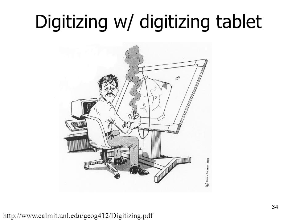
Digitizing w/ digitizing tablet
35
Digitizing Tablet Puck Connected to tablet Records locations from map
Crosshair feature locator Buttons indicate beginning/ending of lines/polygons, left/right polygons

36
Selection & Use of Digitizers
Qualities to be aware of Repeatability Linearity Resolution Skew Stability

37
Selection & Use of Digitizers
Repeatability: Precision; expectation that location data recorded for a single location will be same Good = inch Linearity: Measure of digitizer’s ability to be within a specified distance (tolerance) of the correct value as the puck is move over large distance Common tolerance level: in over 60 in Resolution: Digitizer’s ability to record increments of space Smaller value higher resolution Stability: Tendency of reading to change as digitizer warms up Skew: Do the results produced have the intended shape? Rectangular coordinates input rectangular output Some portions of the tablet can wear out
 of the correct value as the puck is move over large distance. Common tolerance level: in over 60 in. Resolution: Digitizer’s ability to record increments of space. Smaller value higher resolution. Stability: Tendency of reading to change as digitizer warms up. Skew: Do the results produced have the intended shape Rectangular coordinates input rectangular output. Some portions of the tablet can wear out.")
38
Input devices: Scanners
Types: Line-following vector output Placed on line, moves on small wheels Requires technician Distance/time intervals dictate coordinates recorded Problem when line is complex Can get confused (convergence/divergence, color contrast) Flatbed raster output Drum scanners raster output Automated but edits require user intervention A charge-coupled device (CCD) is an image sensor, consisting of an integrated circuit containing an array of linked, or coupled, capacitors sensitive to light. CCDs containing grids of pixels are used in digital cameras, optical scanners and video cameras as light-sensing devices. Can capture the image 1 line at a time or wholly An image is projected by a lens on the capacitor array, causing each capacitor to accumulate an electric charge proportional to the light intensity at that location. Once the array has been exposed to the image, a control circuit causes each capacitor to transfer its contents to its neighbour. The last capacitor in the array dumps its charge into an amplifier that converts the charge into a voltage. By repeating this process, the control circuit converts the entire contents of the array to a varying voltage, which it samples, digitizes and stores in memory.
 Flatbed raster output. Drum scanners raster output. Automated but edits require user intervention. A charge-coupled device (CCD) is an image sensor, consisting of an integrated circuit containing an array of linked, or coupled, capacitors sensitive to light. CCDs containing grids of pixels are used in digital cameras, optical scanners and video cameras as light-sensing devices. Can capture the image 1 line at a time or wholly. An image is projected by a lens on the capacitor array, causing each capacitor to accumulate an electric charge proportional to the light intensity at that location. Once the array has been exposed to the image, a control circuit causes each capacitor to transfer its contents to its neighbour. The last capacitor in the array dumps its charge into an amplifier that converts the charge into a voltage. By repeating this process, the control circuit converts the entire contents of the array to a varying voltage, which it samples, digitizes and stores in memory.")
39
Flatbed scanner & CCD Inexpensive & commonly available
Use CCD (charge-coupled device) Output: raster image Can be converted to vector CCDs: commonly used in aerial photography, satellite remote sensing, and digital cameras Light is converted into a pattern of electronic charges
 Output: raster image. Can be converted to vector. CCDs: commonly used in aerial photography, satellite remote sensing, and digital cameras. Light is converted into a pattern of electronic charges.")
40
Input devices: Drum scanner
Scans one line at a time Drum rotates & sensor moves perpendicular to direction of rotation Can take longer maps than flatbed Output: raster image Can be converted to vector From Fundamentals of Geographic Information Systems, Demers (2005)
")
41
Making New Geographic Datasets Manually From Existing Digital Data
Often done by manually “drawing” features on air photos or satellite imagery on screen Can be used for small areas or in cases where a computer algorithm doesn’t adequately map the features of interest

42
On-screen digitizing w/ PC
DOQ used in image above. DOQ: A photographic image that has been converted to raster form and horizontally corrected for the effects of relief displacement, aircraft tip and tilt, and other image distortions and displacements. It is a photographic map stored in a digital computer environment. Also called “heads-up” digitizing

Similar presentations


