Download presentation
Presentation is loading. Please wait.

1
Skill – C O N T O U R S

2
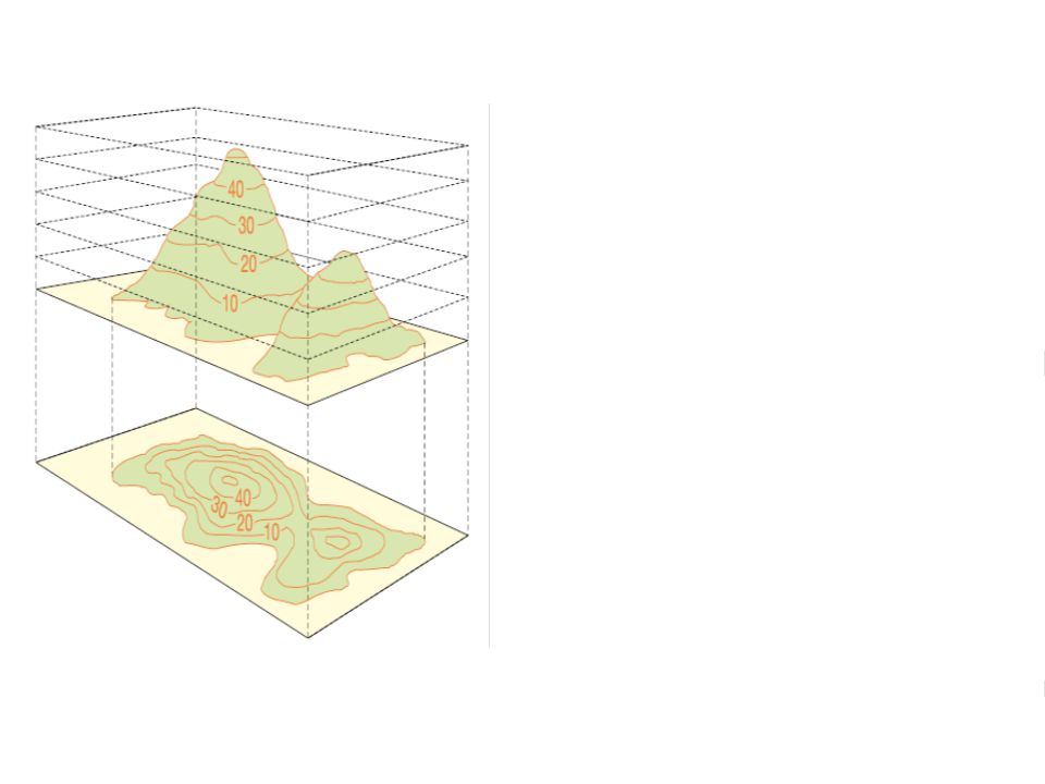
What are they and why are they used? Contours are lines joining places of equal elevation above sea level. Contours lines provide geographers with information about: 1.Height of the ground above sea level (written on each contour is the height of the ground above sea level.) 2.The difference in height between two adjacent contours is the contour interval. 3.Slope of the land – the slope of the land is determined by the spacing between adjacent contours. 4.Shape of the land – the shape of the land formed by the contour lines determines particular types of landforms. 3D ANIMATION
 2.The difference in height between two adjacent contours is the contour interval. 3.Slope of the land – the slope of the land is determined by the spacing between adjacent contours. 4.Shape of the land – the shape of the land formed by the contour lines determines particular types of landforms. 3D ANIMATION.")
4
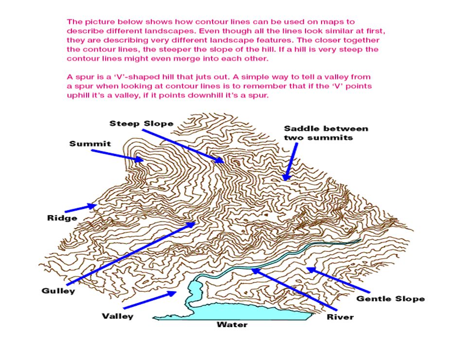
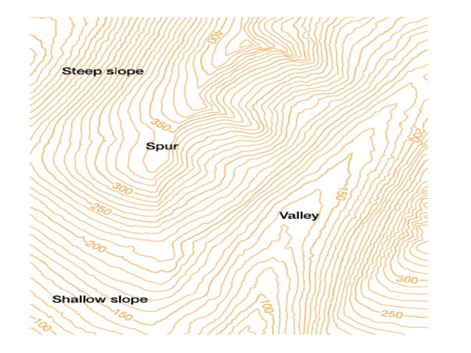
Patterns to remember about Contours Steep slope contours are close together Gentle slope contours are widely spaced Uniform slope contours are evenly spaced Concave slope contours are close together at the centre and widely spaced at the outer edge Convex slope contours are widely spaced at the centre and close together at the outer edge

8
Contour matching exercise Press to play

Similar presentations


>")


