Download presentation
Presentation is loading. Please wait.

4
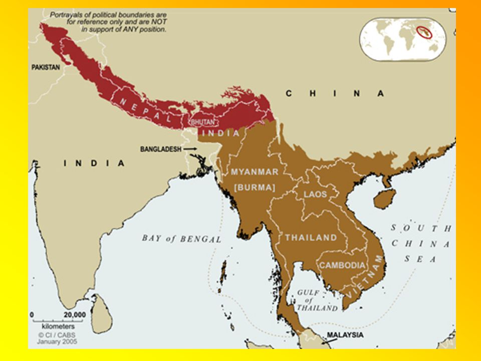
The Indian sub-continent

8
The highest mountain range in the world, located between India and China on an east-west axis.

14
The highest point on Earth Elevation: 29,035 feet

16
Located on the border of Nepal and China.

23
Average elevation: 16,000 ft.

42
Highest mountain in Japan at 12,388 ft. Extinct volcano. Last erupted in 1707.

43
Mt. Fuji is a sacred mountain. Thousands hike to its summit every summer.

46
Largest desert in Asia. Fourth largest desert in the world.

48
The Gobi is a “cold desert” – high latitude.

51
The source of all major river systems in Asia is the Himalaya Mountains or the Tibetan Plateau.

52
Large rivers in mountainous areas make transportation very difficult.

56
According to Hindu belief, the Ganges River spouts from Lord Shiva, a Hindu deity. The water is therefore sacred.

58
The Ganges is one of the most polluted rivers in the world.

63
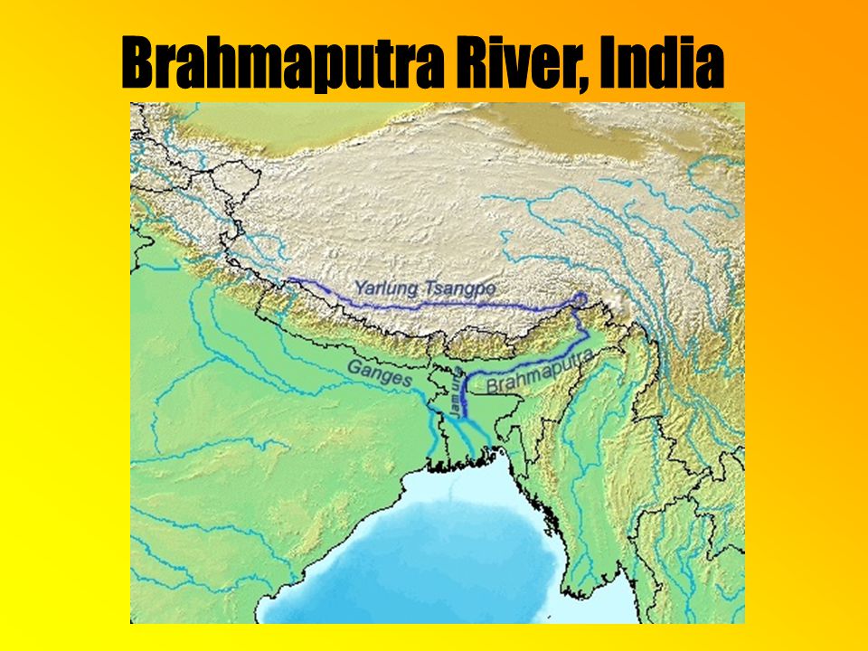
Begins on the Tibetan Plateau in China.

64
Flows through India into Bangladesh.

65
Like the Ganges, the Brahmaputra is a sacred river to Hindus.

68
The name “India” is derived from this river. The name “India” is derived from this river. It flows from the mountains of Tibet through Pakistan and into the Arabian Sea It flows from the mountains of Tibet through Pakistan and into the Arabian Sea

69
The Indus begins high in the Himalaya Mountains in India in a region called Kashmir. It then flows into Pakistan.

70
India and Pakistan are in a tense duel over the right to use the Indus’ water. This dam is in Pakistan.

71
Control of Kashmir means control of the Indus. It is no small matter. The two countries have fought wars over this territory.

73
Mekong River

74
The “turbulent river” is about 3,000 miles long. It is the 11 th longest river in the world. Many rapids and waterfalls make the Mekong difficult to navigate.

75
Mekong River The Mekong in Laos.

76
Mekong River Khone Falls in Laos prevents the Mekong from being useful for transporting goods to China.

77
Mekong River U.S. Navy boats were common on the Mekong in the 1960s during the Vietnam War.

78
Yangtze (Chang Jiang) River The Yangtze is the longest river in Asia, 3,915 miles. It is the third longest river in the world after the Nile and the Amazon.

79
Yangtze River The Yangtze begins in the Dangla Mountains on the Tibetan plateau.

80
Yangtze River The Yangtze crossing the Tibetan Plateau.

81
Yangtze River The “first turn” of the Yangtze in Yunnan Province.

82
Yangtze River Building new freight boats on the banks of the Yangtze.

83
Yangtze River The Three Gorges dam on the Yangtze.

84
Yangtze River The Three Gorges dam on the Yangtze.

85
Yangtze River Focus question: Why is the Three Gorges Dam being constructed?

86
Yellow (Huang He) River The second longest river in China, sixth longest in the world at 3,398 miles. Sometimes called “The River” or the “Mother River” by the Chinese.

87
Yellow River Like the Yangtze, it begins on the Tibetan Plateau.

88
Yellow (Huang He) River Water being released from the Xiaolangdi Dam on the Yellow River.
 River Water being released from the Xiaolangdi Dam on the Yellow River.")
89
Yellow (Huang He) River loess The river gets its English name from the color of the water as it carries loess soil eroded from the arid interior. Loess: Eroded soil carried by a river during flooding.

90
Yellow (Huang He) River loess As the loess erodes, the river turns yellow in color.
 River loess As the loess erodes, the river turns yellow in color.")
91
Yellow (Huang He) River Focus question: Why the name “yellow?”
 River Focus question: Why the name yellow")
92
Yellow (Huang He) River Focus question: Why the name “yellow?”
 River Focus question: Why the name yellow")
93
Yellow (Huang He) River In 1931, severe flooding on the Yellow River killed 3,700,000 people, the worst natural disaster in human history. It has another nickname: “China’s Sorrow.”

94
The Citarum River in Indonesia might be THE most polluted river in the world. The people no longer fish. It is more profitable to forage the garbage for items to sell.

95
Sadly, people still rely on the Citarum for their washing, cooking and drinking water.

96
Much of East Asia is prone to earthquakes and volcanoes because it is on the ____________________.

Similar presentations


 FSMS Standard SS7G9.a Standard SS7G9.a Days 1-3 Days 1-3.>")


 Largest Mountain chain in the world.>")
