Download presentation
Presentation is loading. Please wait.

1
The National Hydrography Dataset Plus What is NHDPlus?

2
Vision for a National Geospatial Surface Water Framework
National Hydrography Dataset (NHD) National Elevation Dataset (NED) Watershed Boundary Dataset (WBD) How will this vision be attained?
 National Elevation Dataset (NED) Watershed Boundary Dataset (WBD) How will this vision be attained")
3
The Team EPA Project Lead Tommy Dewald Horizon Systems Cindy McKay
Jen Hill Bob Deffenbaugh USGS WRD Al Rea Rich Moore Craig Johnston Modeling Consultant Tim Bondelid

4
NHDPlus links the mapped stream network
An integrated suite of application-ready geospatial surface water data products. It’s the first national effort to integrate: National Hydrography Dataset (NHD) National Elevation Dataset (NED) National Watershed Boundary Dataset (WBD) National Land Cover Dataset (NLCD) NHDPlus links the mapped stream network to the landscape.
 National Elevation Dataset (NED) National Watershed Boundary Dataset (WBD) National Land Cover Dataset (NLCD) NHDPlus links the mapped stream network. to the landscape.")
5
NHD Plus – What’s Inside?
Greatly improved 1:100K National Hydrography Dataset PLUS (9 more components): Value Added Attributes Elevation-based Catchments Catchment Characteristics Headwater Node Areas Cumulative Drainage Area Characteristics Flow Direction, Flow Accumulation, and Elevation Grids Min/Max Elevations and Slopes Flow Volume & Velocity Estimates Flow Gages with Network Locations NHDPlus evolved from an EPA project intended to produce flow volume and velocity estimates for the stream network in 1:100K NHD. Along the way, we produced a set of very useful components. Obviously the first is (CLICK) READ
: Value Added Attributes. Elevation-based Catchments. Catchment Characteristics. Headwater Node Areas. Cumulative Drainage Area Characteristics. Flow Direction, Flow Accumulation, and Elevation Grids. Min/Max Elevations and Slopes. Flow Volume & Velocity Estimates. Flow Gages with Network Locations. NHDPlus evolved from an EPA project intended to produce flow volume and velocity estimates for the stream network in 1:100K NHD. Along the way, we produced a set of very useful components. Obviously the first is (CLICK) READ.")
6
What is the National Hydrography Dataset (NHD)?
A Framework dataset that includes: Hydrographic features for making maps A national stream addressing system A modeling network for navigating upstream/downstream A maintenance infrastructure User updates Distributed formats – personal geodatabase, shapefiles, coverages Compatible with ArcHydro Model & Tools As the name implies NHDPlus begins with the NHD. Courses on NHD can last the better part of a week. Here is NHD in a single slide. First of all it’s a Framework dataset – that’s framework with a capital F – because the Federal Geographic Data Committee has designated NHD as national framework layer for hydrography. NHD consists of a set of approximately 50 hydrographic feature types that can be used to make maps. NHD contains a national stream addressing system that enables you to tie points (CLICK) such as drinking water intakes or monitoring stations to positions along the NHD stream network. Or you can tie information such as locations of impairments (CLICK) to stretches along the a stream. The stream network provides a modeling network on which you can navigate upstream and downstream. Possibly one of NHD’s most important characteristics is that it has a maintenance infrastructure that allows and even encourages user updates. All the NHD predecessors (the EPA River Reach Files and the USGS Digital Line Graph datasets) either did not support any updating or didn’t support updates from the user community. NHD is distributed in a variety of formats including pgdb and shapefiles. Finally, NHD is compatible with the ArcHydro data model and the ArcHydro tool set. 3 1 2 Impairment Drinking Water Intake
 such as. drinking water intakes or monitoring stations to positions along the NHD stream network. Or you can tie information such as locations of impairments (CLICK) to stretches along the a stream. The stream network provides a modeling network on which you can navigate upstream and downstream. Possibly one of NHD’s most important characteristics is that it has a maintenance infrastructure that allows and even encourages user updates. All the NHD predecessors (the EPA River Reach Files and the USGS Digital Line Graph datasets) either did not support any updating or didn’t support updates from the user community. NHD is distributed in a variety of formats including pgdb and shapefiles. Finally, NHD is compatible with the ArcHydro data model and the ArcHydro tool set Impairment. Drinking. Water. Intake.")
7
Value-Added Attributes
(Stream Order, Stream Level, Waterbody-Network link and more…) A set of two dozen network characteristics Derived from native NHD content For Analysis, Navigation & Display
 A set of two dozen network characteristics. Derived from native NHD content. For Analysis, Navigation & Display.")
8
Elevation Grid (elev_cm)
National Elevation Data (NED) used to create the NHDPlus
 used to create the NHDPlus.")
9
Hydrologically-Conditioned Elevation
National Hydrography Dataset (NHD) Watershed Boundary Dataset (WBD) The first elevation processing step was to hydrologically condition the elevation values. This means that we made the (CLICK) elevation data agree with the (CLICK) watershed boundary dataset and (CLICK) with the NHD dataset. National Elevation Dataset (NED)
 Watershed. Boundary. Dataset (WBD) The first elevation processing step was to hydrologically condition the elevation values. This means that we made the (CLICK) elevation data agree with the (CLICK) watershed boundary dataset and (CLICK) with the NHD dataset. National. Elevation. Dataset (NED)")
10
Flow Direction Grid (FDR)
Cells point down hill to the neighboring cell with the lowest elevation Flow Accumulation Grid (FAC) 5 Cells contains the count of the number of cells that are uphill
 5. Cells contains the count of the number of cells that are uphill.")
11
Catchment Grid & Shapefile
The portion of the land surface that drains to a network flowline

12
Catchment Attributes Mean Annual Temperature (Prism - 4km)
Mean Annual Precipitation (Prism - 4km) % of each of the 21 land use classifications from the 1992 National Land Cover Dataset (NLCD)
 % of each of the 21 land use classifications from the 1992 National Land Cover Dataset (NLCD)")
13
Flowline Attributes Raw min/max elevations Smoothed min/max elevations
Slope Cumulative drainage area Cumulative land use classifications Flow volume, incremental inflow – Unit Runoff Method Flow volume – Vogel Method Velocity – Jobsen

14
USGS Gage Point Events on NHDPlus – Coming Soon!
Many Attributes: Gage ID Reachcode/Measure Lat/Long Agency Station Name Several Dozen Flow Stats And more… We built this file as part of the NHDPlus project. Blind snap to NHD network. QAQC by WRD District Offices Conversion of qaqc’ed locations to reachcodes/measures Distributed as a shapefile. This was not a totally altruistic exercise. We needed these gages to qaqc our drainage areas and flow volume and velocity. So this is a perfect time to take a break and when we come back Tim will talk about remaining parts of NHDPlus. Before we break, we have a few minutes for questions – does anyone have questions?

15
Distribution Units for Elevation, FAC, and FDR Grids
62 units total

16
NHDPlus Distribution Units for NHD, Catchments, and Attribute Tables
09 17 10U 01 04 02 07 16 10L 14 05 18 11 06 15 13 08 03 0318 20 12 10 06 01 02 03 04 09 11 07 05 12 13 14 16 17 18 20 0318 08 15

17
Linking Data to the NHDPlus
Linear Reach: Measure: Point Links Linear Links Linear Reach: From Measure: 15.0 To Measure: Area Links Waterbody Reach: shape

18
Things Linked to NHDPlus
EPA Water Programs Water Quality Standards Water Quality Monitoring Stations Assessed Waters Impaired Waters Nonpoint Source Projects Beaches Fish Consumption Advisories Sewage No Discharge Zones Permitted Dischargers Drinking Water Intakes Drinking Water Wells Clean Watershed Needs Special Appropriations Projects And More… USGS Flow Gages Rather than creating events, you may chose to use the many, many events that have been tied to NHD by various federal and state agencies. For example, here is the list of events available from EPA. Many EPA Water Programs have been linked to NHD. (CLICK) This is the current list but it’s constantly growing. (CLICK)Some of the event tables are downloadable from the EPA website.
 This is the current list but it’s constantly growing. (CLICK)Some of the event tables are downloadable from the EPA website.")
22
A Quick Example of Analysis Using NHDPlus

23
STEP 1 Knowing this is all well and good, except the discharge points on an impaired water are not the only discharge points that we need to be concerned about. The ones upstream of an impaired water may also be important to our analysis. So lets pick an impaired water and use our VAA navigation tool to click on the downstream end of the impairment and (CLICK)
")
24
STEP 2

25
STEP 3

26
STEP 4

27
STEP 5

28
STEP 6

29
STEP 7

30
STEP 8 Value Added Attributes Temperature & Precipitation Flow Volume
Velocity Land Use

31
Watershed Characterization
Main Stem: Huntsville Spring Branch Stream Order: 3 Stream Level: 4 Area weighted precipitation mm Area weighted temperature oC Land Use Open Water 1% Residential 28% Commercial/Ind/Trans 9% Barren % Forest % Pasture/Hay % Row Crops 12% Urban/Rec Grasses 5% Wetlands 5% Other 1% Drainage area km2 Mean Annual Flow (UROM) cfs Mean Annual Flow (Vogel) cfs Mean Annual Velocity (UROM) 0.95 fps Mean Annual Velocity (Vogel) fps So we know that – READ We’ve done all this with just the native NHDPlus content.
 cfs. Mean Annual Flow (Vogel) cfs. Mean Annual Velocity (UROM) 0.95 fps. Mean Annual Velocity (Vogel) 0.87 fps. So we know that – READ. We’ve done all this with just the native NHDPlus content.")
32
Importance of the NHDPlus
The NHDPlus Is a Complete Analytical Tool Very Robust Stream Network New Attributes for Improved Applications Catchments, FDR, FAC and Elevation Add the Landscape into the Analytic Environment Watershed Delineation and Characterization Integration with virtually any landscape dataset Models!!!!

33
NHDPlus – What’s Available?
Data: Great Lakes (04) Mississippi (05, 06, 07, 08, 10, 11 and 0318) Texas (12) Rio Grande (13) Colorado (14 and 15) Great Basin (16) Pacific Northwest (17) California (18) New England (01) Mid-Atlantic (02) By End of September – South Atlantic (03), Souris-Red-Rainy (09) Documentation: User Guide Various Presentations Metadata Release Notes for each hydro region Training: Eight Exercises/Tutorials Tools: NHD Flow Table Navigator NHDPlus VAA Navigator #0 – Preparation #1 – Setting Up The Data #2 – Linking Data to NHD #3 – Navigating with Geometry #4 – Navigating with VAAs & Flow Table #5 – Network Analysis #6 – Raster Dataset #7 – Watershed Delineation #8 – Simple Model
 Mississippi (05, 06, 07, 08, 10, 11 and 0318) Texas (12) Rio Grande (13) Colorado (14 and 15) Great Basin (16) Pacific Northwest (17) California (18) New England (01) Mid-Atlantic (02) By End of September – South Atlantic (03), Souris-Red-Rainy (09) Documentation: User Guide. Various Presentations. Metadata. Release Notes for each hydro region. Training: Eight Exercises/Tutorials. Tools: NHD Flow Table Navigator. NHDPlus VAA Navigator. #0 – Preparation. #1 – Setting Up The Data. #2 – Linking Data to NHD. #3 – Navigating with Geometry. #4 – Navigating with VAAs & Flow Table. #5 – Network Analysis. #6 – Raster Dataset. #7 – Watershed Delineation. #8 – Simple Model.")
34
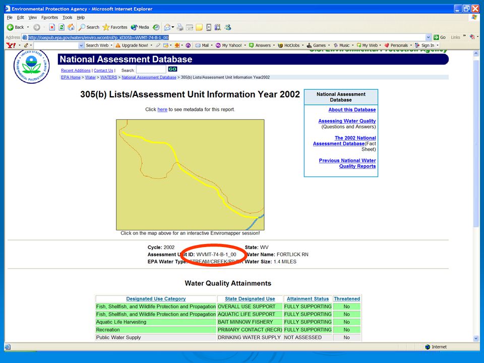
Where to get NHDPlus Data, Documentation, Presentations, Exercises and Tools
Web Site: Click on “NHDPlus” Web Site: FTP Site: ftp://ftp.horizon-systems.com/nhdplus Fall 2006: In the EPA Waters Database

Similar presentations


 1.Set PowerPoint to work in Outline. View/Normal click.>")


 4(d² + 4) 3rs(2r – s) 15cd(1 + 2cd) 8(4a² + 3b²)>")


