Download presentation
Presentation is loading. Please wait.

1
Public Health Informatics and GIS Maged N Kamel Boulos, PhD, FRGS Senior Lecturer in Health Informatics University of Plymouth mnkamelboulos@plymouth.ac.uk mnkamelboulos@plymouth.ac.uk “ The lecturer should give the audience full reason to believe that all his powers have been exerted for their pleasure and instruction. ” — Michael Faraday (1791-1867) - English physicist
 - English physicist.")
2
Agenda Introduction to Public Health Informatics Introduction to Public Health Informatics Definition and Growth as a Discipline Definition and Growth as a Discipline Four Underpinning Principles Four Underpinning Principles Syndromic Surveillance and e-Epidemiology Syndromic Surveillance and e-Epidemiology Geographic Information Systems Geographic Information Systems Definition and Value Definition and Value Applications Applications Internet GIS Internet GIS Spatially Enabling Health Organisations — Tomlinson ’ s Methodology Spatially Enabling Health Organisations — Tomlinson ’ s Methodology Related Technologies (RS, GPS, LBS, Consumer Geoinformatics) Related Technologies (RS, GPS, LBS, Consumer Geoinformatics) Resources Resources
 Related Technologies (RS, GPS, LBS, Consumer Geoinformatics) Resources Resources")
3
Portland Square Building, University of Plymouth, Plymouth, UK – Photo © MNK Boulos

4
Public Health Informatics: An “ Emerging ” Discipline Like the very closely related term Geographic Information Systems, this term, Public Health Informatics, has been added to MeSH (Medical Subject Headings) very recently in 2003.* * MeSH Links: http://www.nlm.nih.gov/cgi/mesh/2006/MB_cgi?mode=&term=Geographic+Information+Systems&field=entry http://www.nlm.nih.gov/cgi/mesh/2006/MB_cgi?mode=&term=Public+Health+Informatics&field=entry Like the very closely related term Geographic Information Systems, this term, Public Health Informatics, has been added to MeSH (Medical Subject Headings) very recently in 2003.* * MeSH Links: http://www.nlm.nih.gov/cgi/mesh/2006/MB_cgi?mode=&term=Geographic+Information+Systems&field=entry http://www.nlm.nih.gov/cgi/mesh/2006/MB_cgi?mode=&term=Public+Health+Informatics&field=entry http://www.nlm.nih.gov/cgi/mesh/2006/MB_cgi?mode=&term=Geographic+Information+Systems&field=entry http://www.nlm.nih.gov/cgi/mesh/2006/MB_cgi?mode=&term=Public+Health+Informatics&field=entry http://www.nlm.nih.gov/cgi/mesh/2006/MB_cgi?mode=&term=Geographic+Information+Systems&field=entry http://www.nlm.nih.gov/cgi/mesh/2006/MB_cgi?mode=&term=Public+Health+Informatics&field=entry
 very recently in 2003.* * MeSH Links: mode=&term=Geographic+Information+Systems&field=entry mode=&term=Public+Health+Informatics&field=entry Like the very closely related term Geographic Information Systems, this term, Public Health Informatics, has been added to MeSH (Medical Subject Headings) very recently in 2003.* * MeSH Links: mode=&term=Geographic+Information+Systems&field=entry mode=&term=Public+Health+Informatics&field=entry mode=&term=Geographic+Information+Systems&field=entry mode=&term=Public+Health+Informatics&field=entry mode=&term=Geographic+Information+Systems&field=entry mode=&term=Public+Health+Informatics&field=entry")
6
Early Definition/Recognition (1995) “ “ Public Health Informatics ” (PHI) is the science of applying information-age technology to serve the specialized needs of public health. ” * * Friede A, Blum HL, McDonald M: Public health informatics: how information-age technology can strengthen public health. Annual Review of Public Health 1995, 16: 239- 252. “ “ Public Health Informatics ” (PHI) is the science of applying information-age technology to serve the specialized needs of public health. ” * * Friede A, Blum HL, McDonald M: Public health informatics: how information-age technology can strengthen public health. Annual Review of Public Health 1995, 16: 239- 252.
 is the science of applying information-age technology to serve the specialized needs of public health. * * Friede A, Blum HL, McDonald M: Public health informatics: how information-age technology can strengthen public health. Annual Review of Public Health 1995, 16:")
7
Today (March 2006)
")
8
Postgraduate Degrees in PHI

10
Four universities — Columbia University, the Johns Hopkins University School of Medicine, the University of Utah, and the University of Washington — now offer two-year fellowships in Public Health Informatics. The programs, designed to prepare public health leaders to apply informatics to public health problems, are supported by a $3.68 million grant from The Robert Wood Johnson Foundation to the US National Library of Medicine (NLM).
..")
11
Dedicated Research Groups/Academic Departments

12
Public Health Informatics at The University of Manchester, UK “ Public Health Informatics is the study of systems for creating information and managing knowledge to understand, protect and improve health in society. ”

13
So Again What Is PHI? PHI is “ the systematic application of information and computer science and technology to public health practice, research and learning. ” * * Yasnoff WA, O ’ Carroll PW, Koo D, Linkins RW, Kilbourne EM: Public health informatics: improving and transforming public health in the information age. J Public Health Manag Pract 2000 Nov, 6(6): 67-75. Koo D, O'Carroll P, LaVenture M: Public health 101 for informaticians. J Am Med Inform Assoc 2001 Nov-Dec, 8(6): 585-97. PHI is “ the systematic application of information and computer science and technology to public health practice, research and learning. ” * * Yasnoff WA, O ’ Carroll PW, Koo D, Linkins RW, Kilbourne EM: Public health informatics: improving and transforming public health in the information age. J Public Health Manag Pract 2000 Nov, 6(6): 67-75. Koo D, O'Carroll P, LaVenture M: Public health 101 for informaticians. J Am Med Inform Assoc 2001 Nov-Dec, 8(6): 585-97.
: Koo D, O Carroll P, LaVenture M: Public health 101 for informaticians. J Am Med Inform Assoc 2001 Nov-Dec, 8(6): PHI is the systematic application of information and computer science and technology to public health practice, research and learning. * * Yasnoff WA, O ’ Carroll PW, Koo D, Linkins RW, Kilbourne EM: Public health informatics: improving and transforming public health in the information age. J Public Health Manag Pract 2000 Nov, 6(6): Koo D, O Carroll P, LaVenture M: Public health 101 for informaticians. J Am Med Inform Assoc 2001 Nov-Dec, 8(6):")
14
Four Underpinning Principles As a discipline, PHI focuses on the information science and technology applications that are relevant to public health, while always keeping in mind that: As a discipline, PHI focuses on the information science and technology applications that are relevant to public health, while always keeping in mind that: 1. The primary focus of public health is to promote the health of populations and not the health of specific individuals. 2. The primary strategy of public health is prevention of disease and injury by altering the conditions or the environment that put populations at risk. 3. Public health professionals explore the potential for prevention at all vulnerable points in the causal chains leading to disease, injury, or disability; public health activities are not restricted to particular social, behavioural, or environmental contexts. 4. Public health interventions must reflect the governmental context in which public health is practiced. (Yasnoff et al., 2000; Koo et al., 2001)
.")
15
The Bio/Medical/Health/Public Health Informatics Continuum

16
Related Terms/Sub- disciplines -1 Syndromic Surveillance

19
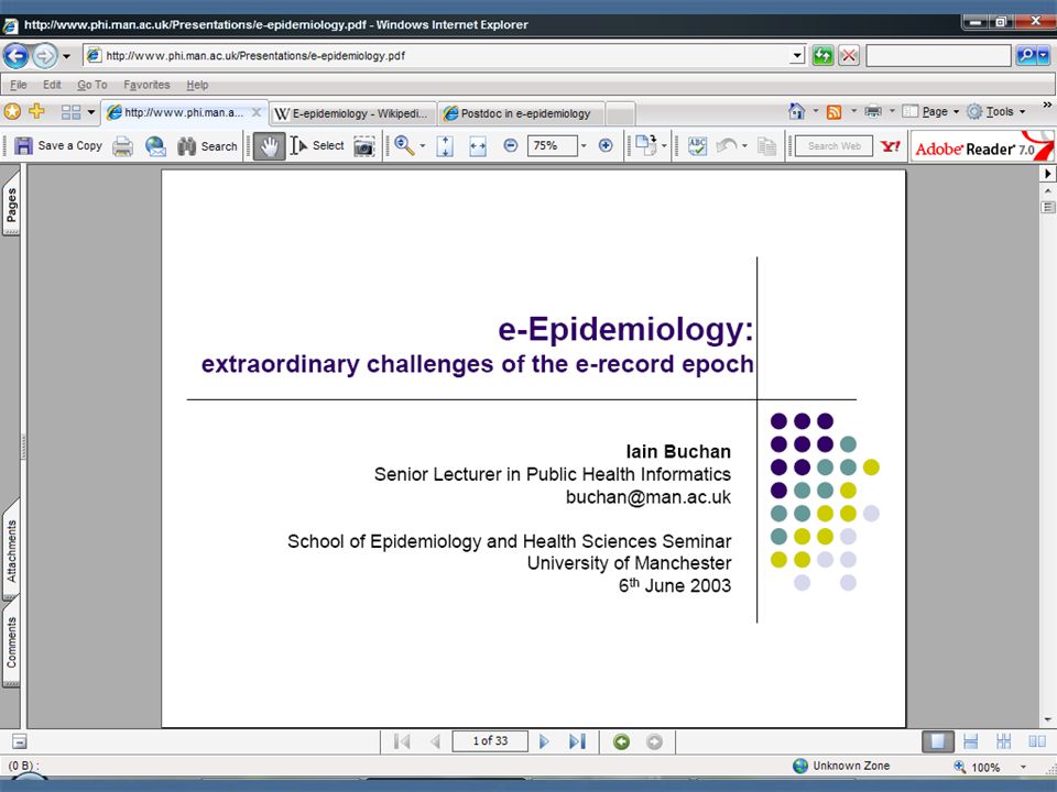
Related Terms/Sub- disciplines -2 e-Epidemiology

21
Important aspects of e-epidemiology include the development of security and confidentiality preserving solutions to protect individual integrity and research data ownership.

22
The Barbican Harbour, Plymouth, UK – Photo © MNK Boulos

23
Geographic Information Systems Important core set of methods in Public Health Informatics. Important core set of methods in Public Health Informatics. “ GIS is (are) not simply the geographical equivalent of word processing. It is a way of integrating information from different sources and doing so in a way, which is underpinned by good science. From this comes added value: the range of questions which can be addressed expands very rapidly as the number of data sets safely linked together is increased. ” — David Rhind, CBE, Vice-Chancellor of City University, London “ GIS is (are) not simply the geographical equivalent of word processing. It is a way of integrating information from different sources and doing so in a way, which is underpinned by good science. From this comes added value: the range of questions which can be addressed expands very rapidly as the number of data sets safely linked together is increased. ” — David Rhind, CBE, Vice-Chancellor of City University, London
 not simply the geographical equivalent of word processing. It is a way of integrating information from different sources and doing so in a way, which is underpinned by good science. From this comes added value: the range of questions which can be addressed expands very rapidly as the number of data sets safely linked together is increased. — David Rhind, CBE, Vice-Chancellor of City University, London GIS is (are) not simply the geographical equivalent of word processing. It is a way of integrating information from different sources and doing so in a way, which is underpinned by good science. From this comes added value: the range of questions which can be addressed expands very rapidly as the number of data sets safely linked together is increased. — David Rhind, CBE, Vice-Chancellor of City University, London.")
24
GIS in MeSH 2006

25
PubMed (March 2006)
")
26
GIS in Health and Healthcare The US FGDC* defines GIS as “ computer systems for the input, storage, maintenance, management, retrieval, analysis, synthesis, and output of geographic or location- based information. In the most restrictive usage, GIS refer only to hardware and software. In common usage (by organisations), they include hardware, software, and data. For some, GIS also imply the people and procedures involved in GIS operation. ” The US FGDC* defines GIS as “ computer systems for the input, storage, maintenance, management, retrieval, analysis, synthesis, and output of geographic or location- based information. In the most restrictive usage, GIS refer only to hardware and software. In common usage (by organisations), they include hardware, software, and data. For some, GIS also imply the people and procedures involved in GIS operation. ” GIS have many potential applications in studying geographically differentiated health and healthcare phenomena, and changes in those phenomena over time, for example, cardiovascular disease in a given community. GIS have many potential applications in studying geographically differentiated health and healthcare phenomena, and changes in those phenomena over time, for example, cardiovascular disease in a given community. * Federal Geographic Data Committee
, they include hardware, software, and data. For some, GIS also imply the people and procedures involved in GIS operation. The US FGDC* defines GIS as computer systems for the input, storage, maintenance, management, retrieval, analysis, synthesis, and output of geographic or location- based information. In the most restrictive usage, GIS refer only to hardware and software. In common usage (by organisations), they include hardware, software, and data. For some, GIS also imply the people and procedures involved in GIS operation. GIS have many potential applications in studying geographically differentiated health and healthcare phenomena, and changes in those phenomena over time, for example, cardiovascular disease in a given community. GIS have many potential applications in studying geographically differentiated health and healthcare phenomena, and changes in those phenomena over time, for example, cardiovascular disease in a given community. * Federal Geographic Data Committee.")
27
Cardiovascular Disease Example cardiovascular disease data are geographically differentiated, and hence lend themselves naturally to GIS processing. “ Cardiovascular disease (CVD), including coronary heart disease (CHD) and stroke, is the leading cause of death in the United States, and state rates of CVD vary by state and by region of the country. Several behavioural risk factors (i.e., overweight, physical inactivity, smoking, hypertension, and diabetes mellitus) and preventive practices (i.e., weight loss and smoking cessation) are associated with the development of CVD and also vary geographically. ” Quoted from: Hahn RA, Heath GW, Chang MH: Cardiovascular disease risk factors and preventive practices among adults — United States, 1994: a behavioral risk factor atlas. Behavioral Risk Factor Surveillance System State Coordinators. MMWR CDC Surveill Summ 1998 Dec 11, 47(5): 35-69. See also: http://www.cdc.gov/cvh/maps/cvdatlas/index.htm cardiovascular disease data are geographically differentiated, and hence lend themselves naturally to GIS processing. “ Cardiovascular disease (CVD), including coronary heart disease (CHD) and stroke, is the leading cause of death in the United States, and state rates of CVD vary by state and by region of the country. Several behavioural risk factors (i.e., overweight, physical inactivity, smoking, hypertension, and diabetes mellitus) and preventive practices (i.e., weight loss and smoking cessation) are associated with the development of CVD and also vary geographically. ” Quoted from: Hahn RA, Heath GW, Chang MH: Cardiovascular disease risk factors and preventive practices among adults — United States, 1994: a behavioral risk factor atlas. Behavioral Risk Factor Surveillance System State Coordinators. MMWR CDC Surveill Summ 1998 Dec 11, 47(5): 35-69. See also: http://www.cdc.gov/cvh/maps/cvdatlas/index.htmhttp://www.cdc.gov/cvh/maps/cvdatlas/index.htm
, including coronary heart disease (CHD) and stroke, is the leading cause of death in the United States, and state rates of CVD vary by state and by region of the country. Several behavioural risk factors (i.e., overweight, physical inactivity, smoking, hypertension, and diabetes mellitus) and preventive practices (i.e., weight loss and smoking cessation) are associated with the development of CVD and also vary geographically. Quoted from: Hahn RA, Heath GW, Chang MH: Cardiovascular disease risk factors and preventive practices among adults — United States, 1994: a behavioral risk factor atlas. Behavioral Risk Factor Surveillance System State Coordinators. MMWR CDC Surveill Summ 1998 Dec 11, 47(5): See also: cardiovascular disease data are geographically differentiated, and hence lend themselves naturally to GIS processing. Cardiovascular disease (CVD), including coronary heart disease (CHD) and stroke, is the leading cause of death in the United States, and state rates of CVD vary by state and by region of the country. Several behavioural risk factors (i.e., overweight, physical inactivity, smoking, hypertension, and diabetes mellitus) and preventive practices (i.e., weight loss and smoking cessation) are associated with the development of CVD and also vary geographically. Quoted from: Hahn RA, Heath GW, Chang MH: Cardiovascular disease risk factors and preventive practices among adults — United States, 1994: a behavioral risk factor atlas. Behavioral Risk Factor Surveillance System State Coordinators. MMWR CDC Surveill Summ 1998 Dec 11, 47(5): See also:")
28
Data Linkage Health organisations in developed countries regularly collect and store a vast array of data from multiple sources, much of which is linkable through some kind of unique person/patient identifier. Health organisations in developed countries regularly collect and store a vast array of data from multiple sources, much of which is linkable through some kind of unique person/patient identifier. These data sets can in turn be linked to many other data sets that contribute to “ the big picture ” from different government, public and private entities, using location as main key/common linker. (According to the US FGDC, geographic location is a key feature of 80-90% of all government data.) These data sets can in turn be linked to many other data sets that contribute to “ the big picture ” from different government, public and private entities, using location as main key/common linker. (According to the US FGDC, geographic location is a key feature of 80-90% of all government data.)
 These data sets can in turn be linked to many other data sets that contribute to the big picture from different government, public and private entities, using location as main key/common linker. (According to the US FGDC, geographic location is a key feature of 80-90% of all government data.).")
29
GIS in Decision Support GIS have the potential to turn an organisation ’ s data into meaningful decision support information. This can result in the following service benefits (via helping in a better understanding of current situations, planning/targeting appropriate interventions, and prioritising, monitoring and tweaking those interventions as necessary): GIS have the potential to turn an organisation ’ s data into meaningful decision support information. This can result in the following service benefits (via helping in a better understanding of current situations, planning/targeting appropriate interventions, and prioritising, monitoring and tweaking those interventions as necessary): Improved decision making (clinical/public health and organisational/managerial); Improved decision making (clinical/public health and organisational/managerial); Improved service and health outcomes; Improved service and health outcomes; Reduced health inequalities; and Reduced health inequalities; and Reduced costs. Reduced costs.
: GIS have the potential to turn an organisation ’ s data into meaningful decision support information. This can result in the following service benefits (via helping in a better understanding of current situations, planning/targeting appropriate interventions, and prioritising, monitoring and tweaking those interventions as necessary): Improved decision making (clinical/public health and organisational/managerial); Improved decision making (clinical/public health and organisational/managerial); Improved service and health outcomes; Improved service and health outcomes; Reduced health inequalities; and Reduced health inequalities; and Reduced costs. Reduced costs..")
31
Beyond Simple Maps …

32
Data Sharing and Joined-up Working GIS can also promote cooperation with other partner organisations and government departments, through a culture of data sharing and joined-up working. GIS can also promote cooperation with other partner organisations and government departments, through a culture of data sharing and joined-up working. The ability to efficiently and effectively share, compare, and integrate their data silos, will ultimately result in more informed, coordinated planning and better outcomes across all involved organisations and departments. The ability to efficiently and effectively share, compare, and integrate their data silos, will ultimately result in more informed, coordinated planning and better outcomes across all involved organisations and departments.

33
What GIS Can Do in Health and Healthcare Two broad types of GIS applications exist that also reflect the two traditions in health geography (geography of disease and geography of healthcare systems): Two broad types of GIS applications exist that also reflect the two traditions in health geography (geography of disease and geography of healthcare systems): Health outcomes and epidemiology applications, including the more recent real time/near real time applications of GIS in health and environmental surveillance/monitoring; and Health outcomes and epidemiology applications, including the more recent real time/near real time applications of GIS in health and environmental surveillance/monitoring; and Healthcare delivery applications, including the health service and resource allocation/management applications of GIS. Healthcare delivery applications, including the health service and resource allocation/management applications of GIS. There are also studies at the interface (overlap) between epidemiological and healthcare delivery applications, for example, in relation to healthcare commissioning and needs assessment. There are also studies at the interface (overlap) between epidemiological and healthcare delivery applications, for example, in relation to healthcare commissioning and needs assessment.
 between epidemiological and healthcare delivery applications, for example, in relation to healthcare commissioning and needs assessment. There are also studies at the interface (overlap) between epidemiological and healthcare delivery applications, for example, in relation to healthcare commissioning and needs assessment..")
34
Non-conventional Applications of GIS Source: ESRI

35
Internet GIS With the advent of Internet GIS and mapping, GIS information products (output) have become accessible to a much wider audience of decision makers who have no GIS skills (they just need to be able to use any standard Web browser). Internet GIS applications include: With the advent of Internet GIS and mapping, GIS information products (output) have become accessible to a much wider audience of decision makers who have no GIS skills (they just need to be able to use any standard Web browser). Internet GIS applications include: Those that help identifying services (including routing applications), or accessing health and related data sets based on location; and Those that help identifying services (including routing applications), or accessing health and related data sets based on location; and Those enabling the integration and interactive visualisation of health indicators/outcomes, services and statistics through thematic mapping and other visualisation techniques. Those enabling the integration and interactive visualisation of health indicators/outcomes, services and statistics through thematic mapping and other visualisation techniques.
 have become accessible to a much wider audience of decision makers who have no GIS skills (they just need to be able to use any standard Web browser). Internet GIS applications include: Those that help identifying services (including routing applications), or accessing health and related data sets based on location; and Those that help identifying services (including routing applications), or accessing health and related data sets based on location; and Those enabling the integration and interactive visualisation of health indicators/outcomes, services and statistics through thematic mapping and other visualisation techniques. Those enabling the integration and interactive visualisation of health indicators/outcomes, services and statistics through thematic mapping and other visualisation techniques..")
36
http://www.ij-healthgeographics.com/articles/browse.asp?sort=Editorial http://www.ij-healthgeographics.com/articles/browse.asp?sort=Editorial

37
Inside Portland Square Building, University of Plymouth, Plymouth, UK – Photo © MNK Boulos

38
Spatially Enabling Health Organisations GIS applications are very data-intensive, and typically rely on data from multiple sources. They process these data, turning them into more useful information that can support informed decision making. GIS applications are very data-intensive, and typically rely on data from multiple sources. They process these data, turning them into more useful information that can support informed decision making. Securing the necessary data sets for GIS applications depends on having proper in-house data collection practices, as well as data sharing agreements and appropriate collaborations and partnerships in place for accessing external data sets, as necessary (especially confidential ones). Securing the necessary data sets for GIS applications depends on having proper in-house data collection practices, as well as data sharing agreements and appropriate collaborations and partnerships in place for accessing external data sets, as necessary (especially confidential ones).
. Securing the necessary data sets for GIS applications depends on having proper in-house data collection practices, as well as data sharing agreements and appropriate collaborations and partnerships in place for accessing external data sets, as necessary (especially confidential ones)..")
39
On the Need to Compile an Organisational Inventory of Data Sources/Assets Never underestimate the costs and difficulties of proper data acquisition! Never underestimate the costs and difficulties of proper data acquisition! While base geographic data sets, and other relevant sets, e.g., demographic, socioeconomic/deprivation and some lifestyle (geodemographics) data sets can relatively easily be obtained or purchased (though in many cases the costs will be high), other crucial data sources might not be readily available or easily accessible, e.g., congenital and chronic disease, healthcare services and environmental data sets. While base geographic data sets, and other relevant sets, e.g., demographic, socioeconomic/deprivation and some lifestyle (geodemographics) data sets can relatively easily be obtained or purchased (though in many cases the costs will be high), other crucial data sources might not be readily available or easily accessible, e.g., congenital and chronic disease, healthcare services and environmental data sets.
 data sets can relatively easily be obtained or purchased (though in many cases the costs will be high), other crucial data sources might not be readily available or easily accessible, e.g., congenital and chronic disease, healthcare services and environmental data sets. While base geographic data sets, and other relevant sets, e.g., demographic, socioeconomic/deprivation and some lifestyle (geodemographics) data sets can relatively easily be obtained or purchased (though in many cases the costs will be high), other crucial data sources might not be readily available or easily accessible, e.g., congenital and chronic disease, healthcare services and environmental data sets..")
40
Data Sources: Disease Registries Acute, chronic and congenital disease registries* (e.g., for the different sexually transmitted infections, different types of heart disease, hypertension, diabetes, etc.) are key sources, and one needs to start by investigating any existing ones, including their data quality, any barriers to access (data protection/ privacy and confidentiality issues that might need to be addressed), geographical coverage, and the availability of appropriate spatio- temporal references in the records of those registries, e.g., patient address/postcode, to enable geographical/spatio-temporal analyses at the desired scale(s). * A good resource though not covering spatially-enabled registries: Using Computerized Registries in Chronic Disease Care http://www.chcf.org/documents/chronicdisease/ComputerizedRegistriesInChronicDisease.pdf Acute, chronic and congenital disease registries* (e.g., for the different sexually transmitted infections, different types of heart disease, hypertension, diabetes, etc.) are key sources, and one needs to start by investigating any existing ones, including their data quality, any barriers to access (data protection/ privacy and confidentiality issues that might need to be addressed), geographical coverage, and the availability of appropriate spatio- temporal references in the records of those registries, e.g., patient address/postcode, to enable geographical/spatio-temporal analyses at the desired scale(s). * A good resource though not covering spatially-enabled registries: Using Computerized Registries in Chronic Disease Care http://www.chcf.org/documents/chronicdisease/ComputerizedRegistriesInChronicDisease.pdf http://www.chcf.org/documents/chronicdisease/ComputerizedRegistriesInChronicDisease.pdf
 are key sources, and one needs to start by investigating any existing ones, including their data quality, any barriers to access (data protection/ privacy and confidentiality issues that might need to be addressed), geographical coverage, and the availability of appropriate spatio- temporal references in the records of those registries, e.g., patient address/postcode, to enable geographical/spatio-temporal analyses at the desired scale(s). * A good resource though not covering spatially-enabled registries: Using Computerized Registries in Chronic Disease Care")
41
Compiling A Data Inventory – Cont ’ d Gaps will also be highlighted, if there is a need to build new (spatially-enabled) registries. Gaps will also be highlighted, if there is a need to build new (spatially-enabled) registries. Cancer registries in developed countries, specially the USA, have been associated with some very useful GIS applications/studies* (but also “ plagued ” with confidentiality issues). * The North American Association of Central Cancer Registries, Inc. (NAACCR): Using Geographic Information Systems Technology in the Collection, Analysis, and Presentation of Cancer Registry Data: A Handbook of Basic Practices. Springfield, Illinois; 2002. http://www.naaccr.org/filesystem/pdf/GIS%20handbook%206-3-03.pdf Cancer registries in developed countries, specially the USA, have been associated with some very useful GIS applications/studies* (but also “ plagued ” with confidentiality issues). * The North American Association of Central Cancer Registries, Inc. (NAACCR): Using Geographic Information Systems Technology in the Collection, Analysis, and Presentation of Cancer Registry Data: A Handbook of Basic Practices. Springfield, Illinois; 2002. http://www.naaccr.org/filesystem/pdf/GIS%20handbook%206-3-03.pdf http://www.naaccr.org/filesystem/pdf/GIS%20handbook%206-3-03.pdf
 registries. Cancer registries in developed countries, specially the USA, have been associated with some very useful GIS applications/studies* (but also plagued with confidentiality issues). * The North American Association of Central Cancer Registries, Inc. (NAACCR): Using Geographic Information Systems Technology in the Collection, Analysis, and Presentation of Cancer Registry Data: A Handbook of Basic Practices. Springfield, Illinois; Cancer registries in developed countries, specially the USA, have been associated with some very useful GIS applications/studies* (but also plagued with confidentiality issues). * The North American Association of Central Cancer Registries, Inc. (NAACCR): Using Geographic Information Systems Technology in the Collection, Analysis, and Presentation of Cancer Registry Data: A Handbook of Basic Practices. Springfield, Illinois;")
42
Data Alone Are Not Enough! Applications Are Also Needed! It is crucial here to note that an overemphasis on data acquisition and metadata portals, without developing practical and useful spatial applications around those data, will not provide any momentum for further development, and any such data silos that are not directly linked to applications that are needed will end up becoming useless and a waste of resources. It is crucial here to note that an overemphasis on data acquisition and metadata portals, without developing practical and useful spatial applications around those data, will not provide any momentum for further development, and any such data silos that are not directly linked to applications that are needed will end up becoming useless and a waste of resources. Applications should also ideally guide/highlight the needs for any new data acquisition. Applications should also ideally guide/highlight the needs for any new data acquisition.

43
Tomlinson ’ s 10-stage GIS Planning Methodology Free first module of ‘ Planning for a GIS ’ by Roger Tomlinson: http://campus.esri.com /acb2000/showdetl.cfm ?DID=6&Product_ID=574 http://campus.esri.com /acb2000/showdetl.cfm ?DID=6&Product_ID=574 Needs Assessment Conceptual Design Physical Design Implementation http://www.utdallas.edu/ ~briggs/poec6383/introx. ppt http://www.utdallas.edu/ ~briggs/poec6383/introx. ppt See also: R Briggs: GIS Management & Implementation: The Challenges (PPT) http://www.utdallas.edu/ ~briggs/poec6383/introx. ppt http://www.utdallas.edu/ ~briggs/poec6383/introx. ppt
 ~briggs/poec6383/introx. ppt ~briggs/poec6383/introx. ppt.")
44
Related Technologies Remote Sensing — see: http://www.soi.city.ac.uk/~dk708/pg3_2.htm Remote Sensing — see: http://www.soi.city.ac.uk/~dk708/pg3_2.htm http://www.soi.city.ac.uk/~dk708/pg3_2.htm The Global Positioning System (GPS) and Mobile GIS — see: http://www.soi.city.ac.uk/~dk708/pg3_3.htm The Global Positioning System (GPS) and Mobile GIS — see: http://www.soi.city.ac.uk/~dk708/pg3_3.htmhttp://www.soi.city.ac.uk/~dk708/pg3_3.htm Location-based Services — see: http://healthcybermap.org/ip.htm Location-based Services — see: http://healthcybermap.org/ip.htm http://healthcybermap.org/ip.htm Online Consumer Health Geoinformatics Services and Geowikis — see: http://www.ij-healthgeographics.com/content/4/1/22 Online Consumer Health Geoinformatics Services and Geowikis — see: http://www.ij-healthgeographics.com/content/4/1/22 http://www.ij-healthgeographics.com/content/4/1/22 http://www.ij-healthgeographics.com/content/4/1/22
 and Mobile GIS — see: The Global Positioning System (GPS) and Mobile GIS — see: Location-based Services — see: Location-based Services — see: Online Consumer Health Geoinformatics Services and Geowikis — see: Online Consumer Health Geoinformatics Services and Geowikis — see:")
46
Recommended Online Resources The International Journal of Health Geographics http://www.ij-healthgeographics.com/ (Founder and Editor-in-Chief: MNK Boulos, Plymouth University, UK, with RE Hoskins, USA.) The International Journal of Health Geographics http://www.ij-healthgeographics.com/ (Founder and Editor-in-Chief: MNK Boulos, Plymouth University, UK, with RE Hoskins, USA.) http://www.ij-healthgeographics.com/
 The International Journal of Health Geographics (Founder and Editor-in-Chief: MNK Boulos, Plymouth University, UK, with RE Hoskins, USA.)")
47
http://www.informatics. nhs.uk/groups/group3/ http://www.informatics. nhs.uk/groups/group3/ The NHS Informatics UK Health GIS SIG and Online Community http://www.informatics. nhs.uk/groups/group3/ http://www.informatics. nhs.uk/groups/group3/ (Editor: MNK Boulos; free online registration - open to anyone.) The SIG features a document library, a discussion board, and a forum to share news (including news about forthcoming events), maps, pointers to free/Open Source GIS software, and other relevant resources and Web links.
 The SIG features a document library, a discussion board, and a forum to share news (including news about forthcoming events), maps, pointers to free/Open Source GIS software, and other relevant resources and Web links..")
48
http://www.soi.city.ac.uk/~dk708/

49
Online Proceedings of the First International Symposium on Health GIS, Bangkok, Thailand, December 1 – 2, 2005 Full access to many useful papers/presentations: http://www.j-geoinfo.net/HealthGIS/FISH_prog.htm http://j-geoinfo.net/HealthGIS/ppt/GIS%20in%20Health_Bangkok_2005.pdf http://j-geoinfo.net/HealthGIS/ppt/GIS%20in%20Health_Bangkok_2005.pdf Including an ESRI keynote presentation entitled 'GIS in the Health Organization ‘ : http://j-geoinfo.net/HealthGIS/ppt/GIS%20in%20Health_Bangkok_2005.pdf http://j-geoinfo.net/HealthGIS/ppt/GIS%20in%20Health_Bangkok_2005.pdf

50
Take Home Message Never underestimate the inter- and multidisciplinary nature of Public Health Informatics (and GIS)! Never underestimate the inter- and multidisciplinary nature of Public Health Informatics (and GIS)! Successful PHI and GIS educational, research and work/practice programmes depend on a wide range of knowledge and expertise drawn from multiple contributing disciplines, and on effective collaboration and team working between members of those disciplines. Successful PHI and GIS educational, research and work/practice programmes depend on a wide range of knowledge and expertise drawn from multiple contributing disciplines, and on effective collaboration and team working between members of those disciplines.
. Successful PHI and GIS educational, research and work/practice programmes depend on a wide range of knowledge and expertise drawn from multiple contributing disciplines, and on effective collaboration and team working between members of those disciplines. Successful PHI and GIS educational, research and work/practice programmes depend on a wide range of knowledge and expertise drawn from multiple contributing disciplines, and on effective collaboration and team working between members of those disciplines..")
51
Smeaton ’ s Tower, Plymouth, UK – Photo © MNK Boulos

52
“ The scholar must be a solitary, modest and charitable soul. He must embrace solitude as a bride...that he may become acquainted with his thoughts. ” — Ralph Waldo Emerson (1803-82) - Author, poet and philosopher Thank You
 - Author, poet and philosopher Thank You.")
Similar presentations


 & Recommendations for Future Scholarly Work Darius Tandon, PhD Assistant Professor,>")


 Specialist Libraries An example of a Community of Practice.>")


