Download presentation
Presentation is loading. Please wait.

1
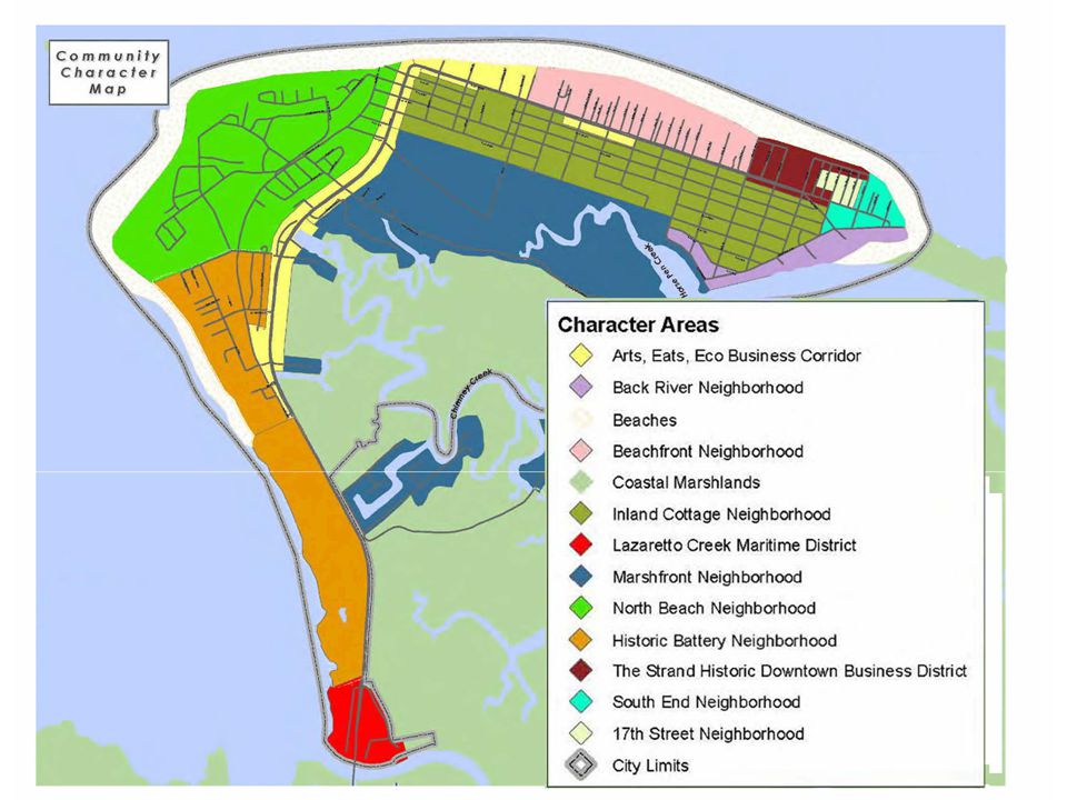
City of Tybee Island 2007 Master Plan Summary Report Area Character Maps and Area Development Recommendations

4
Arts, Eats, Eco Activity Center Develop consistent with existing character Mixed use, with set residential maximum Encourage infill & redevelopment along 80 Develop and enforce landscaping standards Improve pedestrian utility Continue bikeway development Develop and enforce signage guidelines & consistency Establish sight/sound buffers between commercial and residential areas

7
Back River Neighborhood Develop consistent with existing character Boat ramp, marina & fishing: critical elements Encourage traffic calming Encourage historic restoration & preservation – City should provide incentives to do so Develop and enforce landscaping and architectural standards Enforce noise, parking ordinances Preserve & enhance access to beach & water

10
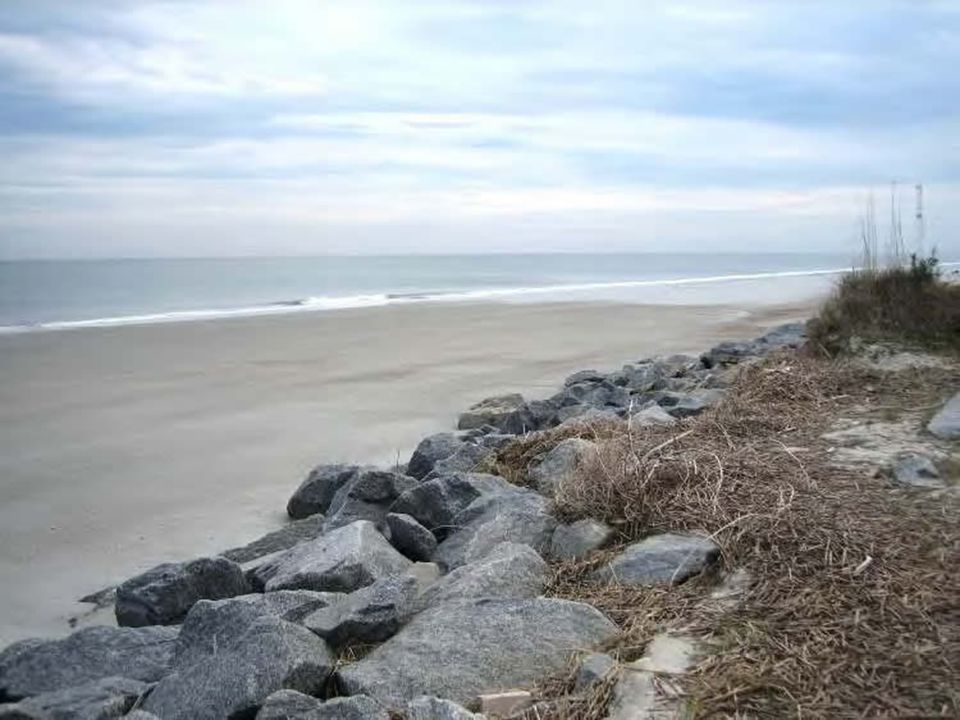
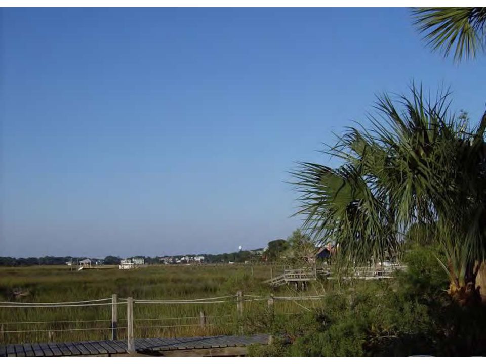
Beaches Maintain natural state Prohibit development on beach or dunes Continue to buffer from development Add educational aspects to crossing walkways Enhance as wildlife habitat Promote as recreation and tourist destination Remove swimming hazards Promote & enhance adjacent green space Enhance signage to highlight crossing locales from beach Maintain dune crossings with least possible impact Enhance sand and beach management

13
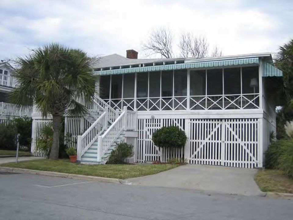
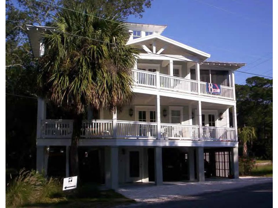
Beachfront Neighborhood Develop consistent with existing character Preserve low-density character Improve pedestrian utility Encourage historic restoration & preservation – City should provide incentives to do so Preserve old growth trees Preserve & enhance access to beach & water Do not allow commercial incursions

16
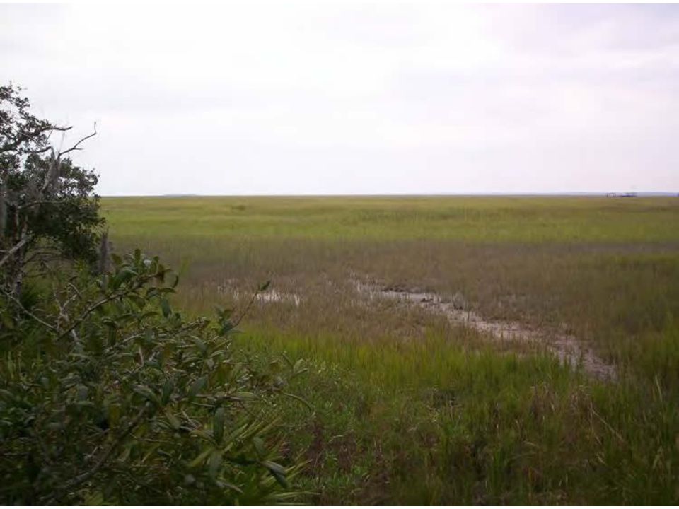
Coastal Marshlands Property maintained in natural state Restrict development and encroachment into area Promote use of conservation easements to protect marshland Promote areas as passive-use recreation destinations Support use for shellfish aquaculture as appropriate Encourage restoration of oyster reefs Require use of naturally vegetated, adjacent buffers Restrict/discourage use that may contribute to pollution Enforce adjacent erosion and sedimentation control Improve coordination with GDOT on clearing/cutting projects Restrict signage within or adjacent to, or with views of, marsh

19
Inland Cottage Neighborhood Develop consistent with existing character – low density residential, public/institutional, and low impact commercial Develop and implement design and architectural standards Improve pedestrian/bicycle environment and encourage safety and mobility Historic structures in this area should be restored and/or preserved whenever possible – The City should provide appropriate incentives for historic restoration projects

22
Lazaretto Creek Maritime District Develop and enforce signage guidelines & consistency Ensure consistency of development Consider design and installation of gateway signage and associated beautification measures along Hiway 80 Allow for development of services that serve year-round and seasonal population Provide signage for landmarks and commercial businesses Improve pedestrian environment to allow for pedestrian/bicycle movement throughout as well as to and from the area Discourage down-zoning from commercial to residential Improve street conditions through grading improvements

25
Marshfront Neighborhood Ensure consistency of development Permit only uses compatible with the character of area that will not adversely impact marsh Limit housing density, size, and height through zoning Establish and enforce marsh buffer standards; identify uses allowed and prohibited within buffer Tree preservation prioritized to protect scenic and habitat value Clearly define guidelines that protect against stormwater pollution including: xeriscape landscaping, pervious surfaces, and erosion and sedimentation control.

28
North Beach Neighborhood Ensure consistency of development Develop & enforce signage guidelines & consistency Provide signage for landmarks, commercial business Encourage historic restoration & preservation – City should provide incentives to do so Pursue historic district/structure designations as appropriate Continue preservation of old growth trees, parks, greenspace Continue bikeway development including bike lanes & multi-use trails

31
Historic Battery Neighborhood Ensure consistency of development – as well as uses without adverse impact on marsh, riverfront Continue to work to preserve Battery Halleck (and other archeological resources), connection to multi-use trail system and Fort Pulaski. Encourage projects that will implement the proposed multi-use trail system Consider potential to provide additional parking within this area with transportation to other areas of the Island

34
The Strand District Downtown development to include mix of commercial use – Only uses that are compatible with desired main street character – Appropriate for downstairs commercial and upstairs residential development options – All residential uses should be consistent with the terms of the current C-1 Zoning District Improve safe pedestrian mobility ; improve storm drainage Beautification/façade aesthetic improvements Historic structures restored and/or preserved whenever possible – Adaptive reuse of historic structures is encouraged – City should provide appropriate incentives for historic restoration

35
The Strand District (cont.) Encourage infill development/redevelopment of vacant property and underutilized structures Consider development of Convention Center in association hospitality establishments Re-install elements of the Strand boardwalk/multi- use trail Identify location for additional parking or garage Work to preserve/retain buildings that can house small businesses Add recreational uses
 Encourage infill development/redevelopment of vacant property and underutilized structures Consider development of Convention Center in association hospitality establishments Re-install elements of the Strand boardwalk/multi- use trail Identify location for additional parking or garage Work to preserve/retain buildings that can house small businesses Add recreational uses")
38
17 th Street Neighborhood Ensure consistency of development Future development pedestrian-oriented with safe connections to adjacent neighborhoods Appropriate for residential development of mix of densities and housing options (i.e. multi-family homes, townhouses, condos, apartments, year round rentals, etc.) Mixed-use encouraged to provide for daily needs of residents and tourists All commercial use should be low-intensity, consistent with existing character of neighborhood Uses and zoning within this area should provide transition from South End Neighborhood to SDHBC
 Mixed-use encouraged to provide for daily needs of residents and tourists All commercial use should be low-intensity, consistent with existing character of neighborhood Uses and zoning within this area should provide transition from South End Neighborhood to SDHBC.")
41
South End Neighborhood Future development should be very pedestrian-oriented with safe connections to adjacent areas Ensure consistency of development in terms of mass, scale, use, and density Historic structures in this area should be restored/preserved whenever possible Continue to implement improvements to encourage safe pedestrian mobility

Similar presentations