Download presentation
Presentation is loading. Please wait.

1
FORMOSAT IMAGERY BARRAX (SPAIN) PRELIMINARY ANALYSIS Alfonso Calera, Isidro Campos, Jose Gonzalez-Piqueras Instituto de Desarrollo Regional. Albacete Universidad de Castilla La Mancha (Spain) Tolouse, January, 12th 2010
 Tolouse, January, 12th")
2
Objectives Cross-comparison FORMOSAT_Landsat5-TM (on synchronous images 19/October/2009) Preliminary assessment about crop multitemporal monitoring Materials: Formosat imagery, processed by CESBIO (Olivier Hagolle) Orthorectificaction, Top of Atmosphere and Surface reflectances Landsat imagery, processed by IDR-UCLM Orthorectification, ToA and Surface reflectances Formosat 2009/09/212009/10/032009/10/112009/10/192009/10/272009/11/05 Landsat 2009/09/102009/10/032009/10/122009/10/19 299/10/28 (clouds)
 Preliminary assessment about crop multitemporal monitoring Materials: Formosat imagery, processed by CESBIO (Olivier Hagolle) Orthorectificaction, Top of Atmosphere and Surface reflectances Landsat imagery, processed by IDR-UCLM Orthorectification, ToA and Surface reflectances Formosat 2009/09/212009/10/032009/10/112009/10/192009/10/272009/11/05 Landsat 2009/09/102009/10/032009/10/122009/10/19 299/10/28 (clouds)")
3
Cross-comparison FORMOSAT vs. Landsat5-TM synchronous images 19/October/2009 The comparison has been performed for: Reflectances_ToA Formosat-Landsat5-TM Reflectances_BoA Formosat-Landsat5-TM NDVI_ToA Formosat-Landsat5-TM NDVI_BoA Formosat-Landsat5-TM Besides, we analyzed the performance of the applied atmospheric correction, by comparison Refl_BoA vs. Refl_ToA Formosat Refl_BoA vs. Refl_ToA Landsat

4
METHODOLOGY for the comparison: We set a grid over the study zone, i.e. full Formosat image, where each cell defines the surface to perform the aggregation from each sensor. The side length of each grid cell determines the number of individual pixels to be aggregated. We select a length of cell size of the 90 m (3x3 pixel Landsat). By this way we can avoid the different pixel size and the uncertainty in geolocation The comparison between observations from both sensors will be showed using the graphic representation and calculating the linear curve fit
. By this way we can avoid the different pixel size and the uncertainty in geolocation The comparison between observations from both sensors will be showed using the graphic representation and calculating the linear curve fit.")
5
Landsat 5 TM October 19 th 2009 Methodology for the comparison between reflectance and NDVI. Formosat October 19 th 2009 Comparison reflectance, NDVI,… Individual pixel reflectance and NDVI values : Grid 90 m x 90 m Pixel size: 8 m and 30 m Where n is the number of pixels inside of the cell;

6
RGB 142 Formosat October 19 th 2009. Grid 90 m x 90 m Landsat... Reflectance, Mean NDVI, in each cell: n is 90 x 90 To increase the accuracy of calculation we split the original pixel size to other with 1 m length side

7
RGB 543 Landsat 5 TM October 19 th 2009. Grid 90 m x 90 m Landsat... n is 90 x 90 for each cell To increase the accuracy of calculation, we split the original pixel to other with 1 m length side

8
RESULTS: Reflectances_ToA Formosat-Landsat5-TM

9
RESULTS: Reflectances_ToA Formosat-Landsat5-TM A good linear fit is showed, but the scatter could be due to the remaining uncertainty of geolocation and to the differences on angle of view and illumination. Deviation from 1:1 line could be due to differences on the spectral band width and on the sensor function response

10
RESULTS: Reflectances_BoA Formosat-Landsat5-TM

11
RESULTS: NDVI_ToA Formosat-Landsat5-TM NDVI matches 1:1 line and R 2 is better than reflectances

12
RESULTS: NDVI_BoA Formosat-Landsat5-TM

13
RESULTS: About atmospheric correction applied Refl_BoA vs. Refl_ToA Formosat Atmospheric correction is equivalent to a linear transformation. No scatter is introduced by the applied atmospheric correction

14
RESULTS: About atmospheric correction applied NDVI_BoA vs. NDVI_ToA Formosat Scatter seems to be introduced by the non-linear characteristic of NDVI definition

15
RESULTS: About atmospheric correction applied Refl_BoA vs. Refl_ToA Landsat5-TM

16
RESULTS: About atmospheric correction applied NDVI_BoA vs. NDVI_ToA Landsat5-TM

17
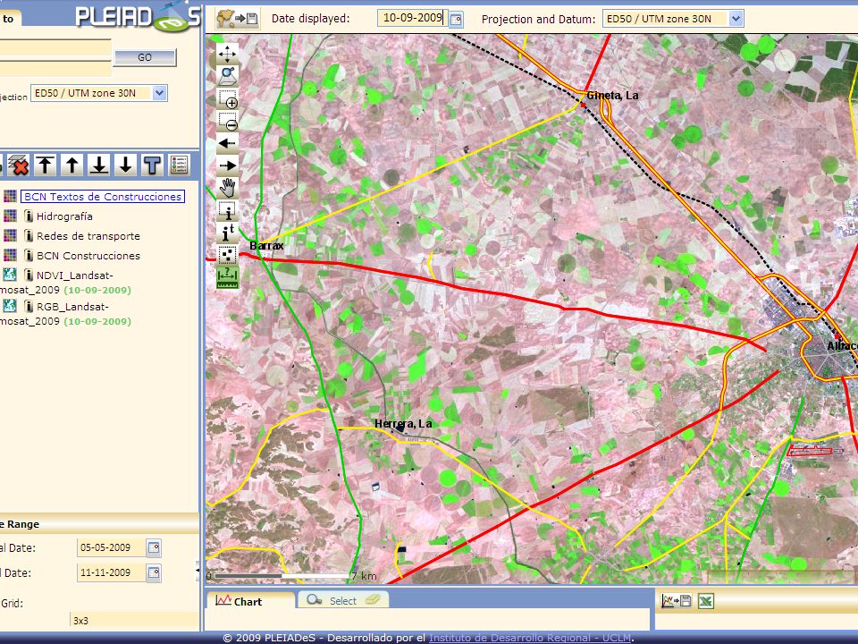
Preliminary assessment about crop multitemporal monitoring To visualize the temporal evolution we upload in the SPIDER system the RGB341 and NDVI from FORMOSAT and RGB543 and NDVI from Landsat. Set the URL of SPIDER: http://161.67.130.130/spider/ http://161.67.130.130/spider/ Is under construction http://161.67.130.130/spider/ http://161.67.130.130/spider/fixedviewer/index.php

20
Maize, after a spring crop

22
Maize.

25
Maize: Discrepancies between NDVI values from F and L sensors, for one point, is dependent not only from the sensor, but also of the status of cover, BRDF?. Other effects about the spatial resolution could be avoided by the uniformity of cover in the case here showed.

26
Maize.

28
Alfalfa. In this case differences between sensors are little, in despite of high variability on the crop uniformity.

30
This is only a starting point …. We need to perform further analysis for other dates under different conditions..... Formosat time series could be a powerful tool to monitor crop development along its growing season. Spatial resolution of Formosat imagery provides a great capability to monitor and visualize the uniformity of crops.

Similar presentations


 Department.>")


