Download presentation
Presentation is loading. Please wait.

8
Geography is the study of where things are found on Earth’s surface and the reasons for the locations. Human geographers ask two simple questions… 1. Where are people and activities found on Earth? 2. Why are they found there?

9
A map is a two-dimensional or flat-scale model of Earth’s surface, or a portion of it. Cartography is the science of mapmaking. Maps serve two purposes… 1. As a reference tool to identify an object’s absolute and relative location. 2. As a communications tool to convey the distribution of human activities or physical features.

10
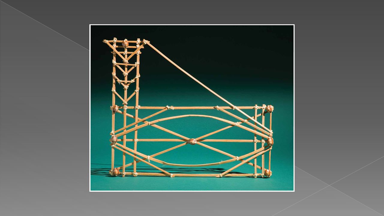
A stone tablet found in a cave in Abauntz in the Navarra region of northern Spain is believed to contain the earliest known representation of a landscape.

11
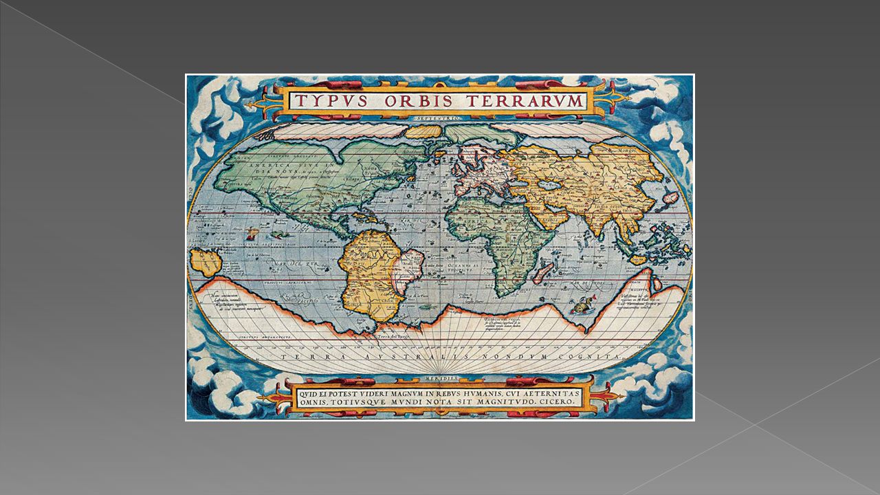
Earliest maps were reference tools — simple navigation devices to show a traveler how to get from Point A to Point B. First world map prepared by Eratosthenes(276 – 194 B.C.) › Improvements to world map later made by Ptolemy. › After Ptolemy, advancements in cartography primarily made outside of Europe by Chinese and Islamic world. Mapmaking revived during the Age of Exploration
 › Improvements to world map later made by Ptolemy. › After Ptolemy, advancements in cartography primarily made outside of Europe by Chinese and Islamic world. Mapmaking revived during the Age of Exploration.")
16
Level of detail and the amount of area covered on the map depend on its map scale. Other Words…The degree to which a map “zooms in” on the area it is representing.

17
Map scale is presented in three ways… 1. Ratio or Fraction Scale : Ex. 1:24,000 or 1/24,000 Number on left is one unit of distance, while number on right represents same unit of distance on Earth’s surface. 2. Written Scale: Ex. 1 inch equals 1 mile Number on left is one unit of distance, while number on right represents a different unit of distance on Earth’s surface. 3. Graphic Scale : Usually consists of a bar line marked to show distance on Earth’s surface Distance between two points can be overlaid on the scale bar to determine the distance on Earth’s surface.

19
“LARGE” OR “SMALL” scale. › The more “zoomed in” the map is on an area, the larger is its map scale. large-scale map depicts a smaller area › The less “zoomed in” the map is on an area, the smaller is its scale. Small-scale map depicts a larger area

23
Show locations of places and geographic features.

24
Tell a story about the degree of an attribute, the pattern of its distribution, or its movement.

25
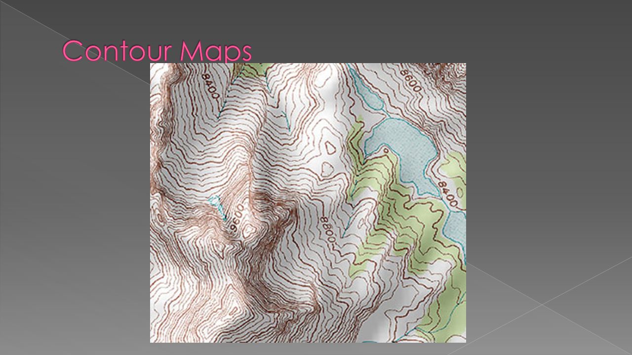
Contour maps use contour lines, to depict where the same elevation exists. The contour interval of a contour map is the difference in elevation between successive contour lines.

27
The proportional symbol technique uses symbols of different sizes to represent data associated with different areas or locations within the map.

28
A dot may be used to locate each occurrence of a phenomenon. Where appropriate, a dot may indicate any number of entities, for example, one dot for every 100 voters. Military families in Ohio

29
Shows statistical data aggregated over predefined regions, such as counties or states, by coloring or shading these regions.

30
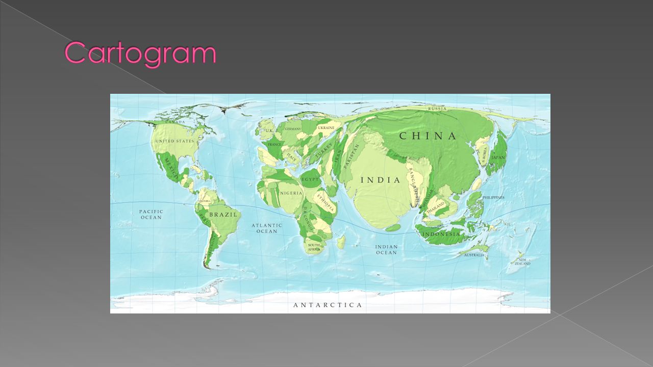
A cartogram is a map in which some thematic mapping variable is substituted for land area or distance. The geometry or space of the map is distorted in order to convey the information of this alternate variable.

32
Global Positioning System Satellite-based system for determining the absolute location of places or geographical features

33
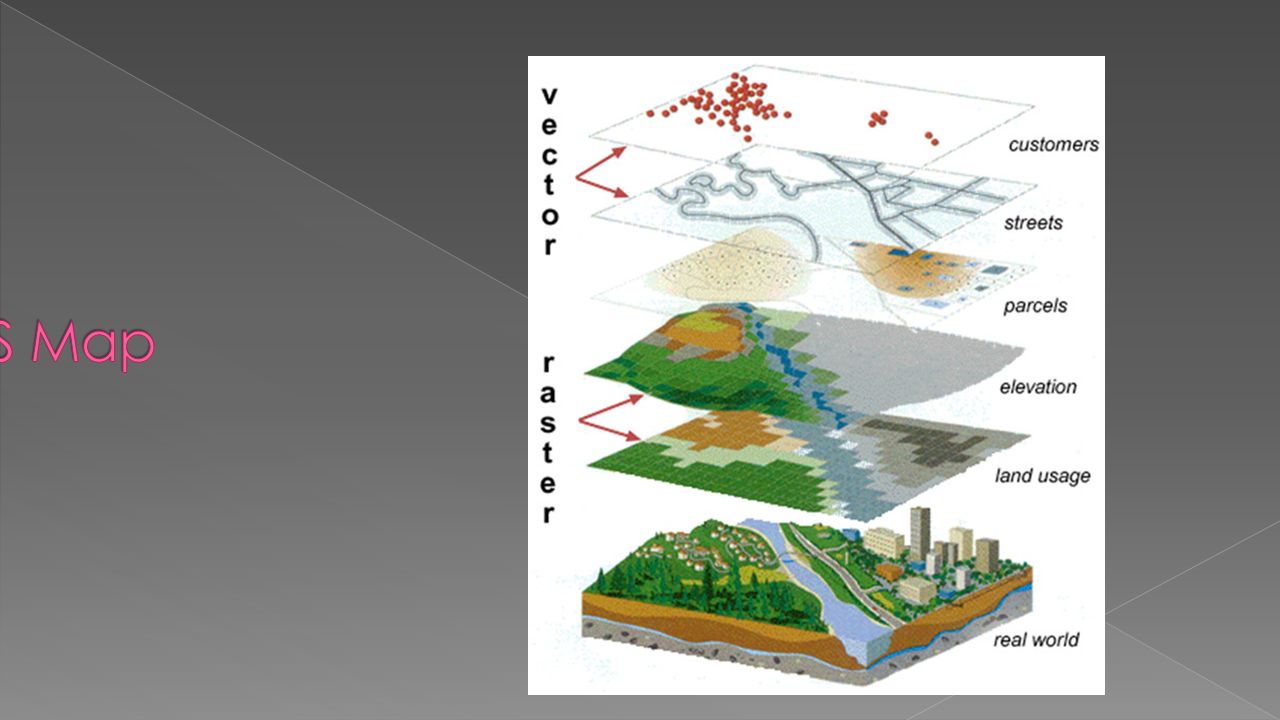
A geographic information system (GIS) integrates hardware, software, and data for capturing, managing, analyzing, and displaying all forms of geographically referenced information. GIS allows us to view, understand, question, interpret, and visualize data in many ways that reveal relationships, patterns, and trends in the form of maps, globes, reports, and charts.

Similar presentations


 Cartography (map-making) involves.>")


. Location – the space.>")


 The study of.>")


