Download presentation
Presentation is loading. Please wait.

1
Marine Spatial Planning at the NOAA Coastal Services Center Betsy Nicholson & Adrianne Harrison National Oceanic and Atmospheric Administration (NOAA) Coastal Services Center March 25, 2009
 Coastal Services Center March 25, 2009")
2
Presentation Outline MSP Overview MSP Tools and Support from NOAA CSC Multipurpose Marine Cadastre Legislative Atlas Digital Coast Discussion on relevance to Council

3
High Demand Exists for the Nation’s Oceans and Great Lakes Marine Spatial Planning (MSP) Is Strategic Forward thinking Proactive Necessary
 Is Strategic Forward thinking Proactive Necessary")
4
MSP in the Gulf of Maine MA Ocean Planning TNC-NOAA Northwest Atlantic Ecological Regional Assessment ME Bay Management ESSIM …

5
Multipurpose Marine Cadastre A marine information system for the outer continental shelf and state waters that provides a data framework to support decision making.

6
What is a Marine Cadastre? “A marine cadastre is a system to enable the boundaries of maritime rights and interests to be recorded, spatially managed and physically defined in relationship to the boundaries of other neighboring or underlying rights and interests.” (Robertson et al., 1999)
.")
7
Why Is this Project Important? Single data portal Integrated system for improved decision making Venue to resolve and modernize boundaries Relevant to state ocean planning issues Mechanism for collaboration and integration of new data

8
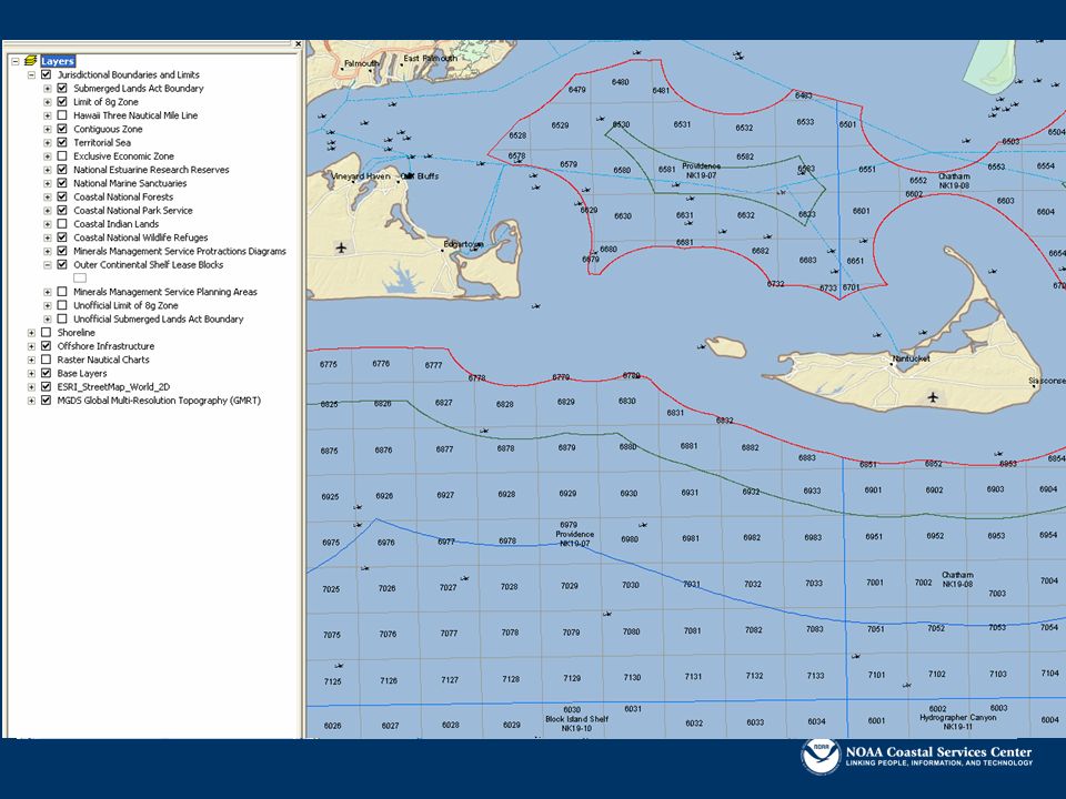
MMC - Data Themes Supporting Data: Coastline or Shoreline Sand Borrow Sites Pipelines Fiber Optic Cables Artificial Reef Sites Shipping Fairways Anchorage Areas Military Restricted Areas Platform Locations Bathymetry Wind, Wave, and Tidal Energy Sites Archeological Sites Aquaculture Sites MMS Leases Liquid Natural Gas (LNG) Sites Benthic Data Core Cadastral Data: Limit of 8(g) Zone Submerged Lands Act Contiguous Zone Territorial Sea Exclusive Economic Zone Shoreline National Estuarine Research Reserves National Marine Sanctuaries National Forests National Park Service Indian Lands National Wildlife Refuge MMS Protraction Diagrams Outer Continental Lease Blocks
 Sites Benthic Data Core Cadastral Data: Limit of 8(g) Zone Submerged Lands Act Contiguous Zone Territorial Sea Exclusive Economic Zone Shoreline National Estuarine Research Reserves National Marine Sanctuaries National Forests National Park Service Indian Lands National Wildlife Refuge MMS Protraction Diagrams Outer Continental Lease Blocks")
9
MMC - Viewers Web-based and client-side ArcIMS ArcReader Google Earth Provides access to data Map-making functionality Used for decision support Driven by partner needs

10
MMC – Partners and Providers Current Partnerships Minerals Management Service (lead) NOAA Coastal Services Center (technical lead) NOAA Office of Coast Survey NOAA National Marine Sanctuaries NOAA Marine Protected Areas NOAA Fisheries U.S. Fish and Wildlife Service National Park Service The Nature Conservancy California Coastal Conservancy Potential Partnership Opportunities DOD Coast Guard FERC Department of Energy Massachusetts CZM Rhode Island CRMC South Carolina OCRM NROC Other States

11
Case Studies Partners: Minerals Management Service and NOAA CSC Issue: Alternative Energy Development on the OCS Task: Develop mapping applications to support energy planning and regulations Status: Ongoing effort

12
Case Studies Partner: NOAA NMFS Habitat Conservation Division Issues: Map hydrokinetic projects and critical habitat data; system to support permit review Status: Ongoing; figuring out best way to collaborate

13
Demonstration Scenario: Permit review or site selection for energy projects Location: State and Federal Waters off of Massachusetts Users: Minerals Management Service, State Permitting Offices, private sector

15
Other Uses TNC – investigating MMS’ block system as a standardized mapping unit for ecoregional assessment data California Coastal Conservancy – using data and maps for wave energy studies Providing web map services for state ocean planning

16
In Summary… MMC is issue driven Gaining momentum through case studies and partnerships Scalable and transferrable Products and support include: Authoritative marine boundary and supporting data Stand-alone and customizable data viewers Templates for developing map viewers Support on a case-by-case basis http://www.csc.noaa.gov/mmc

17
Legislative Atlas Spatial data depicting coastal and marine regulatory framework at federal and state levels Web-based mapping and information resource Currently includes Federal legislation for Atlantic, Pacific, Gulf coasts State legislation for Gulf of Mexico region, CA, OR, WA & Gulf of Maine region Database of coastal laws

18
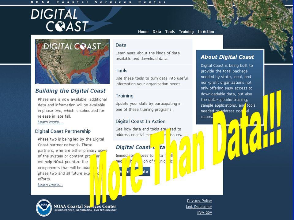
Digital Coast: Legislative Atlas Website Searchable Database of Legislation Ability to search by region, issue, or agency Returns brief legislative summary Contains links to full text

19
Digital Coast: Legislative Atlas Website Spatial Data Viewers View agency jurisdictions, federal legislation, and state legislation Ability to identify laws and jurisdictions and link back to legislative summaries

20
Vision Easy access to data and tools Coastal organizations come together to address coastal issues

22
Discussion Is it appropriate for the Council to play a role in MSP? How could the Council become a user or advise its jurisdictions on MSP issues? How can the U.S. and Canadian feds use the Council to better edge match our efforts to benefit our ecosystem management in the GOM? What are additional needs these tools could serve?

23
Betsy Nicholson – NOAA CSC Northeast Region Betsy.Nicholson@noaa.gov David Stein – NOAA CSC, Charleston, SC Dave.Stein@noaa.gov URLs: www.csc.noaa.gov/digitalcoast/ www.csc.noaa.gov/mmc www.csc.noaa.gov/legislativeatlas/ Contacts

Similar presentations


 David.>")


